Difference between revisions of "Salt marshes"
Dronkers J (talk | contribs) |
|||
| (42 intermediate revisions by 6 users not shown) | |||
| Line 1: | Line 1: | ||
| − | |||
| + | This article describes the habitat of saltmarshes. It gives an introduction to the characteristics, distribution, evolution, adaptations, [[zonation]], succession, biota, functions and threats of the organisms that live in saltmarshes. | ||
| − | + | In 2008 the European Union commissioned a series of Habitat Management Models for several of the more important communities. Included is a model for habitat 1330 "Atlantic salt meadows" (Glauco-Puccinellietalia maritimae). | |
| − | + | Visit the European Union web site at [http://ec.europa.eu/environment/nature/natura2000/management/habitats/models_en.htm] to download a copy of the Habitat Management Model for the above community. | |
| − | [[ | + | ==Introduction== |
| + | |||
| + | Saltmarshes are defined as natural or semi-natural terrestrial halophytic ecosystems that occur in the [[intertidal]] zone between the land and the sea and that are covered by salty or brackish water for part of the time. They can be considered, in some way, as the analogue of [[mangrove]]s in temperate and arctic regions. The dominant flora is composed of [[Halophytic plants|halophytic plant]]s such as grasses, shrubs and herbs. The flora is locally rather species poor, but the global species diversity is high, with over 500 saltmarsh plant species known<ref name=S14>Silliman, B.R. 2014. Saltmarshes. Current Biology 24(9) R348</ref>. Saltmarshes are normally associated with [[mud]] flats but also occur on sand flats. These [[Tidal flats from space|mud flats]] are sometimes dominated by [[algae]] and covered with algal mats. They are periodically flooded by the tide, the height of which can vary from several centimetres in enclosed seas (such as the Baltic Sea) to several metres in open seas along the ocean margins. A network of meandering tidal creeks ensures the drainage of seawater. Through these channels, sediments, [[detritus]], dissolved [[nutrient]]s, [[plankton]] and small fishes are flushed in and out the saltmarshes. | ||
==Distribution== | ==Distribution== | ||
| + | Saltmarshes are ubiquitous in estuarine systems in temperate zones all over the world. They seldom occur on open coasts, because the development is inhibited by strong wave action. Although sediment is a prerequisite for their growth in height and width, saltmarsh communities can develop in areas with limited or no sediment supply. Examples include seawater-drenched cliffs and slopes on exposed coasts, at the head of sea lochs and rocky beaches (Doody 2008<ref>Doody, J.P. 2008. Saltmarsh Conservation, Management and Restoration''. Coastal Systems and Continental Margins, Volume 12, Springer, 217 pp. </ref>). Saltmarshes can be found from the Arctic region, over Europe, Africa, America, Asia to the coast of Australia. The most extensive development of saltmarshes occurs in estuaries with a moderate climate, large tidal range, abundant fine-grained sediments and sheltered locations where particles can settle out of the water column. | ||
| − | |||
| − | |||
| − | + | [[File:GlobalDistributionSaltMarshes.jpg|center|thumb|700px|caption|Global distribution of saltmarshes. From Mcowen at al. 2017 <ref>Mcowen, C., Weatherdon, L.V., Bochove, J., Sullivan, E., Blyth, S., Zockler, C., Stanwell-Smith, D., Kingston, N., Martin, C.S., Spalding, M. and Fletcher, S. 2017. A global map of saltmarshes (v6.1). Biodiversity Data Journal 5: e11764. Paper DOI: https://doi.org/10.3897/BDJ.5.e11764</ref>. Creative Commons Licence https://creativecommons.org/licenses/by-nc/3.0/]] | |
| − | [[ | ||
==Evolution== | ==Evolution== | ||
| − | + | Saltmarshes evolve over time from young marshes to old marshes. The natural young marshes in eastern USA are vegetated for the largest part with low marsh cordgrass ''Spartina alterniflora''. [[Nutrient]]s are transported by tidal currents through the tidal channels. This allows the grasses to grow thickly and profuse, so weakening the effect of waves and tidal [[currents]] and increasing the deposition rate of [[mud]]. [[Erosion]] is reduced by the roots and rhizomes of the plants. At the time that the marsh surface builds up above the high water level, high marsh species invade, outcompete and replace the low marsh plants. The most stress-tolerant plant species occupy the lower reaches of the marshes while less specialized competitive species occupy the upper elevations that are less stressful<ref name=S14/>. Deposition of fine sand and mud raises the marsh to the highest tidal water levels. The marsh then becomes dry land almost disconnected from ocean influences<ref name=P98>Pinet P.R. 1998. Invitation to Oceanography. Jones and Barlett Publishers. p. 508</ref>. A cliff develops at the seaward edge of old marshes. Little water flows through the tidal channels of these high marshes. Lateral channel migration and wave attack at the base of marsh cliffs are the main mechanisms for erosion of mature saltmarshes and their subsequent rejuvenation cycle<ref>Levoy, F., Anthony, E.J., Dronkers, J., Monfort, O. and Montreuil, A-L. 2019. Short-term to Decadal-scale Sand Flat Morphodynamics and Sediment Balance of a Megatidal Bay: Insight from Multiple LiDAR Datasets. Journal of Coastal Research SI 88: 61–76</ref><ref>Mariotti, G. and Fagherazzi, S. 2013. Critical width of tidal flats triggers marsh collapse in the absence of sea-level rise, Proc. Natl. Acad. Sci. 110(14): 5353–5356</ref>, see [[Tidal channel meandering and marsh erosion]]. | |
==Requirements for development== | ==Requirements for development== | ||
| − | The requirements for development of | + | The requirements for development of saltmarshes are: |
| − | * They need | + | * They need supply of fine-grained sediments. |
| − | * | + | * They must be sheltered from strong waves. |
| − | * They need salty conditions to grow. They are | + | * They need salty (but not hypersaline) conditions to grow. They are halotolerant and have adaptations to these conditions. |
| − | * They need a temperate or cool | + | * They need a temperate or cool temperature. Incidental freezing temperatures are not damaging the plants. |
| − | * They need a | + | * They need a large tidal range. This is important because it limits the [[erosion]], makes deposition of sediments possible and causes a well-marked [[zonation]]. |
==Zonation== | ==Zonation== | ||
| − | |||
| − | |||
| + | [[image:ZonationSaltMarshes.jpg|left|thumb|400px|Zonation of saltmarshes. Image credit: USGS]] | ||
| − | [[ | + | Based on the topography and characteristic plant assemblages, saltmarshes are classified as low, medium and high marshes. This classification is related to the number of tidal submergences per year (Adam 1990<ref name=A90>Adam, P., 1990. ''Saltmarsh Ecology''. Cambridge University Press, Cambridge</ref>). The 'low marshes' typically extend from the mean tidal level to the mean high water spring tide. The low marshes are drained by tidal creeks that convey flood and ebb flow; ebb flow generally dominates because flood water also inundates the marsh directly from the main channels. The 'high marshes' extend from the mean high water level to the highest springtide level. Flooded only by the highest tides and during storms, they are more like a terrestrial than a true marine environment. The plant community is more diverse than on the low marshes. Typical high marsh species are cordgrass ''Spartina patens'', spike grass ''Distichlis spicata'' and species such as saltwort ''Salsola'' and seablite ''Suaeda''. Distribution, density and activity of invertebrates mainly depend on protection, food and frequency of tidal flooding. <ref name=P98/> To successfully establish, annual species depend on yearly seed recruitment. Perennial species also benefit from establishment by seeds to colonize new areas. Conditions favorable for germination include a minimum bed level, where disturbance by wave and currents is low, and reduced soil salinity, for example through precipitation<ref>van Regteren, M., Amptmeijer, D., de Groot, A.V., Baptist, M.J. and Elschot, K. 2020. Where does the saltmarsh start? Field-based evidence for the lack of a transitional area between a gradually sloping intertidal flat and saltmarsh. Estuarine, Coastal and Shelf Science 243: 106909</ref>. |
| + | |||
| + | |||
| + | {| border="0" align="center" | ||
| + | |- | ||
| + | | valign="top"| | ||
| + | [[File:SpartinaPatens.jpg|thumb|left|150px|''Spartina patens'' Credit T. Forney www.pest.ceris.purdue.edu]] | ||
| + | | valign="top"| | ||
| + | [[File:SalsolaKaliES.jpg|thumb|left|150px|''Salsola kali'' Credit Ed Stikvoort www.freenatureimages.eu]] | ||
| + | | valign="top"| | ||
| + | [[File:SuaedaMaritima.jpg|thumb|left|150px|''Suaeda maritima'' Credit Ed Stikvoort www.freenatureimages.eu]] | ||
| + | |} | ||
==Succession== | ==Succession== | ||
| − | Succession is the | + | Succession is the successive development in time of different vegetation types at one place. It is a complex process; the factors determining zonation and succession in saltmarshes are discussed more in detail in Adam (1990<ref name=A90/>, pages 49-57), Gray (1992<ref>Gray, A.J. 1992. Saltmarsh plant ecology. In: ''Saltmarshes: morphodynamics, conservation and engineering significance'', J.R.L., Allen, & K., Pye, eds., 63-79. Cambridge University Press, Cambridge.</ref>) and Packham & Willis (1997, pages 107-114 <ref>Packham, J.R. & Willis, A.J., 1997. ''Ecology of dunes, saltmarsh and shingle''. Chapman & Hall, London.</ref>). |
| − | The | + | |
| + | {| border="0" align="left" | ||
| + | |- | ||
| + | | valign="top"| | ||
| + | [[File:Biofilm.jpg|thumb|left|175px|Biofilm of unicellular algae <ref name="multiple"> Credit Eric Coppejans - http://www.vliz.be/imis/imis.php?module=person&persid=134</ref>]] | ||
| + | | valign="top"| | ||
| + | [[File:Filamentous algae.JPG|thumb|left|175px|Fixation of the sediment by blue-green and green algae <ref name="multiple"/>]] | ||
| + | |} | ||
| + | |||
| + | The mudflat colonization starts with unicellular algae such as diatoms sticking the sand together by production of mucus. This causes a brownish biofilm on the substrate. | ||
| + | |||
| + | After this stage, filamentous [[algae]] contribute to the further fixation of sediments. These [[algae]] are mostly blue-green algae, Cyanophyta and Chlorophyta. Small gastropods can feed and develop in huge quantities on it. Locally, the filamentous alga ''Vaucheria'' can form banquettes or elevations. Brown algae can be associated with this stage. | ||
| + | <br clear=all> | ||
| + | |||
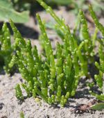
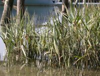
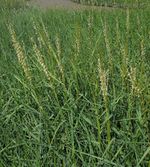
| + | A next stage is the germination of species such as the glasswort ''Salicornia''. The seeds germinate after partial desalination of the soil by rain. Sedimentation between and around the glassworts contributes to elevating and stabilizing the substrate. Other species such as ''Spartina maritima'' and ''Spartina anglica'' compete for the same place. ''S. maritima'' is an indigenous species of continental Europe and ''S. anglica'' is imported from the British Islands. The hybridisation and invasion of "Spartina" spp is a worldwide phenomenon<ref>Strong, D.R. and Ayres, D.R. 2013. Ecological and Evolutionary Misadventures of Spartina. Annu. Rev. Ecol. Evol. Syst. 44: 23.1–23.22</ref>. | ||
| + | |||
| + | |||
| + | {| border="0" align="center" | ||
| + | |- | ||
| + | | valign="top"| | ||
| + | [[File:SalicornaEuropaea.jpg|thumb|left|150px|''Salicorna europaea'' Credit Bart Vastenhouw, www.freenatureimages.eu]] | ||
| + | | valign="top"| | ||
| + | [[File:SpartinaMaritima.jpg|thumb|left|200px|''Spartina maritima'' Credit Ed Stikvoort www.freenatureimages.eu]] | ||
| + | | valign="top"| | ||
| + | [[File:SpartinaAnglica.jpg|thumb|left|150px|''Spartina anglica'' Credit Ed Stikvoort www.freenatureimages.eu]] | ||
| + | |} | ||
| + | |||
| + | |||
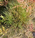
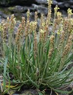
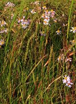
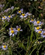
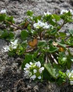
| + | In Europe, other plants also occur. These are the herbs common saltmarsh-grass (''Puccinellia maritima''), sea plantain (''Plantago maritima''), sea arrow-grass (''Triglochin maritinum''), sea aster (''Aster tripolium''), danish scurvy-grass (''Cochlearia danica''), common sea-lavender (''Limonium vulgare''), sea purslane (''Halimione portulacoides''), the red alga ''Bostrychia scorpioides'' and ''Catenella caespitosa''. <ref>Eric Coppejans – Course Biodiversity of aquatic food webs: from algae to marine mammals UGent</ref>. ''Juncus maritimus'' is another species that can occur in saltmarshes. | ||
| + | |||
| + | Initial plant colonizers play an important role in the recovery of saltmarsh vegetation from disturbance events. They provide shading of the substrate of bare areas and reduce salt accumulation in the soils and thereby facilitate colonization by many other plant species<ref name=S14/>. | ||
| + | |||
| + | |||
| + | {| border="0" align="center" | ||
| + | |- | ||
| + | | valign="top"| | ||
| + | [[File:PuccinelliaMaritima.jpg|thumb|left|150px|''Puccinellia maritima'' Credit Peter Meininger www.freenatureimages.eu]] | ||
| + | | valign="top"| | ||
| + | [[File:PlantagoMaritima.jpg|thumb|left|150px|''Plantago maritima'' Credit Jeroen Willemsen www.freenatureimages.eu]] | ||
| + | | valign="top"| | ||
| + | [[File:TriglochinMaritima.jpg|thumb|left|150px|''Triglochin maritima'' Credit Hans Boll www.freenatureimages.eu]] | ||
| + | | valign="top"| | ||
| + | [[File:AsterTripolium.jpg|thumb|left|150px|''Aster tripolium'' Credit Jan van der Straaten www.freenatureimages.eu]] | ||
| + | |} | ||
| + | |||
| + | {| border="0" align="center" | ||
| + | |- | ||
| + | | valign="top"| | ||
| + | [[File:CochleariaDanica.jpg|thumb|left|150px|''Cochlearia danica'' Credit Ed Stikvoort www.freenatureimages.eu]] | ||
| + | | valign="top"| | ||
| + | [[File:LimoniumVulgare.jpg|thumb|left|150px|''Limonium vulgare'' Credit Rutger Barendse www.freenatureimages.eu]] | ||
| + | | valign="top"| | ||
| + | [[File:HalimionePortulacoides.jpg|thumb|left|150px|''Halimione portulacoides'' Credit Jan van der Straaten www.freenatureimages.eu]] | ||
| + | | valign="top"| | ||
| + | [[File:BostrychiaScorpiodes.jpg|thumb|left|150px|''Bostrychia scorpiodes'' Credit Andre Rio. www.Marevita.org]] | ||
| + | |} | ||
| + | |||
| − | + | ==Adaptations== | |
| − | + | Plants and animals living in low saltmarshes must have adaptations to deal with the harsh physical stressors found in this intertidal habitat, including high salt concentrations, intense heat, and low oxygen in waterlogged soils. Some typical adaptations are discussed below. | |
| − | + | The saline environment causes waterstress. Plants have to take up water against the [[Osmosis|osmotic pressure]]. To overcome the negative osmotic pressure, they generate a negative hydrostatic pressure (by transpiration processes). They have thin, fleshy leaves and are sensitive to extra stress such as pollution. Anatomically, the plants are adapted through strong lignification, a well-developed epidermis and succulent leaves and stems. Evaporation can be limited by thin leaves with scale-like hairs. Physiologically, plants are adapted by accumulating salt in their tissues. In this way, normal [[osmosis]] is possible. Other plants have salt gland cells on the lower surface of the leaves and excrete the salt from its tissue. | |
| + | Saltmarsh plants have to deal with an anoxic environment. The tissue of the plants requires oxygen for [[respiration]]. Gas diffusion between sediment particles only occurs in soils that are not waterlogged. Even when the surface water is saturated with oxygen, its concentration in the soil is too low because of the slow oxygen diffusion. Many saltmarsh plants can temporarily cope with low soil oxygen levels by shunting oxygen down to their roots through straw-like vascular tissue called aerenchyma. Roots are superficial systems because of the anoxic sediments. They consist of perennial thick roots with a corky layer and without root hairs. To fix the substrate, short-lived, thin and highly branched roots are developed with numerous root hairs to absorb nutrients. | ||
| − | + | Nitrogen limitation can also play a role in the development of saltmarsh vegetation, even though nitrogen levels can be very high. The reason is that concentrations of sulfide and sodium ions are often high too and interfere with nitrogen uptake by plants<ref name=S14/>. | |
| − | |||
| − | |||
| − | |||
| − | |||
| − | |||
| − | |||
| − | |||
| − | |||
| + | Saltmarsh plants do not tolerate permanent waterlogging. Such conditions exist in depressions of flat, poorly drained marsh areas, where marsh ponds form. These ponds are filled with stagnant anoxic water where collapse of peat soil is caused by microbial mineralization of organic matter<ref>Hutchings, A.M., Antler. G., Wilkening, J.V., Basu, A., Bradbury, H.J., Clegg, J.A., Gorka, M., Lin, C.Y., Mills, J.V., Pellerin, A., Redeker, K.R., Sun, X. and Turchyn, A.V. 2019. Creek Dynamics Determine Pond Subsurface Geochemical Heterogeneity in East Anglian (UK) Salt Marshes. Front. Earth Sci. 7: 41</ref>. | ||
| − | |||
| − | + | ==Functions== | |
| − | + | ||
| − | + | Attenuating the impact of extreme storms on coastal protection structures is a very important function of saltmarshes. Field measurements of wave attenuation over saltmarshes under extreme conditions are rarely available, but experiments in large wave flumes and numerical model simulations provide consistent estimates – for example wave height reduction on the order of 0.5 % per meter saltmarsh width for 1 m significant wave height at the marsh edge and 2 m water depth above the marsh platform<ref>Moller, I., Kudella, M, Rupprecht, F., Spencer, T., Paul, M., van Wesenbeeck, B. K., Wolters, G, Jensen, K., Bouma, T. J., Miranda-Lange, M. and Schimmels, S. 2014. Wave attenuation over coastal saltmarshes under storm surge conditions. Nature Geoscience 7: 727–731 </ref><ref>Garzon, J.L., Maza, M., Ferreira, C.M., Lara, J.L. and Losada, I.J. 2019. Wave Attenuation by Spartina Saltmarshes in the Chesapeake Bay Under Storm Surge Conditions. J. Geophys. Res. Oceans 124: 5220-5243</ref>. A 100 m wide marsh in front of a sea dike can thus reduce the height of storm waves by about 50%. These studies also show that vegetated saltmarshes (with ''Elymus athericus, Puccinellia maritima, Atriplex prostrata, Spartina alterniflora'') dissipate wave energy much more efficiently than bare tidal flats. Soils with a high percentage of fine soft sediments (clay, organic material) cannot bear much weight. Sea dikes built on such soils cannot therefore be raised to great heights. In this case, a saltmarsh in front of the dike can offer equivalent protection with less stringent conditions for the dike design<ref>Zhang, M., Dai, Z., Bouma, T.J., Bricker, J., Townend, I., Wen, J., Zhao, T. and Cai, H. 2021. Tidal-flat reclamation aggravates potential risk from storm impacts. Coastal Engineering 166: 103868</ref>. However, when previously reclaimed salt marshes are restored, they may not be as efficient storm surge attenuators as the original salt marsh; restoration or construction of salt marshes requires thorough knowledge of natural marsh development<ref>Kiesel, J., Schuerch, M., Moller, I., Spencer, T. and Vafeidis, A. 2019. Attenuation of high water levels over restored saltmarshes can be limited. Insights from Freiston Shore, Lincolnshire, UK. Ecological Engineering 136: 89–100</ref>. A more complete introduction to the coastal protection function of salt marshes is given in the article [[Nature-based shore protection]]. | |
| − | + | ||
| − | + | Saltmarshes provide many other [[ecosystem services]]: | |
| − | + | *Coastline stabilization. Saltmarshes are efficient sediment traps; in this way they help stabilizing the coastline. | |
| + | *Water quality. Saltmarshes improve the water quality by filtering water and retaining excess nutrients, toxic chemicals and disease-causing organisms. They remove nitrates and phosphates from rivers and streams which receive wastewater effluents. | ||
| + | *Water supply regulation by recharge and discharge of groundwater. | ||
| + | *Habitat function. Saltmarshes offer nursery grounds and shelter for larvae and other small organisms and provide food and nesting areas for wading birds and other organisms. | ||
| + | *Carbon sequestration, see [[Blue carbon sequestration]]. | ||
==Fauna== | ==Fauna== | ||
| − | + | Saltmarshes are home to many small mammals, small fishes, birds, insects, spiders and marine invertebrates. Marine invertebrates include crustaceans such as [https://en.wikipedia.org/wiki/Amphipoda amphipods] and [https://en.wikipedia.org/wiki/Isopoda isopods], [https://en.wikipedia.org/wiki/Sea_anemone sea anemones], shrimps, crabs, turtles, mollusks and snails. Fishes such as sticklebacks, silversides, mummichogs, eels and flounders are found in the waters of the saltmarshes. The [[benthic]] community consists of mollusks, polychaeta and oligochaeta. Saltmarshes are important breeding, feeding and overwintering grounds for waterfowl. These waterfowl consist of ducks, herons, sharptailed sparrows, Eurasian oystercatchers, reed bunting, etc. In Saudi Arabia, saltmarshes are grazing places for wild dromedaries. | |
| − | |||
| − | |||
| − | In Saudi Arabia, | ||
| + | Although the local diversity of plants and animals found in saltmarshes is comparatively low, the abundance of organisms that do occur in marshes is very high. The abundance per square meter of one species of fiddler crab or snail can reach 100–400 individuals, at times over 1000, and over larger spatial scales the density of one species of non-insect invertebrate (mussels, crabs and snails) can often reach 50,000,000 per square kilometer<ref name=S14/>. | ||
| − | < | + | |
| − | + | Freshwater tidal marshes have a high biodiversity but do not harbor many endemic species<ref> Barendregt, A., Whigham, D.F., Meire, P., Baldwin, A.H., Van Damme, S. 2006. Wetlands in the Tidal Freshwater Zone. In: Bobbink R., Beltman B., Verhoeven J.T.A., Whigham D.F. (eds) Wetlands: Functioning, Biodiversity Conservation, and Restoration. Ecological Studies (Analysis and Synthesis), vol 191. Springer, Berlin, Heidelberg.</ref>. Organisms typical of freshwater tidal marshes are boatmen, flies, mosquitoes and snails. There are also mollusks, ducks, geese, muskrats, raccoons, mink and other small mammals. Some species are seasonal visitors. | |
| − | + | ||
| − | + | ||
| − | + | {| border="0" align="center" | |
| + | |- | ||
| + | | valign="top"| | ||
| + | [[File:Haematopus ostralegus M. Decleer.jpg|thumb|left|300px|Eurasian oystercatcher. Photo credit M. Decleer]] | ||
| + | | valign="top"| | ||
| + | [[File:water boatman E.S.Ross.jpg|thumb|left|200px|Water boatman. Photo credit E.S. Ross]] | ||
| + | | valign="top"| | ||
| + | [[File:Mink.jpg|thumb|left|200px|European mink <ref>http://en.wikipedia.org/wiki/Mink</ref>]] | ||
| + | |} | ||
==Threats== | ==Threats== | ||
| − | The total number and area of | + | The total number and area of saltmarshes has been declining for many years. The main cause is embanking, which deprives the saltmarsh habitat of tidal inundation. This normally occurs in areas where the soil level is high enough and the area large enough for embankment to take place. The saltmarsh is destroyed when converted to other uses, notably conversion to intensive agriculture. Embanking leads to additional marsh loss under sea level rise, as it prevents the saltmarsh from shifting landward (so-called [[coastal squeeze]]). |
| + | |||
| + | In south east England and in France a special type of embanked saltmarshes exist that are protected as a semi-natural habitat. Once enclosed, the saltmarsh still has salt water inlets with creeks and other unaltered features. Dispersed grazing or cropping for hay are often the only uses and with traditional management it develops into a wildlife habitat of some significance. The term [[Coastal grazing marsh]] (in France: prairie subhalophile) is used to describe this habitat. | ||
| + | |||
| + | Climate change threatens saltmarshes in several ways<ref>Fagherazzi, S., Mariotti, G., Leonardi, N., Canestrelli, A., Nardin, W. and Kearney, W.S. 2019. Saltmarsh Dynamics in a Period of Accelerated Sea Level Rise. Journal of Geophysical Research: Earth Surface 125, e2019JF005200</ref>. Many marsh plants have a limited tolerance to high temperatures. The high marsh is sensitive to intense drought, causing salinity stress. Because marshes are efficient sediment traps, they can keep up with sea level rise in estuaries with abundant supply of fine sediment. However, there is a limit that depends on the amount and continuity of sediment supply and the rate of sea level rise. Macrotidal conditions are more favorable than microtidal conditions. Sea level rise exacerbates marsh cliff erosion through increased impact of waves and currents. Marsh inundation and waterlogging inhibits vegetation growth. Primary production adds organic material that contributes to raising the marsh soil (up to a few mm/yr <ref>Morris, J. T., Barber, D. C., Callaway, J. C., Chambers, R., Hagen, S. C., Hopkinson, C. S., Johnson, B.J., Megonigal, P., Neubauer, S.C., Troxler, T. and Wigand, C. 2016. Contributions of organic and inorganic matter to sediment volume and accretion in tidal wetlands at steady state. Earths Future 4: 110–121</ref>), but current sea level rise is rising faster. | ||
| + | |||
| + | Reclamation for harbor development and other infrastructures completely destroys the habitat and with it any opportunities for restoration. Areas outside the reclaimed zones still can produce new marshes if there is sufficient supply of new sediment and conditions suitable for growth of new plants. <ref>Council of Europe – Dijkema K.S. et al. 1984. Saltmarshes in Europe. Nature and environment series No.30 p. 178</ref> However, climate change and the associated sea level rise are diminishing the opportunities for saltmarsh development and the [[coastal squeeze]] process takes place in many areas, especially around the southern North Sea <ref>Doody, J.P. 2004. Coastal squeeze - an historical perspective. Journal of Coastal Conservation 10: 129-138</ref>. | ||
| − | + | Other threats include: | |
| − | * Over-grazing | + | * Over-grazing (especially farm animals, but also grazing by wild geese, crabs and snails) |
| − | * | + | * Eutrophication by agricultural effluents, which makes saltmarshes more susceptible to erosion by increasing microbial decomposition of organic soil material<ref>Fagherazzi, S., FitzGerald, D.M., Fulweiler, R.W., Hughes, Z., Wiberg, P.L., McGlathery, K.J., Morris, J.T., Tolhurst, T.J., Deegan, L.A., Johnson, D.S., Lesser, J.S. and Nelson, J.A. 2022. Ecogeomorphology of Saltmarshes. Ch. 8.14 of Treatise on Geomorphology (ed. Shroder, J.F.), Elsevier</ref> |
| − | |||
* Urbanization | * Urbanization | ||
* Recreation | * Recreation | ||
* [[Coast erosion|Coastal erosion]] | * [[Coast erosion|Coastal erosion]] | ||
| − | * | + | * Industrial pollution and waste water |
| − | * | + | * Altered hydrologic regimes |
| + | * Species invasions (especially invasion of ''Spartina anglica'' and ''Erytrigia'' in eutrophic saltmarshes) | ||
| + | |||
| + | ==Case-study: Land van Saeftinghe<ref>https://www.saeftinghe.eu/nl/</ref>== | ||
| − | + | The [[Tide|tidal]] area ‘Drowned land of Saeftinghe’ (Verdronken land van Saeftinghe) is located near the border between the Netherlands and Belgium, a few kilometers downstream Antwerp in the estuary of the Western Scheldt. It is an official nature reserve since 1976. Because of this legal protection, permits are compulsary for every intervention and strict entrance restrictions are applied. | |
| + | The land is situated at the transition zone of the Western Scheldt where the river Scheldt meets the saline North Sea water. Before the storm surge of 1570, the land was a fertile polder. The area has a surface of 3,484 hectares. Almost 70 % of the area is overgrown by saltmarsh vegetation. The remaining 30 % consists of [[Tidal flats from space|mud flats]], sandbanks and a network of channels. Each [[tide]], the brackish water overflows a large part of the area. The unique vegetation is fully adapted to this. The area is an ideal breeding, rest and wintering place for huge quantities of birds. Since 1996 it is a special protected area for birds (1979 Directive 79/409/EEC on the conservation of wild birds) of international importance. | ||
| − | |||
| − | |||
| + | {| border="0" | ||
| + | |- | ||
| + | | valign="top"| | ||
| + | [[File:Saefringhe NIOO-CEME.jpg|thumb|left|400px|Land of Saeftinghe.]] | ||
| + | | valign="top"| | ||
| + | [[File:gebiedbes-afb-1.gif|thumb|left|400px|Western Scheldt estuary, with the Land of Saeftinghe in green.]] | ||
| + | |} | ||
| − | |||
| + | In the past, a few dikes were created to promote the silting up. The northern dike connects a few hillocks (artificial elevations of earth) with the dike. These dikes are still recognizable and are used as wandering path. The hillocks were used by shepherds when the [[tide]] became too high. | ||
| + | The flora consists of approximately 50 wild plant species. [[Algae]] are not abundant in Saeftinghe because there is too little light that penetrates in the water. Organic matter and a lot of silt make the water turbid. Higher plants are more important in this area. One of the most common plants is pickle weed (''Salicornia''), together with other saltmarsh plants such as English scurvy-grass (''Cochlearia anglica'') and common sea-lavender (''Limonium vulgare''). | ||
| − | + | ||
| − | + | ==Related articles== | |
| + | :[[Dynamics, threats and management of salt marshes]] | ||
| + | :[[Spatial and temporal variability of salt marshes]] | ||
| + | :[[Biogeomorphology of coastal systems]] | ||
| + | :[[Nature-based shore protection]] | ||
| + | :[[Tidal channel meandering and marsh erosion]] | ||
| + | |||
| + | |||
| + | ==Saltmarsh restoration guide== | ||
| + | |||
| + | For information of the management and restoration of saltmarshes in the UK see [https://assets.publishing.service.gov.uk/government/uploads/system/uploads/attachment_data/file/290974/scho0307bmkh-e-e.pdf DEFRA Saltmarsh management manual] | ||
| Line 126: | Line 220: | ||
{{author | {{author | ||
| − | |AuthorID= | + | |AuthorID=16323 |
|AuthorFullName=TÖPKE, Katrien | |AuthorFullName=TÖPKE, Katrien | ||
|AuthorName=Ktopke}} | |AuthorName=Ktopke}} | ||
| − | + | ||
| − | [[Category: | + | |
| − | [[Category: | + | {{Review |
| − | [[Category: | + | |name=Pat Doody|AuthorID=7584| |
| + | }} | ||
| + | {{Review | ||
| + | |name=Job Dronkers|AuthorID=120| | ||
| + | }} | ||
| + | |||
| + | |||
| + | [[Category:Coastal and marine habitats]] | ||
| + | [[Category:Coastal and marine ecosystems]] | ||
| + | [[Category:Salt marshes]] | ||
Revision as of 17:15, 7 March 2023
This article describes the habitat of saltmarshes. It gives an introduction to the characteristics, distribution, evolution, adaptations, zonation, succession, biota, functions and threats of the organisms that live in saltmarshes.
In 2008 the European Union commissioned a series of Habitat Management Models for several of the more important communities. Included is a model for habitat 1330 "Atlantic salt meadows" (Glauco-Puccinellietalia maritimae).
Visit the European Union web site at [1] to download a copy of the Habitat Management Model for the above community.
Contents
Introduction
Saltmarshes are defined as natural or semi-natural terrestrial halophytic ecosystems that occur in the intertidal zone between the land and the sea and that are covered by salty or brackish water for part of the time. They can be considered, in some way, as the analogue of mangroves in temperate and arctic regions. The dominant flora is composed of halophytic plants such as grasses, shrubs and herbs. The flora is locally rather species poor, but the global species diversity is high, with over 500 saltmarsh plant species known[1]. Saltmarshes are normally associated with mud flats but also occur on sand flats. These mud flats are sometimes dominated by algae and covered with algal mats. They are periodically flooded by the tide, the height of which can vary from several centimetres in enclosed seas (such as the Baltic Sea) to several metres in open seas along the ocean margins. A network of meandering tidal creeks ensures the drainage of seawater. Through these channels, sediments, detritus, dissolved nutrients, plankton and small fishes are flushed in and out the saltmarshes.
Distribution
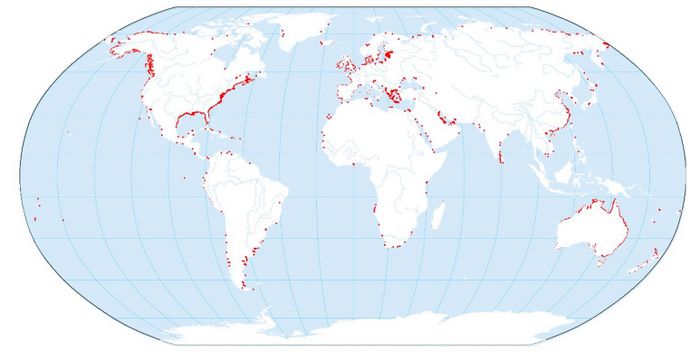
Saltmarshes are ubiquitous in estuarine systems in temperate zones all over the world. They seldom occur on open coasts, because the development is inhibited by strong wave action. Although sediment is a prerequisite for their growth in height and width, saltmarsh communities can develop in areas with limited or no sediment supply. Examples include seawater-drenched cliffs and slopes on exposed coasts, at the head of sea lochs and rocky beaches (Doody 2008[2]). Saltmarshes can be found from the Arctic region, over Europe, Africa, America, Asia to the coast of Australia. The most extensive development of saltmarshes occurs in estuaries with a moderate climate, large tidal range, abundant fine-grained sediments and sheltered locations where particles can settle out of the water column.
Evolution
Saltmarshes evolve over time from young marshes to old marshes. The natural young marshes in eastern USA are vegetated for the largest part with low marsh cordgrass Spartina alterniflora. Nutrients are transported by tidal currents through the tidal channels. This allows the grasses to grow thickly and profuse, so weakening the effect of waves and tidal currents and increasing the deposition rate of mud. Erosion is reduced by the roots and rhizomes of the plants. At the time that the marsh surface builds up above the high water level, high marsh species invade, outcompete and replace the low marsh plants. The most stress-tolerant plant species occupy the lower reaches of the marshes while less specialized competitive species occupy the upper elevations that are less stressful[1]. Deposition of fine sand and mud raises the marsh to the highest tidal water levels. The marsh then becomes dry land almost disconnected from ocean influences[4]. A cliff develops at the seaward edge of old marshes. Little water flows through the tidal channels of these high marshes. Lateral channel migration and wave attack at the base of marsh cliffs are the main mechanisms for erosion of mature saltmarshes and their subsequent rejuvenation cycle[5][6], see Tidal channel meandering and marsh erosion.
Requirements for development
The requirements for development of saltmarshes are:
- They need supply of fine-grained sediments.
- They must be sheltered from strong waves.
- They need salty (but not hypersaline) conditions to grow. They are halotolerant and have adaptations to these conditions.
- They need a temperate or cool temperature. Incidental freezing temperatures are not damaging the plants.
- They need a large tidal range. This is important because it limits the erosion, makes deposition of sediments possible and causes a well-marked zonation.
Zonation
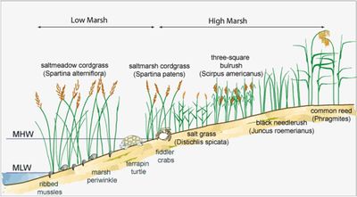
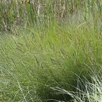
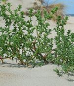
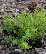
Based on the topography and characteristic plant assemblages, saltmarshes are classified as low, medium and high marshes. This classification is related to the number of tidal submergences per year (Adam 1990[7]). The 'low marshes' typically extend from the mean tidal level to the mean high water spring tide. The low marshes are drained by tidal creeks that convey flood and ebb flow; ebb flow generally dominates because flood water also inundates the marsh directly from the main channels. The 'high marshes' extend from the mean high water level to the highest springtide level. Flooded only by the highest tides and during storms, they are more like a terrestrial than a true marine environment. The plant community is more diverse than on the low marshes. Typical high marsh species are cordgrass Spartina patens, spike grass Distichlis spicata and species such as saltwort Salsola and seablite Suaeda. Distribution, density and activity of invertebrates mainly depend on protection, food and frequency of tidal flooding. [4] To successfully establish, annual species depend on yearly seed recruitment. Perennial species also benefit from establishment by seeds to colonize new areas. Conditions favorable for germination include a minimum bed level, where disturbance by wave and currents is low, and reduced soil salinity, for example through precipitation[8].
Succession
Succession is the successive development in time of different vegetation types at one place. It is a complex process; the factors determining zonation and succession in saltmarshes are discussed more in detail in Adam (1990[7], pages 49-57), Gray (1992[9]) and Packham & Willis (1997, pages 107-114 [10]).
 Biofilm of unicellular algae [11] |
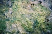 Fixation of the sediment by blue-green and green algae [11] |
The mudflat colonization starts with unicellular algae such as diatoms sticking the sand together by production of mucus. This causes a brownish biofilm on the substrate.
After this stage, filamentous algae contribute to the further fixation of sediments. These algae are mostly blue-green algae, Cyanophyta and Chlorophyta. Small gastropods can feed and develop in huge quantities on it. Locally, the filamentous alga Vaucheria can form banquettes or elevations. Brown algae can be associated with this stage.
A next stage is the germination of species such as the glasswort Salicornia. The seeds germinate after partial desalination of the soil by rain. Sedimentation between and around the glassworts contributes to elevating and stabilizing the substrate. Other species such as Spartina maritima and Spartina anglica compete for the same place. S. maritima is an indigenous species of continental Europe and S. anglica is imported from the British Islands. The hybridisation and invasion of "Spartina" spp is a worldwide phenomenon[12].
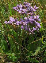
In Europe, other plants also occur. These are the herbs common saltmarsh-grass (Puccinellia maritima), sea plantain (Plantago maritima), sea arrow-grass (Triglochin maritinum), sea aster (Aster tripolium), danish scurvy-grass (Cochlearia danica), common sea-lavender (Limonium vulgare), sea purslane (Halimione portulacoides), the red alga Bostrychia scorpioides and Catenella caespitosa. [13]. Juncus maritimus is another species that can occur in saltmarshes.
Initial plant colonizers play an important role in the recovery of saltmarsh vegetation from disturbance events. They provide shading of the substrate of bare areas and reduce salt accumulation in the soils and thereby facilitate colonization by many other plant species[1].
Adaptations
Plants and animals living in low saltmarshes must have adaptations to deal with the harsh physical stressors found in this intertidal habitat, including high salt concentrations, intense heat, and low oxygen in waterlogged soils. Some typical adaptations are discussed below.
The saline environment causes waterstress. Plants have to take up water against the osmotic pressure. To overcome the negative osmotic pressure, they generate a negative hydrostatic pressure (by transpiration processes). They have thin, fleshy leaves and are sensitive to extra stress such as pollution. Anatomically, the plants are adapted through strong lignification, a well-developed epidermis and succulent leaves and stems. Evaporation can be limited by thin leaves with scale-like hairs. Physiologically, plants are adapted by accumulating salt in their tissues. In this way, normal osmosis is possible. Other plants have salt gland cells on the lower surface of the leaves and excrete the salt from its tissue.
Saltmarsh plants have to deal with an anoxic environment. The tissue of the plants requires oxygen for respiration. Gas diffusion between sediment particles only occurs in soils that are not waterlogged. Even when the surface water is saturated with oxygen, its concentration in the soil is too low because of the slow oxygen diffusion. Many saltmarsh plants can temporarily cope with low soil oxygen levels by shunting oxygen down to their roots through straw-like vascular tissue called aerenchyma. Roots are superficial systems because of the anoxic sediments. They consist of perennial thick roots with a corky layer and without root hairs. To fix the substrate, short-lived, thin and highly branched roots are developed with numerous root hairs to absorb nutrients.
Nitrogen limitation can also play a role in the development of saltmarsh vegetation, even though nitrogen levels can be very high. The reason is that concentrations of sulfide and sodium ions are often high too and interfere with nitrogen uptake by plants[1].
Saltmarsh plants do not tolerate permanent waterlogging. Such conditions exist in depressions of flat, poorly drained marsh areas, where marsh ponds form. These ponds are filled with stagnant anoxic water where collapse of peat soil is caused by microbial mineralization of organic matter[14].
Functions
Attenuating the impact of extreme storms on coastal protection structures is a very important function of saltmarshes. Field measurements of wave attenuation over saltmarshes under extreme conditions are rarely available, but experiments in large wave flumes and numerical model simulations provide consistent estimates – for example wave height reduction on the order of 0.5 % per meter saltmarsh width for 1 m significant wave height at the marsh edge and 2 m water depth above the marsh platform[15][16]. A 100 m wide marsh in front of a sea dike can thus reduce the height of storm waves by about 50%. These studies also show that vegetated saltmarshes (with Elymus athericus, Puccinellia maritima, Atriplex prostrata, Spartina alterniflora) dissipate wave energy much more efficiently than bare tidal flats. Soils with a high percentage of fine soft sediments (clay, organic material) cannot bear much weight. Sea dikes built on such soils cannot therefore be raised to great heights. In this case, a saltmarsh in front of the dike can offer equivalent protection with less stringent conditions for the dike design[17]. However, when previously reclaimed salt marshes are restored, they may not be as efficient storm surge attenuators as the original salt marsh; restoration or construction of salt marshes requires thorough knowledge of natural marsh development[18]. A more complete introduction to the coastal protection function of salt marshes is given in the article Nature-based shore protection.
Saltmarshes provide many other ecosystem services:
- Coastline stabilization. Saltmarshes are efficient sediment traps; in this way they help stabilizing the coastline.
- Water quality. Saltmarshes improve the water quality by filtering water and retaining excess nutrients, toxic chemicals and disease-causing organisms. They remove nitrates and phosphates from rivers and streams which receive wastewater effluents.
- Water supply regulation by recharge and discharge of groundwater.
- Habitat function. Saltmarshes offer nursery grounds and shelter for larvae and other small organisms and provide food and nesting areas for wading birds and other organisms.
- Carbon sequestration, see Blue carbon sequestration.
Fauna
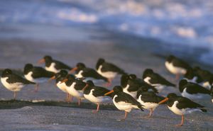
Saltmarshes are home to many small mammals, small fishes, birds, insects, spiders and marine invertebrates. Marine invertebrates include crustaceans such as amphipods and isopods, sea anemones, shrimps, crabs, turtles, mollusks and snails. Fishes such as sticklebacks, silversides, mummichogs, eels and flounders are found in the waters of the saltmarshes. The benthic community consists of mollusks, polychaeta and oligochaeta. Saltmarshes are important breeding, feeding and overwintering grounds for waterfowl. These waterfowl consist of ducks, herons, sharptailed sparrows, Eurasian oystercatchers, reed bunting, etc. In Saudi Arabia, saltmarshes are grazing places for wild dromedaries.
Although the local diversity of plants and animals found in saltmarshes is comparatively low, the abundance of organisms that do occur in marshes is very high. The abundance per square meter of one species of fiddler crab or snail can reach 100–400 individuals, at times over 1000, and over larger spatial scales the density of one species of non-insect invertebrate (mussels, crabs and snails) can often reach 50,000,000 per square kilometer[1].
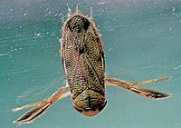
Freshwater tidal marshes have a high biodiversity but do not harbor many endemic species[19]. Organisms typical of freshwater tidal marshes are boatmen, flies, mosquitoes and snails. There are also mollusks, ducks, geese, muskrats, raccoons, mink and other small mammals. Some species are seasonal visitors.
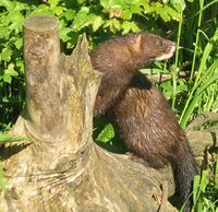 European mink [20] |
Threats
The total number and area of saltmarshes has been declining for many years. The main cause is embanking, which deprives the saltmarsh habitat of tidal inundation. This normally occurs in areas where the soil level is high enough and the area large enough for embankment to take place. The saltmarsh is destroyed when converted to other uses, notably conversion to intensive agriculture. Embanking leads to additional marsh loss under sea level rise, as it prevents the saltmarsh from shifting landward (so-called coastal squeeze).
In south east England and in France a special type of embanked saltmarshes exist that are protected as a semi-natural habitat. Once enclosed, the saltmarsh still has salt water inlets with creeks and other unaltered features. Dispersed grazing or cropping for hay are often the only uses and with traditional management it develops into a wildlife habitat of some significance. The term Coastal grazing marsh (in France: prairie subhalophile) is used to describe this habitat.
Climate change threatens saltmarshes in several ways[21]. Many marsh plants have a limited tolerance to high temperatures. The high marsh is sensitive to intense drought, causing salinity stress. Because marshes are efficient sediment traps, they can keep up with sea level rise in estuaries with abundant supply of fine sediment. However, there is a limit that depends on the amount and continuity of sediment supply and the rate of sea level rise. Macrotidal conditions are more favorable than microtidal conditions. Sea level rise exacerbates marsh cliff erosion through increased impact of waves and currents. Marsh inundation and waterlogging inhibits vegetation growth. Primary production adds organic material that contributes to raising the marsh soil (up to a few mm/yr [22]), but current sea level rise is rising faster.
Reclamation for harbor development and other infrastructures completely destroys the habitat and with it any opportunities for restoration. Areas outside the reclaimed zones still can produce new marshes if there is sufficient supply of new sediment and conditions suitable for growth of new plants. [23] However, climate change and the associated sea level rise are diminishing the opportunities for saltmarsh development and the coastal squeeze process takes place in many areas, especially around the southern North Sea [24].
Other threats include:
- Over-grazing (especially farm animals, but also grazing by wild geese, crabs and snails)
- Eutrophication by agricultural effluents, which makes saltmarshes more susceptible to erosion by increasing microbial decomposition of organic soil material[25]
- Urbanization
- Recreation
- Coastal erosion
- Industrial pollution and waste water
- Altered hydrologic regimes
- Species invasions (especially invasion of Spartina anglica and Erytrigia in eutrophic saltmarshes)
Case-study: Land van Saeftinghe[26]
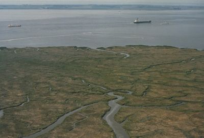
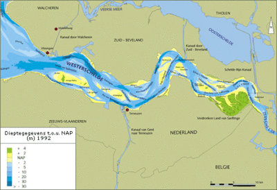
The tidal area ‘Drowned land of Saeftinghe’ (Verdronken land van Saeftinghe) is located near the border between the Netherlands and Belgium, a few kilometers downstream Antwerp in the estuary of the Western Scheldt. It is an official nature reserve since 1976. Because of this legal protection, permits are compulsary for every intervention and strict entrance restrictions are applied. The land is situated at the transition zone of the Western Scheldt where the river Scheldt meets the saline North Sea water. Before the storm surge of 1570, the land was a fertile polder. The area has a surface of 3,484 hectares. Almost 70 % of the area is overgrown by saltmarsh vegetation. The remaining 30 % consists of mud flats, sandbanks and a network of channels. Each tide, the brackish water overflows a large part of the area. The unique vegetation is fully adapted to this. The area is an ideal breeding, rest and wintering place for huge quantities of birds. Since 1996 it is a special protected area for birds (1979 Directive 79/409/EEC on the conservation of wild birds) of international importance.
In the past, a few dikes were created to promote the silting up. The northern dike connects a few hillocks (artificial elevations of earth) with the dike. These dikes are still recognizable and are used as wandering path. The hillocks were used by shepherds when the tide became too high.
The flora consists of approximately 50 wild plant species. Algae are not abundant in Saeftinghe because there is too little light that penetrates in the water. Organic matter and a lot of silt make the water turbid. Higher plants are more important in this area. One of the most common plants is pickle weed (Salicornia), together with other saltmarsh plants such as English scurvy-grass (Cochlearia anglica) and common sea-lavender (Limonium vulgare).
Related articles
- Dynamics, threats and management of salt marshes
- Spatial and temporal variability of salt marshes
- Biogeomorphology of coastal systems
- Nature-based shore protection
- Tidal channel meandering and marsh erosion
Saltmarsh restoration guide
For information of the management and restoration of saltmarshes in the UK see DEFRA Saltmarsh management manual
References
- ↑ 1.0 1.1 1.2 1.3 1.4 Silliman, B.R. 2014. Saltmarshes. Current Biology 24(9) R348
- ↑ Doody, J.P. 2008. Saltmarsh Conservation, Management and Restoration. Coastal Systems and Continental Margins, Volume 12, Springer, 217 pp.
- ↑ Mcowen, C., Weatherdon, L.V., Bochove, J., Sullivan, E., Blyth, S., Zockler, C., Stanwell-Smith, D., Kingston, N., Martin, C.S., Spalding, M. and Fletcher, S. 2017. A global map of saltmarshes (v6.1). Biodiversity Data Journal 5: e11764. Paper DOI: https://doi.org/10.3897/BDJ.5.e11764
- ↑ 4.0 4.1 Pinet P.R. 1998. Invitation to Oceanography. Jones and Barlett Publishers. p. 508
- ↑ Levoy, F., Anthony, E.J., Dronkers, J., Monfort, O. and Montreuil, A-L. 2019. Short-term to Decadal-scale Sand Flat Morphodynamics and Sediment Balance of a Megatidal Bay: Insight from Multiple LiDAR Datasets. Journal of Coastal Research SI 88: 61–76
- ↑ Mariotti, G. and Fagherazzi, S. 2013. Critical width of tidal flats triggers marsh collapse in the absence of sea-level rise, Proc. Natl. Acad. Sci. 110(14): 5353–5356
- ↑ 7.0 7.1 Adam, P., 1990. Saltmarsh Ecology. Cambridge University Press, Cambridge
- ↑ van Regteren, M., Amptmeijer, D., de Groot, A.V., Baptist, M.J. and Elschot, K. 2020. Where does the saltmarsh start? Field-based evidence for the lack of a transitional area between a gradually sloping intertidal flat and saltmarsh. Estuarine, Coastal and Shelf Science 243: 106909
- ↑ Gray, A.J. 1992. Saltmarsh plant ecology. In: Saltmarshes: morphodynamics, conservation and engineering significance, J.R.L., Allen, & K., Pye, eds., 63-79. Cambridge University Press, Cambridge.
- ↑ Packham, J.R. & Willis, A.J., 1997. Ecology of dunes, saltmarsh and shingle. Chapman & Hall, London.
- ↑ 11.0 11.1 Credit Eric Coppejans - http://www.vliz.be/imis/imis.php?module=person&persid=134
- ↑ Strong, D.R. and Ayres, D.R. 2013. Ecological and Evolutionary Misadventures of Spartina. Annu. Rev. Ecol. Evol. Syst. 44: 23.1–23.22
- ↑ Eric Coppejans – Course Biodiversity of aquatic food webs: from algae to marine mammals UGent
- ↑ Hutchings, A.M., Antler. G., Wilkening, J.V., Basu, A., Bradbury, H.J., Clegg, J.A., Gorka, M., Lin, C.Y., Mills, J.V., Pellerin, A., Redeker, K.R., Sun, X. and Turchyn, A.V. 2019. Creek Dynamics Determine Pond Subsurface Geochemical Heterogeneity in East Anglian (UK) Salt Marshes. Front. Earth Sci. 7: 41
- ↑ Moller, I., Kudella, M, Rupprecht, F., Spencer, T., Paul, M., van Wesenbeeck, B. K., Wolters, G, Jensen, K., Bouma, T. J., Miranda-Lange, M. and Schimmels, S. 2014. Wave attenuation over coastal saltmarshes under storm surge conditions. Nature Geoscience 7: 727–731
- ↑ Garzon, J.L., Maza, M., Ferreira, C.M., Lara, J.L. and Losada, I.J. 2019. Wave Attenuation by Spartina Saltmarshes in the Chesapeake Bay Under Storm Surge Conditions. J. Geophys. Res. Oceans 124: 5220-5243
- ↑ Zhang, M., Dai, Z., Bouma, T.J., Bricker, J., Townend, I., Wen, J., Zhao, T. and Cai, H. 2021. Tidal-flat reclamation aggravates potential risk from storm impacts. Coastal Engineering 166: 103868
- ↑ Kiesel, J., Schuerch, M., Moller, I., Spencer, T. and Vafeidis, A. 2019. Attenuation of high water levels over restored saltmarshes can be limited. Insights from Freiston Shore, Lincolnshire, UK. Ecological Engineering 136: 89–100
- ↑ Barendregt, A., Whigham, D.F., Meire, P., Baldwin, A.H., Van Damme, S. 2006. Wetlands in the Tidal Freshwater Zone. In: Bobbink R., Beltman B., Verhoeven J.T.A., Whigham D.F. (eds) Wetlands: Functioning, Biodiversity Conservation, and Restoration. Ecological Studies (Analysis and Synthesis), vol 191. Springer, Berlin, Heidelberg.
- ↑ http://en.wikipedia.org/wiki/Mink
- ↑ Fagherazzi, S., Mariotti, G., Leonardi, N., Canestrelli, A., Nardin, W. and Kearney, W.S. 2019. Saltmarsh Dynamics in a Period of Accelerated Sea Level Rise. Journal of Geophysical Research: Earth Surface 125, e2019JF005200
- ↑ Morris, J. T., Barber, D. C., Callaway, J. C., Chambers, R., Hagen, S. C., Hopkinson, C. S., Johnson, B.J., Megonigal, P., Neubauer, S.C., Troxler, T. and Wigand, C. 2016. Contributions of organic and inorganic matter to sediment volume and accretion in tidal wetlands at steady state. Earths Future 4: 110–121
- ↑ Council of Europe – Dijkema K.S. et al. 1984. Saltmarshes in Europe. Nature and environment series No.30 p. 178
- ↑ Doody, J.P. 2004. Coastal squeeze - an historical perspective. Journal of Coastal Conservation 10: 129-138
- ↑ Fagherazzi, S., FitzGerald, D.M., Fulweiler, R.W., Hughes, Z., Wiberg, P.L., McGlathery, K.J., Morris, J.T., Tolhurst, T.J., Deegan, L.A., Johnson, D.S., Lesser, J.S. and Nelson, J.A. 2022. Ecogeomorphology of Saltmarshes. Ch. 8.14 of Treatise on Geomorphology (ed. Shroder, J.F.), Elsevier
- ↑ https://www.saeftinghe.eu/nl/
Please note that others may also have edited the contents of this article.
|
