File:RSFFFig2.jpg
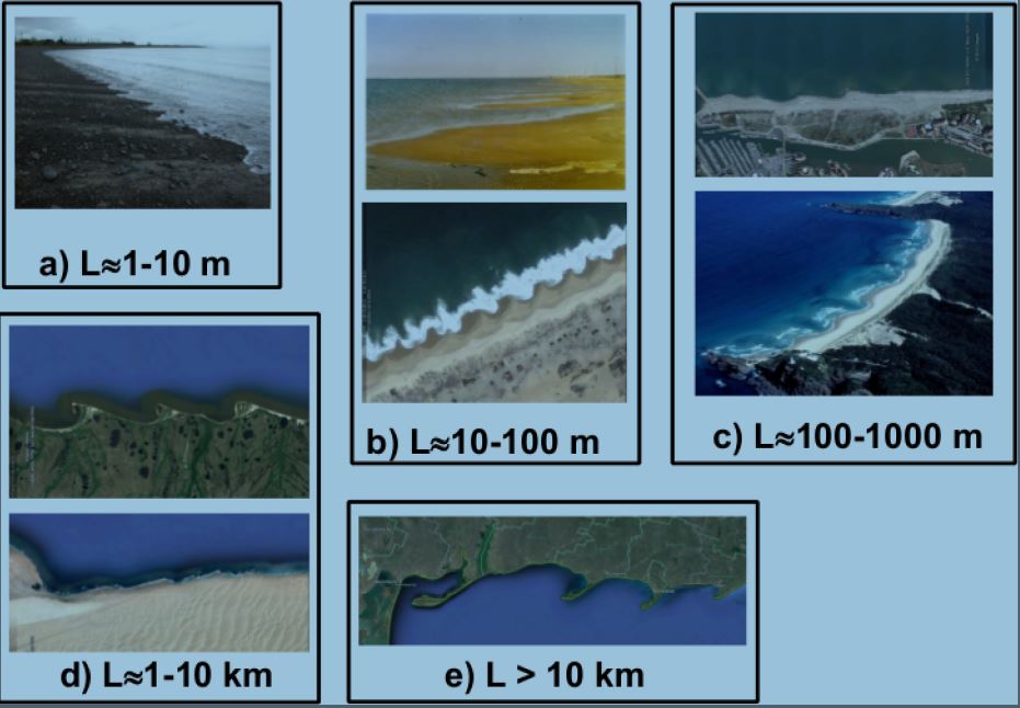
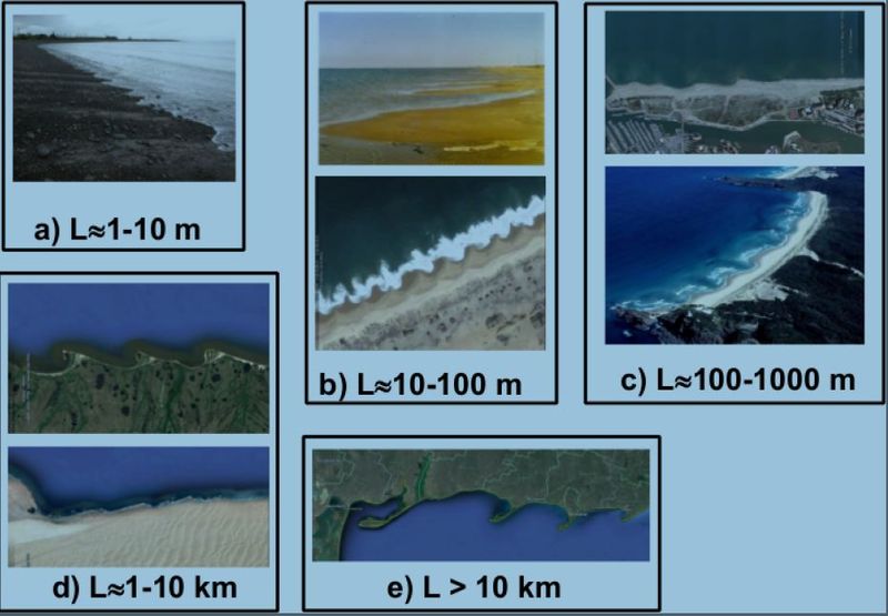
Rhythmic shoreline features at various lengthscales. a) Beach cusps (Matingarahi, NZ. Source: courtesy of Prof. A.D. Short); b) up: megacups associated to transverse bars (Ebro delta, Catalonia (Spain), image taken by the authors); b) down: large beach cusps (Angola. Source: Google Earth, image from Digital-Globe); c) up: megacusps associated to a crescentic bar (Saint Cyprien, France. Source: Google Earth, image from Data SIO, NOAA, U.S. Navy, NGA, GEBCO); c) down: megacusps associated to transverse bars (Lighthouse Beach, NSW, Australia. Source: courtesy of Prof. A.D. Short); d) up: rhythmic spits (Gulf of Amur. Source: Google Earth, image from TerraMetrics); d) down: shoreline sand waves (Namibia. Source: Google Earth, image from Digital Globe); e) rhythmic spits (Azov sea. Source: Google Earth, image from Data SIO, NOAA, U.S. Navy, NGA, GEBCO).
File history
Click on a date/time to view the file as it appeared at that time.
| Date/Time | Thumbnail | Dimensions | User | Comment | |
|---|---|---|---|---|---|
| current | 14:13, 16 May 2017 | | 931 × 646 (84 KB) | Dronkers J (talk | contribs) | Rhythmic shoreline features at various lengthscales. a) Beach cusps, b) up: megacups associated to transverse bars, Ebro delta, Spain, b) down: large beach cusps, Angola, c) up: megacusps associated to a crescentic bar, Saint Cyprien, France, c) down:... |
- You cannot overwrite this file.
File usage
There are no pages that link to this file.
