File:StLawrenceTides.jpg
From Coastal Wiki
Revision as of 21:09, 6 June 2023 by Dronkers J (talk | contribs) (Tide gauge data at a downstream and an upstream location along the St. Lawrence River (Canada) during the month September 1976. Redrawn from LeBlond (1979).)

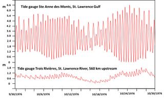
Size of this preview: 800 × 482 pixels. Other resolutions: 320 × 193 pixels | 1,599 × 963 pixels.
Original file (1,599 × 963 pixels, file size: 277 KB, MIME type: image/jpeg)
Summary
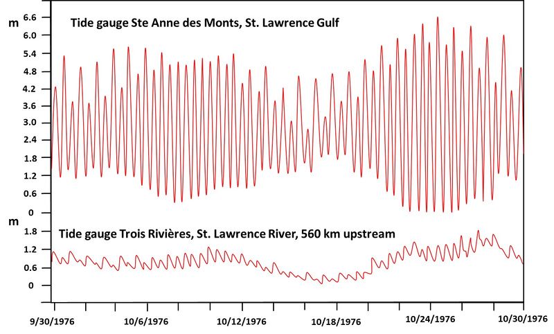
Tide gauge data at a downstream and an upstream location along the St. Lawrence River (Canada) during the month September 1976. Redrawn from LeBlond (1979).
File history
Click on a date/time to view the file as it appeared at that time.
| Date/Time | Thumbnail | Dimensions | User | Comment | |
|---|---|---|---|---|---|
| current | 18:06, 22 June 2023 | | 1,599 × 963 (277 KB) | Dronkers J (talk | contribs) | Tide gauge data at the St. Lawrence estuary mouth (Ste Anne des Monts) and at an upstream location (Trois Rivières) along the St. Lawrence River (Canada) during the month September 1976.The 0-meter datum is chosen arbitrarily for both stations. Redraw... |
| 21:09, 6 June 2023 | 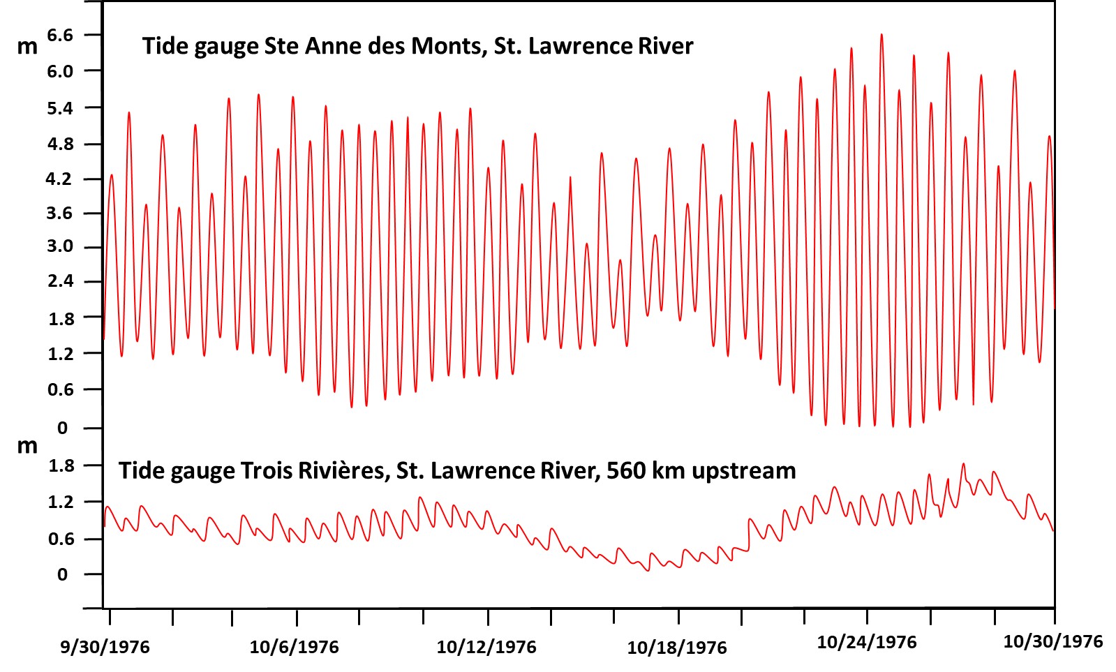 | 1,599 × 963 (277 KB) | Dronkers J (talk | contribs) | Tide gauge data at a downstream and an upstream location along the St. Lawrence River (Canada) during the month September 1976. Redrawn from LeBlond (1979). |
- You cannot overwrite this file.
File usage
The following page links to this file:
