File list
This special page shows all uploaded files.
| Date | Name | Thumbnail | Size | Description | Versions |
|---|---|---|---|---|---|
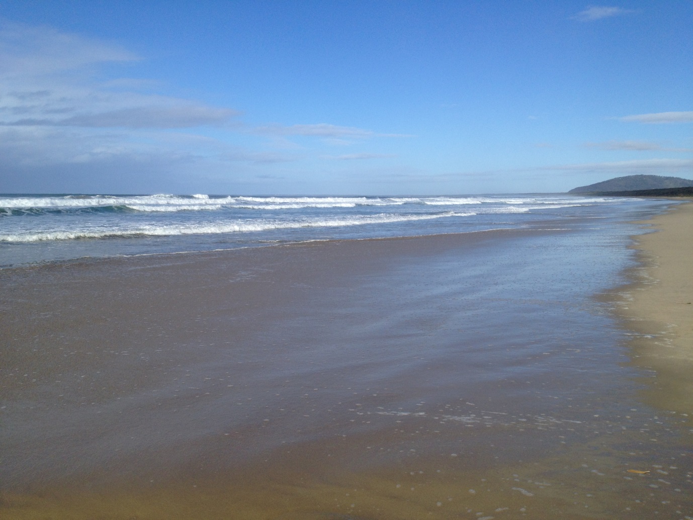
| 09:05, 30 May 2017 | BaldockFig2a.jpg (file) |  |
328 KB | Seven Mile Beach, NSW, Australia, a dissipative beach. Photo shows conditions after a swash rundown, with only small bores reaching the swash zone. Photo: Dr Hannah Power, University of Newcastle, NSW, Australia. | 1 |
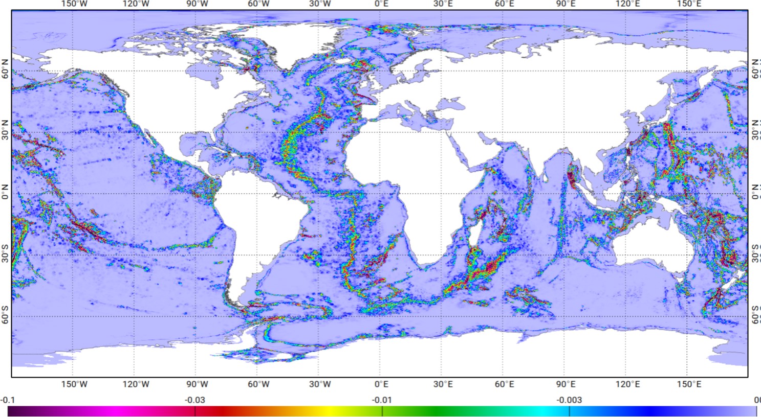
| 21:54, 10 August 2021 | M2EnergyDissipationFES.jpg (file) |  |
330 KB | Energy (W/m2) dissipated by bottom friction in the FES2014 hydrodynamic model for the M2 wave. From Lyard et al. (2021) Creative Commons Licence. | 1 |
| 09:22, 30 May 2017 | BaldockFig10.jpg (file) |  |
333 KB | A LIDAR system mounted above the swash zone, together with ultrasonic distance point sensors. Photo: Dr Chris Blenkinsopp, University of Bath, UK. | 1 |
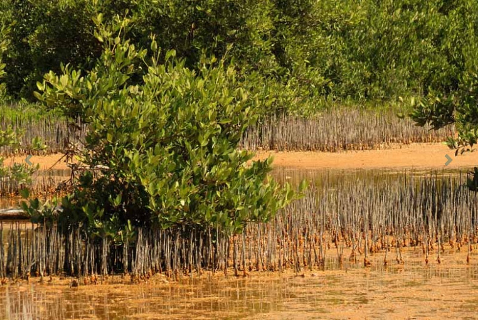
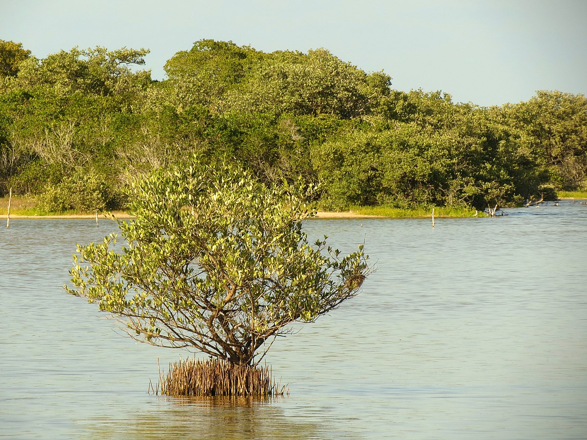
| 17:42, 25 June 2022 | BlackMangrove.jpg (file) |  |
333 KB | Black mangrove (''Avicennia'') | 1 |
| 17:47, 26 September 2016 | BaZaFig1.jpg (file) |  |
334 KB | Key elements and the flow of information within THESEUS DSS. | 1 |
| 19:41, 4 May 2019 | UndularTidalBoreGaronne.jpg (file) |  |
336 KB | Non-breaking undular tidal bore in the Garonne River. | 1 |
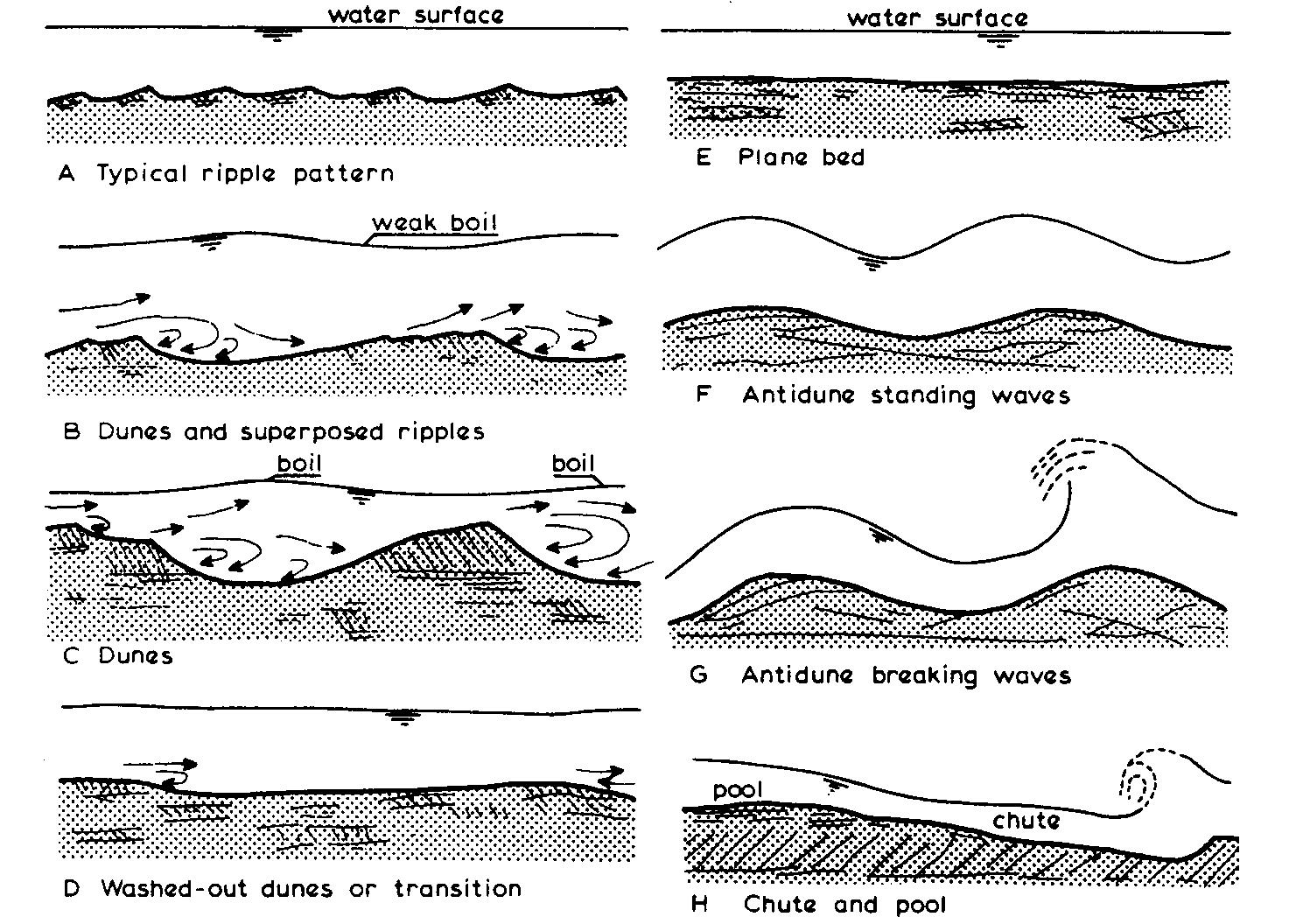
| 11:21, 10 October 2016 | VanRijnFig4.jpg (file) |  |
337 KB | Bed forms in steady flows (rivers). | 1 |
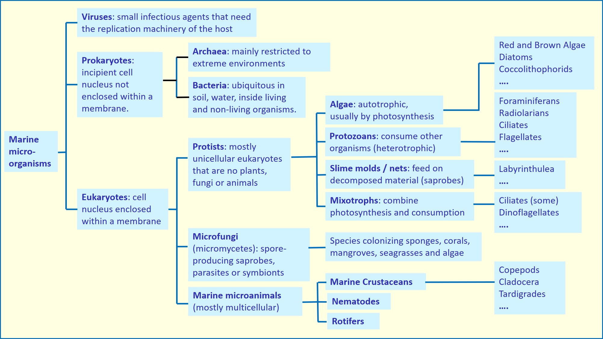
| 11:15, 21 February 2022 | MarineMicroorganisms.jpg (file) |  |
338 KB | Classification of marine microorganisms. | 2 |
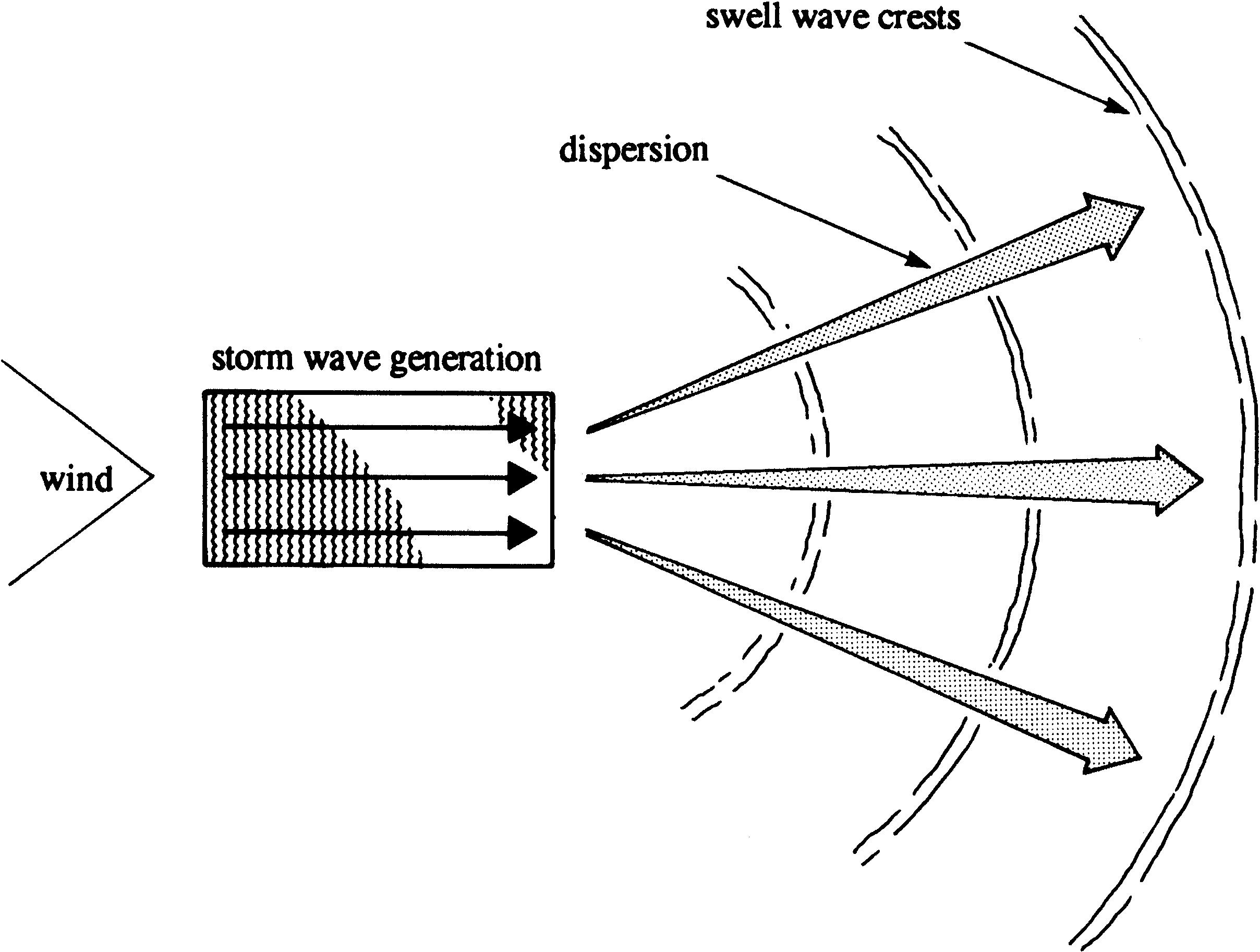
| 09:50, 6 June 2017 | ChadwickFig1.jpg (file) |  |
339 KB | Wave generation and dispersion. | 1 |
| 12:37, 5 April 2020 | UpconingWell.jpg (file) |  |
339 KB | Upconing brackish water under a pumping well. | 1 |
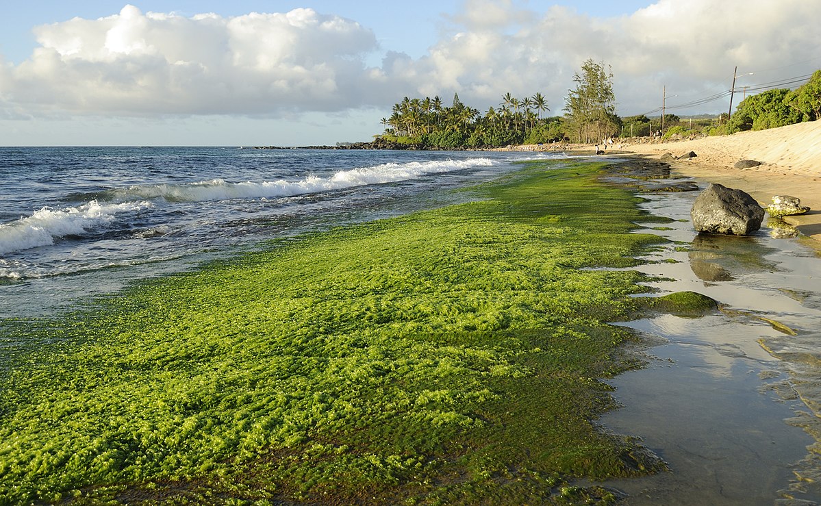
| 23:57, 14 November 2020 | GreenAlgae D Ramirez.jpg (file) |  |
342 KB | Macroalgae washed ashore. Photo credit D. Ramirez | 1 |
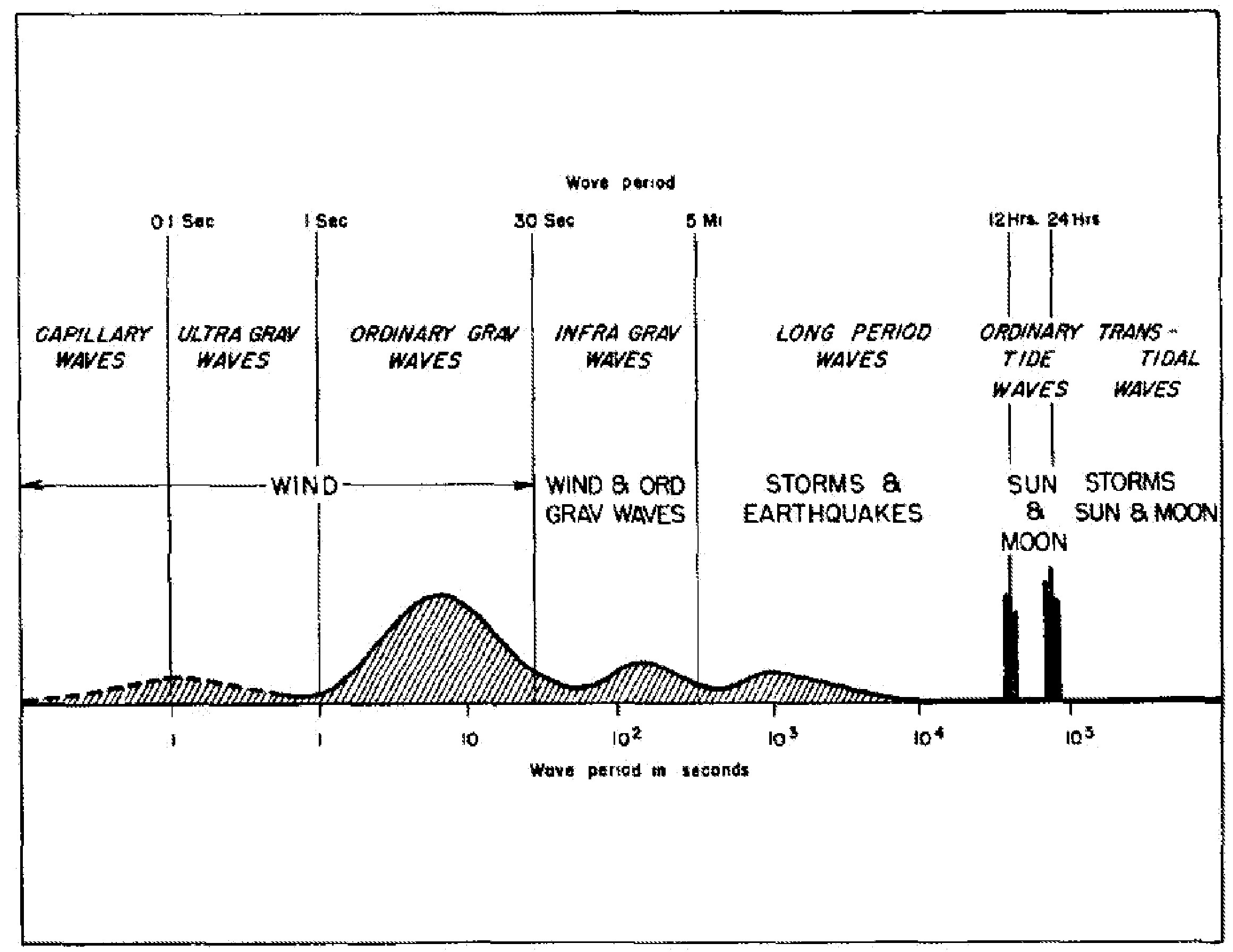
| 21:11, 20 January 2017 | WaveSpectrum.jpg (file) |  |
344 KB | Classification of ocean waves according to wave period. | 1 |
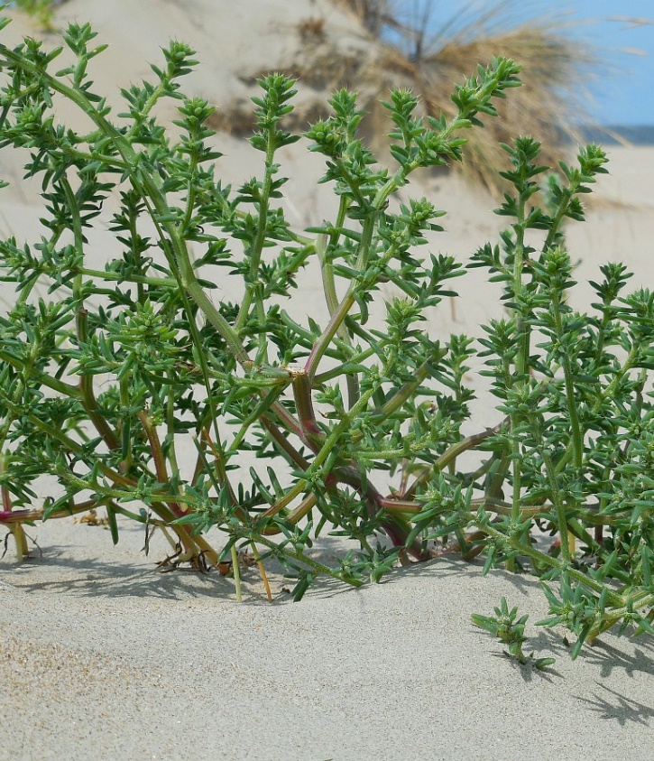
| 11:40, 27 February 2021 | SalsolaKaliES.jpg (file) |  |
345 KB | ''Salsola kali'' Credit Ed Stikvoort, Creative Commons Licence. www.freenatureimages.eu | 1 |
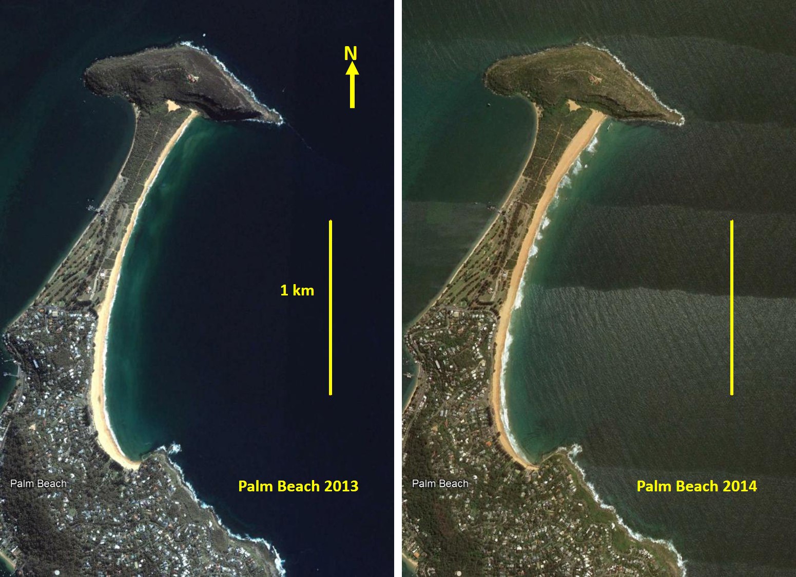
| 20:44, 1 October 2021 | BeachRotationPB.jpg (file) |  |
346 KB | Example of beach rotation, Palm Beach, Australian east coast. In 2013 the beach width was greatest in the southern part; in 2014 the width was greatest in the northern part. Images Google Earth. | 1 |
| 17:42, 4 May 2024 | MytilicultureSaintMichel.jpg (file) |  |
348 KB | Mussel farm in Baie du Mont Saint Michel (France). Mussel cultivating takes place on poles (bouchots) drilled deep into the seabed. For seed collection, a coconut fiber rope is wrapped in a spiral around the post. When time comes for grow-out, a nettin... | 1 |
| 15:18, 6 May 2019 | PetitcodiacRiver Credit Jim Hoffman.jpg (file) |  |
349 KB | Breaking undular tidal bore in the Petitcodiac River at Moncton, Canada. | 1 |
| 21:55, 10 August 2021 | M2BaroclinicDissipationFES.jpg (file) |  |
351 KB | M2 barotropic energy conversion rate (W/m2) toward baroclinic internal tides computed from the FES2014 hydrodynamic model. From Lyard et al. (2021) Creative Commons Licence. | 1 |
| 18:49, 18 August 2016 | NienhuisFig2.jpg (file) |  |
357 KB | Figure 2: The Rio Grijalva in Mexico. | 1 |
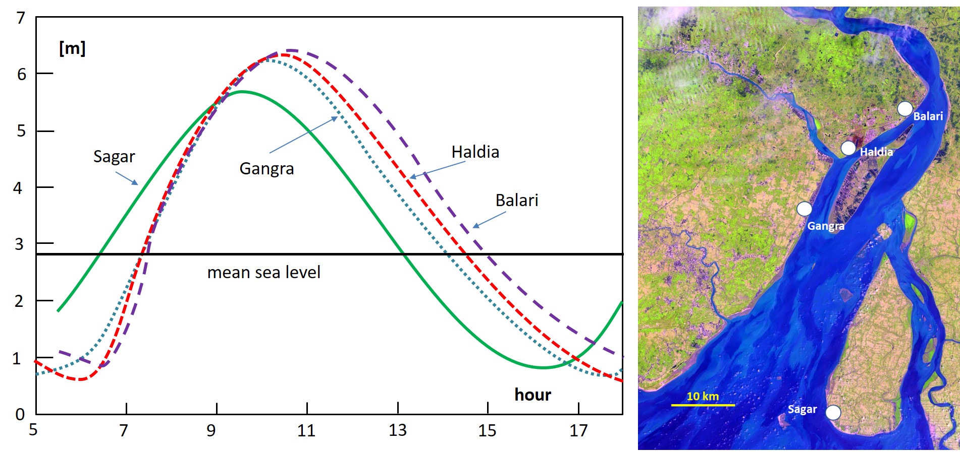
| 14:03, 15 May 2019 | HooghlyTidalWaveDeformation.jpg (file) |  |
358 KB | Tide curves in the Hooghly estuary observed during a high springtide (19/9/2009) at different tide gauges along the estuary. | 1 |
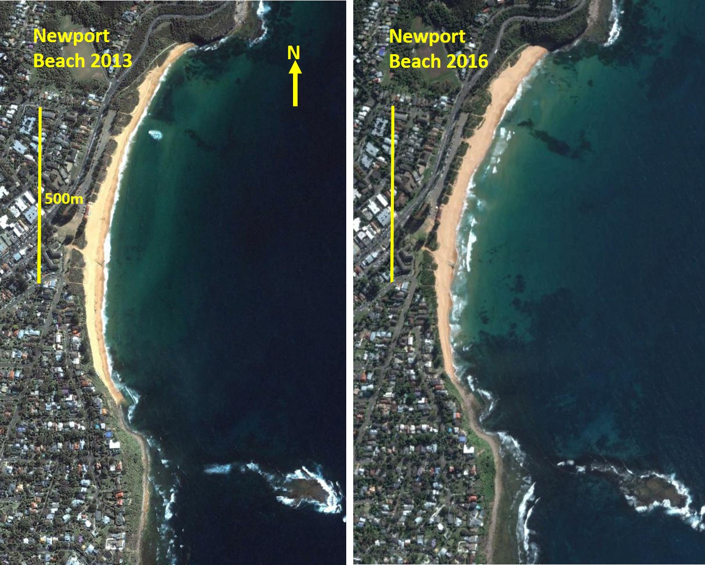
| 15:25, 1 October 2021 | BeachRotation.jpg (file) |  |
366 KB | Example of beach rotation, Newport Beach, Australian east coast. In 2013 the beach width was greatest in the south-middle part; in 2016 the width was greatest in the northern part. Images Google Earth. | 1 |
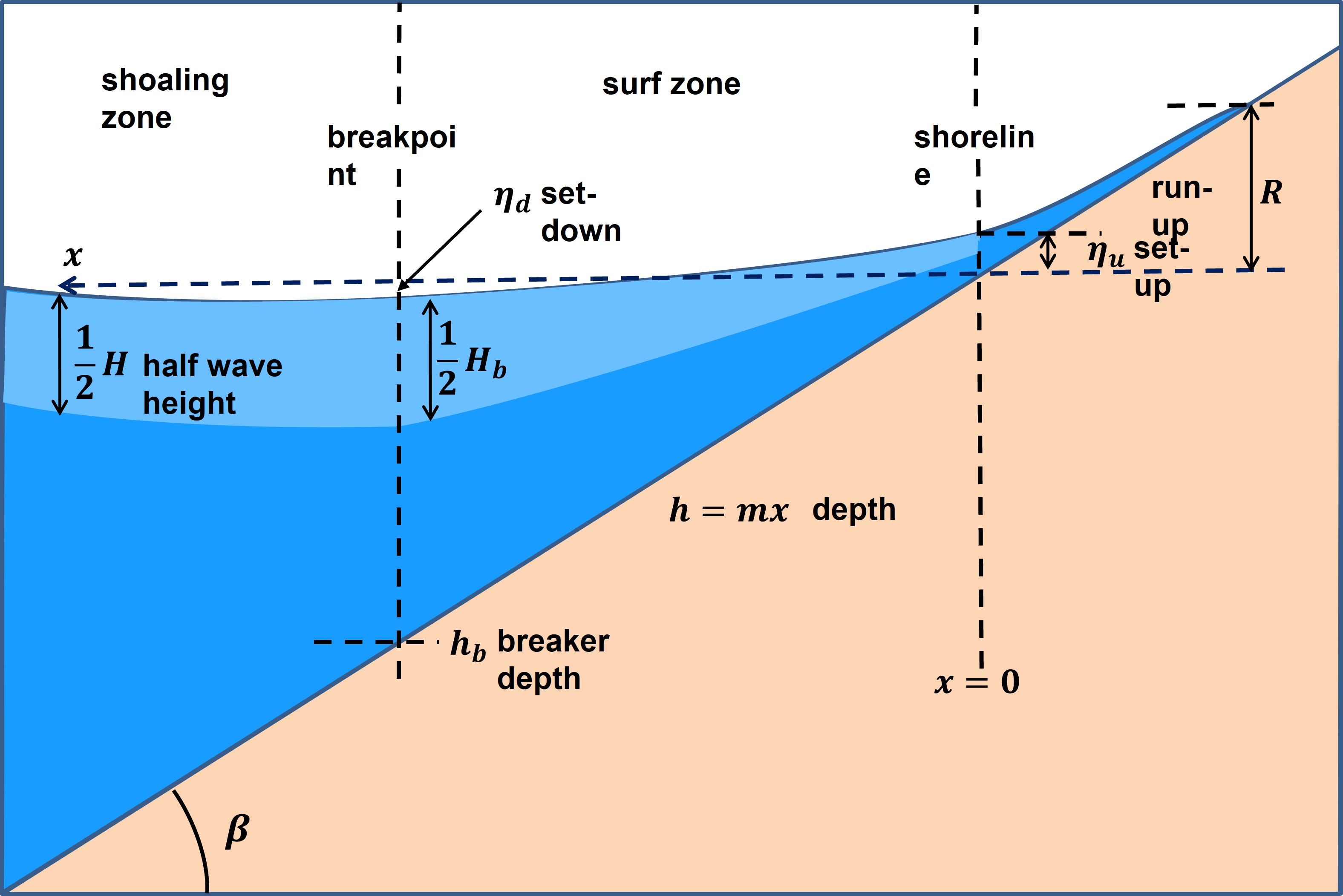
| 17:02, 25 December 2022 | SetupRunup.jpg (file) |  |
366 KB | Definition sketch wave set-down, wave set-up and wave run-up. | 1 |
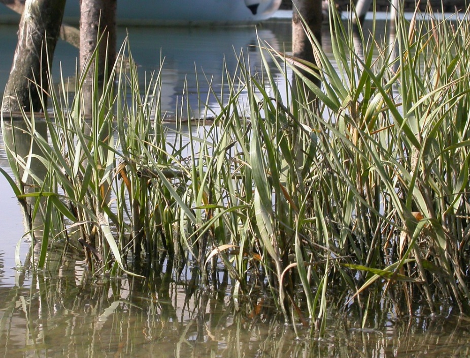
| 11:44, 27 February 2021 | SpartinaMaritima.jpg (file) |  |
366 KB | ''Spartina maritima'' Credit Ed Stikvoort, Creative Commons Licence. www.freenatureimages.eu | 1 |
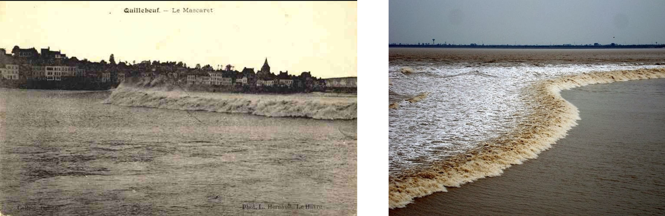
| 18:46, 25 May 2019 | Seine-Qiangtang.jpg (file) |  |
366 KB | Tidal bores in the Seine River (around 1960) and in the Qiangtang estuary. | 1 |
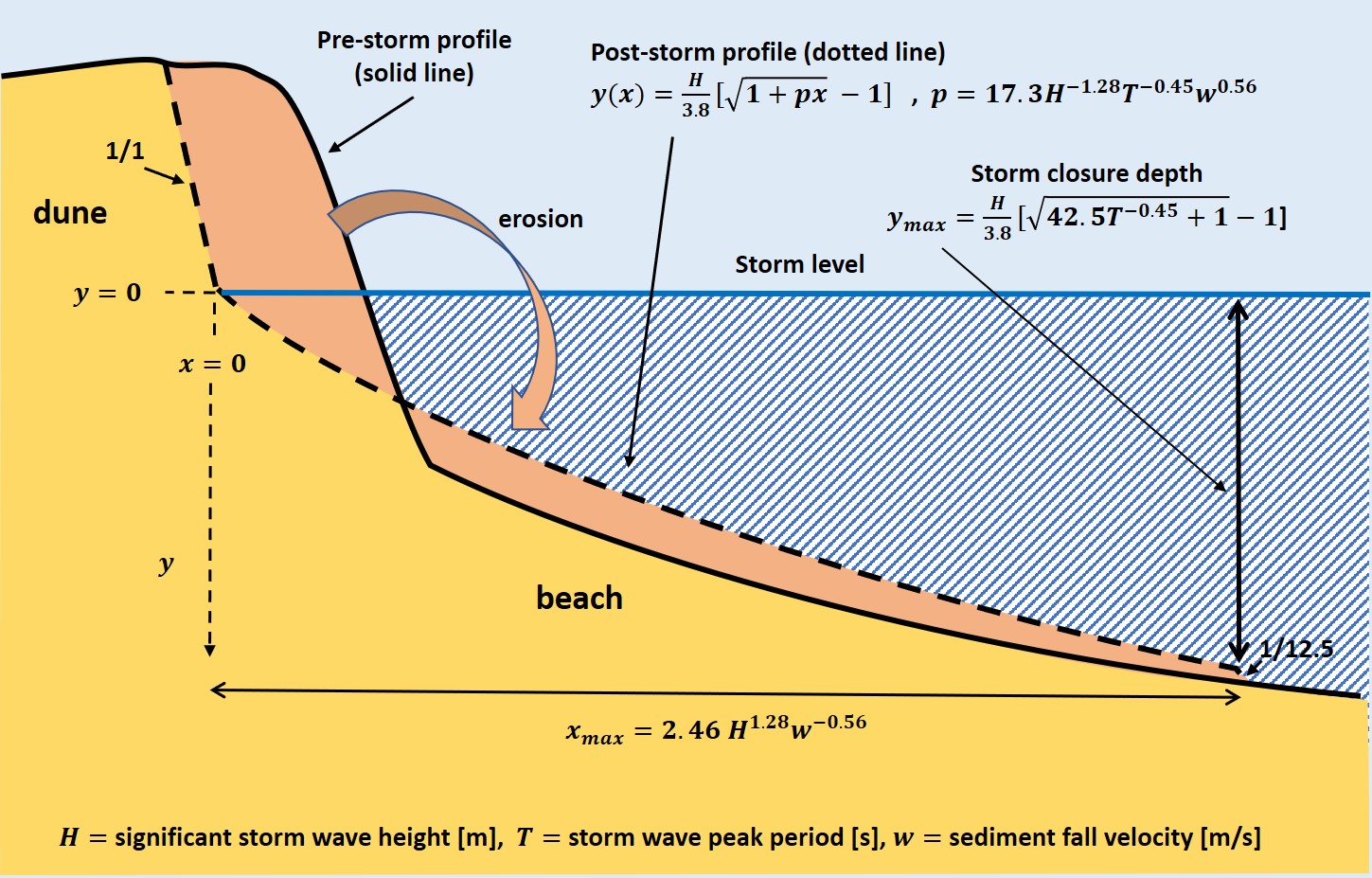
| 13:44, 15 February 2021 | ErosionProfile.jpg (file) |  |
368 KB | Erosion profile method for estimating dune erosion. | 1 |
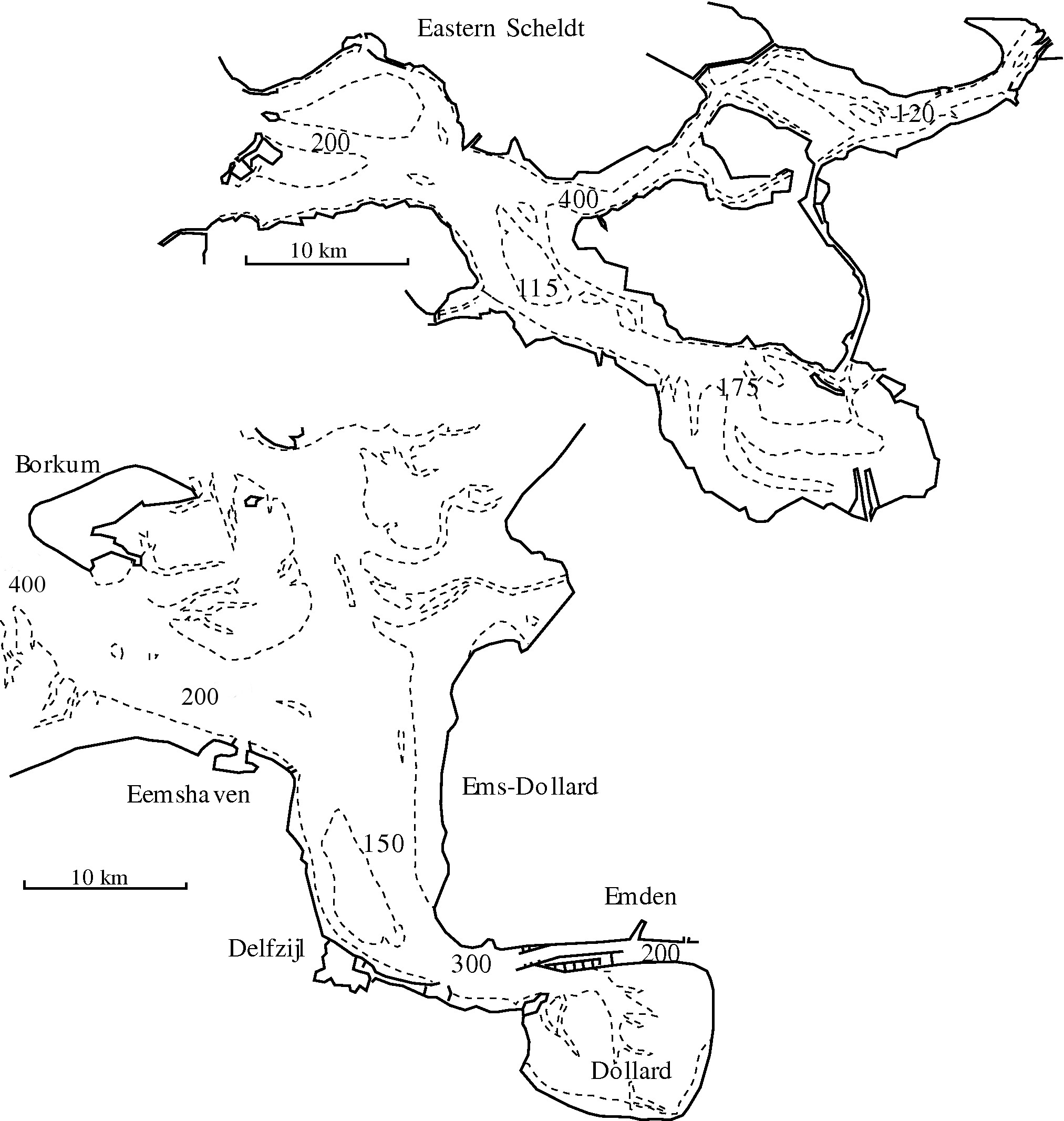
| 23:21, 25 January 2016 | OSEDdispersion.JPG (file) |  |
372 KB | Values of the dispersion coëfficiënt at different locations in the Eastern Scheldt and Ems-Dollard estuaries, derived from observed salinity distributions at small constant river discharge. | 2 |
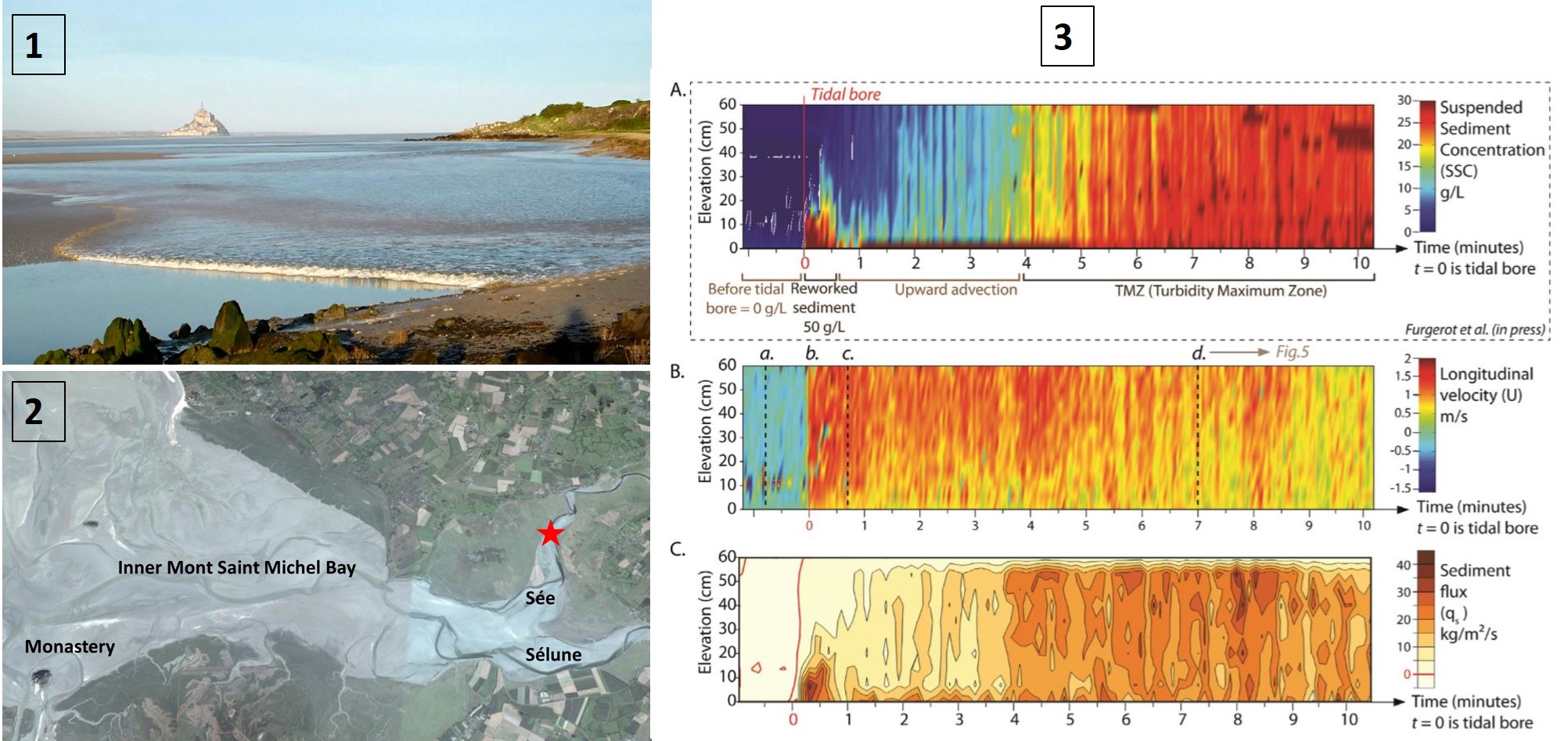
| 13:57, 16 August 2019 | TidalBoreSedimentSeeRiver Furgerot.jpg (file) |  |
377 KB | Measurement of sediment transport by a tidal bore in the Sée River on 8 May 2012. | 1 |
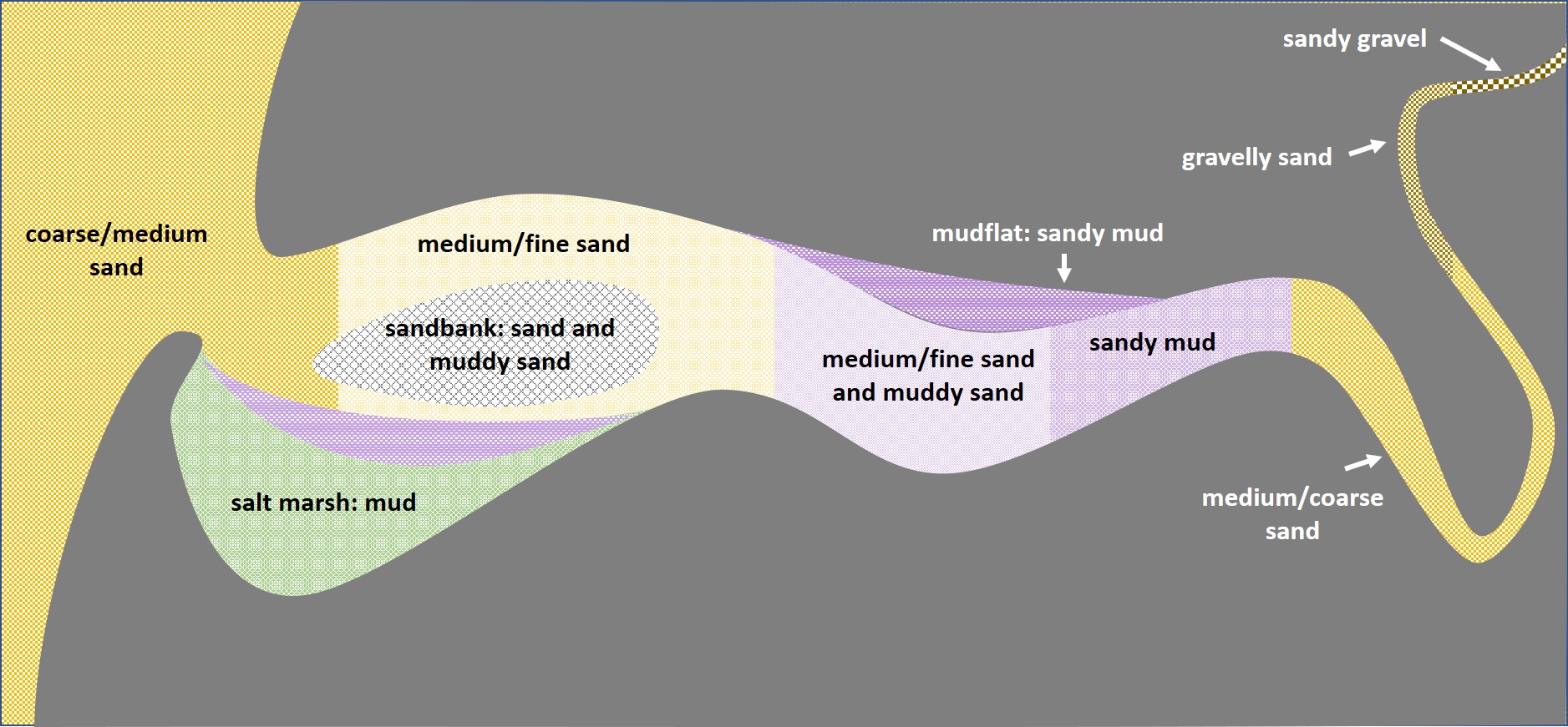
| 00:42, 18 November 2018 | EstuarineBedSedimentDistribution.jpg (file) |  |
383 KB | Typical example of the spatial distribution of bed sediments in a coastal plain estuary, schematically represented. | 1 |
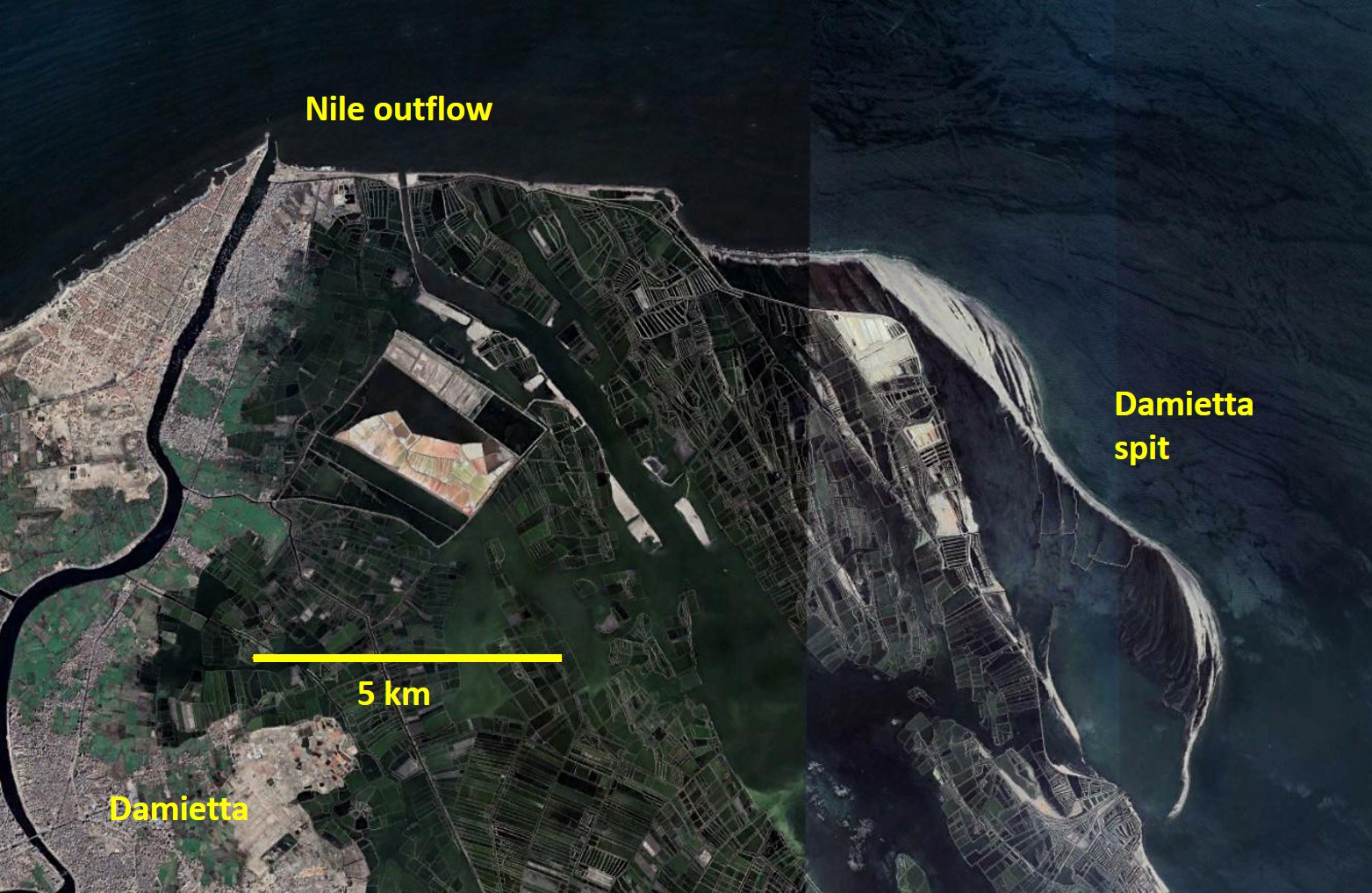
| 21:22, 21 June 2022 | DamiettaSpit.jpg (file) |  |
383 KB | Strong littoral drift from west to east at the Damietta Nile outflow has generated a large sandspit to the east of the Damietta promontory, which is bent towards the coast by cross-shore sediment transport processes. | 1 |
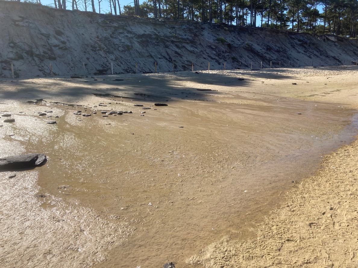
| 15:06, 30 August 2021 | BackshoreGroundwaterUpwelling.jpg (file) |  |
384 KB | Backshore groundwater upwelling, near the foot of the eroded dune face, Aquitaine coast, France. | 1 |
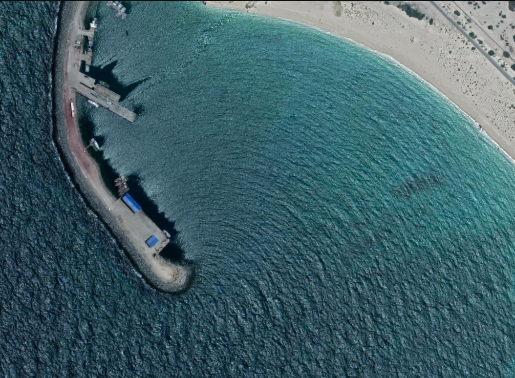
| 17:24, 5 May 2023 | AlexandriaAbuQirBeach.JPG (file) |  |
385 KB | Abu Qir beach, Alexandria. | 1 |
| 09:07, 30 May 2017 | BaldockFig2b.jpg (file) |  |
388 KB | Avoca Beach, NSW, Australia, a reflective beach. Photo shows the inner surf zone and a bore reaching the swash zone in the background and a swash uprush reaching the top of a beach berm in the foreground. Photo: Dr Hannah Power, University of Newcastle... | 1 |
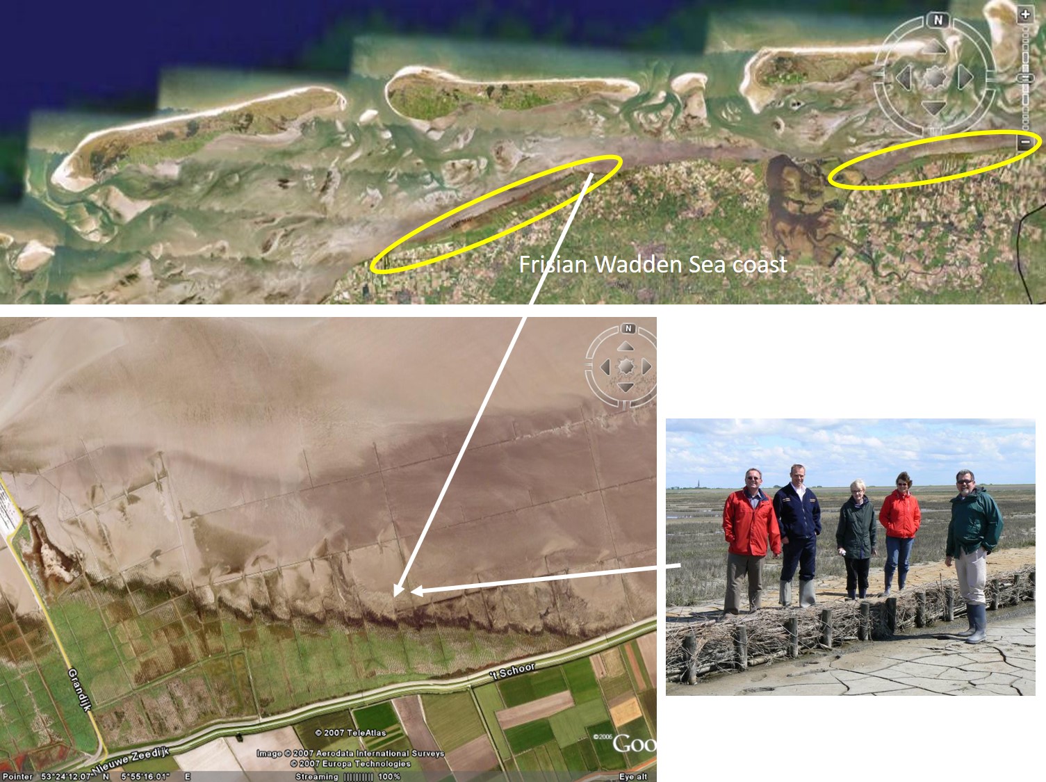
| 21:32, 29 September 2019 | WaddenSeaMarshCreation.jpg (file) |  |
388 KB | Dikes along the Wadden Sea are protected by marshland created by stimulating natural sedimentation through fences of braided willow twigs. | 1 |
| 11:42, 27 February 2021 | HalimionePortulacoides.jpg (file) |  |
390 KB | ''Halimione portulacoides'' Credit Jan van der Straaten, Creative Commons Licence. www.freenatureimages.eu | 1 |
| 17:18, 25 June 2022 | BlackMangrove Flickr Commons.jpg (file) |  |
397 KB | Black mangroves (''Avicennia'') | 1 |
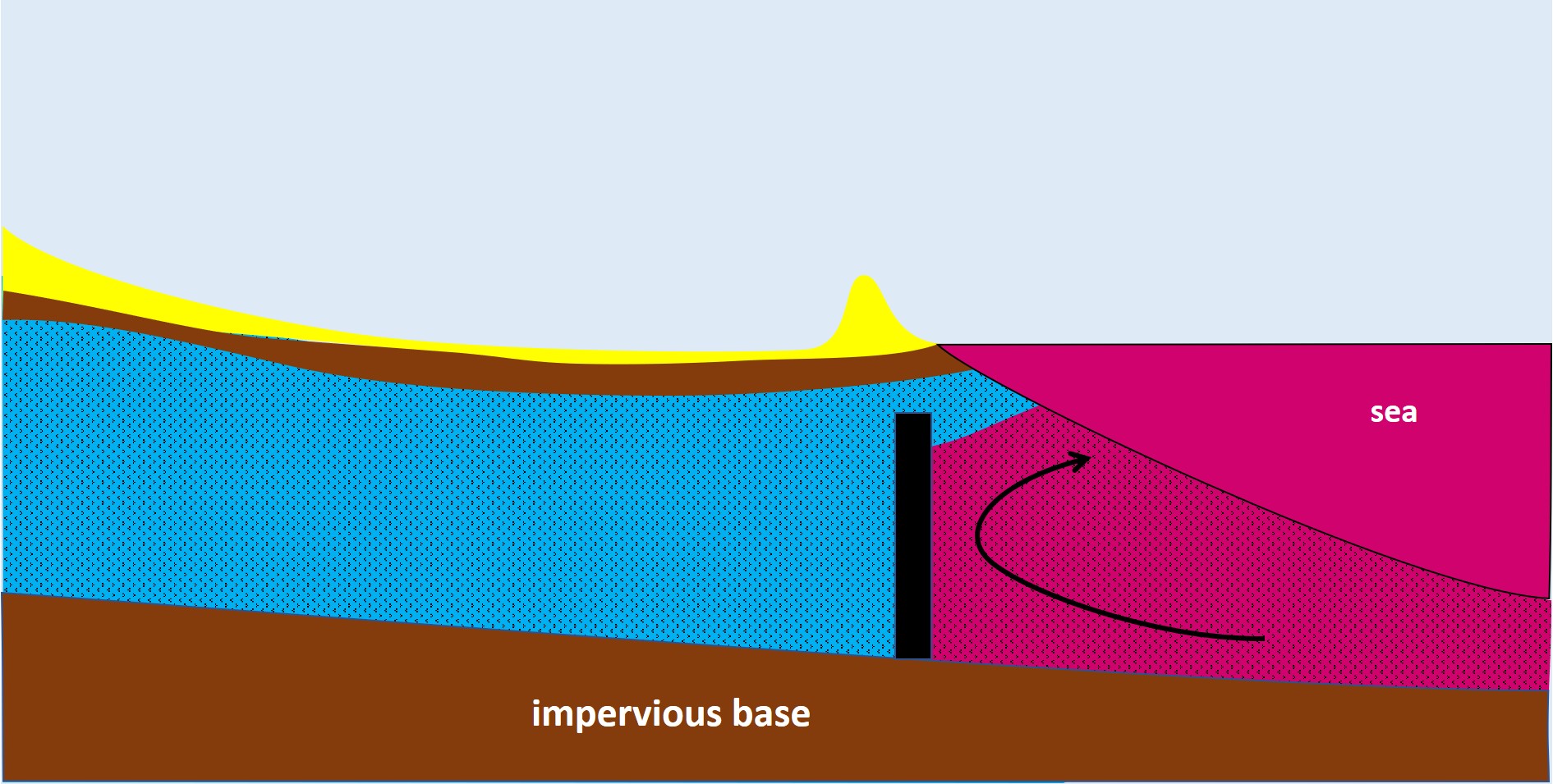
| 12:54, 5 April 2020 | PhysicalBarrier.jpg (file) |  |
399 KB | Physical subsurface barrier at the seaward entrance of an aquifer. | 2 |
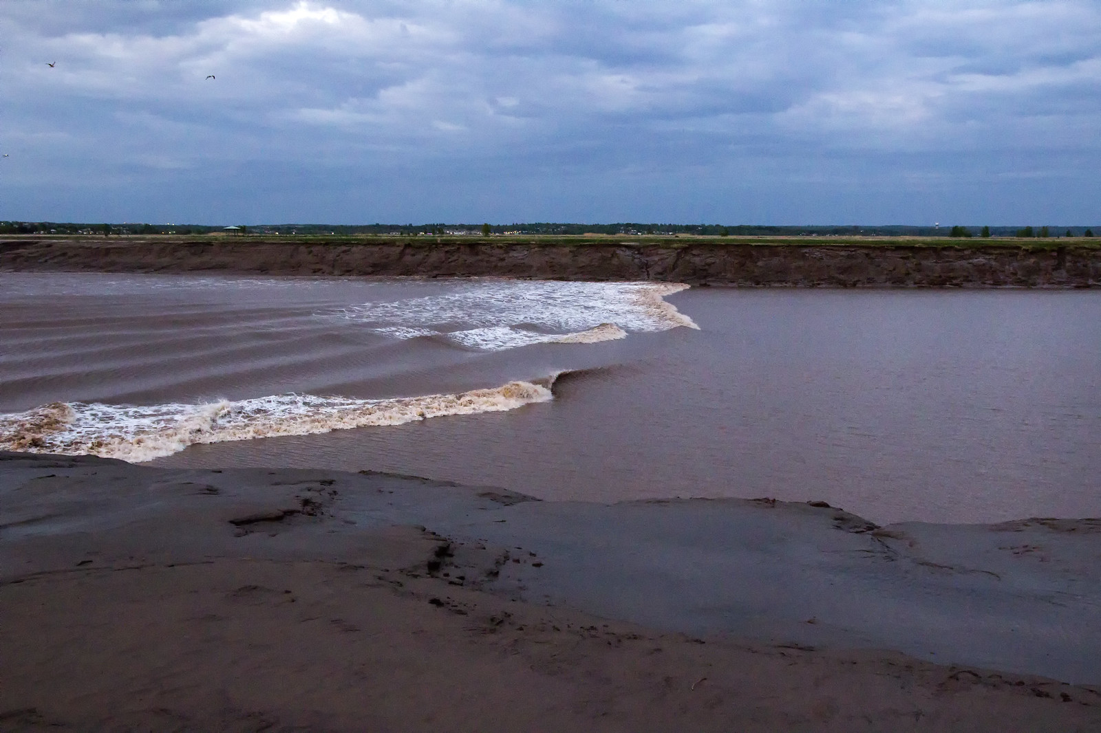
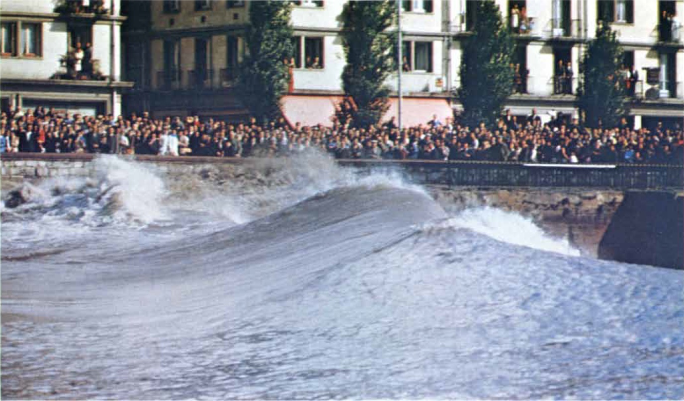
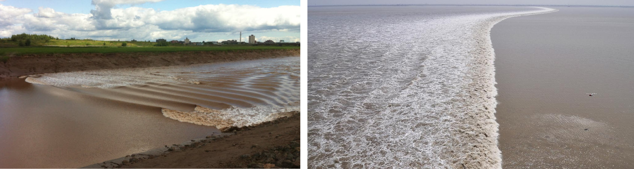
| 10:41, 1 May 2019 | SeineBore.jpg (file) |  |
407 KB | Tidal bore in the Seine at Caudebec in 1963 (Lynch, 1982). | 2 |
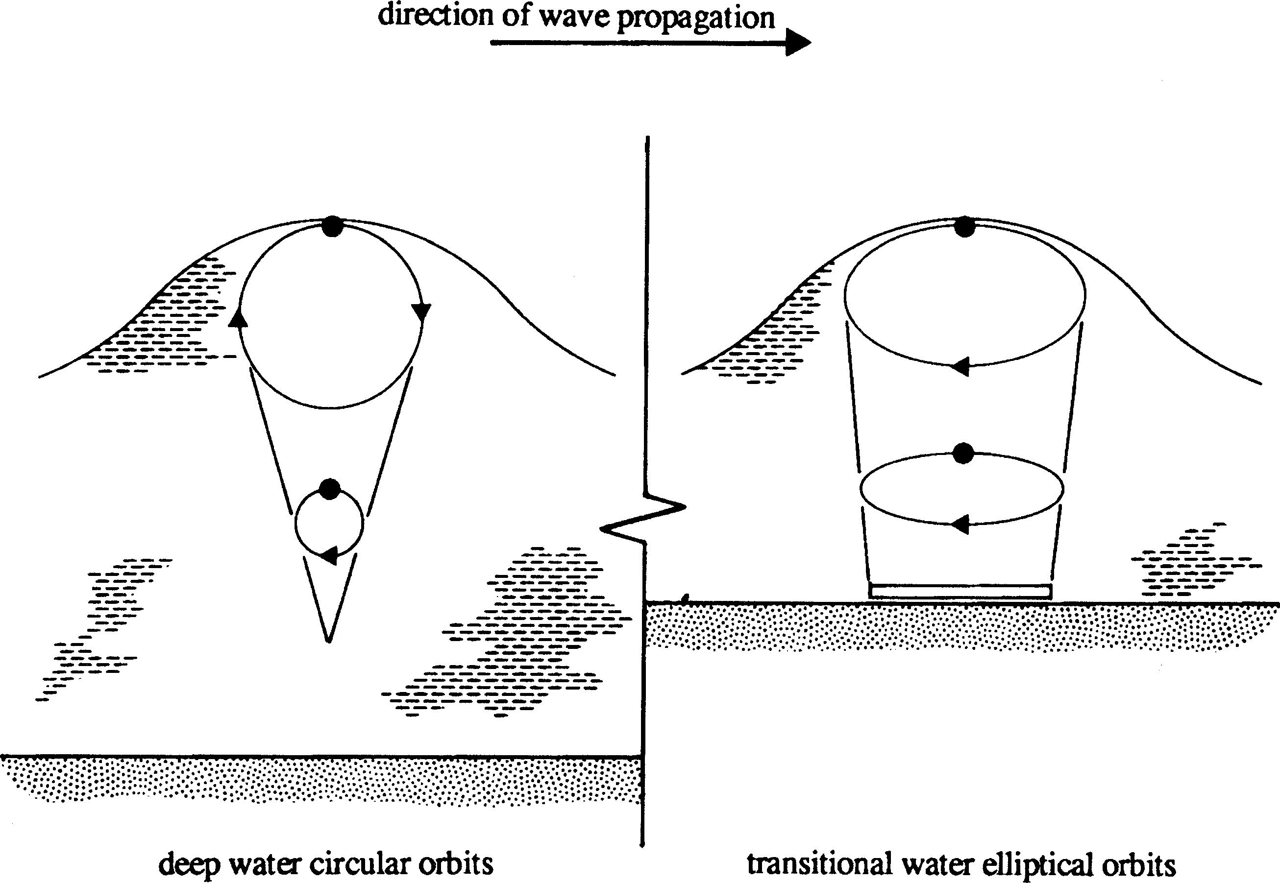
| 09:53, 6 June 2017 | ChadwickFig4.jpg (file) |  |
407 KB | Particle displacements for deep and transitional waves. | 1 |
| 20:21, 13 January 2020 | BandAcehTsunamiLeadingDepression.jpg (file) |  |
412 KB | Retreating shoreline before arrival of the major wave of the Indian Ocean tsunami at Banda Aceh on December 26, 2004. | 1 |
| 14:12, 27 December 2023 | GrassCoveredSeadike.jpg (file) |  |
418 KB | Grass covered dike, Wolphaartsdijk - Veerse Meer, Zeeland, Netherlands (Image Bank Rijkswaterstaat, photo Jan van den Broeke). | 1 |
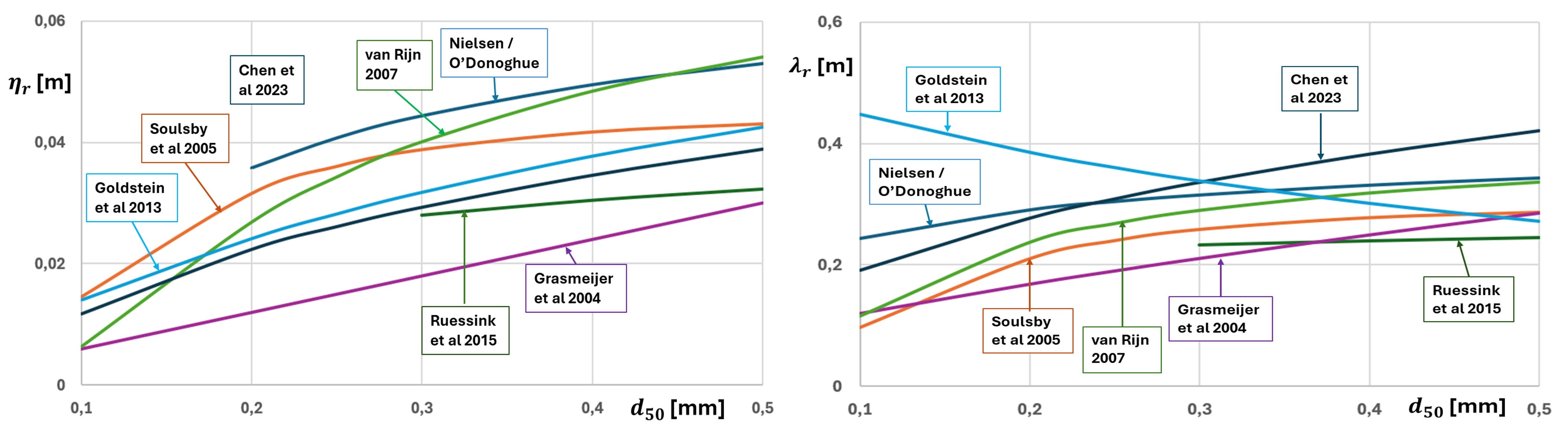
| 11:52, 16 May 2024 | RippleModels.jpg (file) |  |
423 KB | Empirical ripple prediction formulas. Left: Predictions of the ripple height. Right: Predictions of the ripple wavelength. | 2 |
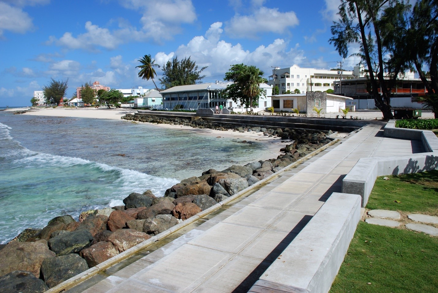
| 13:29, 5 February 2019 | BoardwalkBarbados.jpg (file) |  |
433 KB | View of the Boardwalk scheme in Barbados. | 1 |
| 23:39, 25 May 2019 | PetitcodiacRiver-KamparRiver.jpg (file) | 436 KB | Left image: Tidal bore in the Petitcodiac River, which is undular at the middle of the channel and breaking near the channel banks. Right image: Breaking tidal bore in the Kampar River, Sumatra. | 1 | |
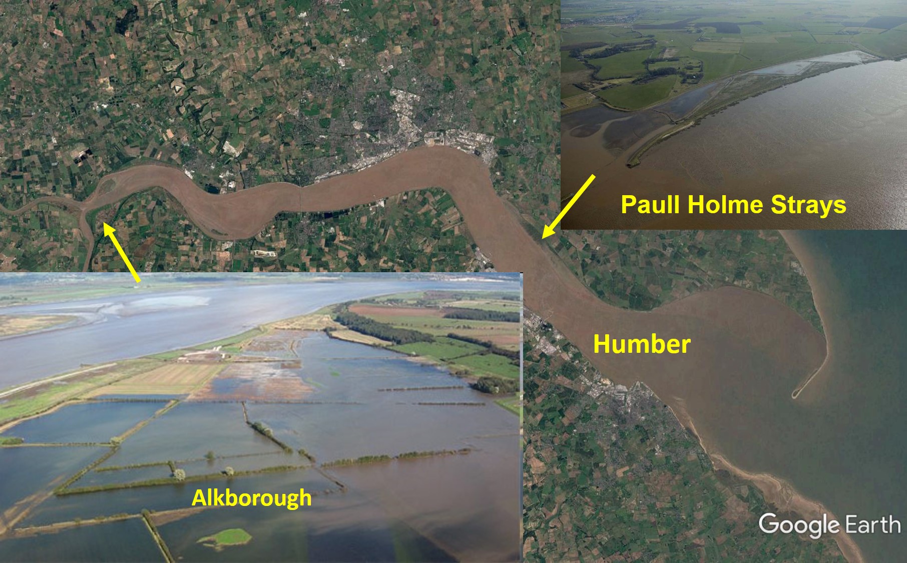
| 19:34, 16 February 2019 | HumberWetlandRestoration.jpg (file) |  |
439 KB | Realignment of coastal defences and wetland restoration projects in the Humber estuary (UK). | 1 |
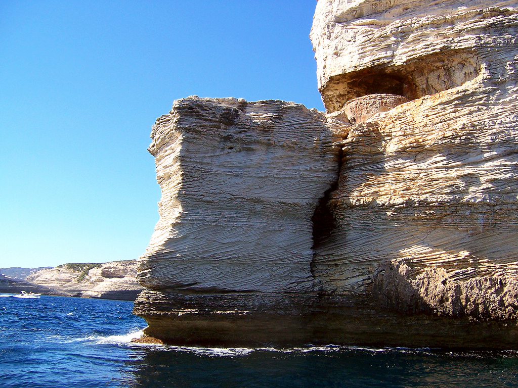
| 20:54, 16 April 2018 | CliffErosion Bonifacio Corsica Andrea Papi.jpg (file) |  |
442 KB | Cliff erosion at Bonifacio, Corsica. Photo credit: Andrea Papi. | 1 |
| 16:47, 29 March 2021 | WaveDiffraction.jpg (file) |  |
442 KB | Wave diffraction around the tip of a breakwater. Image Google Earth. | 1 |
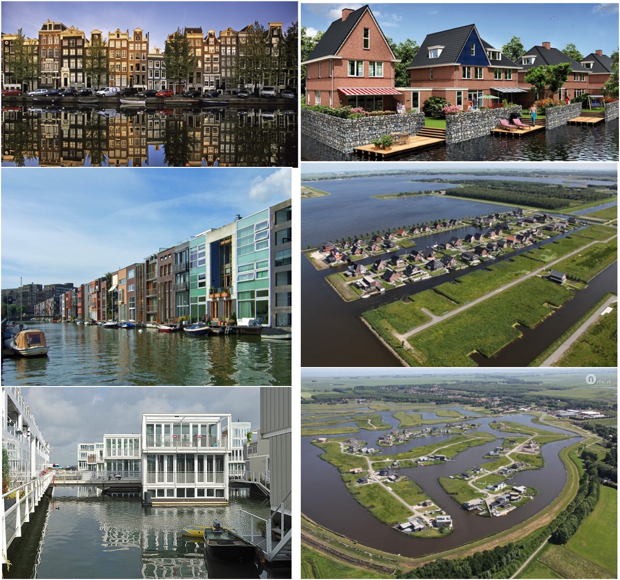
| 17:34, 5 February 2020 | RoomForWaterCoastalCities.jpg (file) |  |
445 KB | Examples of room for water in Dutch cities. | 1 |
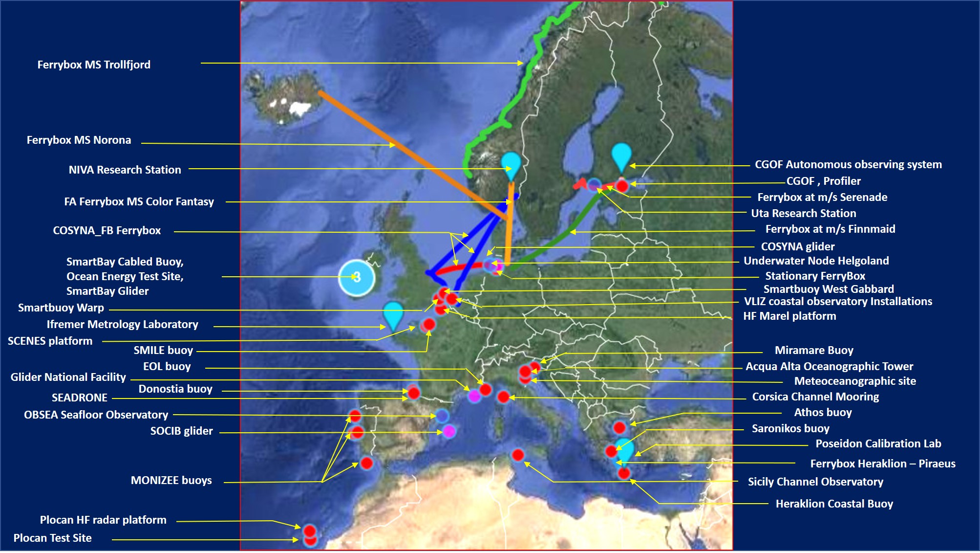
| 14:37, 18 August 2020 | EUmapObservatories.jpg (file) |  |
445 KB | Location of field observatories participating in the JERICO network. | 1 |
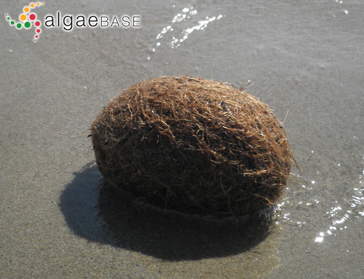
| 13:32, 2 March 2021 | Egagropili.jpg (file) |  |
453 KB | ''Posidonia oceanica'' egagropili [https://www.algaebase.org/ Photo credit Isabel Rubio]. | 1 |
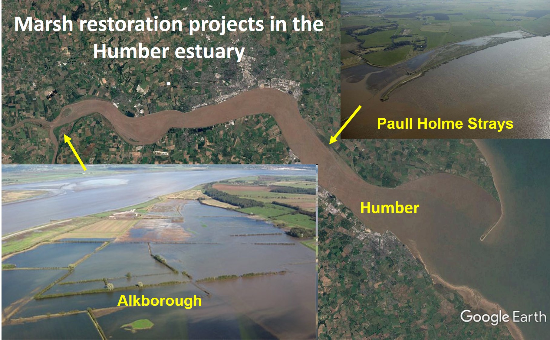
| 18:45, 23 November 2020 | MarshRestorationHumber.jpg (file) |  |
455 KB | Marsh restoration projects in the Humber estuary. | 1 |
| 13:16, 27 December 2022 | BarFormationTransports.jpg (file) | 462 KB | Schematic of the major bar-building sediment transport processes. | 1 |