File list
This special page shows all uploaded files.
| Date | Name | Thumbnail | Size | Description | Versions |
|---|---|---|---|---|---|
| 19:55, 15 April 2024 | RippleRegimeTransportCompressed.gif (file) | 1.9 MB | Wave-induced sand transport over a seabed ripple. Courtesy Jebbe van der Werf. | 1 | |
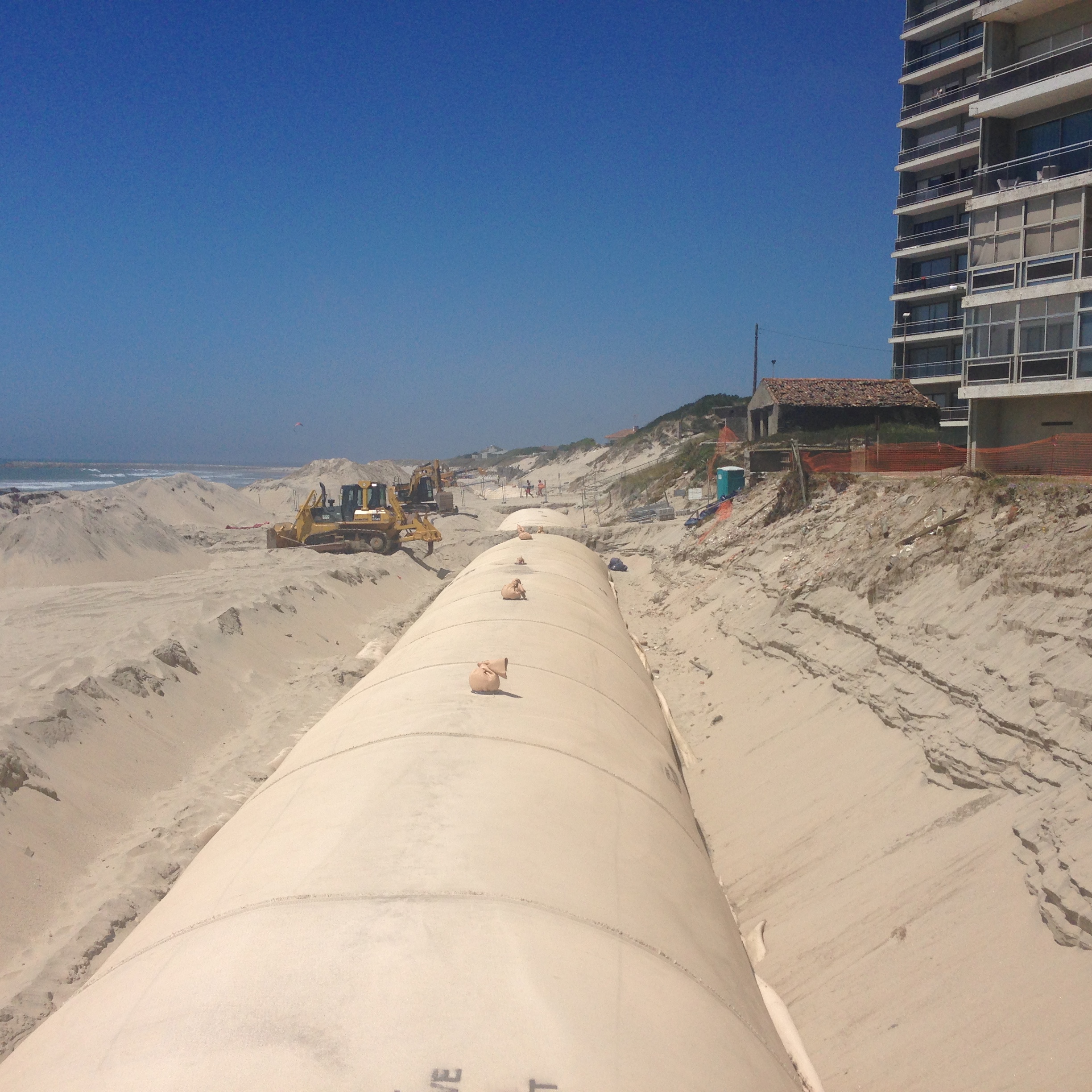
| 10:06, 19 September 2016 | LucianaFig.jpg (file) |  |
1.64 MB | Geotextile tube application at the beach of Ofir, Esposende, Portugal. | 1 |
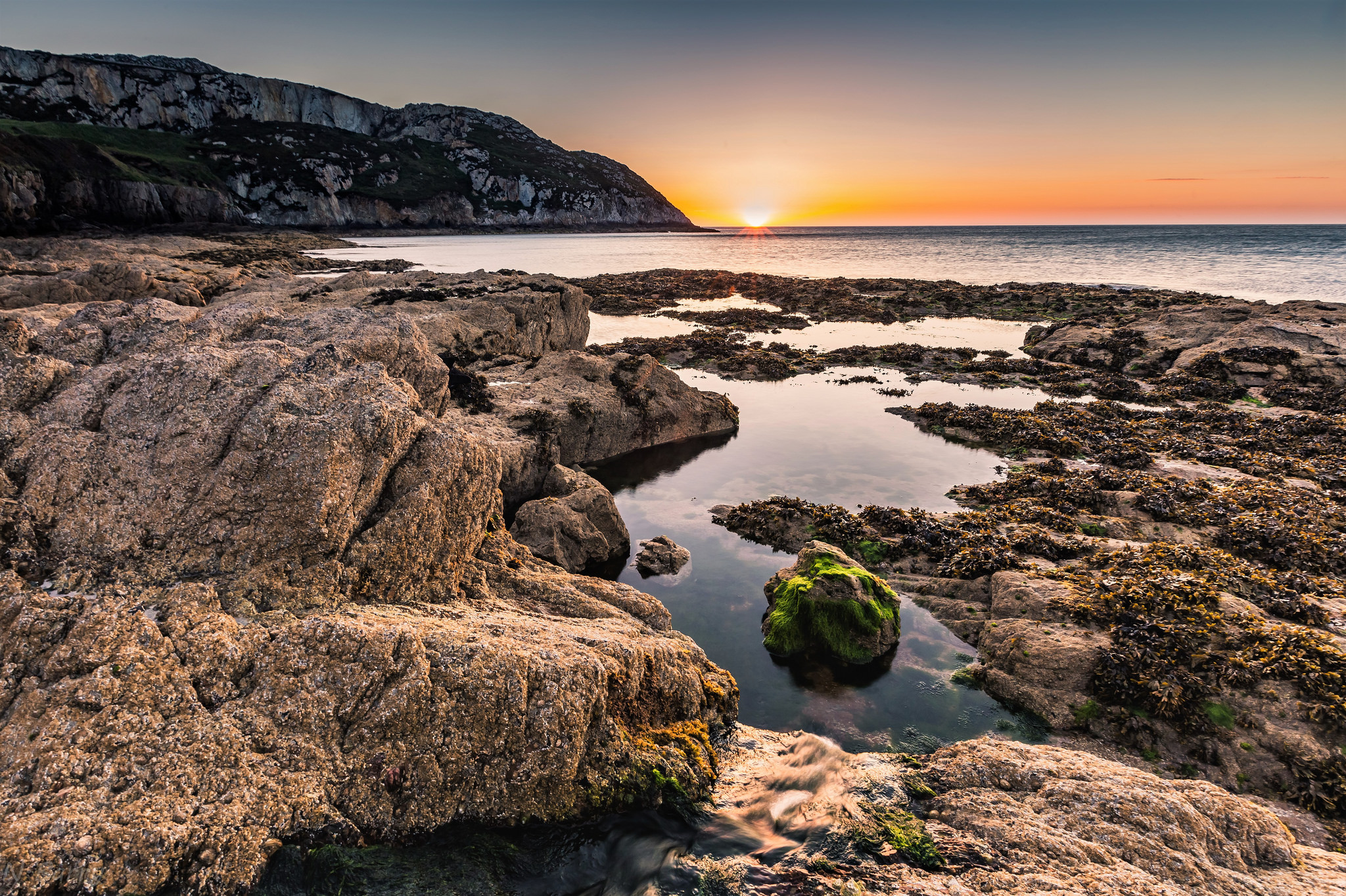
| 20:55, 16 April 2018 | RockyShorePlatform Holyhead-Wales UK Nigel Barry.jpg (file) |  |
1.38 MB | Rocky shore platform, Holyhead, Wales (UK). Photo credit: Nigel Barry. | 1 |
| 10:06, 6 June 2017 | ChadwickFig17a.jpg (file) |  |
1.32 MB | The surf zone, conceptual. | 1 |
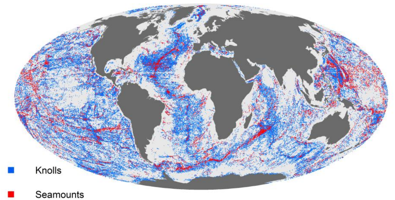
| 18:42, 24 February 2021 | SeamountsGlobalMap.png (file) |  |
1.32 MB | Global distribution of seamounts. From Yesson et al. (2011). Creative Commons licence. | 1 |
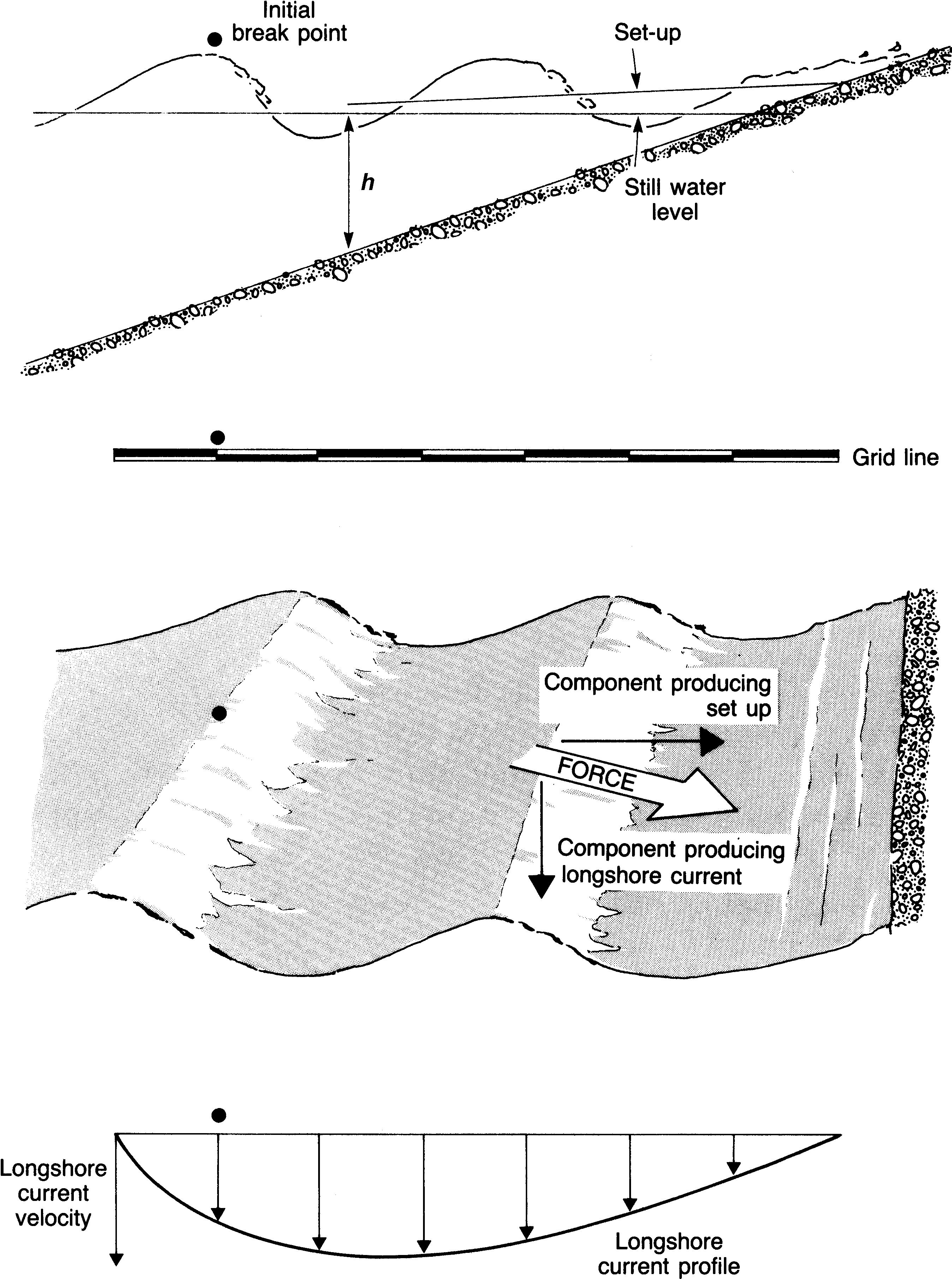
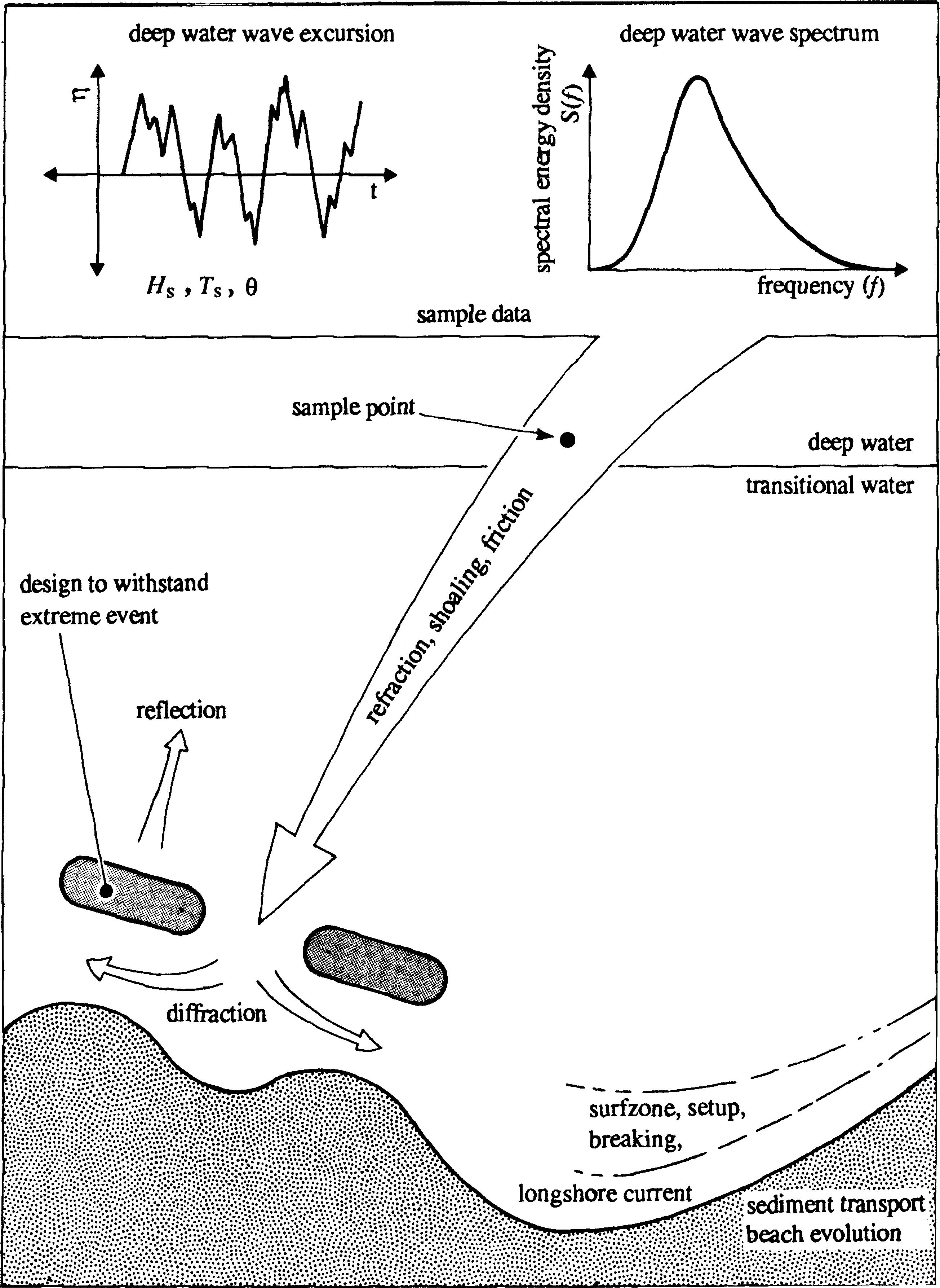
| 09:52, 6 June 2017 | ChadwickFig2b.jpg (file) |  |
1.12 MB | Wave generation and dispersion. | 1 |
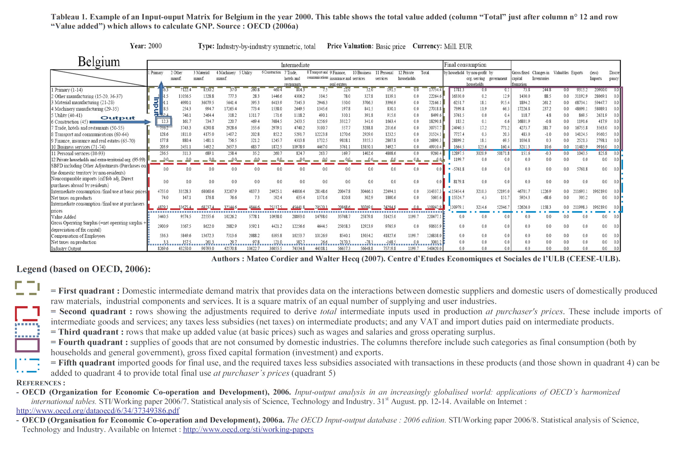
| 18:32, 25 February 2019 | InputOutputMatrixBelgium2000.jpg (file) |  |
1.12 MB | Input-Output matrix for Belgium (2009) | 1 |
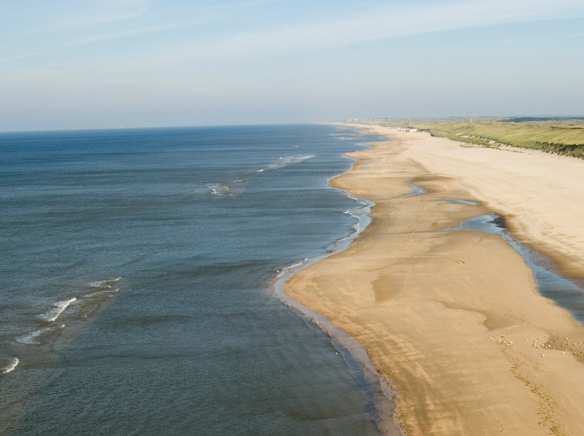
| 13:55, 18 September 2018 | DutchCoastNorthHolland.jpg (file) |  |
1.02 MB | The barred coast of North Holland, The Netherlands. https://beeldbank.rws.nl, Rijkswaterstaat / Rens Jacobs | 1 |
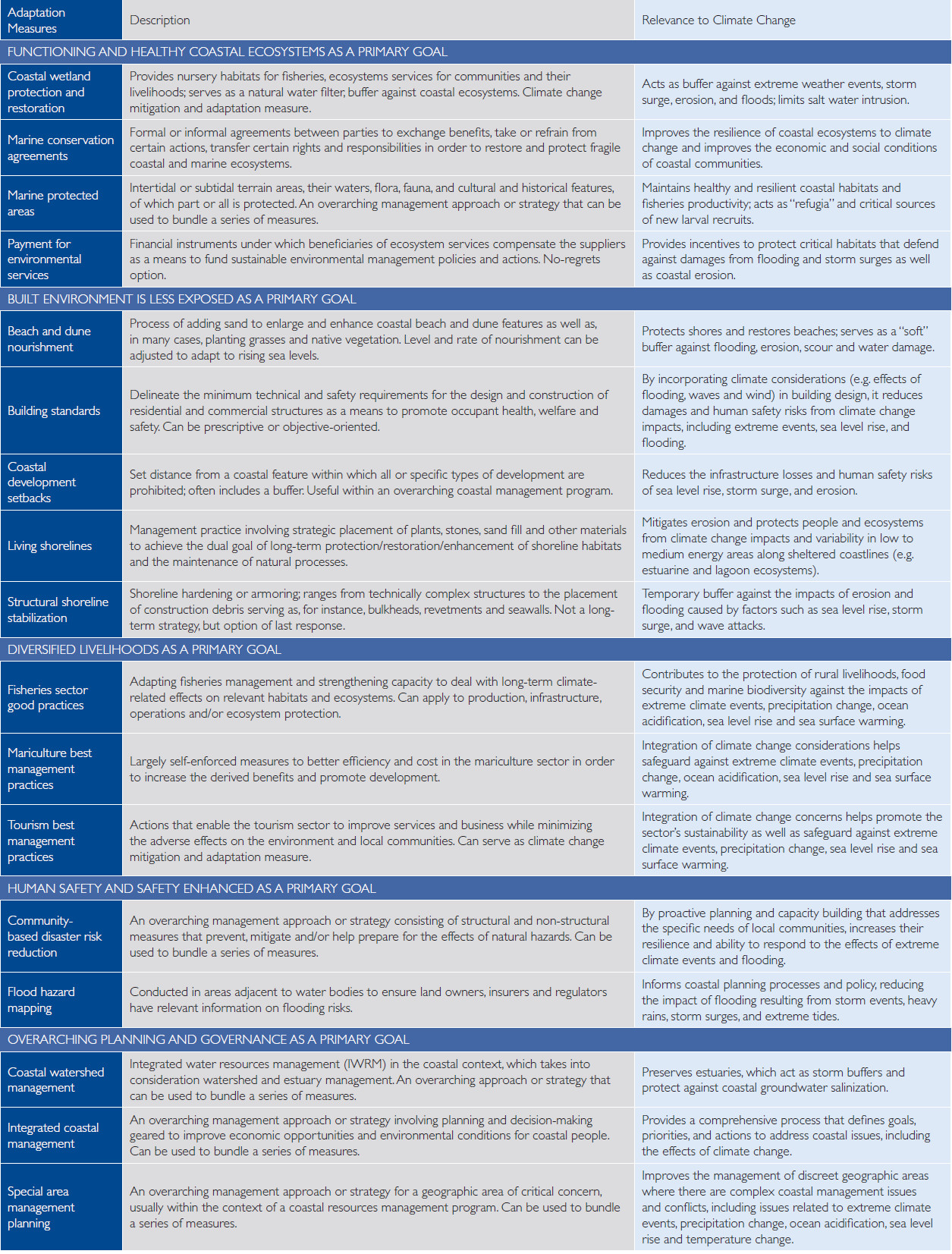
| 23:46, 22 February 2019 | AdaptationMeasuresUSAID.jpg (file) |  |
911 KB | Climate adaptation measures for the coastal zone (USAID, 2009) | 1 |
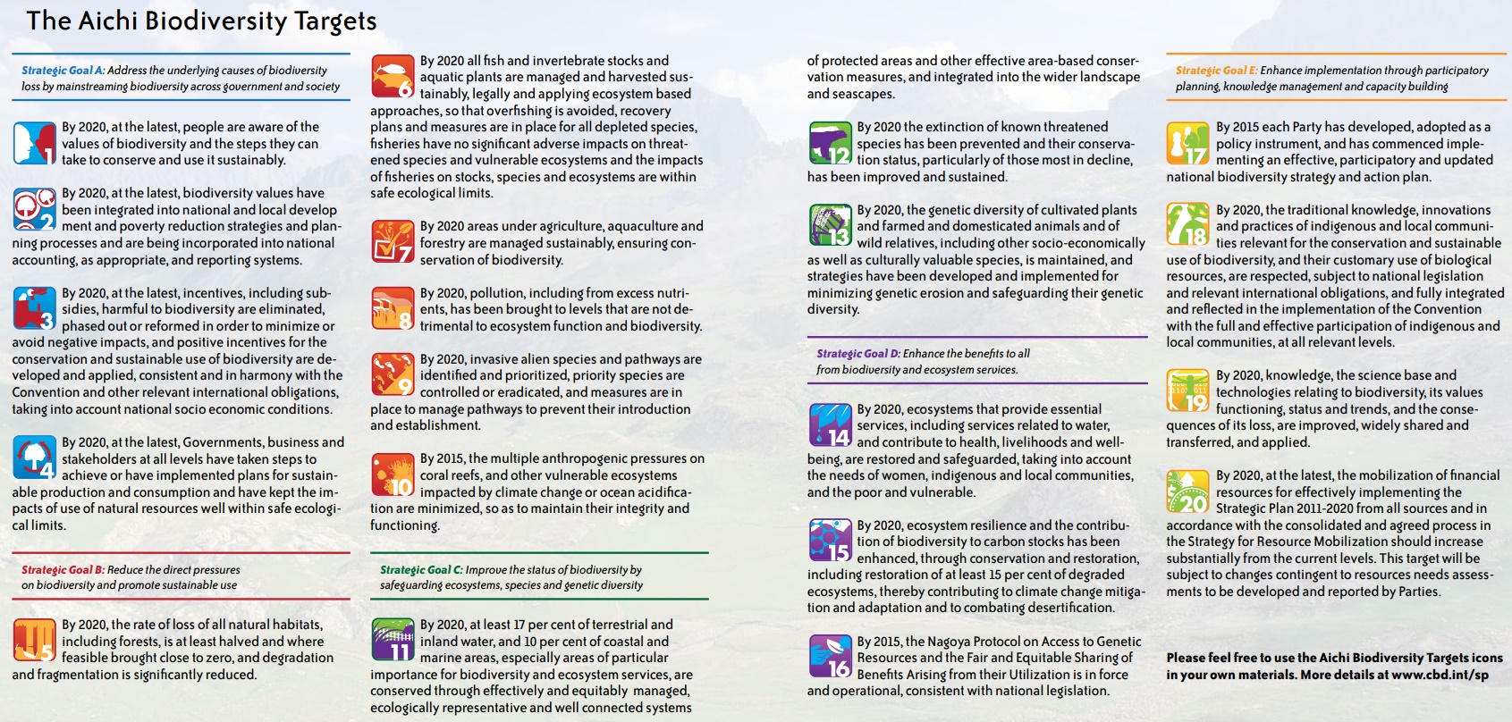
| 12:24, 26 September 2021 | AichiTargets.jpg (file) |  |
827 KB | AICHI Biodiversity Targets. | 1 |
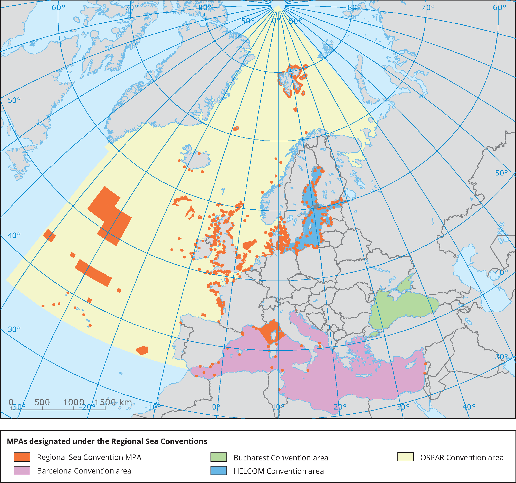
| 22:16, 12 September 2020 | EuropeMarineProtectedAreas2015.gif (file) |  |
819 KB | Map of Marine Protected Areas designated under the Regional Sea Conventions, situation 2015. From EEA report 3/2015: Marine protected areas in Europe's seas. An overview and perspectives for the future. | 1 |
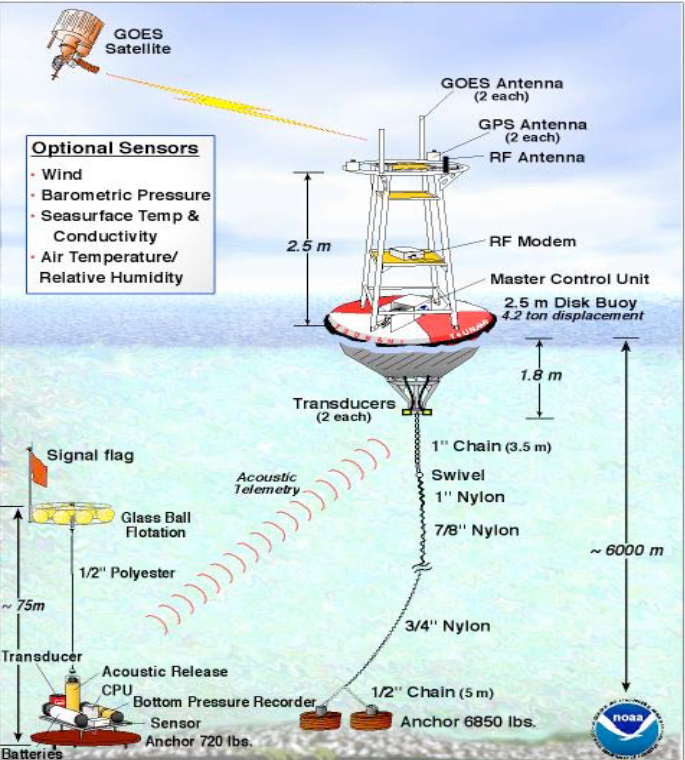
| 20:24, 13 January 2020 | TsunamiWarningDARTsystem.png (file) |  |
807 KB | The DART monitoring system. Image NOAA. | 1 |
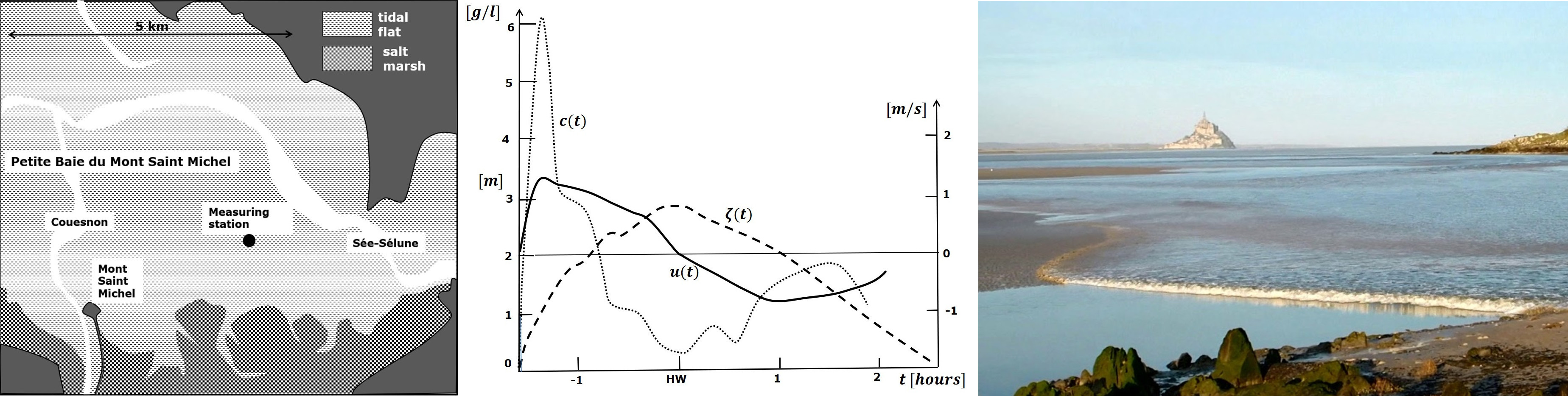
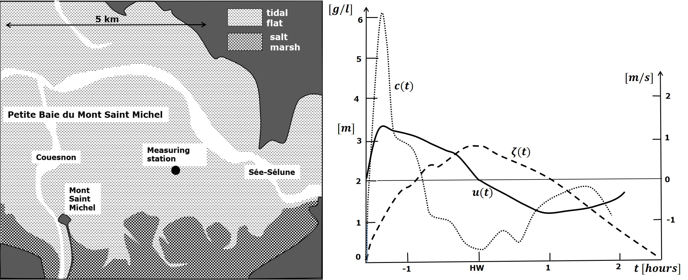
| 19:19, 25 May 2019 | SedimentTideBoreSaintMichel.jpg (file) | 731 KB | Tide elevation, current velocity and suspended sediment concentration during springtide on a tidal flat in the Baie du Mont Saint Michel and tidal bore photo. | 1 | |
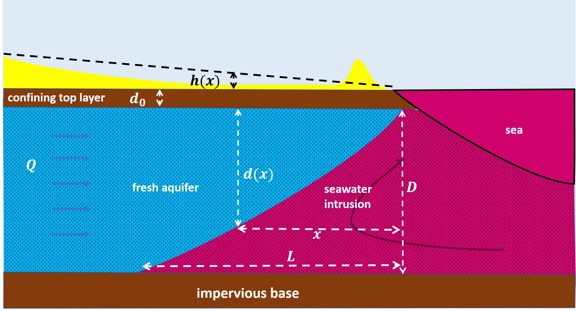
| 16:10, 12 February 2021 | SeawaterIntrusion0.jpg (file) |  |
694 KB | Schematic representation of seawater intrusion in a simplified aquifer system (distorted scale). | 1 |
| 16:09, 12 February 2021 | SeawaterIntrusion2.jpg (file) |  |
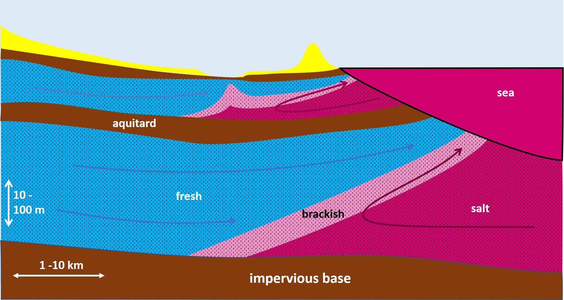
688 KB | Schematic representation of seawater intrusion into a multi-aquifer system. | 1 |
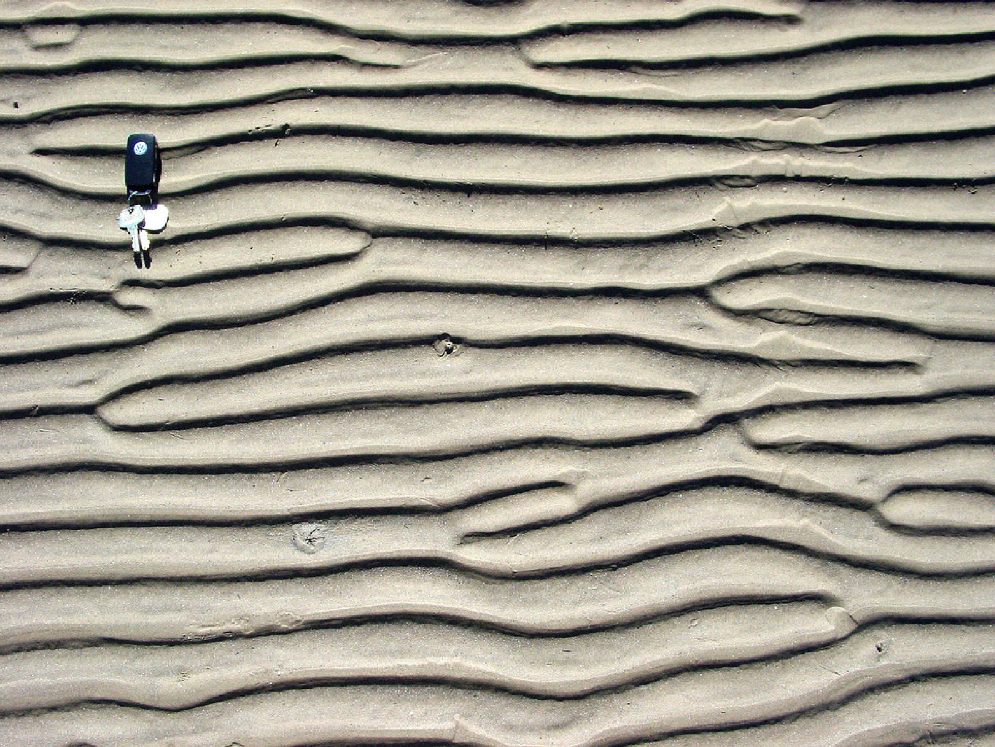
| 10:40, 3 July 2017 | WaveRippleFormationFig0.jpg (file) |  |
678 KB | Ripples observed at Sea Rim State Park, along the coast of east Texas close to the border with Louisiana (courtesy by Zoltan Sylvester). | 1 |
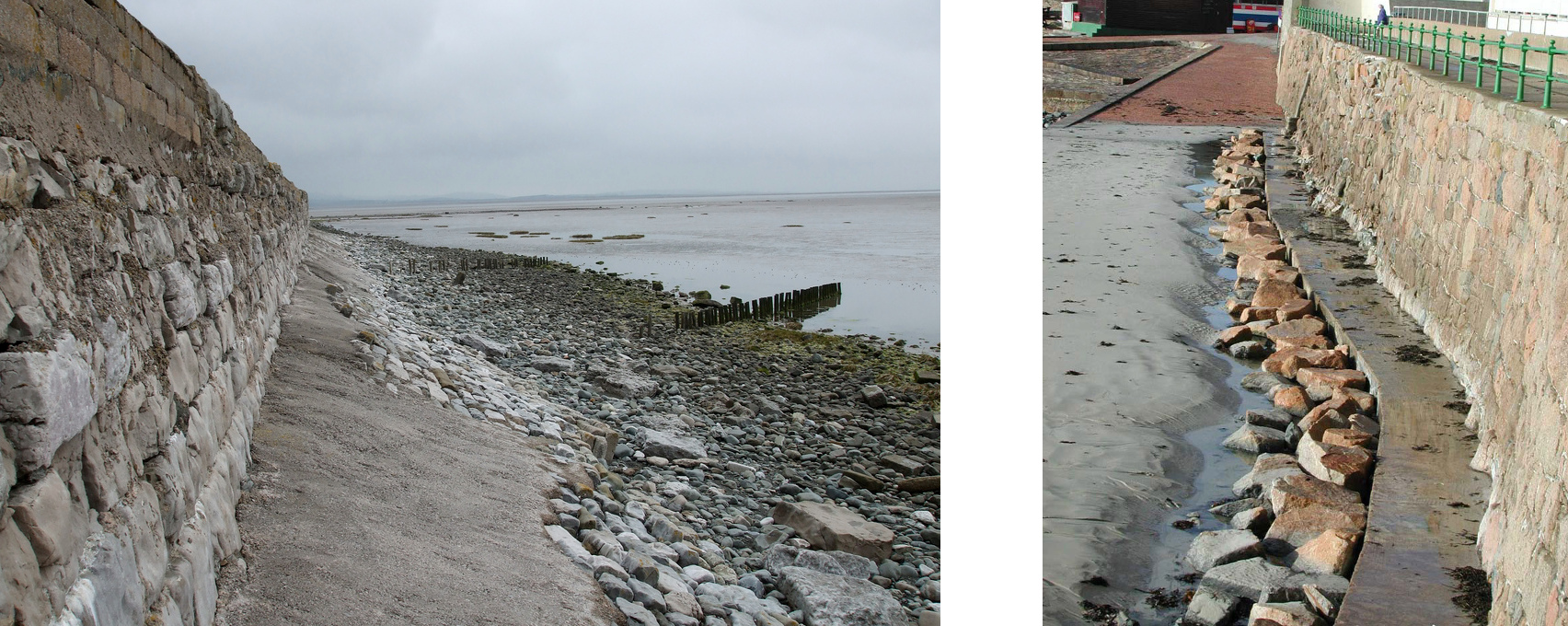
| 12:59, 21 May 2018 | SeawallToe.jpg (file) |  |
657 KB | Left: Low eroded beach at the Bardsea seawall, situated on the macrotidal Morecambe Bay (UK); Photo credit: Stephen Mackenzie. Right: Rock infill of a trench scoured at the toe of a seawall at Le Dicq (Island of Jersey): Photo credit: HR Wallingford. | 1 |
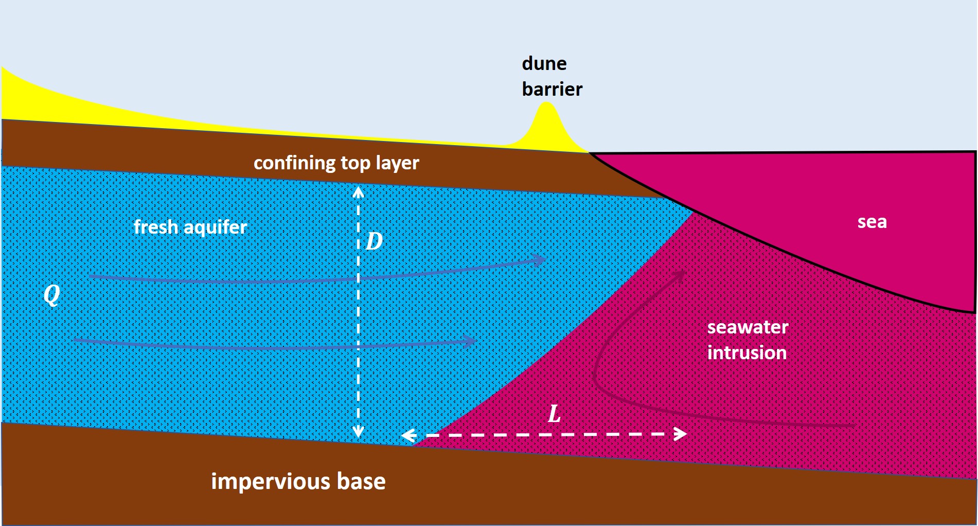
| 16:09, 12 February 2021 | SeawaterIntrusion1.jpg (file) |  |
652 KB | Schematic representation of seawater intrusion into a homogeneous coastal aquifer. | 1 |
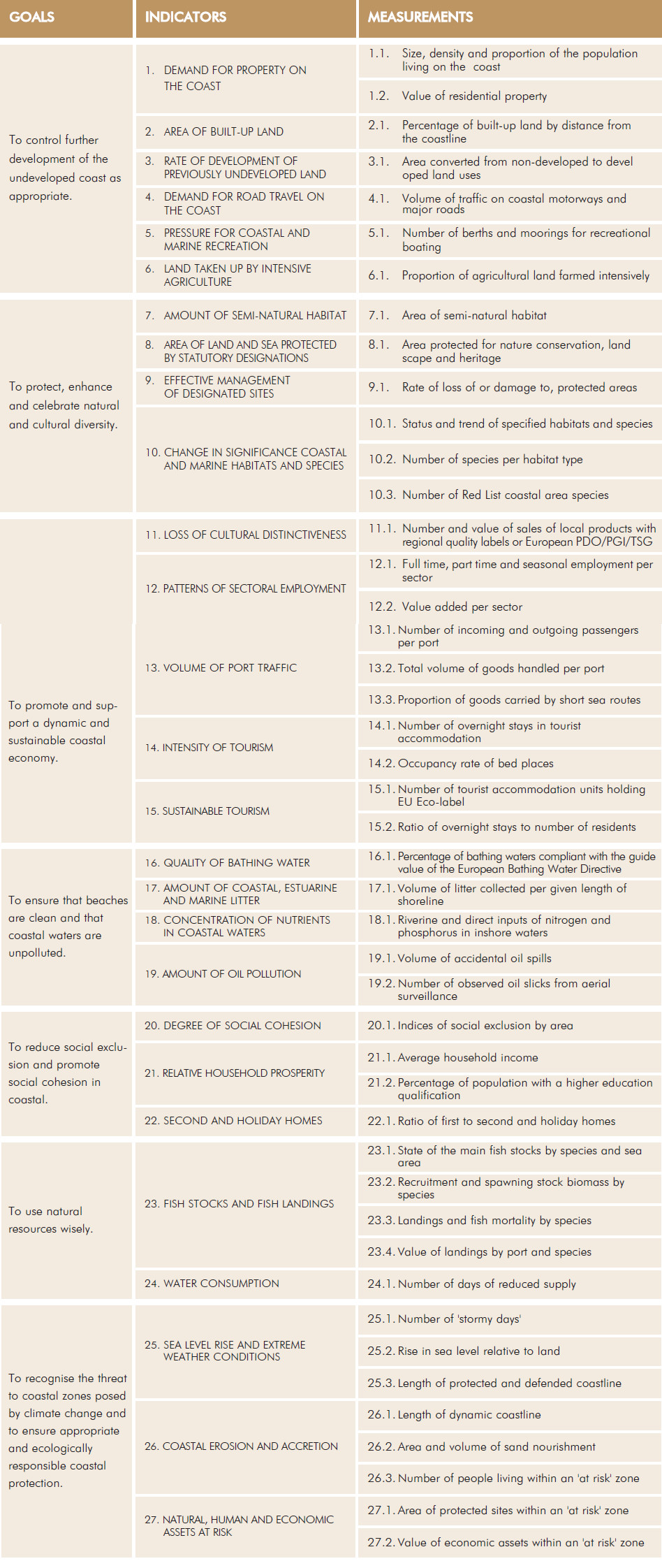
| 18:43, 16 February 2019 | ICZMindicatorsDEDUCE.jpg (file) |  |
642 KB | Quantitative ICZM indicators proposed by the DEDUCE project (Marti et al, 2007) | 2 |
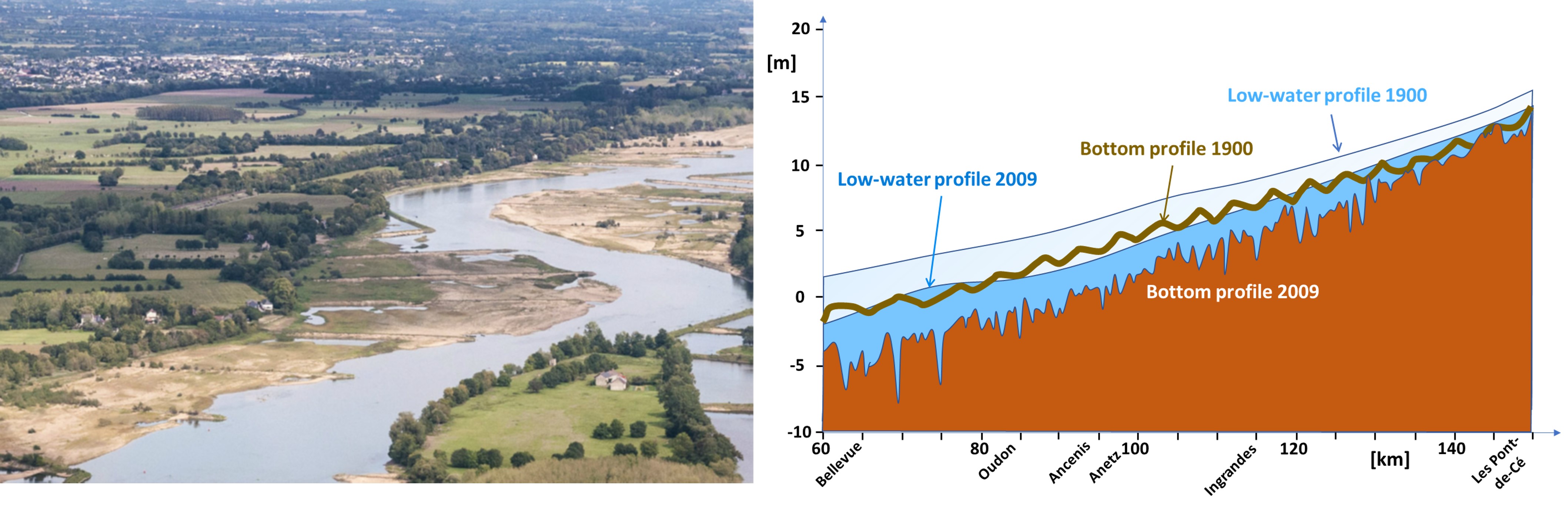
| 20:19, 16 June 2023 | LoireGroins.jpg (file) |  |
632 KB | Channel incision Loire tidal river. Left panel: Groins in the Loire tidal river near Anetz. Photo credit GIP Loire Estuaire. Right panel: Lowering of the river bed along the thalweg due to channel constriction. Redrawn from VNF (2019). | 1 |
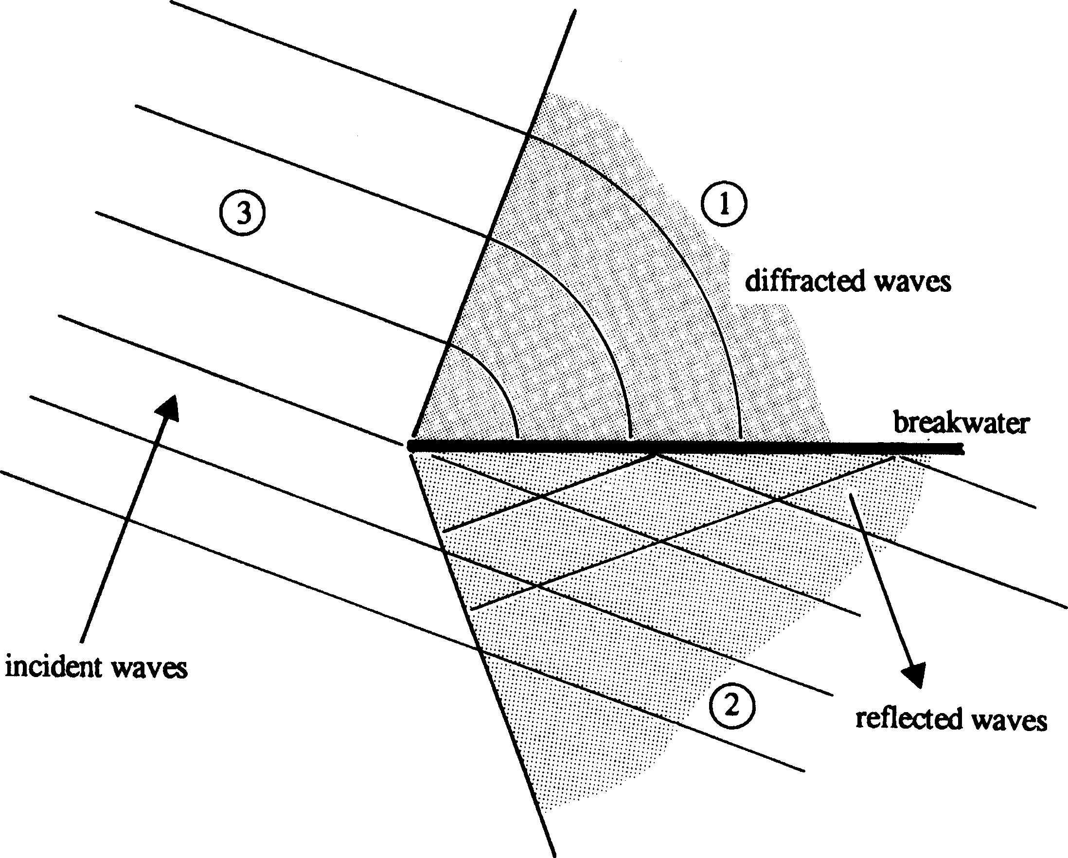
| 10:03, 6 June 2017 | ChadwickFig15a.jpg (file) |  |
613 KB | Idealised wave diffraction around an impermeable breakwater. | 1 |
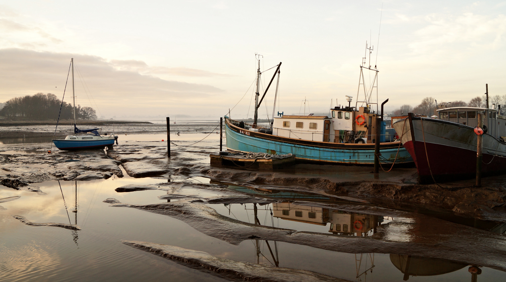
| 12:36, 16 April 2018 | DebenEstuary.JPG (file) |  |
610 KB | Deben estuary, UK. Photo credit: Bescoe | 1 |
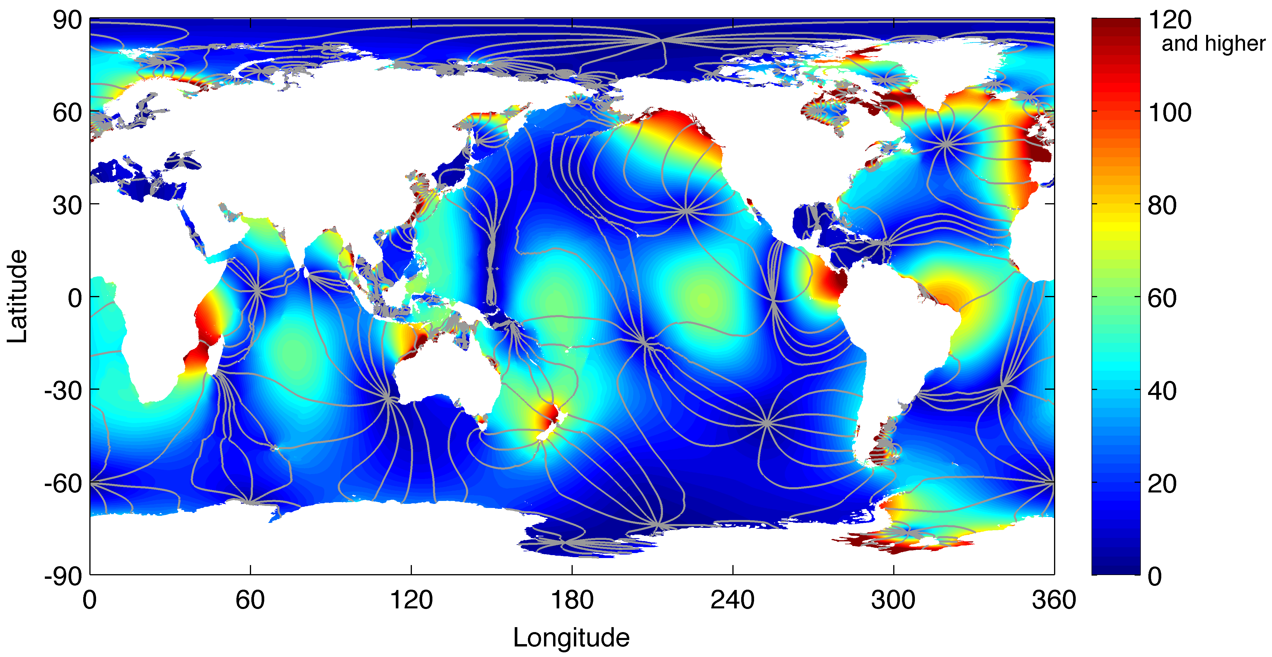
| 13:44, 29 February 2020 | Figure5 1 COLOR.png (file) |  |
608 KB | Global map of the principal lunar semidiurnal component. | 1 |
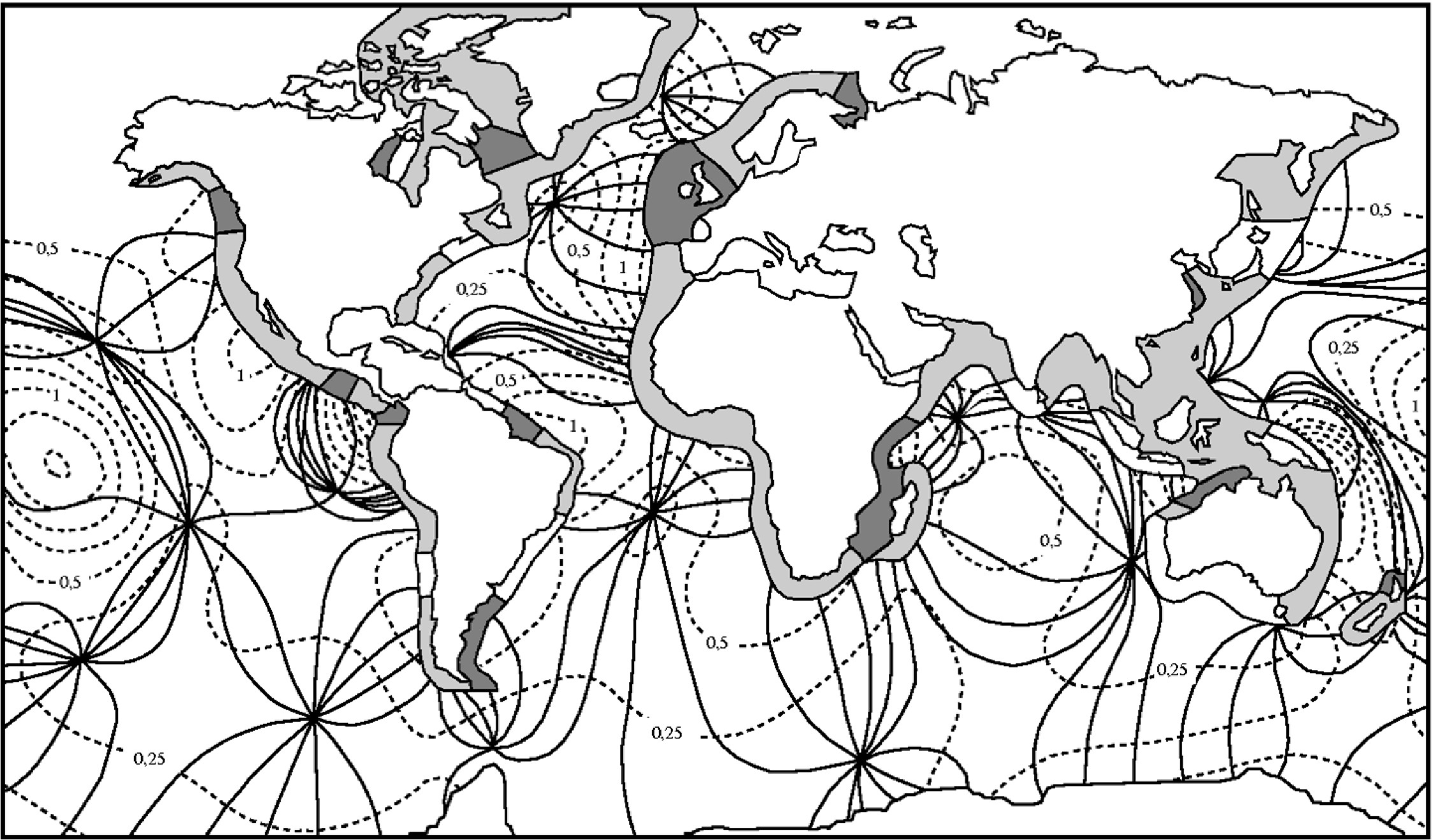
| 14:34, 22 March 2016 | Worldtides.jpeg (file) |  |
596 KB | Co-tidal lines (solid lines) and lines of equal amplitude (dashed lines, amplitude in meters) of the semidiurnal lunar M2-tide in the oceans. The tidal range along the coast is indicated in dark for tidal ranges larger than 4 m, in grey for tidal range... | 1 |
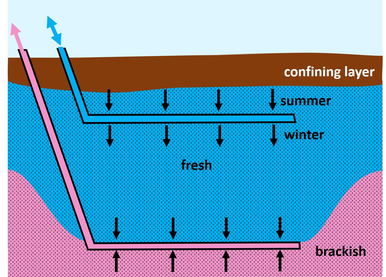
| 12:38, 5 April 2020 | PolderDrainage.jpg (file) |  |
584 KB | Drainage of a polder causing upconing of brackish water into the ditches. | 1 |
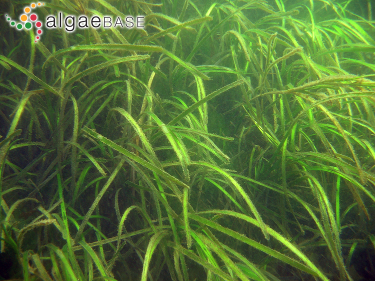
| 13:26, 2 March 2021 | ZosteraMarina.jpg (file) |  |
581 KB | Zostera marina. Photo credit Ignacio Barbara. www.algaebase.org | 1 |
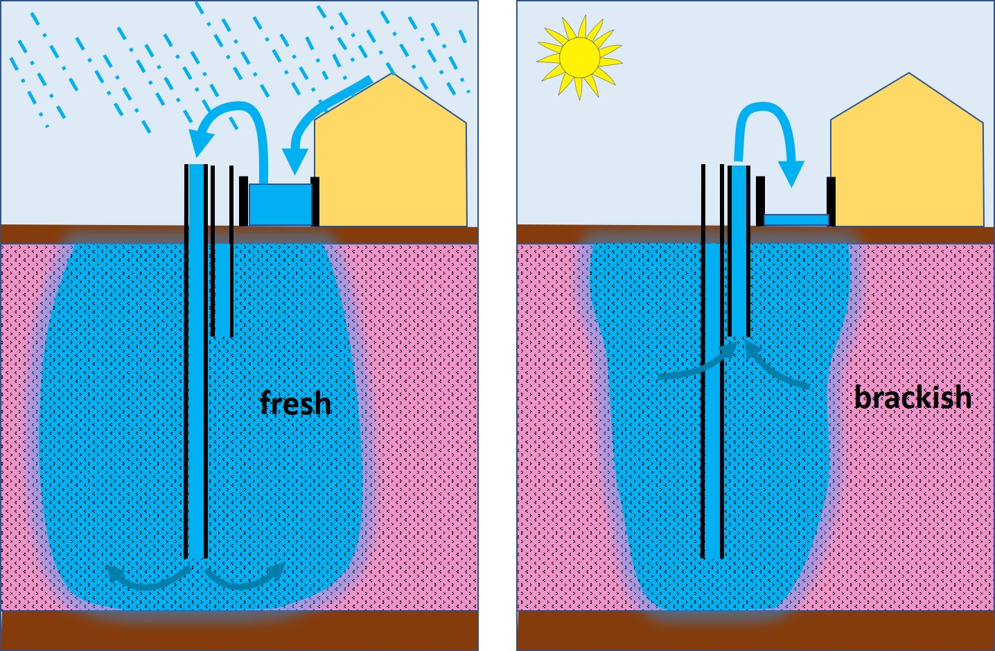
| 12:48, 5 April 2020 | Freshmaker.jpg (file) |  |
580 KB | Principle of the freshmaker system: withdrawal of brackish groundwater to make room for a thick fresh water lens. | 1 |
| 12:47, 5 April 2020 | TemporaryStorage.jpg (file) |  |
578 KB | Temporary storage of rainwater. | 1 |
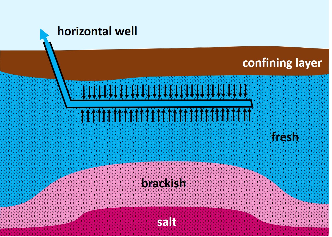
| 12:43, 5 April 2020 | SkimmingWell.jpg (file) |  |
561 KB | Horizontal skimming well. The upconing effect is limited by spreading the extraction is spread over a broad zone. | 1 |
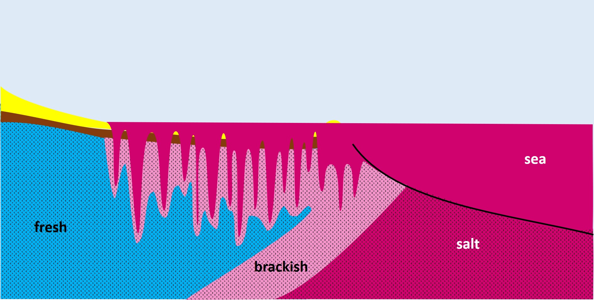
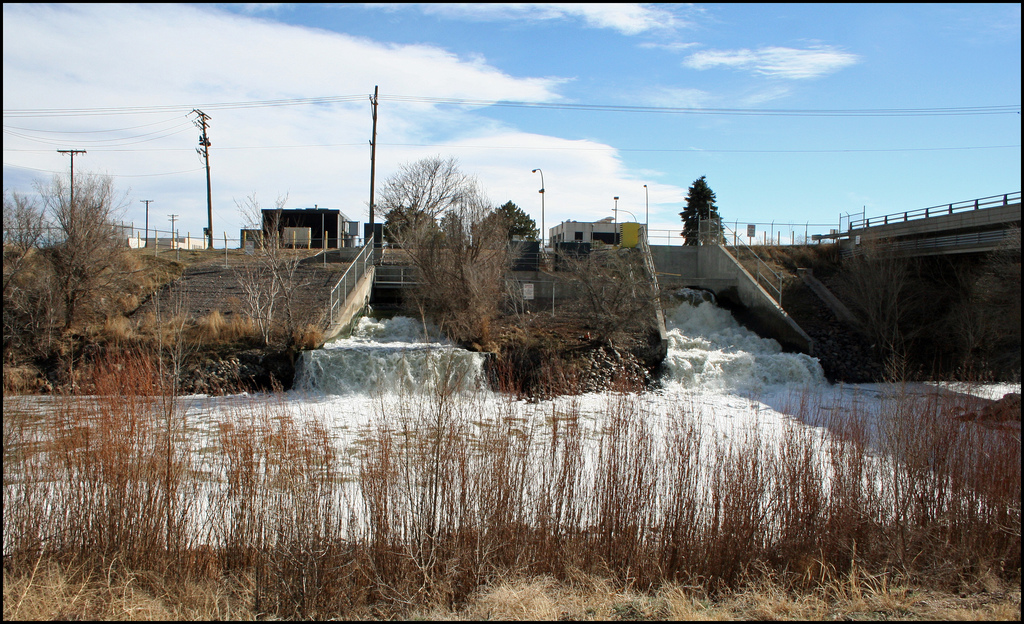
| 12:35, 5 April 2020 | MarineTransgression.jpg (file) | 546 KB | Infiltration of marine flood water into the underground. | 1 | |
| 12:03, 14 November 2018 | Worlderosion.jpg (file) |  |
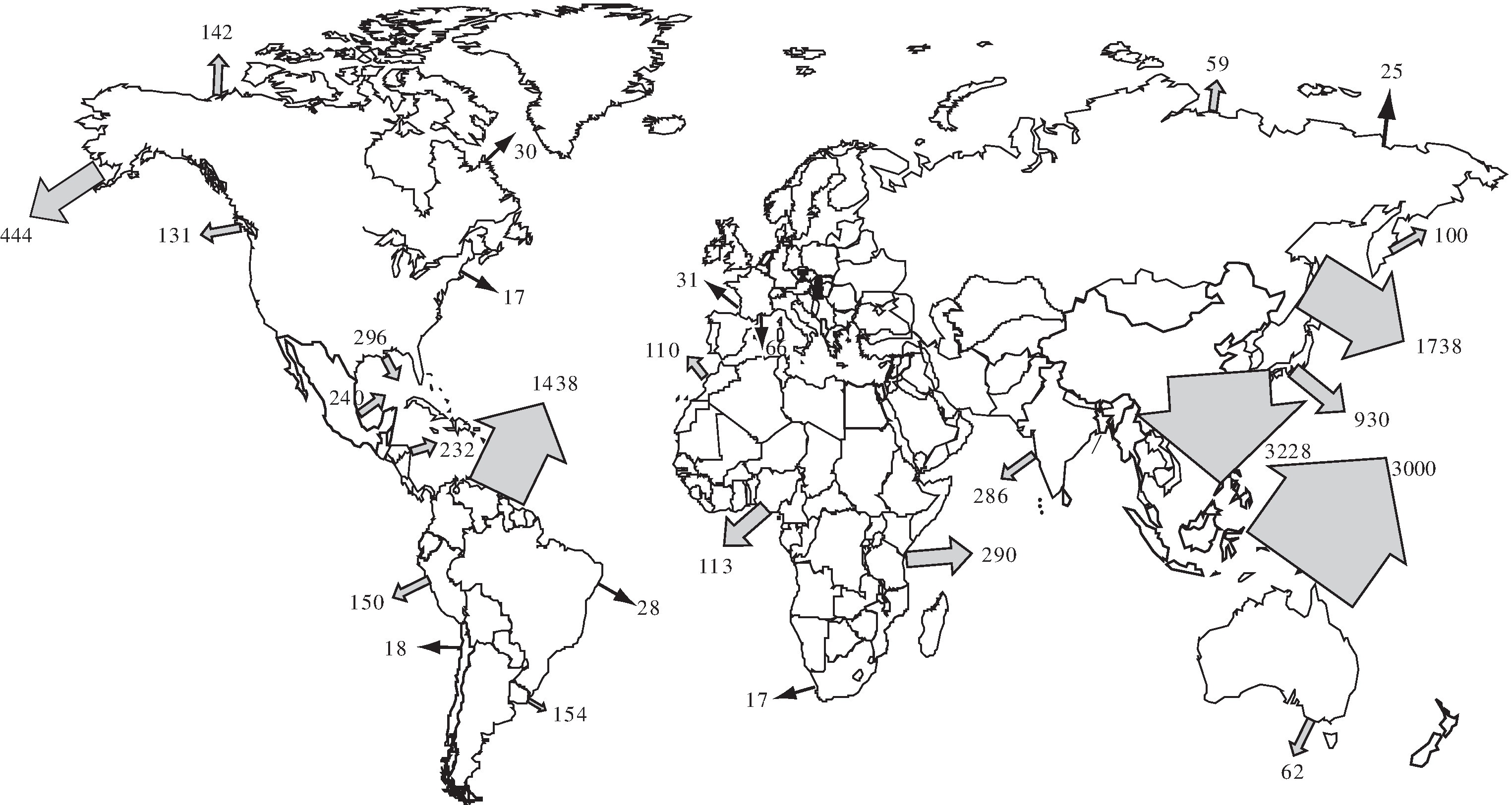
543 KB | Annual discharge of sediments from world's catchment basins. Redrawn after Milliman and Meade (1983). | 1 |
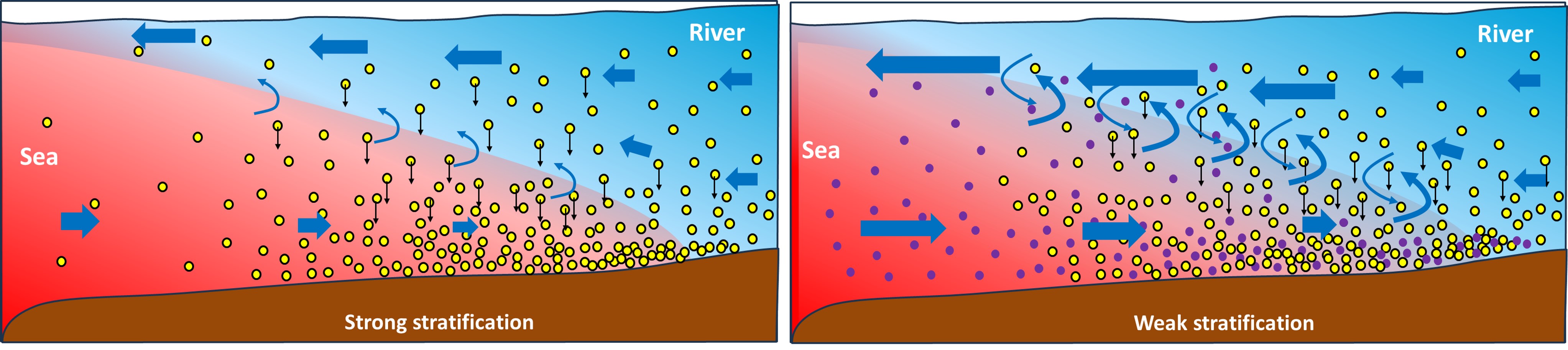
| 21:14, 1 July 2023 | StratificationETM.jpg (file) | 533 KB | Cartoon explaining the effect of density stratification on the estuarine turbidity maximum (ETM). Red = sea water, blue = river water. Yellow dots = fluvial sediment, violet dots = marine sediment. Left panel: Strong stratification. Right panel: Weak s... | 1 | |
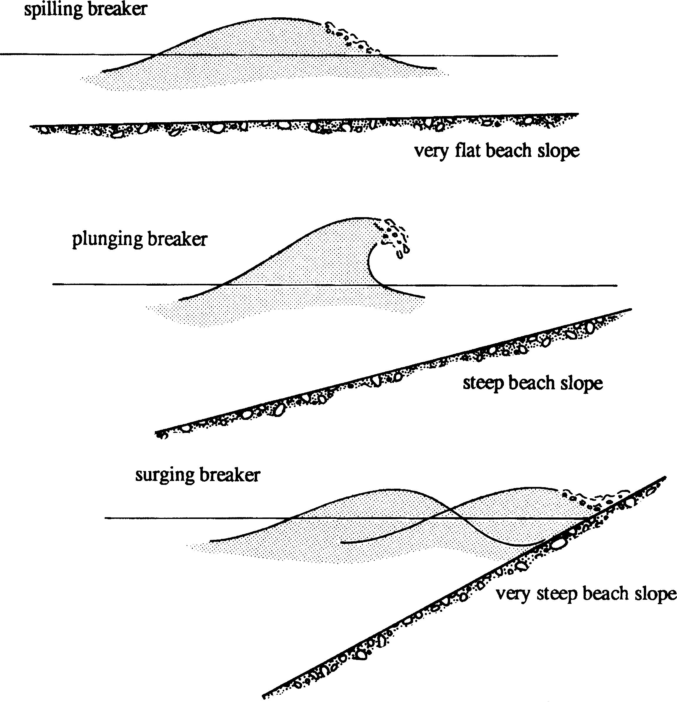
| 10:07, 6 June 2017 | ChadwickFig18a.jpg (file) |  |
525 KB | Principal types of breaking waves. | 1 |
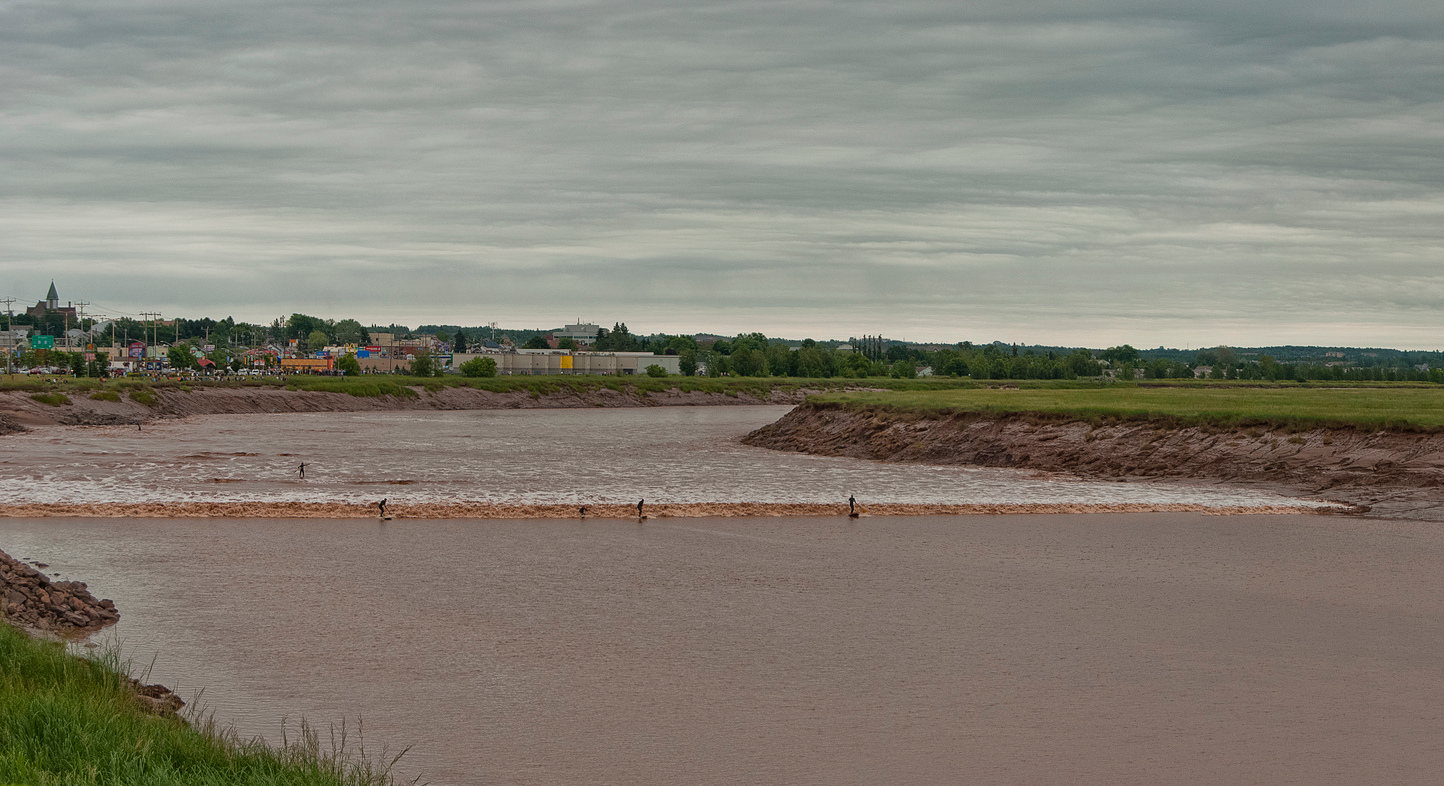
| 15:41, 29 September 2018 | TidalBorePetitcodiacRiver.jpg (file) |  |
521 KB | Tidal bore in the Petitcodiac River (Bay of Fundy, Canada) | 1 |
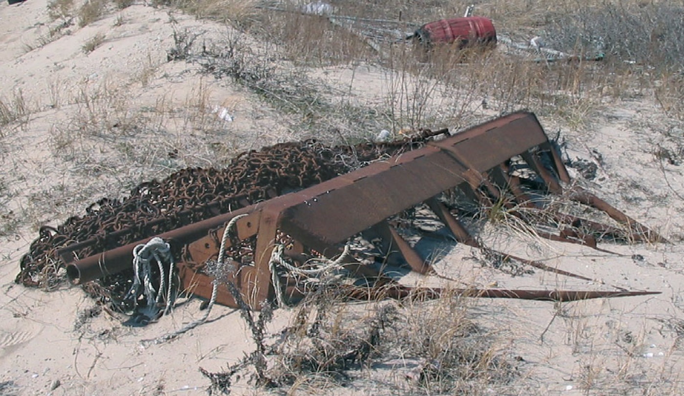
| 16:03, 30 December 2020 | ScallopFishingGear.jpg (file) |  |
516 KB | Scallop fishing gear. Photo credit: Michel Kaiser. | 1 |
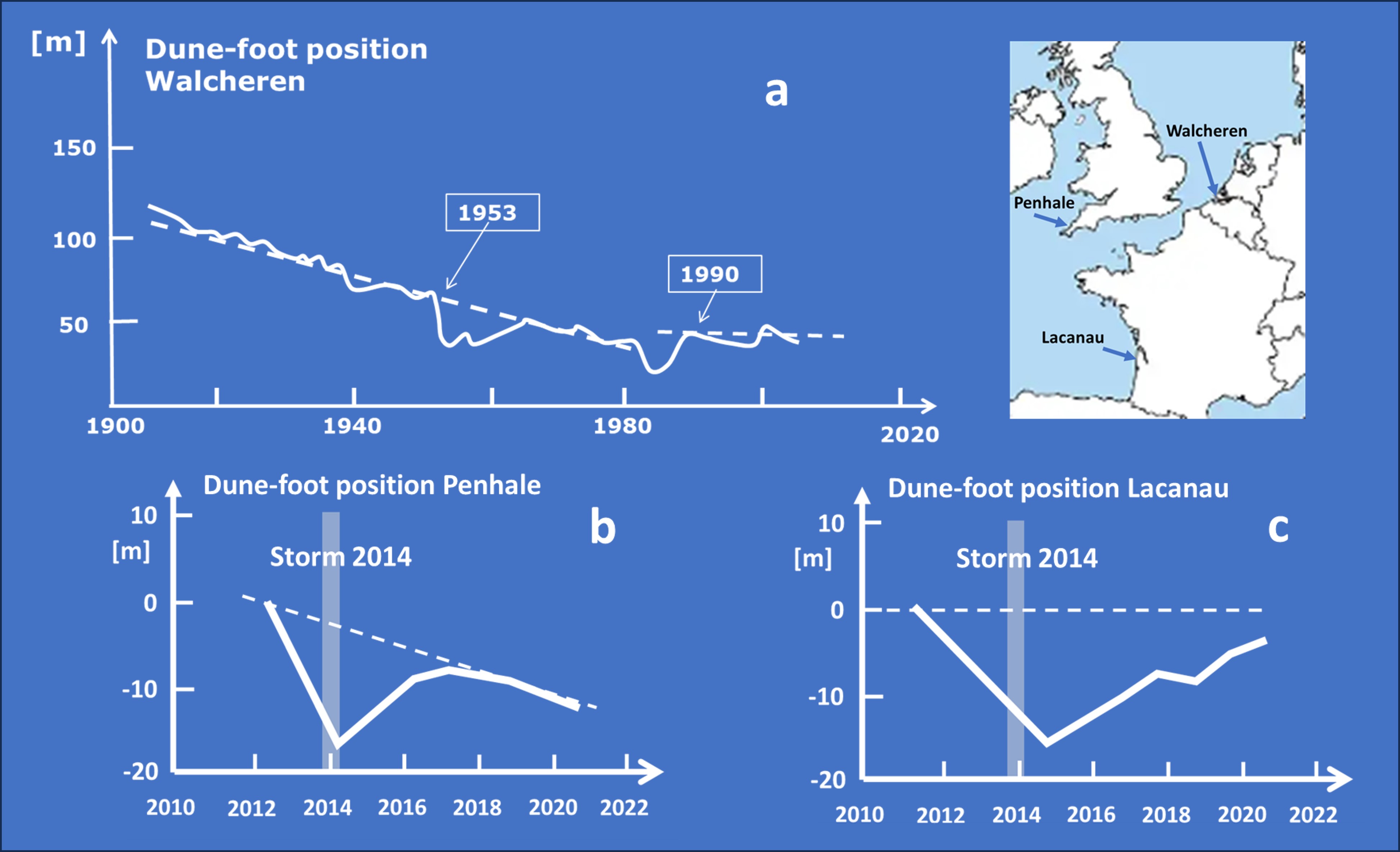
| 20:28, 13 September 2023 | DuneFootRecovery.jpg (file) |  |
513 KB | Examples of dune-foot retreat and recovery. 7a. Variation of the dune-foot position in a beach transect of the island Walcheren (Netherlands) over the period 1900-2010 (solid white line, based on annual surveys of Rijkswaterstaat <ref>Jeuken, C., Ruess... | 1 |
| 23:19, 4 May 2019 | SedimentTideSaintMichel.jpg (file) |  |
512 KB | Current velocity and suspended sediment concentration at a tidal flat in the Baie du Mont Saint Michel for a fast rising tide. | 1 |
| 21:15, 20 January 2017 | WaveHeight.jpg (file) |  |
512 KB | Significant wave height values of incoming (triangles) and outgoing (dots) infragravity waves for different frequency bands. | 1 |
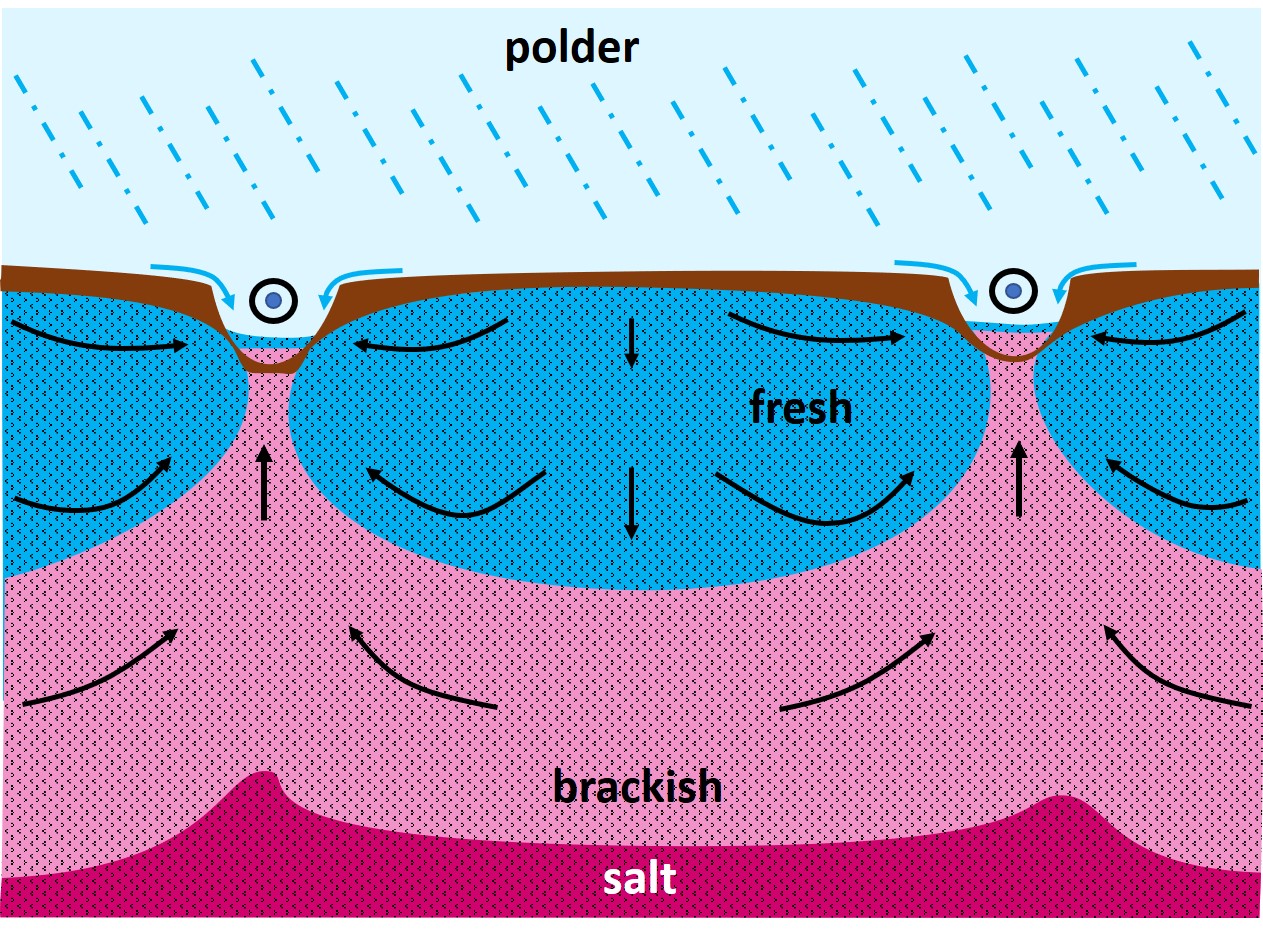
| 22:36, 5 April 2020 | PolderSeepage.jpg (file) |  |
505 KB | Groundwater seepage into a polder and associated rise of the salt-fresh interface. | 2 |
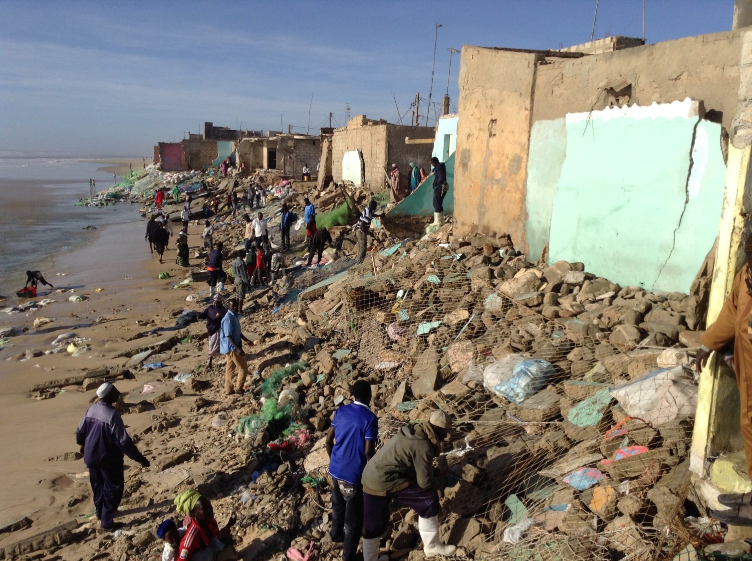
| 21:25, 30 September 2019 | SaintLouisCoastalErosion.jpg (file) |  |
501 KB | Destruction of fishermen's houses on the beach of Saint-Louis (Senegal) by swell waves at high springtide (March 2015). | 1 |
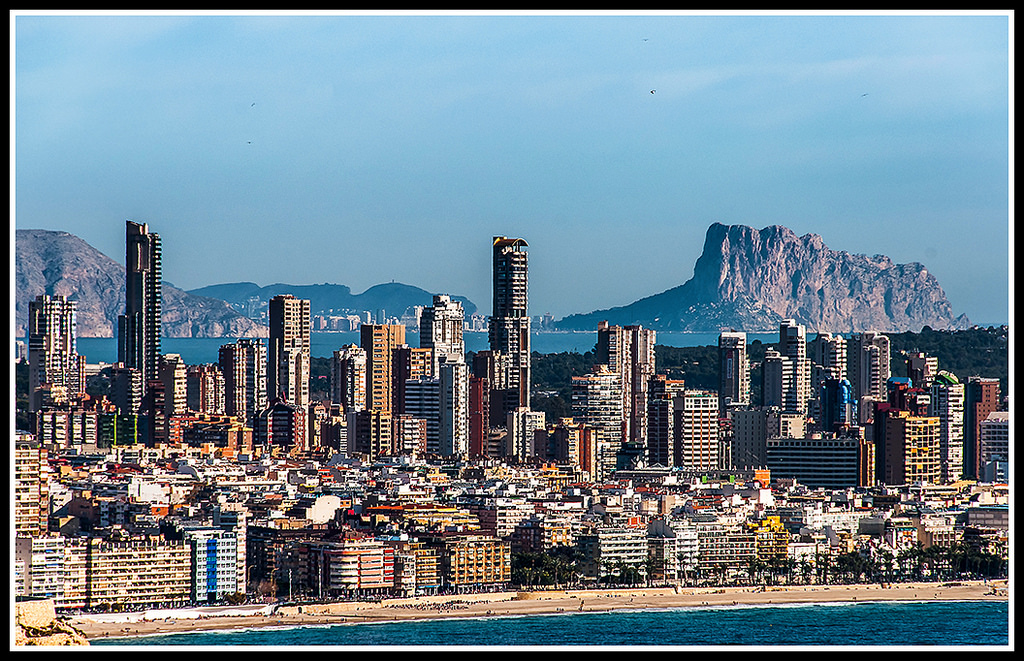
| 15:15, 21 June 2018 | Benidorm EnriqueDomingo jpg.jpg (file) |  |
499 KB | Tourist resort Benidorm on the Spanish Mediterranean coast. Photo credit Enrique Domingo [https://www.flickr.com/photos/edomingo/] | 1 |
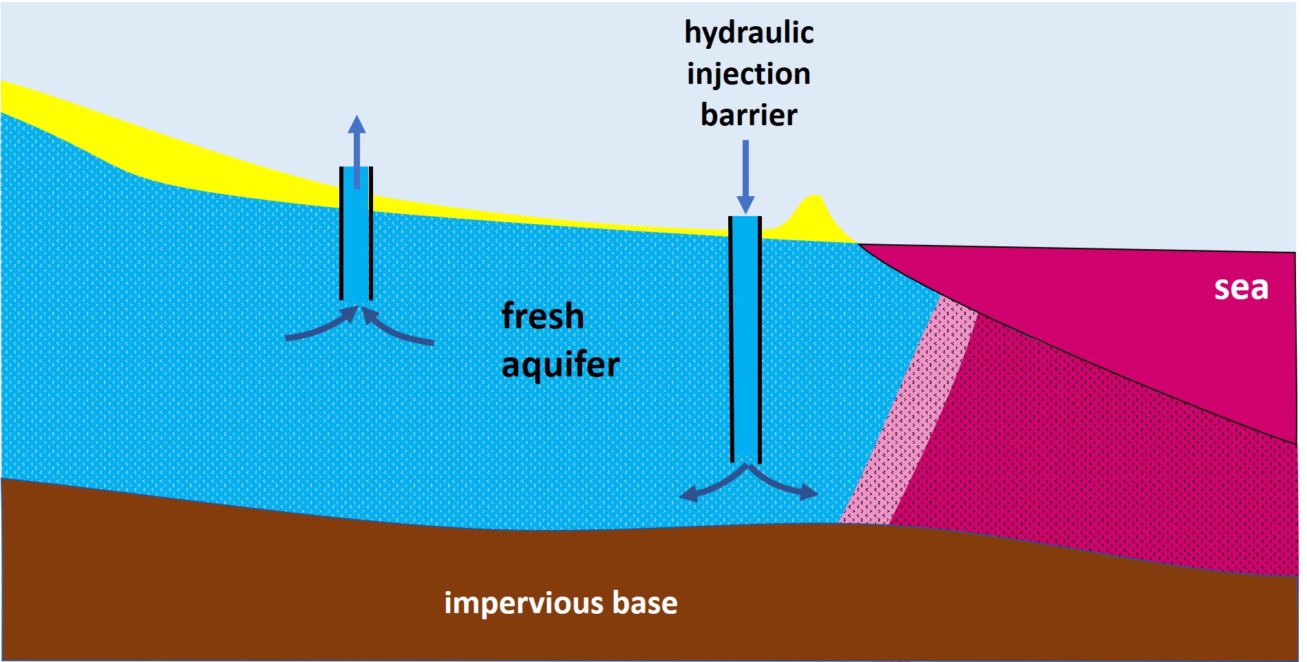
| 12:51, 5 April 2020 | HydraulicInjectionBarrier.jpg (file) |  |
497 KB | Hydraulic injection barrier at the seaward entrance of an aquifer. | 1 |
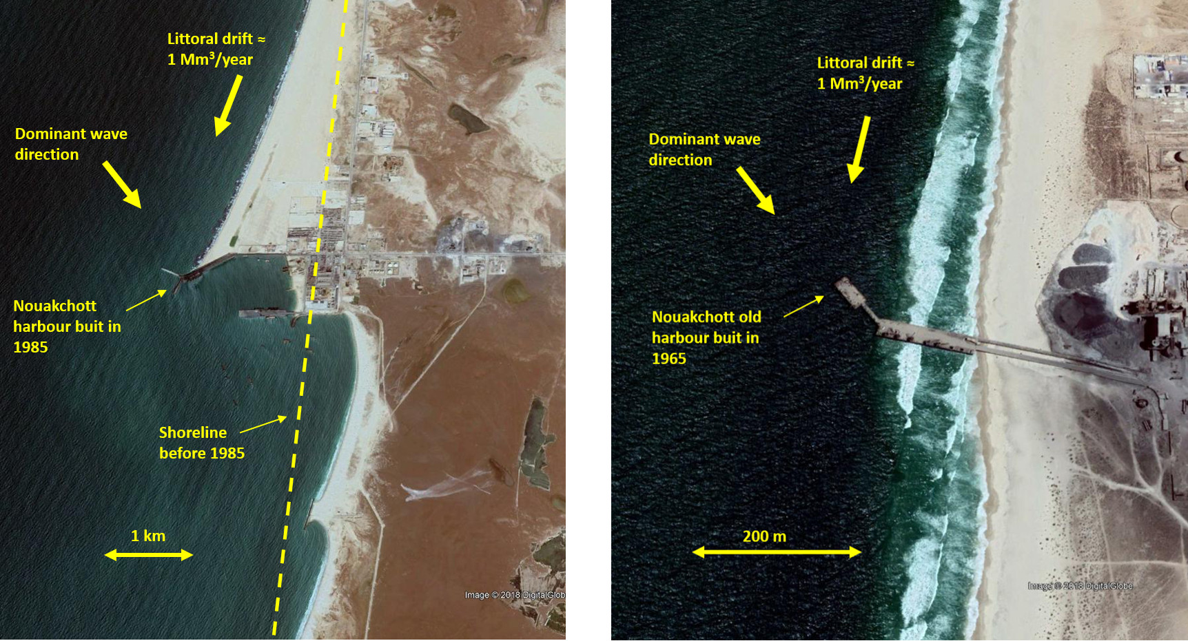
| 12:57, 21 May 2018 | NouakchottPorts.jpg (file) |  |
495 KB | Left: The new seaport of Nouakchott (Mauritania) built in 1985 (image October 2017). Right: The (smaller) old port of Nouakchott, built in 1965, situated ten kilometers north of the new port (image April 2018). | 1 |
| 13:49, 29 February 2020 | Figure6 3 COLOR.png (file) |  |
493 KB | Global map of the amplitude of quarterdiurnal tide M4. | 1 |
| 13:46, 29 February 2020 | Figure5 2 COLOR.png (file) |  |
491 KB | Global map of the luni-solar declinational diurnal component K1. | 1 |
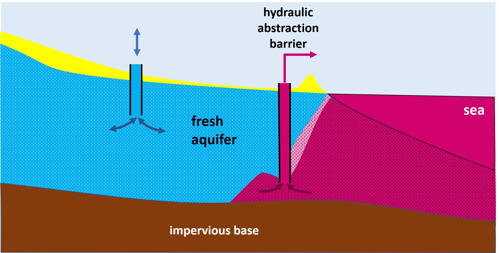
| 12:53, 5 April 2020 | HydraulicAbstractionBarrier.jpg (file) |  |
491 KB | Hydraulic abstraction barrier at the seaward entrance of an aquifer. | 1 |
| 22:28, 10 June 2018 | SewageEffluentDenver.jpg (file) |  |
485 KB | Sewage effluent Denver in Platte River. Photo credit Jeffrey Beall (2008) | 1 |
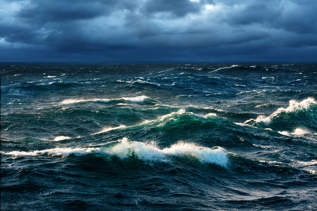
| 15:55, 1 September 2020 | WhiteCappedWaves.jpg (file) |  |
483 KB | White-capped waves. Credit recon.sccf.org | 1 |
| 22:49, 26 November 2018 | WesterscheldeSentinelMarch2016.jpg (file) |  |
474 KB | Western Scheldt and Scheldt estuary, Netherlands, Belgium (Sentinel image). | 1 |
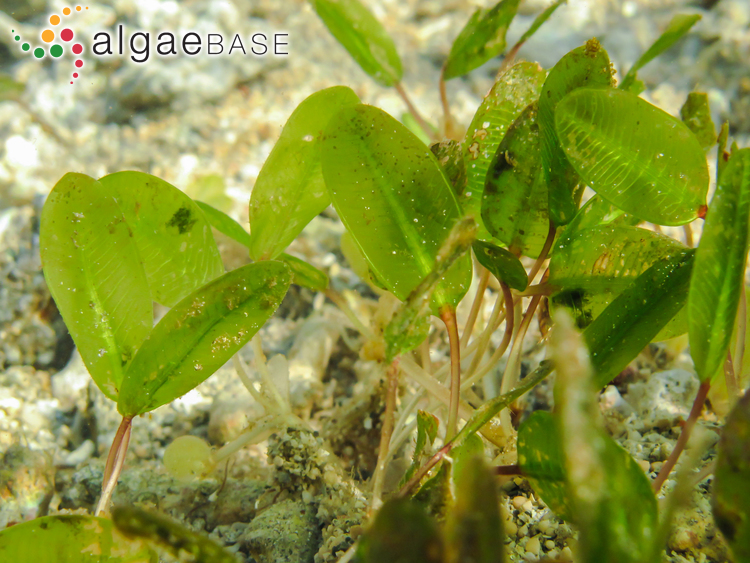
| 12:30, 2 March 2021 | HalophilaOvalis.jpg (file) |  |
465 KB | Halophila ovalis. Photo credit Fernando Boisset. www.algaebase.org | 1 |