File list
This special page shows all uploaded files.
| Date | Name | Thumbnail | Size | Description | Versions |
|---|---|---|---|---|---|
| 15:27, 31 May 2007 | Table 1.jpg (file) |  |
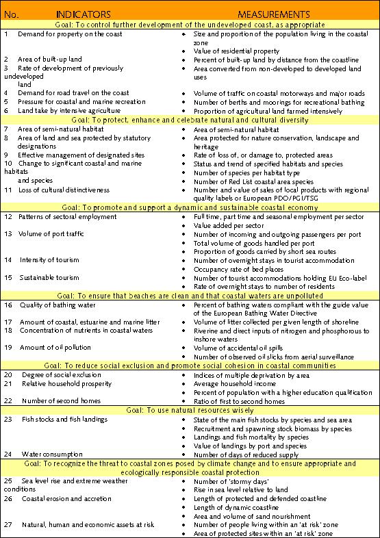
143 KB | The EU 27 Sustainability indicators of the Coastal Zone | 1 |
| 23:50, 29 August 2008 | Knowledgecycle.JPG (file) |  |
29 KB | 4 | |
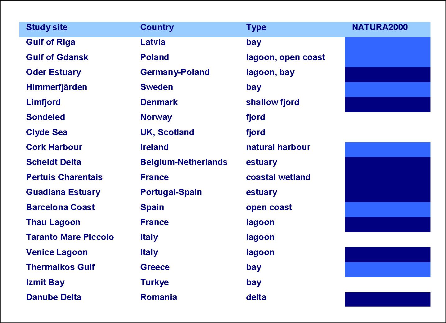
| 22:14, 25 November 2009 | SSANATURA2000.JPG (file) |  |
157 KB | 1 | |
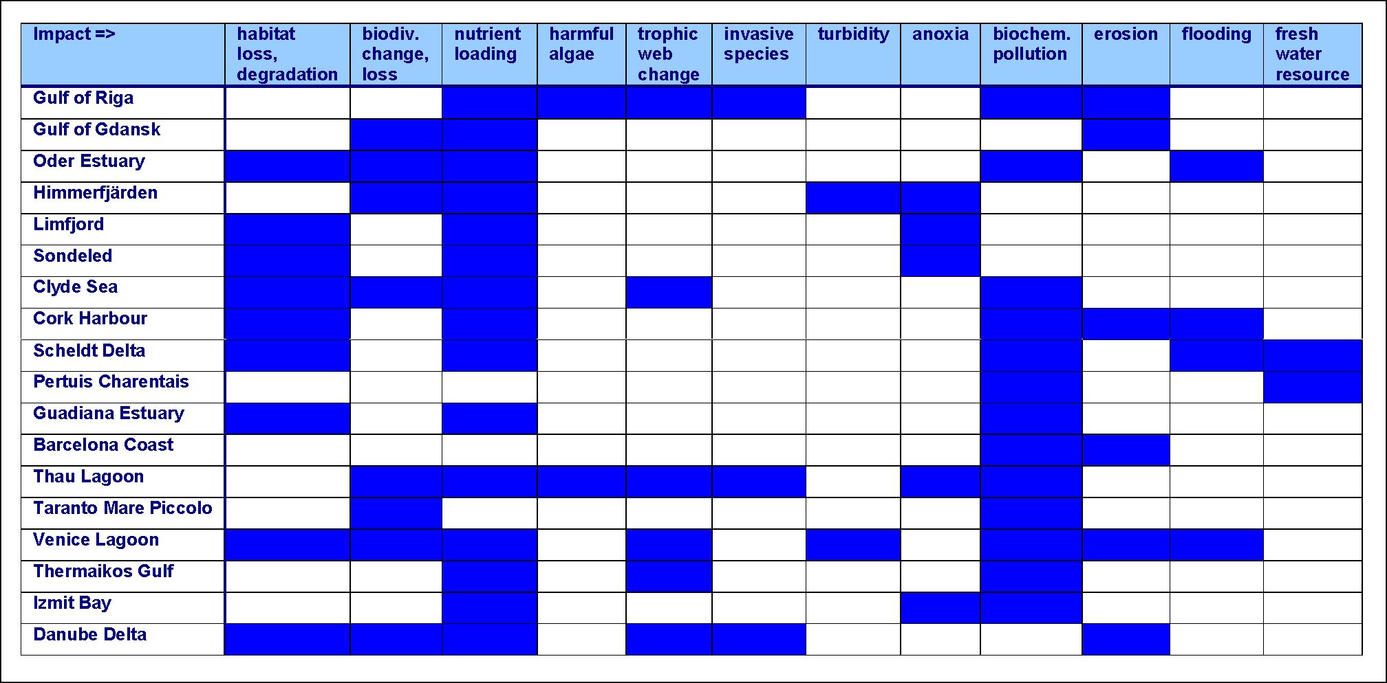
| 23:45, 25 November 2009 | SSAimpacts.JPG (file) |  |
227 KB | 1 | |
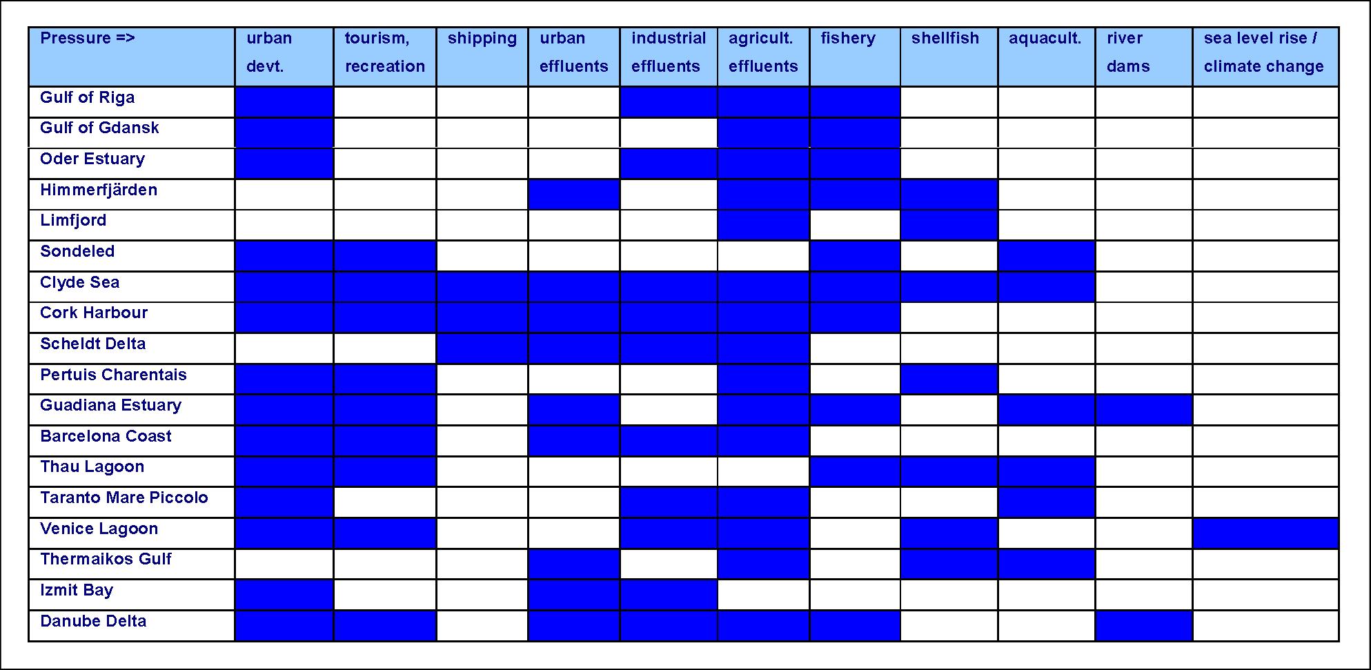
| 23:45, 25 November 2009 | SSApressures.JPG (file) |  |
226 KB | 1 | |
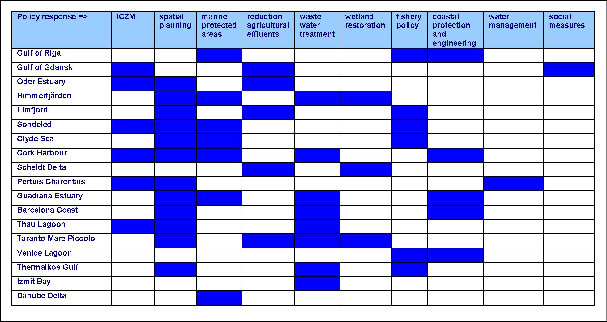
| 23:50, 25 November 2009 | SSApolicies.JPG (file) |  |
240 KB | 1 | |
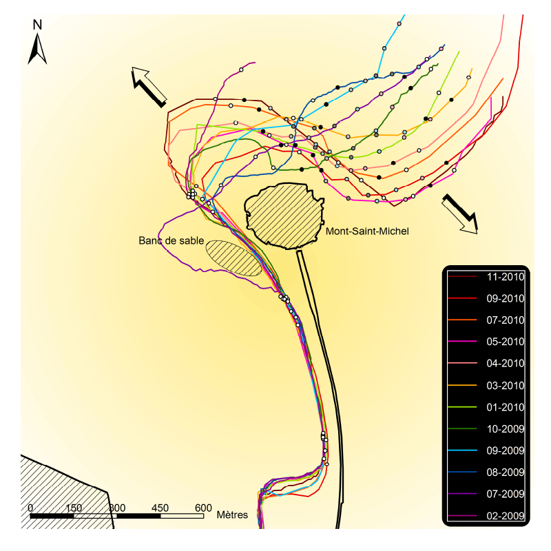
| 19:24, 14 January 2013 | DivagationCouesnon.png (file) |  |
219 KB | Shifting meanders of the highly dynamic Couesnon channel at the Mont Saint-Michel. | 1 |
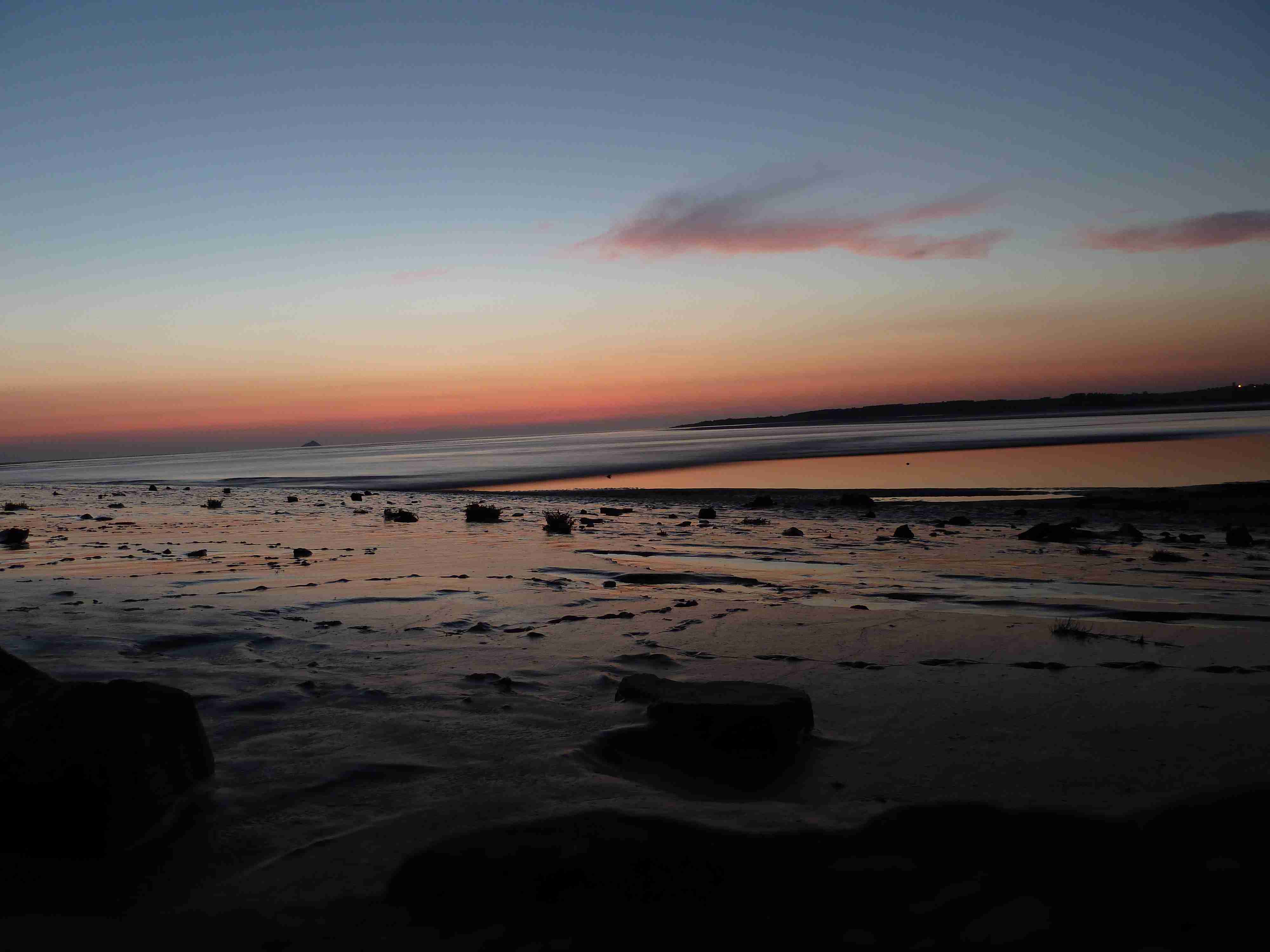
| 23:26, 14 January 2013 | P1000464.JPG (file) |  |
203 KB | Tidal bore rushing into the Baie du Mont Saint-Michel at sunset on the 1st of September 2011. | 1 |
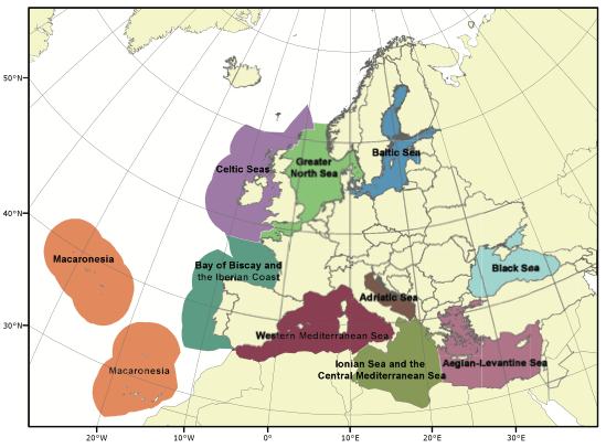
| 00:02, 19 January 2013 | Msfd sub regions.png (file) |  |
153 KB | Marine sub-regions, relevant for the implementation of the Marine Strategy Framework Directive. Image taken from the website of the EC LIFE+ project PISCES. | 1 |
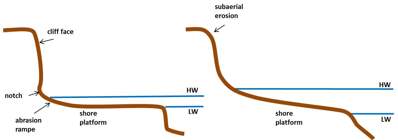
| 12:04, 26 November 2015 | ShorePlatform.jpg (file) |  |
34 KB | Typical rocky shore profiles. | 1 |
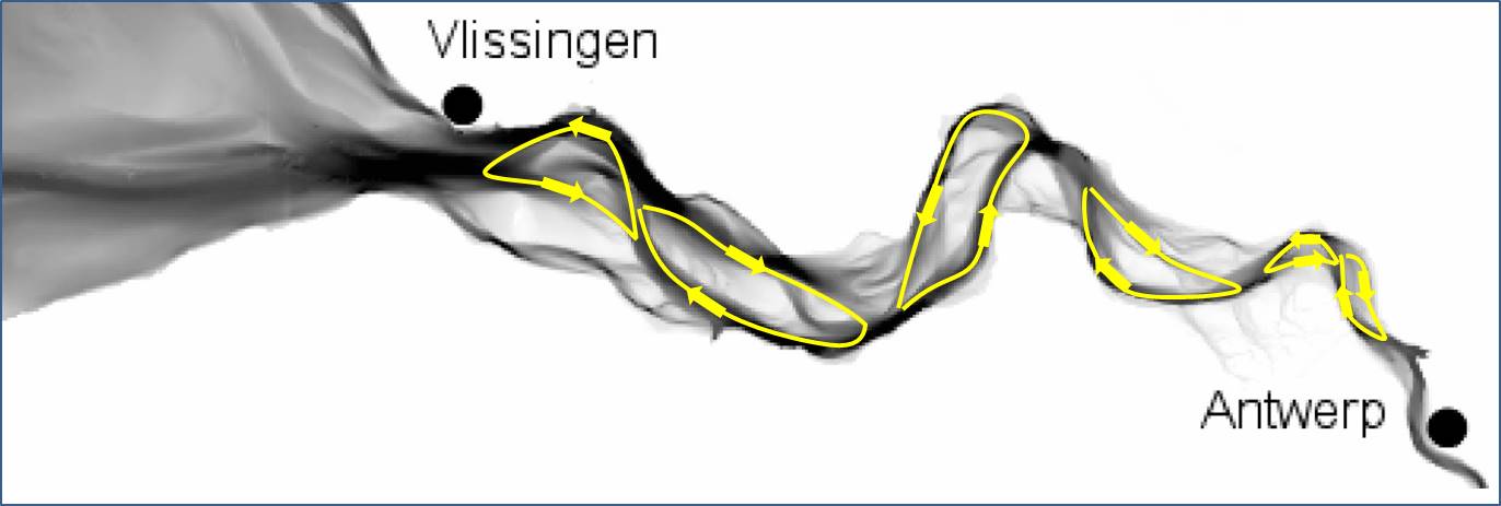
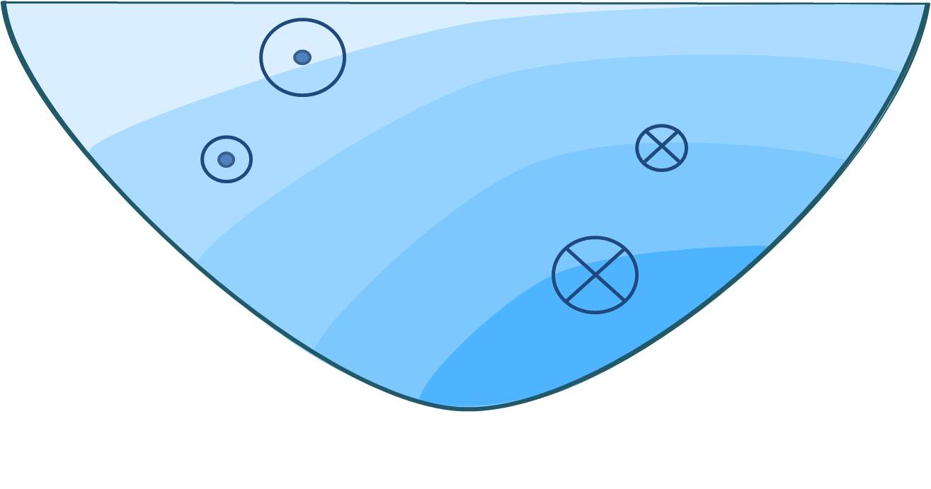
| 23:01, 25 January 2016 | WScirculations.JPG (file) |  |
48 KB | Circulation cells in the Western Scheldt related to ebb- and flood-dominated channels. | 1 |
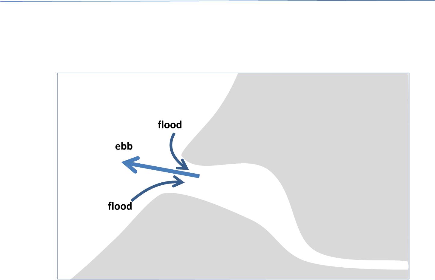
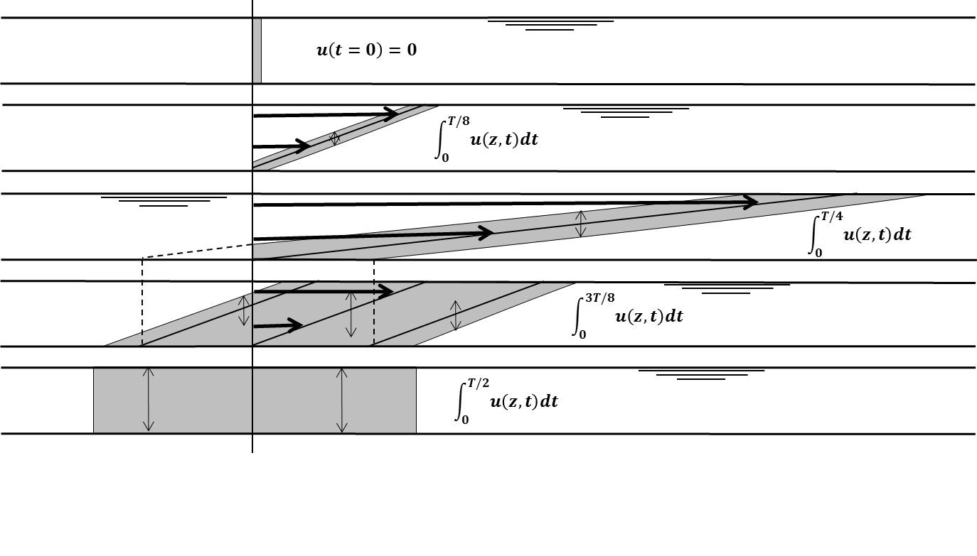
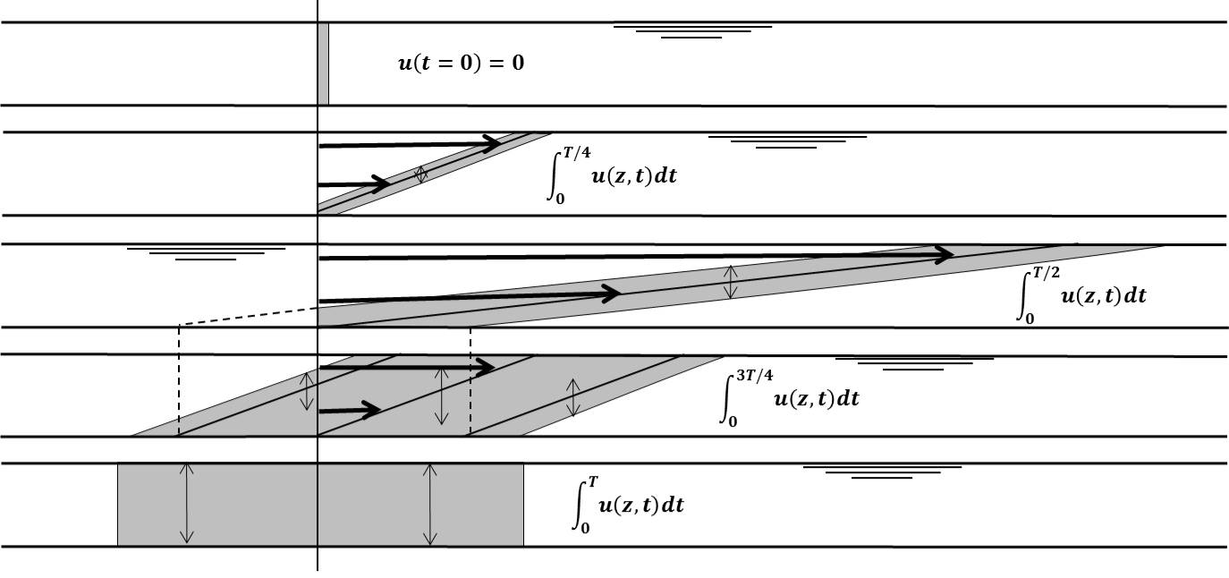
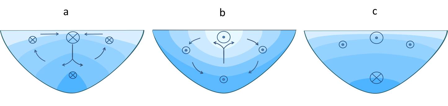
| 23:03, 25 January 2016 | TidalPumping.JPG (file) |  |
41 KB | Schematic representation of seawater intrusing in an estuary by tidal pumping. | 1 |
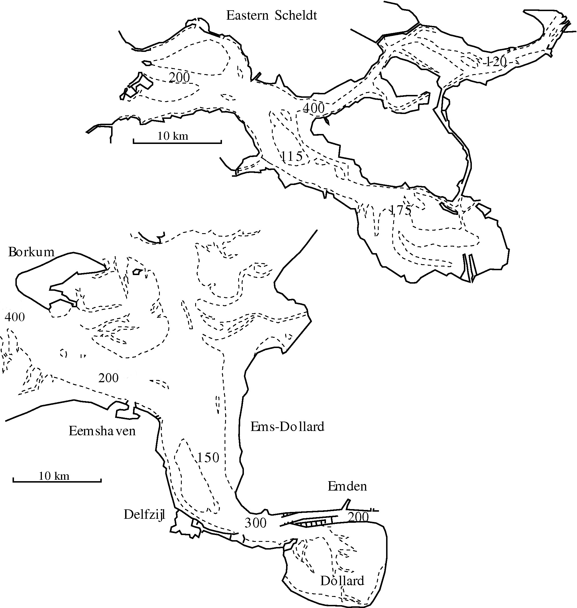
| 23:21, 25 January 2016 | OSEDdispersion.JPG (file) |  |
372 KB | Values of the dispersion coëfficiënt at different locations in the Eastern Scheldt and Ems-Dollard estuaries, derived from observed salinity distributions at small constant river discharge. | 2 |
| 23:20, 29 January 2016 | ShearDispersion.JPG (file) |  |
75 KB | Schematic representation of shear dispersion by tidal current. | 4 |
| 10:21, 30 January 2016 | TidalShearDispersion.JPG (file) |  |
73 KB | Schematic representation of longitudinal dispersion by a gradiënt in the vertical tidal current profile. | 3 |
| 10:52, 30 January 2016 | DispersionTidalShear.JPG (file) |  |
73 KB | Schematic representation of longitudinal dispersion by a gradiënt in the vertical tidal current profile. | 1 |
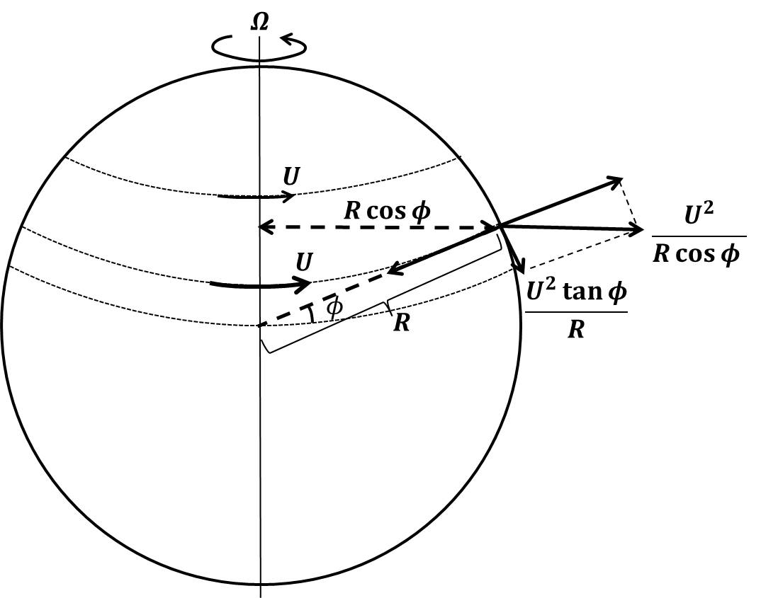
| 14:31, 22 March 2016 | TangentForce.jpg (file) |  |
48 KB | The tangential component of the centrifugal force. | 1 |
| 14:33, 22 March 2016 | TaylorSolution.jpg (file) |  |
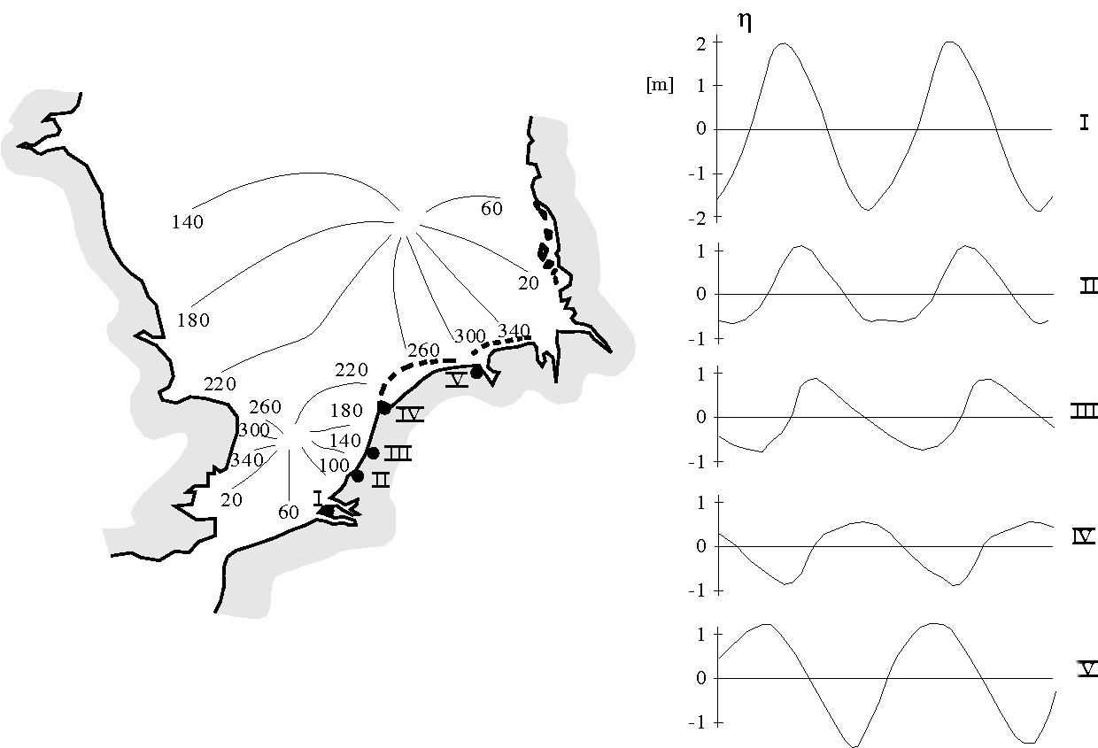
52 KB | Co-tidal lines (indicated by dashed lines, with phase hour) and lines of equal amplitude (solid lines) according to the solution of G.I. Taylor, for tidal propagation in a rectangular semi-enclosed basin with uniform depth. | 1 |
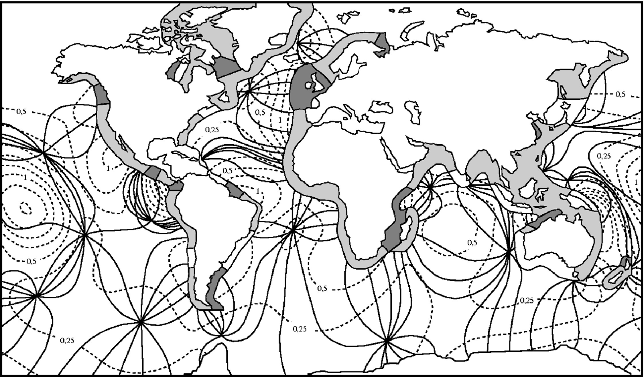
| 14:34, 22 March 2016 | Worldtides.jpeg (file) |  |
596 KB | Co-tidal lines (solid lines) and lines of equal amplitude (dashed lines, amplitude in meters) of the semidiurnal lunar M2-tide in the oceans. The tidal range along the coast is indicated in dark for tidal ranges larger than 4 m, in grey for tidal range... | 1 |
| 14:36, 22 March 2016 | NLcoastasym.jpeg (file) |  |
94 KB | Left panel: Co-tidal lines of the M2-tidal wave in the North Sea. The tidal wave enters mainly from the north, follows the UK coast at the right hand and returns along the Dutch, German and Danish coast. The amphidromic point in the central North Sea... | 1 |
| 14:37, 22 March 2016 | FrictionEllipse.jpg (file) |  |
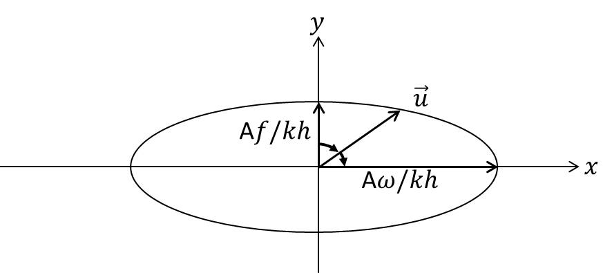
27 KB | Transformation of a rectilinear tidal current near the surface to an elliptic tidal current near the bottom, by the combined influence of Coriolis acceleration and bottom friction. | 1 |
| 12:53, 23 March 2016 | TidalEllipse.jpg (file) |  |
16 KB | Reverted to version as of 10:48, 23 March 2016 | 4 |
| 13:00, 23 March 2016 | TidalEllipse1.jpg (file) |  |
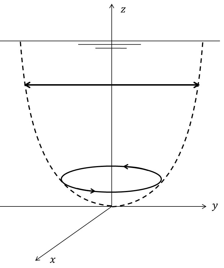
16 KB | At some distance from the coastal boundaries the tidal current vector describes an ellipse during the tidal cycle. The current vector runs the ellipse in clockwise direction on the northern hemisphere. | 1 |
| 20:25, 1 April 2016 | SaltWedgeLength.jpg (file) |  |
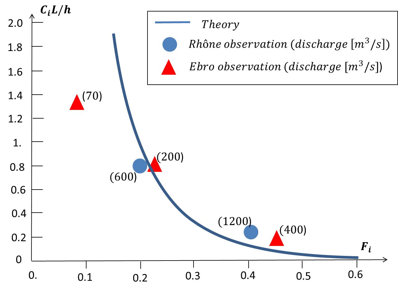
71 KB | Dimensionless salt wedge length <math>C_i L / h</math> according to the theory for a prismatic estuary and observed salt wedge lengths in the Rhône and Ebro estuaries at different discharges (corresponding to different internal river Froude numbers <m... | 1 |
| 12:26, 12 April 2016 | CoriolisEstCirc.jpg (file) |  |
36 KB | Influence of earth rotation on estuarine circulation. | 1 |
| 12:27, 12 April 2016 | LateralEstCirc.jpg (file) | 29 KB | Lateral density-driven exchange flow related to cross-channel depth variation. | 1 | |
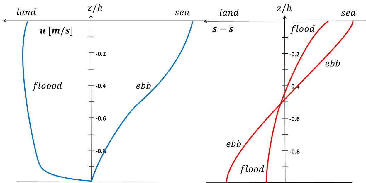
| 12:30, 12 April 2016 | EbbFloodProfiles.jpg (file) |  |
48 KB | Schematic representation of vertical profiles of salinity and along-channel velocity for flood and ebb. | 1 |
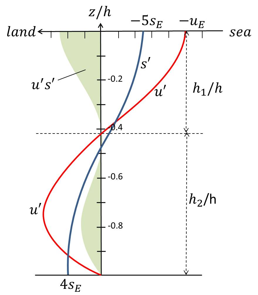
| 12:31, 12 April 2016 | VelSalProfiles.jpg (file) |  |
52 KB | Vertical profiles of estuarine circulation and salinity according to the classical theory. | 1 |
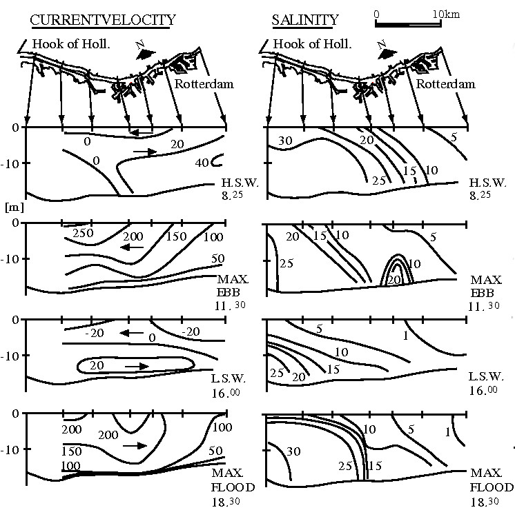
| 12:34, 12 April 2016 | RdamWaterwayVelSal.jpg (file) |  |
133 KB | Velocity and salinity distributions in a longitudinal section of Rotterdam Waterway on 9 September 1967 at different tidal phases: at the end of flood tide (H.S.W.=high slack water), during maximum ebb flow, at the end of ebb tide (L.W.S.-low slack wat... | 1 |
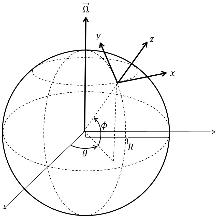
| 13:52, 19 May 2016 | RotatingAxes.jpg (file) |  |
65 KB | Definition of x,y,z axes on the rotating earth | 2 |
| 14:06, 19 May 2016 | RotatingAxesDef.jpg (file) |  |
65 KB | Definition of x,y,z axes on the rotating earth | 1 |
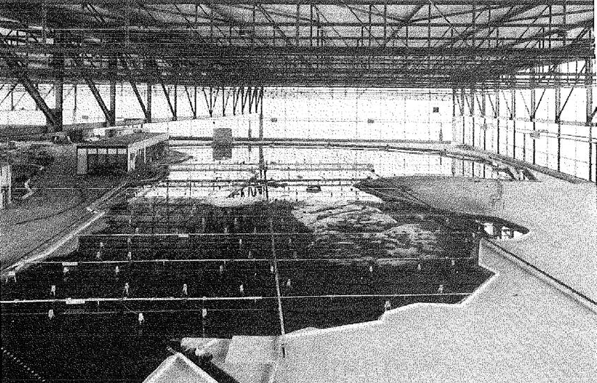
| 10:29, 24 May 2016 | EasternScheldtModelM1000.jpg (file) |  |
187 KB | Eastern Scheldt hydraulic scale model M1000 | 1 |
| 10:33, 24 May 2016 | DyeExperiment4.jpg (file) |  |
165 KB | Dye experiment 4 | 1 |
| 10:33, 24 May 2016 | DyeExperiment5.jpg (file) |  |
289 KB | Dye experiment 5 | 1 |
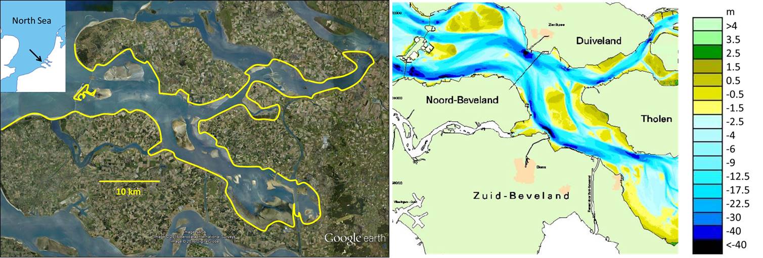
| 11:16, 24 May 2016 | EasternScheldtMapDepth.jpg (file) |  |
141 KB | Eastern Scheldt estuary: Map and depth contours. | 2 |
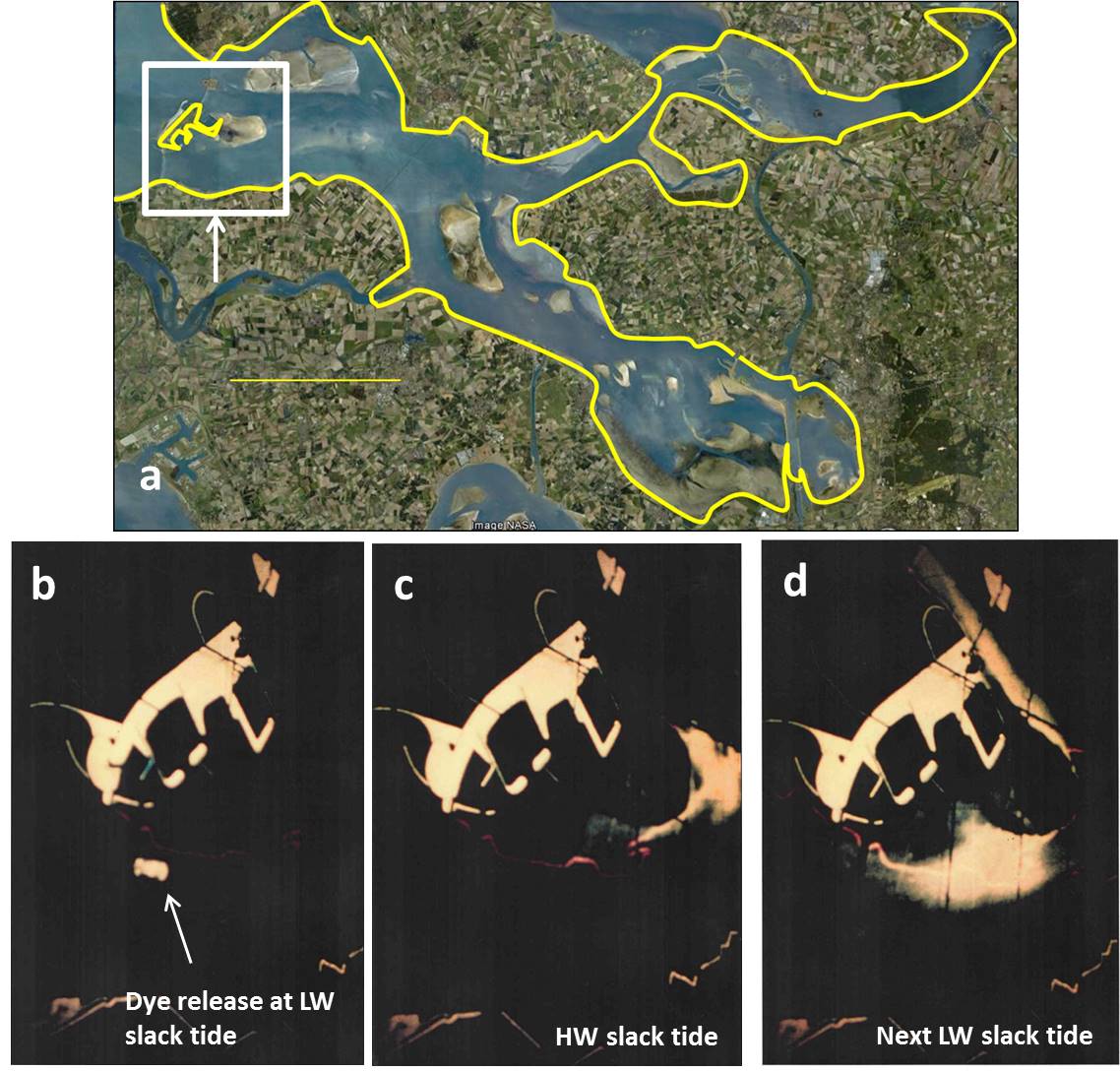
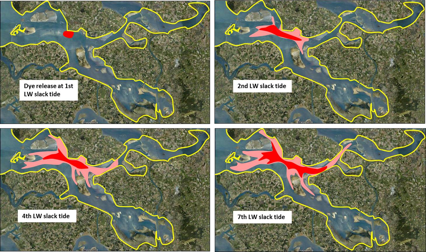
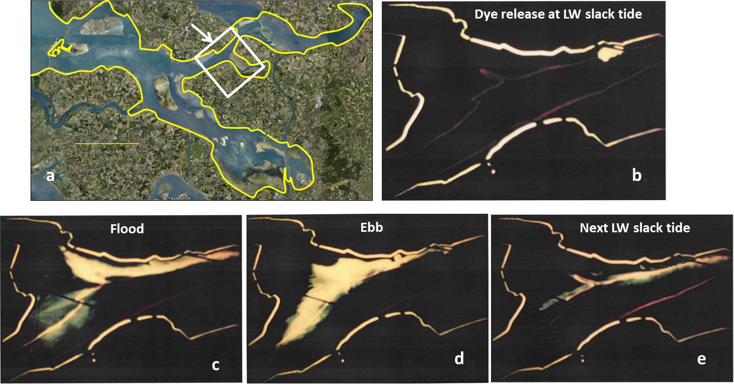
| 11:18, 24 May 2016 | DyeExperiment1.jpg (file) |  |
160 KB | Dye experiment 1. Panel a: Location viewed by the camera. Panels b, c, d: dye patch at different tidal phases. | 2 |
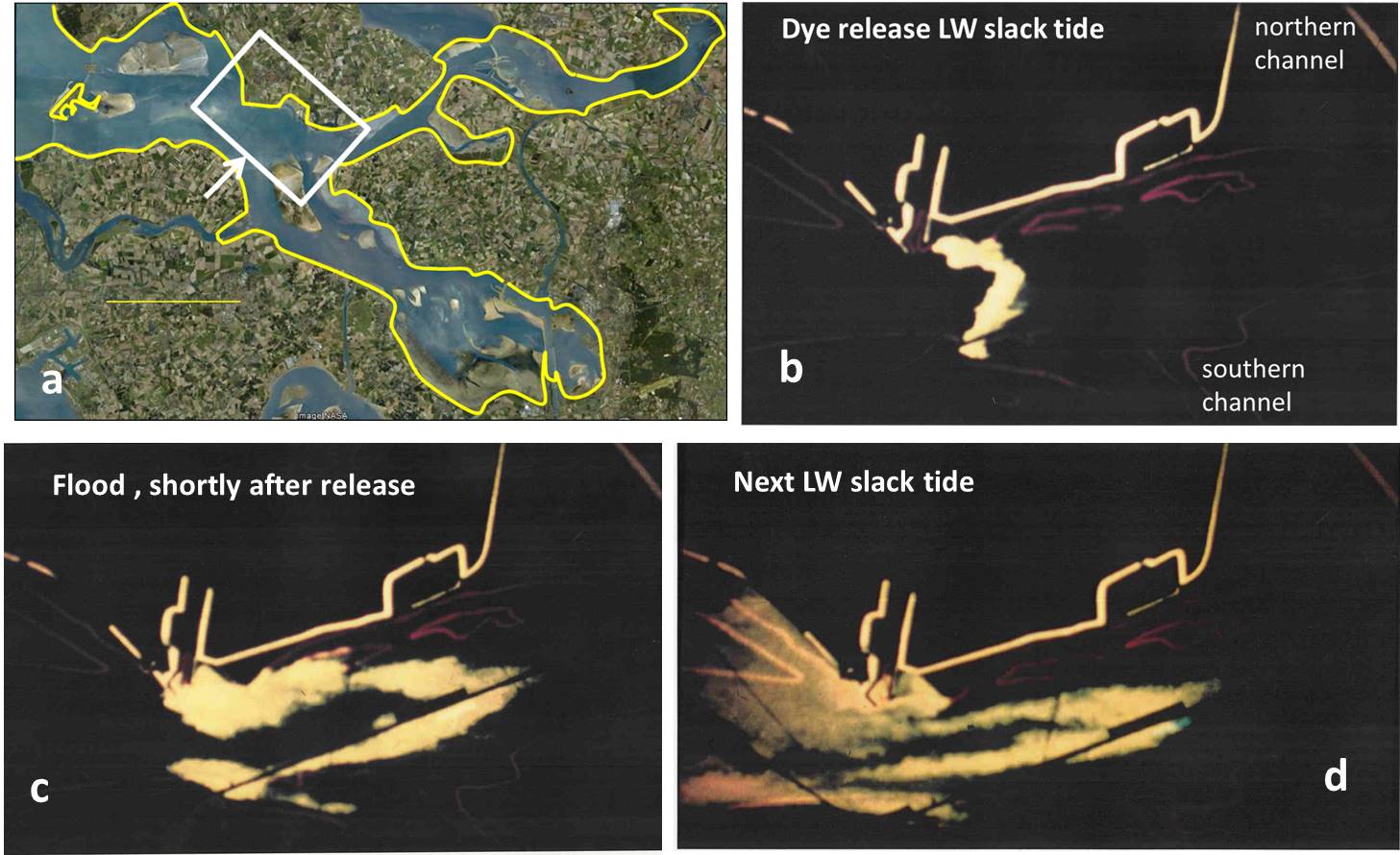
| 11:20, 24 May 2016 | DyeExperiment2.jpg (file) |  |
145 KB | Dye experiment 2. Panel a: Location viewed by the camera. Panels b, c, d: dye patch at different tidal phases. | 2 |
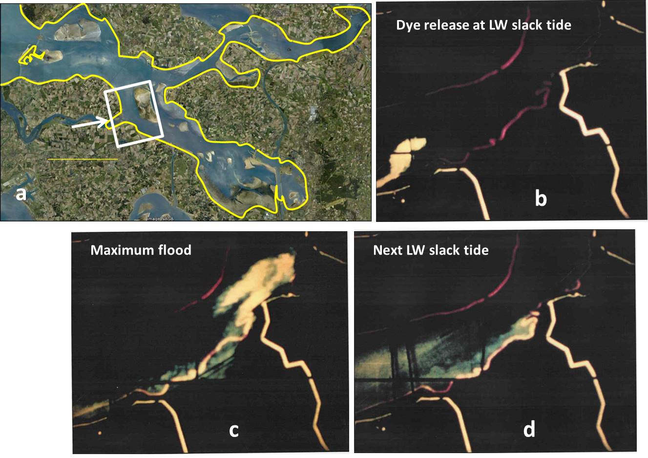
| 11:21, 24 May 2016 | DyeExperiment3.jpg (file) |  |
137 KB | Dye experiment 3. Panel a: Location viewed by the camera. Panels b, c, d, e: dye patch at different tidal phases. | 2 |
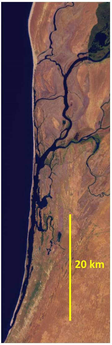
| 16:59, 6 July 2016 | Hooghly.jpeg (file) |  |
113 KB | Hooghly estuary | 1 |
| 17:00, 6 July 2016 | Curonian.jpeg (file) |  |
111 KB | Curonian Lagoon | 1 |
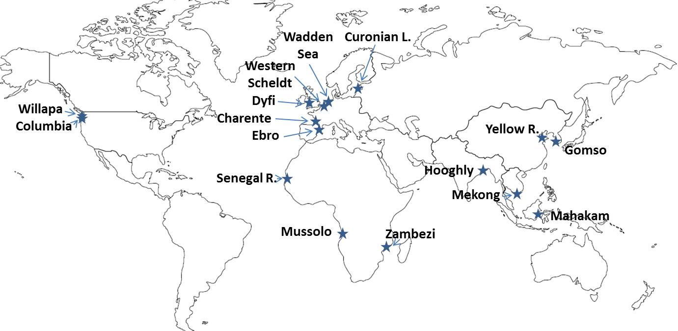
| 17:02, 6 July 2016 | EstuaryLocation.jpeg (file) |  |
88 KB | Location of estuaries discussed in the text on the world map | 1 |
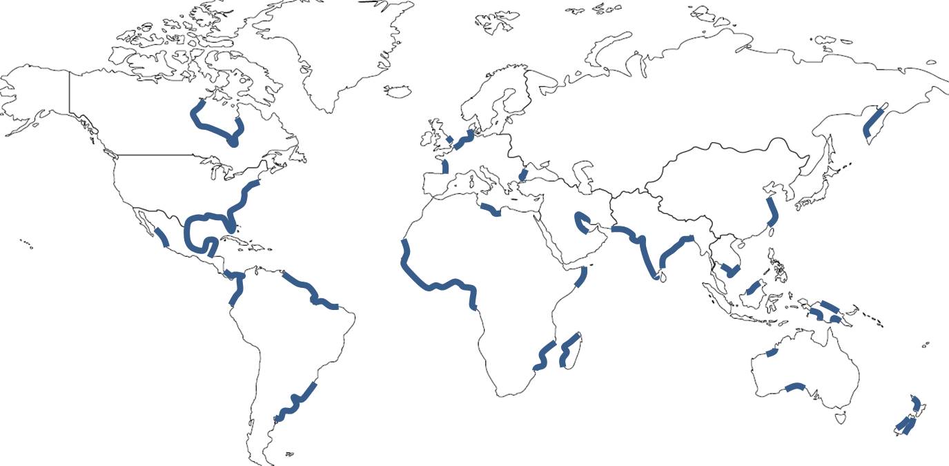
| 17:02, 6 July 2016 | WorldCoastalPlains.jpeg (file) |  |
73 KB | World map of coastal plains | 1 |
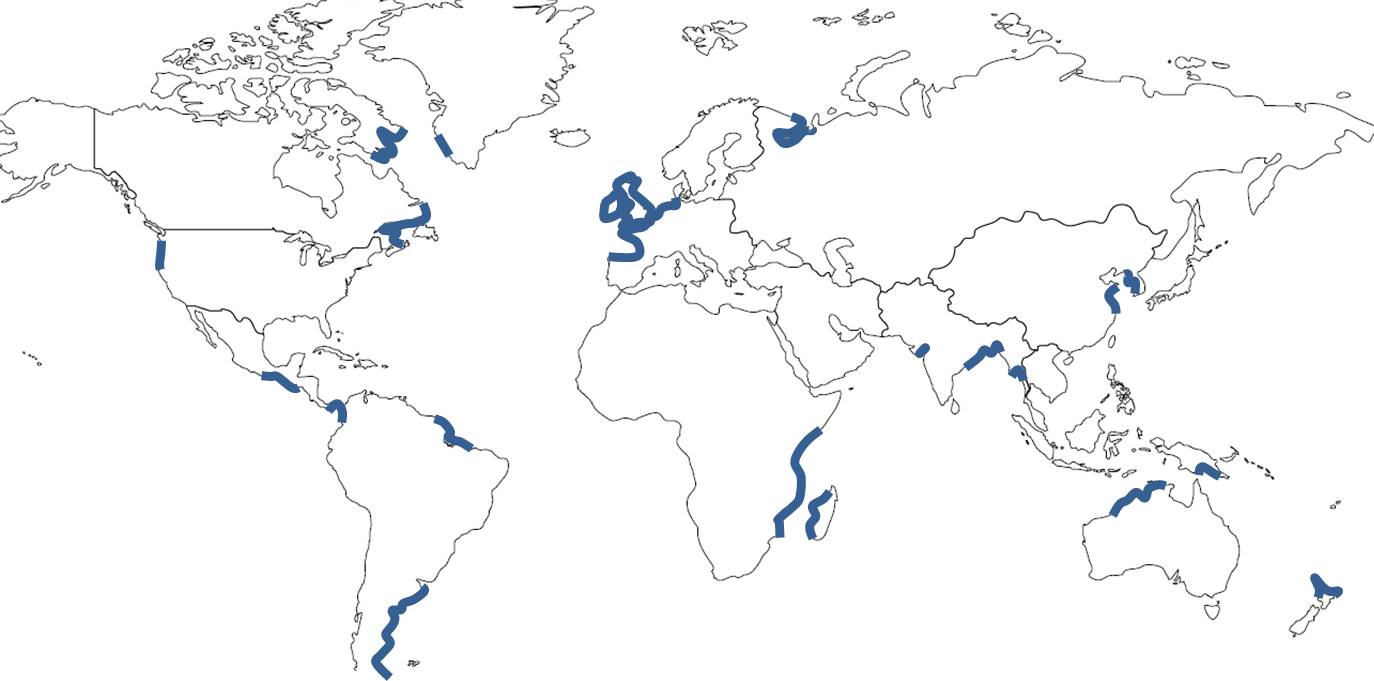
| 17:03, 6 July 2016 | WorldMacroTidalZones.jpg (file) |  |
71 KB | World map of macrotidal coastal zones | 1 |
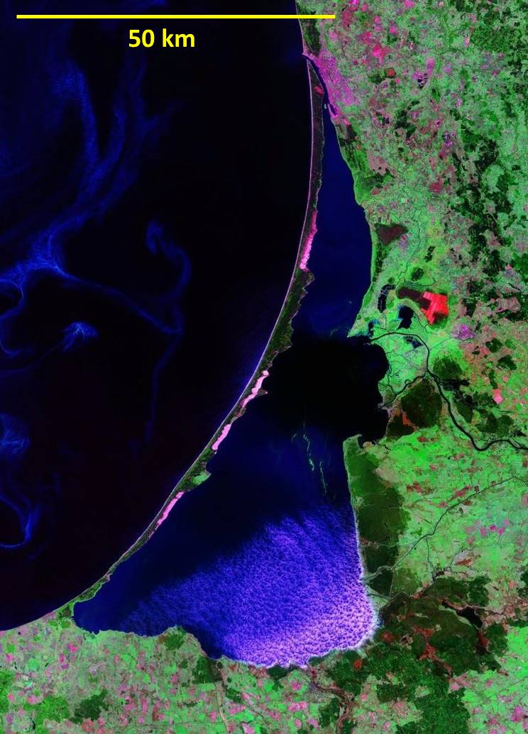
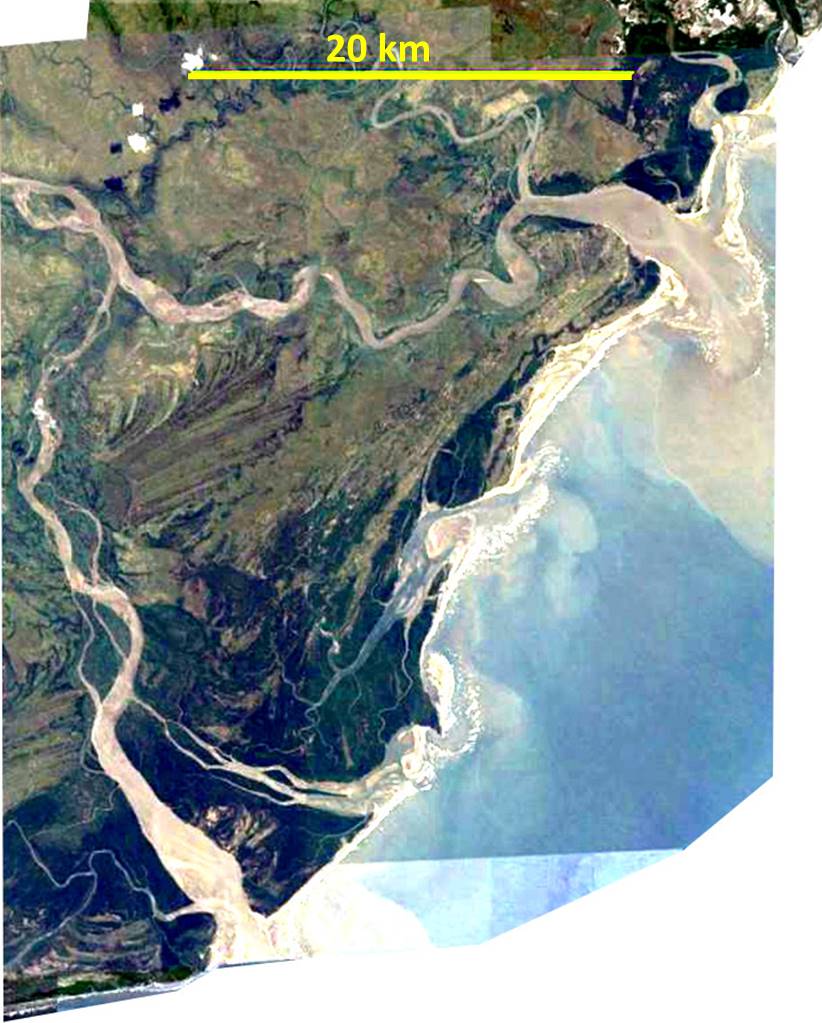
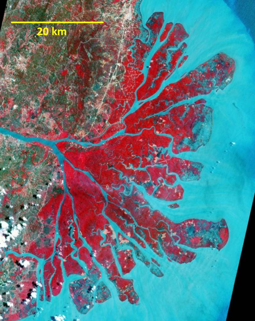
| 17:15, 6 July 2016 | Zambezi.jpg (file) |  |
120 KB | Zambezi River delta | 1 |
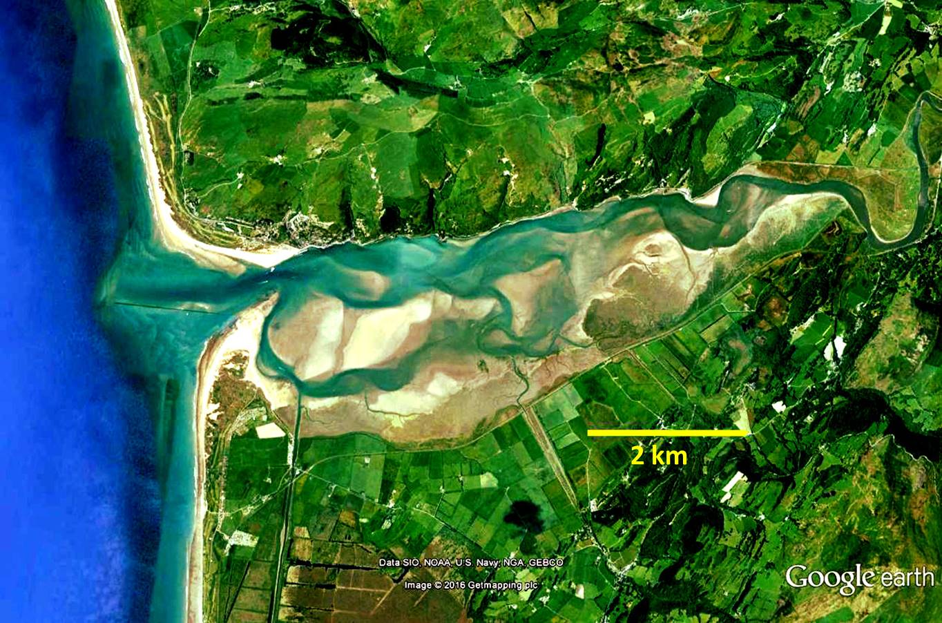
| 17:16, 6 July 2016 | Dyfi.jpg (file) |  |
238 KB | Dyfi estuary | 1 |
| 17:16, 6 July 2016 | Willapa.jpg (file) |  |
151 KB | Willapa Bay | 1 |
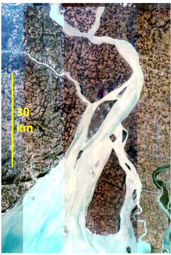
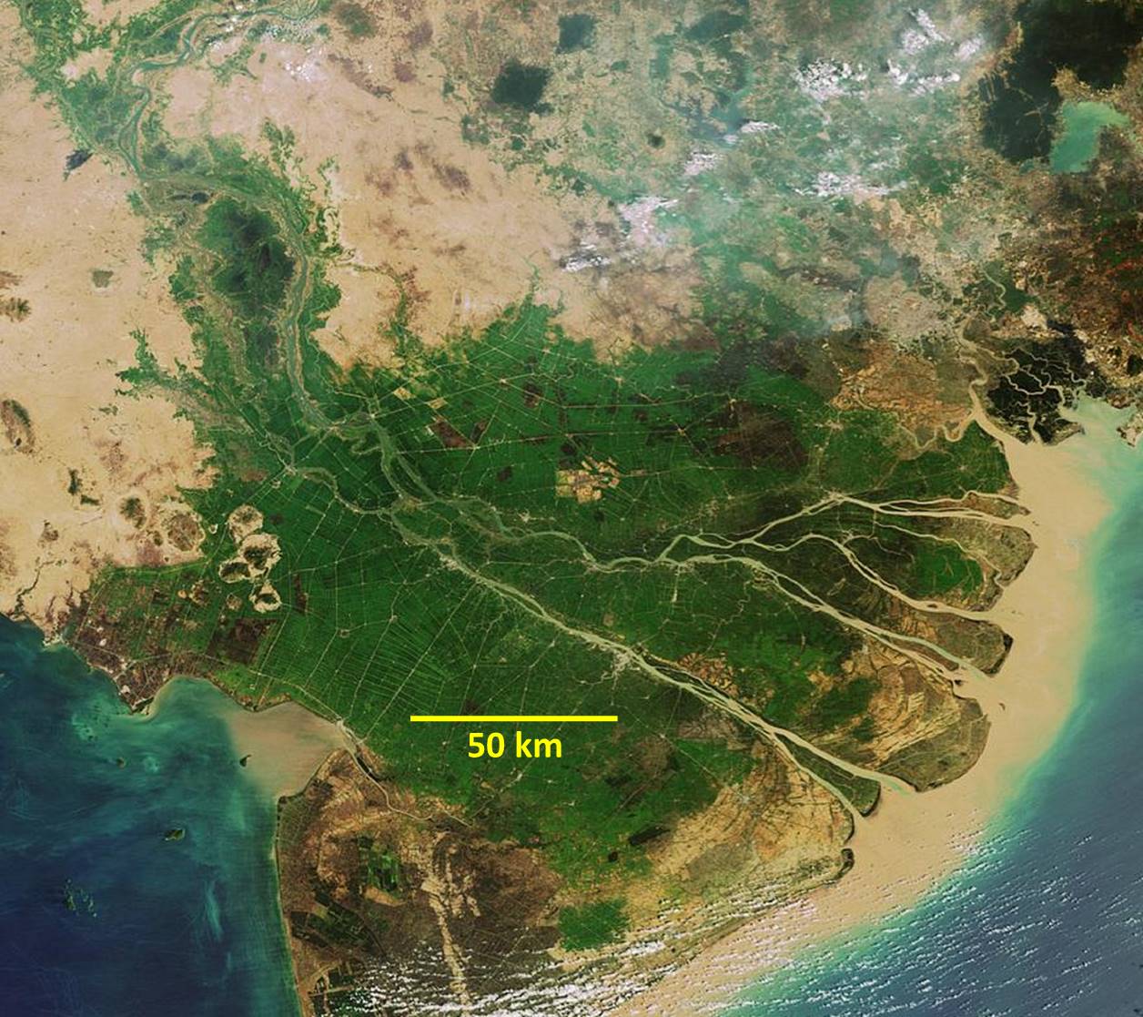
| 17:17, 6 July 2016 | Mekong.jpg (file) |  |
233 KB | Mekong delta | 1 |
| 17:18, 6 July 2016 | Mahakam.jpg (file) |  |
135 KB | Mahakam River delta | 1 |
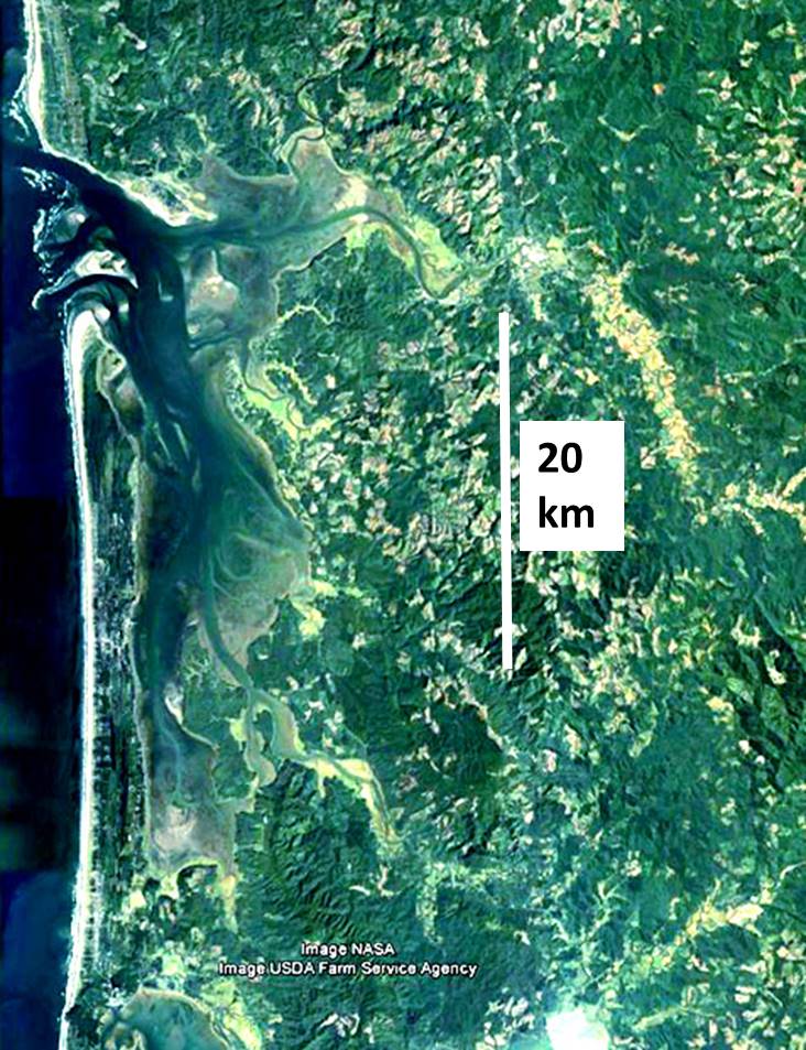
| 17:18, 6 July 2016 | Senegal.jpg (file) |  |
47 KB | Senegal River delta | 1 |
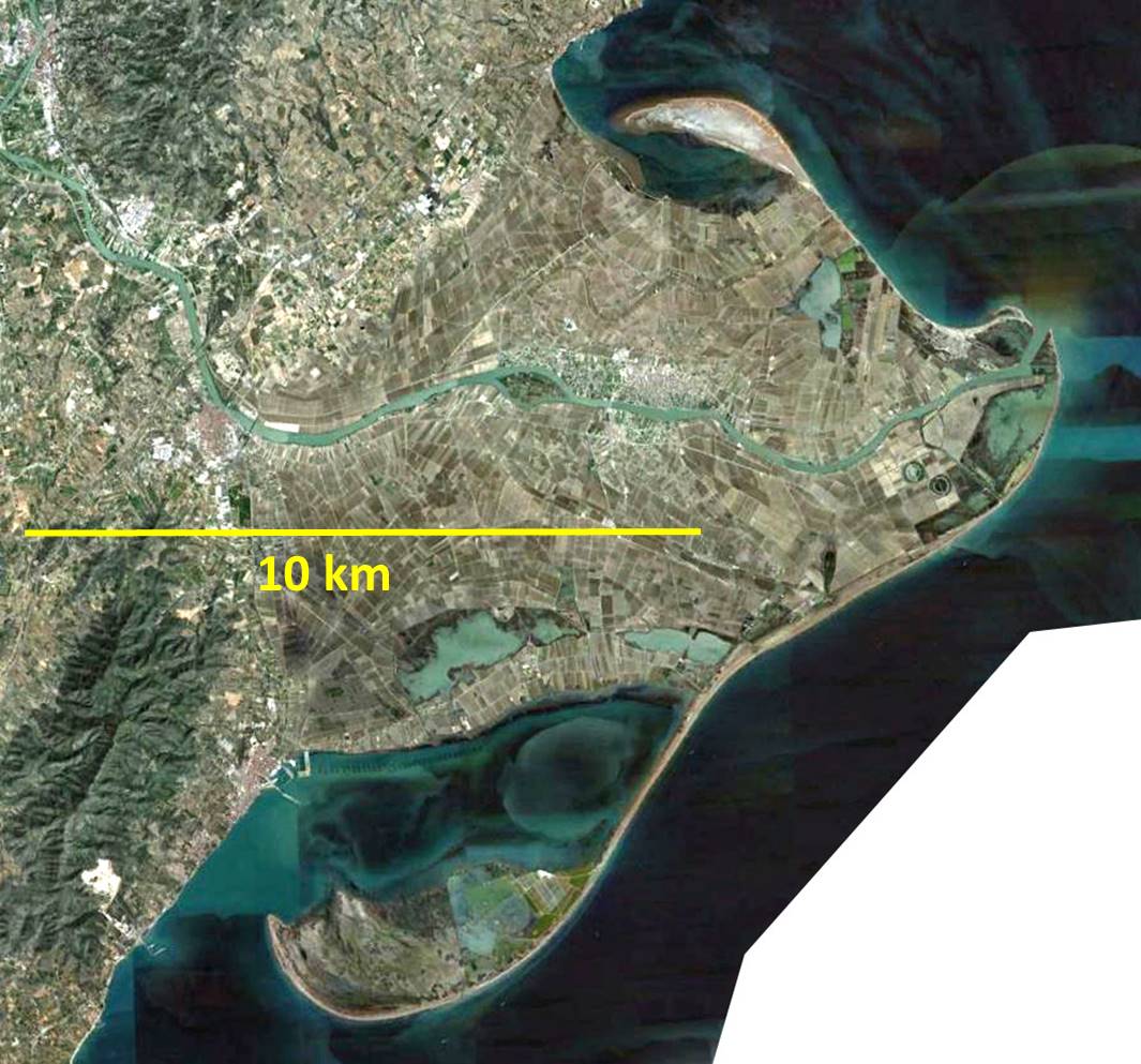
| 17:20, 6 July 2016 | Ebro.jpg (file) |  |
156 KB | Ebro delta | 1 |