Difference between revisions of "Template:This weeks featured article"
(→Use of Lidar for coastal habitat mapping) |
(→Waves) |
||
| Line 1: | Line 1: | ||
| − | == | + | ==Waves== |
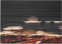
| − | [[ | + | [[Image:irregular storm a.jpg|thumb|200px|Fig. 1a. Irregular directional storm waves (including white capping)]] |
| + | [[Image:irregular storm b.jpg|thumb|200px|Fig. 1b. Regular unidirectional swell.]] | ||
| − | + | There is typically a distinction between short waves, which are waves with periods less than approximately 20 s, and long waves or long period oscillations, which are oscillations with periods between 20-30 s and 40 min. Water-level oscillations with periods or recurrence intervals larger than around 1 hour, such as [[tide|astronomical tide]] and [[storm surge]], are referred to as water-level variations. The short waves are wind waves and swell, whereas long waves are divided into [[surf beat]]s, harbour resonance, [[seiche]] and [[tsunami]]s. Natural waves can be viewed as a wave field consisting of a large number of single wave components each characterised by a [[wave height]], a [[wave period]] and a propagation direction. Wave fields with many different [[wave period]]s and heights are called irregular. | |
| − | |||
| − | |||
| − | |||
| − | |||
| − | |||
| − | |||
Revision as of 14:16, 6 October 2008
Waves
There is typically a distinction between short waves, which are waves with periods less than approximately 20 s, and long waves or long period oscillations, which are oscillations with periods between 20-30 s and 40 min. Water-level oscillations with periods or recurrence intervals larger than around 1 hour, such as astronomical tide and storm surge, are referred to as water-level variations. The short waves are wind waves and swell, whereas long waves are divided into surf beats, harbour resonance, seiche and tsunamis. Natural waves can be viewed as a wave field consisting of a large number of single wave components each characterised by a wave height, a wave period and a propagation direction. Wave fields with many different wave periods and heights are called irregular.

