File:BaZaTable1.jpg
From Coastal Wiki
Size of this preview: 500 × 600 pixels. Other resolutions: 200 × 240 pixels | 1,248 × 1,497 pixels.
Original file (1,248 × 1,497 pixels, file size: 241 KB, MIME type: image/jpeg)
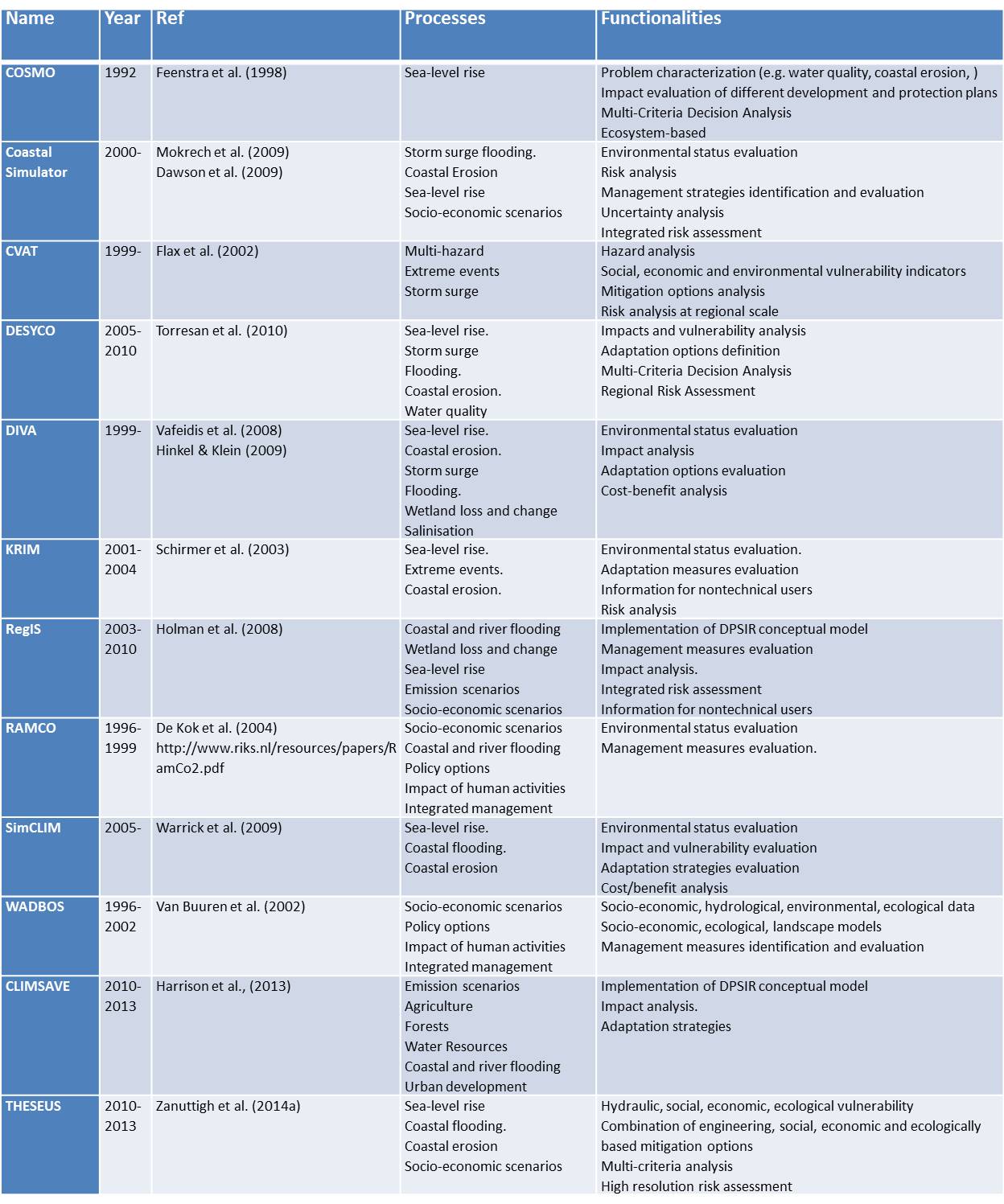
Review of existing exploratory tools that can be used for supporting decisions applied to coastal areas. These GIS-based tools perform scenario construction and analysis.
File history
Click on a date/time to view the file as it appeared at that time.
| Date/Time | Thumbnail | Dimensions | User | Comment | |
|---|---|---|---|---|---|
| current | 17:46, 26 September 2016 | | 1,248 × 1,497 (241 KB) | Dronkers J (talk | contribs) | Review of existing exploratory tools that can be used for supporting decisions applied to coastal areas. These GIS-based tools perform scenario construction and analysis. |
- You cannot overwrite this file.
File usage
The following page links to this file:
