File:NauticalDepthScheme.jpg
From Coastal Wiki
Size of this preview: 800 × 369 pixels. Other resolutions: 320 × 147 pixels | 870 × 401 pixels.
Original file (870 × 401 pixels, file size: 53 KB, MIME type: image/jpeg)
Summary
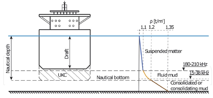
Illustration of nautical depth. From Kirichek, A., Shakeel, A. and Chassagne, C. 2020. Using in situ density and strength measurements for sediment maintenance in ports and waterways. J. Soils Sediments 20: 2546–2552, Creative Commons International License.
File history
Click on a date/time to view the file as it appeared at that time.
| Date/Time | Thumbnail | Dimensions | User | Comment | |
|---|---|---|---|---|---|
| current | 11:46, 27 February 2023 | | 870 × 401 (53 KB) | Dronkers J (talk | contribs) | Illustration of nautical depth. From Kirichek, A., Shakeel, A. and Chassagne, C. 2020. Using in situ density and strength measurements for sediment maintenance in ports and waterways. J. Soils Sediments 20: 2546–2552, Creative Commons International... |
- You cannot overwrite this file.
File usage
The following page links to this file:
