PEGASO case study North Adriatic Sea
CASE description
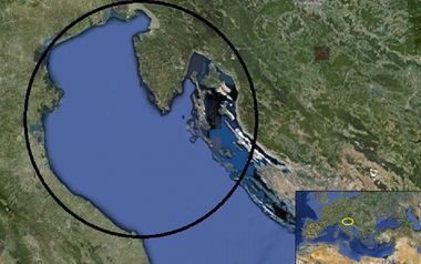
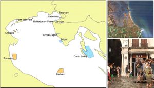
The North Adriatic is a transboundary case comprising coastal zones of three different nations bordering the Upper Adriatic sea; the North Adriatic sea southern limit is given by the ideal line linking the city of Ancona in Italy and the City of Zadar in Croatia.The CASE includes, from south west, the coastal zone of 4 Italian Regions: Marche, Emilia Romagna, Veneto and Friuli-Venezia Giulia; the Slovenian coastal zone and the coast of 4 Croatian Counties: Istria, Rijeka, Lika and Senj, Zadar, for a total coastline length of about 2,227 km of coastline of mainland and 1,502 km of islands. The western Adriatic Italian coast is generally low, merging into the marshes and lagoons (e.g. Venice, Marano and Grado lagoons) on both sides of the protruding Po river delta, the most important river flowing into the Adriatic sea. Further north the landscape gets rockier and steeper. From the south of the Istrian peninsula, which is divided between Italy, Slovenia and Croatia, a fringe of over thousand islands extends as far south as Dubrovnik.
ICZM phase
Main coastal issues
- Climate change impacts and risks assessment in the CASE coastal areas
- Water quality assessment (particularly concerning bathing and tourism)
- Lack of common vision for the implementation of the ICZM protocol in the Adriatic
Relation between the Coastal issue and the ICZM protocol principles and articles.
In our view, the identified coastal issues relate at least to seven specific ICZM protocol articles: art. 7 (Coordination), art. 14 (Participation), art. 15 (Awareness-raising, training, education and research), art. 18 (National Coastal strategies, plans and programs), art. 22 (Natural hazards), art. 25 (Training and research) and art. 28 (Transboundary cooperation). Climate change impacts and water quality assessment imply an interdisciplinary scientific research which aims to define appropriate indicators, to formulate ICZM strategies, to identify priorities and ecosystem management measures (art. 15, 18, 22, 25). The lack of cooperation between and within the different national authorities and management bodies highlights the need to avoid sectoral approaches and foster stakeholders involvement (see art. 7, 14 and 28).
Relevance of the coastal issue
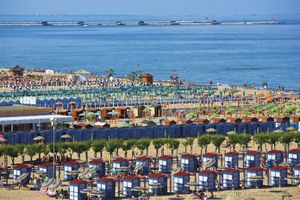
The North Adriatic zone is a traditional European destination for seaside tourism (almost 20 million of international arrivals in 2008 if considering also Slovenia and Croatia). The North Adriatic has many factors of attraction, such as nature, culture and gastronomy. Sea quality is extremely important not only for the economic weight directly related to bathing tourism, but also for its crucial role in the whole North Adriatic image and tourism system (e.g. cruise sector as well as nautical tourism). Italian national agencies estimated a daily consumption of almost 80 euro per tourist for sea destination. The same parameter for mountain, lake, cultural and gastronomic tourism ranges from 90 to 110 euro. However, the greater number of presences makes Italian seaside destination able to compete with the cultural ones (which are the most important in term of provided income). Data referring to seaside tourism performances, in the context of the North Adriatic, are available only for Emilia Romagna and Veneto. These two regions represent respectively 21,6% and 16.2% of the total Italian seaside tourism presences.
| Presences | Arrivals | |
| Emilia Romagna | 27,9 million | 5,5 million |
| Veneto | 26,5 million | 3,9 million |
An important indicator for the tourism sector service is the number of bed provided by hotel and other accommodations. The below table illustrates the situation of Veneto tourism districts.
| Bibione-Caorle | 129.889 (18,7%) |
| Jesolo- Eraclea | 108.459 (15,6%) |
| Cavallino | 55.603 (8,0%) |
| Chioggia | 24.926 ( 3,6%) |
Chioggia tourism district, the case study for the implementation of the Bathing Water Advisory Model (BHAM), experienced in 2011 more than 261.500 arrivals and more than 2 million presences (7.5% of the seaside holidays regional quota).
Pollution issue: safe bathing conditions
According to the parameters stated in the Decree 116/2008 and in the Ministerial Decree 30/03/2010, no bathing coastal waters of Veneto region are nowadays banned. The situation has improved in the last two years (no banned zones in 2010 and only two zones banned in 2011) however, very large and persistent bathing prohibitions were declared right up to 2009. The graph below, produced by the Veneto Environmental Regional Agency (ARPAV), shows the monitoring activity of ten bathing tourist districts since 1997. The values represent the percentage of the total monitored zones (several for each district) which did not passed the hygienic and health tests. Chioggia district is the most affected by the issue of bathing water quality, as a matter of fact, with the exceptions of 2007, 2010 and 2011, every year at least one of its zone failed the water quality assessment. For instance in 2009, 100% of the district was banned to bathing activities. Caorle and Rosolina are the second and the third most problematic districts with notable and repeated percentages of banned zones (33% of Rosolina district was declared banned zones in 2009). Also the other districts showed notable percentages of banned zones. Jesolo, Porto Viro, and Porto Tolle tourist districts, failed the tests at least once during the 15 years of monitoring. In 2000, Porto Viro experienced instead the peak of 50% banned zones, but it seems an isolated event.
| SITES | 1997 | 1998 | 1999 | 2000 | 2001 | 2002 | 2003 | 2004 | 2005 | 2006 | 2007 | 2008 | 2009 | 2010 | 2011 |
| Caorle | 2 | 2 | 4 | - | - | 4 | - | 1 | 2 | - | - | 1 | 1 | - | 2 |
| Jesolo | - | - | - | - | - | 1 | - | - | - | - | - | - | - | - | - |
| Chioggia | 9 | 6 | 1 | 4 | 5 | 9 | 4 | 6 | 4 | 3 | - | 7 | 11 | - | - |
| Rosolina | - | 1 | 2 | - | 2 | - | - | - | - | - | - | - | 3 | - | - |
| Porto Viro | - | - | - | 1 | - | - | - | - | - | - | - | - | - | - | - |
| Porte Tolle | 1 | - | - | - | - | - | - | - | - | - | - | - | - | - | - |
The table illustrates the number of negative bathing suitability tests zones from 1997 to 2011. During 15 years of monitoring Chioggia sampling zones were affected by bathing restriction 69 times (an annual average of almost 44% of total zones not suitable), recording the worst water quality situation of the whole Veneto region.
Objectives
- To support the development of coastal adaptation strategies
- To improve monitoring activities of coastal water qualities
- To foster cooperation among countries at institutional level for common vision of Marine protected areas
End Products
DSS Climate change- Water Quality Model - North Adriatic transboundary strategy, with particular reference to Marine Protected Areas
PEGASO tools developed and used
indicators and participation (DSS-Desyco (DEcision support SYstem for COastal climate change impact assessment) and BHAM (Beach Health Advisory Model)).
CASE Responsible
Stefano Soriani - Ca’ Foscari University of Venice - email: soriani@unive.it
Elaboration: Stefano Soriani, Fabrizia Buono, Monica Camuffo, Marco Tonino, University Ca’ Foscari of Venice.


