File list
This special page shows all uploaded files.
| Date | Name | Thumbnail | Size | Description | Versions |
|---|---|---|---|---|---|
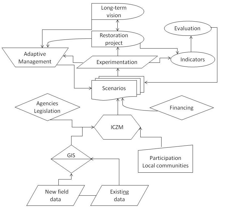
| 11:07, 5 September 2012 | A model plan for the restauration of an estuary.jpg (file) |  |
50 KB | 2 | |
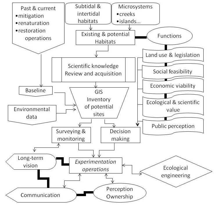
| 11:45, 5 September 2012 | Model plan for sustaining an estuary in a healthy state.jpg (file) |  |
83 KB | 3 | |
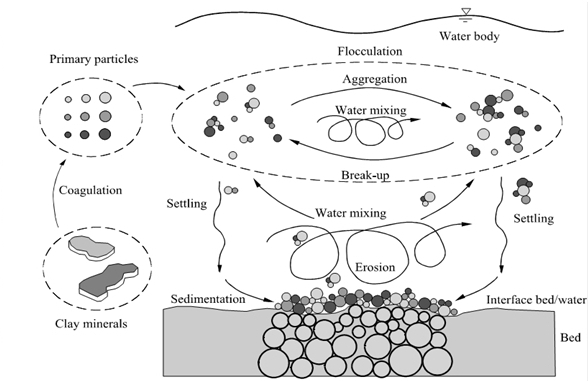
| 13:00, 6 September 2012 | Schematic representation of mud floc dynamics.jpg (file) |  |
84 KB | 3 | |
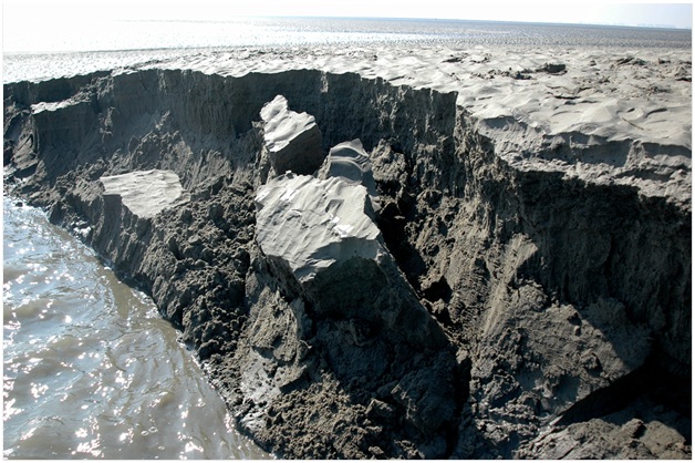
| 13:04, 6 September 2012 | Cliff erosion of an intertidal mudflat in the Western Scheldt Estuary.jpg (file) |  |
140 KB | 1 | |
| 13:09, 6 September 2012 | Fluid mud at the Suriname Coast..jpg (file) |  |
79 KB | 1 | |
| 13:25, 6 September 2012 | Mud pebble formation after cliff erosion along the Yzer mouth intertidal mudflat.jpg (file) |  |
118 KB | 1 | |
| 13:29, 6 September 2012 | Mud density currents generated in laboratory flume.jpg (file) | 58 KB | 1 | ||
| 11:57, 12 September 2012 | Cross section of Zeebrugge rubble mound breakwater .png (file) |  |
81 KB | 2 | |
| 12:18, 12 September 2012 | Ratio between prototype overtopping discharge and upscaled model overtopping discharge .png (file) |  |
39 KB | 1 | |
| 13:47, 12 September 2012 | Map of the coastal domain and of the local domain .png (file) |  |
72 KB | 1 | |
| 15:36, 12 September 2012 | Composite modelling approach.png (file) |  |
60 KB | 1 | |
| 15:41, 12 September 2012 | Final bathymetry after 9 tests.png (file) |  |
105 KB | 1 | |
| 16:47, 15 October 2012 | Barierbeach.png (file) |  |
104 KB | 1 | |
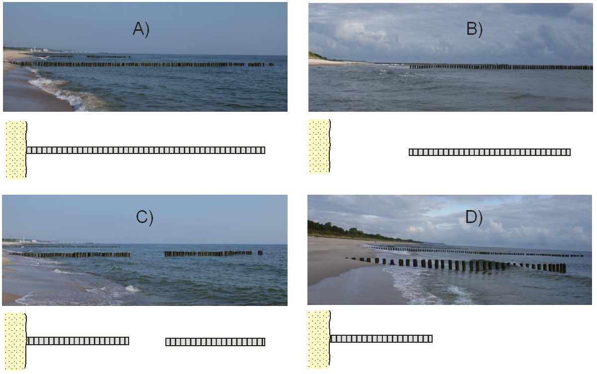
| 15:02, 16 October 2012 | Healthy groyne and groynes with gaps.jpg (file) |  |
129 KB | 1 | |
| 17:56, 30 November 2012 | Location of Hel Peninsula.png (file) |  |
79 KB | 1 | |
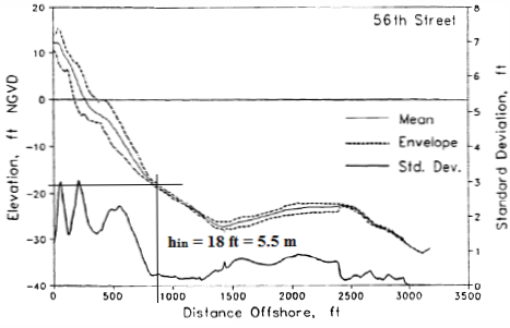
| 11:52, 28 January 2013 | Closure depth Mean, envelope and standard deviation of profile survey elevations .png (file) |  |
55 KB | 2 | |
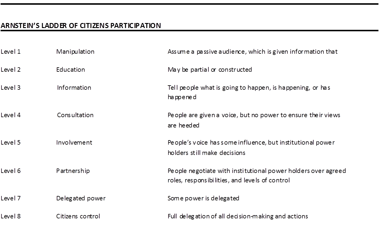
| 14:24, 11 March 2013 | Arnsteins ladder of citizens participation.png (file) |  |
45 KB | 1 | |
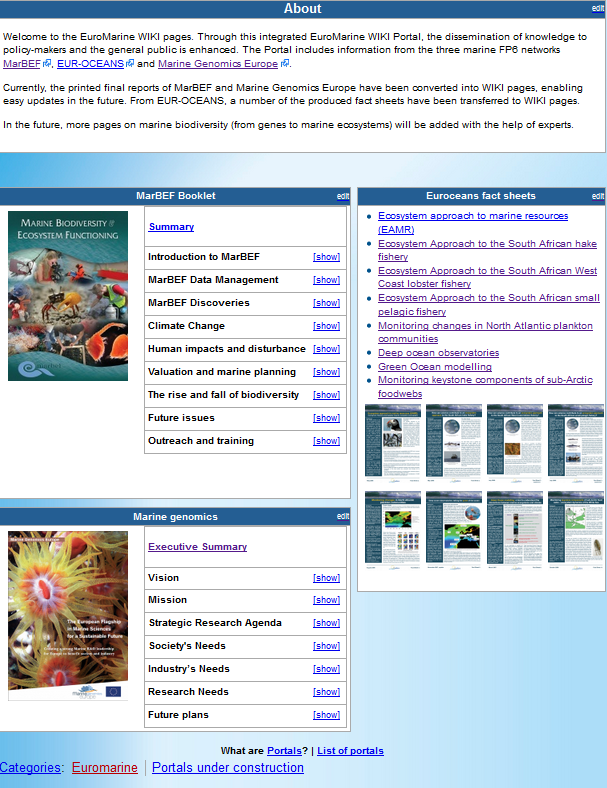
| 10:48, 13 March 2013 | Portal euromarine.png (file) |  |
275 KB | 1 | |
| 11:18, 13 March 2013 | Portal marine biotech.jpg (file) |  |
29 KB | 1 | |
| 13:44, 15 March 2013 | Portal PEGASO PEGASO Cases.kml (file) | 5 KB | 2 | ||
| 10:38, 18 March 2013 | PEGASO methodological paper.pdf (file) | 711 KB | PEGASO Methodological paper Version 4. | 1 | |
| 10:50, 18 March 2013 | PEGASO Methodological paper Annex1.pdf (file) | 23 KB | Annex 1 of PEGASO Methodolical paper Version 4 | 1 | |
| 10:59, 18 March 2013 | PEGASO Methodological paper Annex2.pdf (file) | 20 KB | Annex 2 of PEGASO Methodolical paper Version 4 | 1 | |
| 12:12, 18 March 2013 | PEGASO Methodological paper Annex3.pdf (file) | 171 KB | Annex 3 of PEGASO Methodolical paper Version 4 | 1 | |
| 12:17, 18 March 2013 | PEGASO methodological factsheet.pdf (file) | 91 KB | Version 2 | 1 | |
| 15:22, 2 April 2013 | Kakuschke 2.jpg (file) |  |
128 KB | 2 | |
| 12:52, 10 April 2013 | Mermaidlogo.jpg (file) |  |
37 KB | 1 | |
| 13:41, 10 April 2013 | Mermaidleaflet.jpg (file) |  |
84 KB | 1 | |
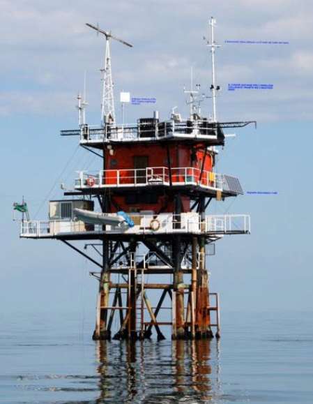
| 15:39, 10 April 2013 | AcquaAltaplatform1.jpg (file) |  |
44 KB | 1 | |
| 15:47, 10 April 2013 | AcquaAltaplatform2.jpg (file) |  |
26 KB | 1 | |
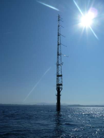
| 16:02, 10 April 2013 | Idermarmeteofloatingmetmast..jpg (file) |  |
13 KB | 1 | |
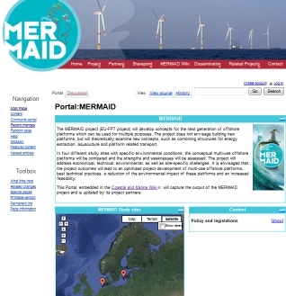
| 16:48, 28 June 2013 | Mermaid.jpg (file) |  |
76 KB | 2 | |
| 10:10, 6 August 2013 | WP4 Factsheet 4.3 updated July2013.pdf (file) | 365 KB | 2 | ||
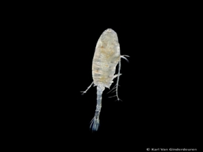
| 10:45, 7 October 2013 | Pacifisch eenoogkreeftje.jpg (file) |  |
8 KB | 1 | |
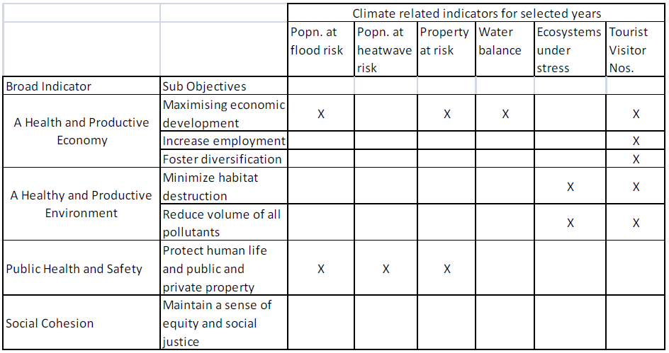
| 13:41, 30 October 2013 | Possible climate related Indicators that complement other indicators for the ICZM.png (file) |  |
61 KB | 2 | |
| 15:49, 30 October 2013 | Data Provided on a Downscaled Basis for Making a Risk Assessment.jpg (file) |  |
50 KB | 1 | |
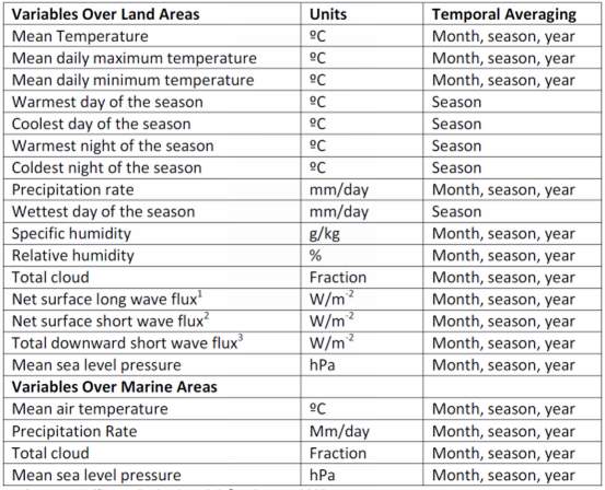
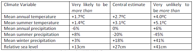
| 15:58, 30 October 2013 | Typical Data Reported from the Climate Models Projections for SW England in the 2050s.png (file) | 24 KB | 1 | ||
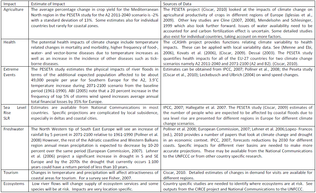
| 16:16, 30 October 2013 | Main Impacts of Climate Variability and Change and Sources of Data.png (file) |  |
183 KB | 1 | |
| 16:45, 30 October 2013 | Coasts Covered under the DIVA Model.png (file) |  |
168 KB | 1 | |
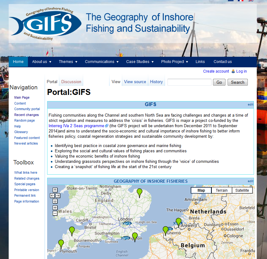
| 10:46, 5 November 2013 | GIFS portal.png (file) |  |
457 KB | 1 | |
| 11:56, 8 November 2013 | Cesenatico study site poster.pdf (file) | 358 KB | Cesenatico study site poster created by: Unibo team. (2013). THESEUS a new wave in coastal protection, Cesenatico case study site. Alma Mater Studiorum - Università di Bologna (UniBo): Bologna, 1 poster pp. | 1 | |
| 12:12, 8 November 2013 | Elbe study site poster.pdf (file) | 4.29 MB | THESEUS Elbe Study site poster created by: Kappenberg, J., Sothmann J., Ohle, N., Schuster, D. (2013). THESEUS a new wave in coastal protection, Elbe estuary case study site. Hamburg Port Authority (HPA), Helmholtz-Zentrum Geesthacht (HZG): Hamburg, 1 ... | 1 | |
| 12:15, 8 November 2013 | Teign Estuary Case Study site.pdf (file) | 3.14 MB | THESEUS Teign Estuary Case Study site Simmonds, D.; Reeve, D. E.; Penning-Rowsell, E.; Nicholls, R. J.; Thompson, R. C.; Pan, S.; Hanley, M.; Hanson, S.; Fox, A.; Horrillo-Caraballo, J.; Hoggart, S. P. G.; Gonzalez-Santamaria, R. (2013). THESEUS a new... | 1 | |
| 13:05, 19 November 2013 | Isecalogo.png (file) |  |
14 KB | 1 | |
| 16:43, 26 November 2013 | Gifslogo2.png (file) |  |
3 KB | 1 | |
| 17:57, 29 November 2013 | Locatie bij benadering2.png (file) |  |
1 KB | 1 | |
| 14:09, 6 February 2014 | ArticleunderConstruction.png (file) | 10 KB | 1 | ||
| 15:32, 5 March 2014 | Harbor.png (file) |  |
897 bytes | 1 | |
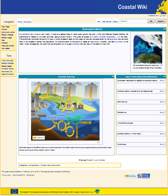
| 11:33, 8 October 2014 | Portal eutrophication.png (file) |  |
164 KB | 2 | |
| 15:43, 8 April 2016 | Compendiumcoastandsea.jpg (file) |  |
73 KB | 1 |