File list
This special page shows all uploaded files.
| Date | Name | Thumbnail | Size | User | Description | Versions |
|---|---|---|---|---|---|---|
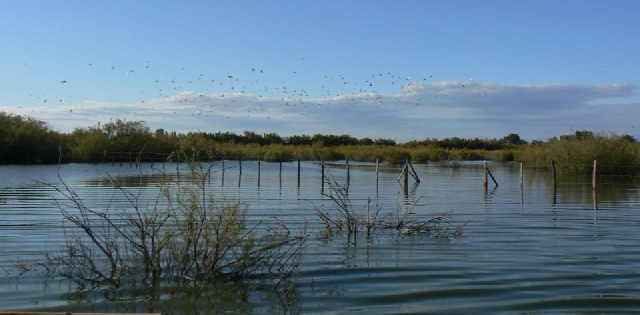
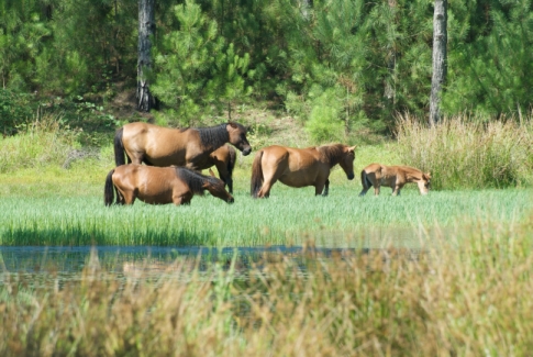
| 19:13, 29 June 2011 | Bouches du rhone2.jpg (file) |  |
124 KB | Heidid | Camargue (Photos: Tour du Valat) | 1 |
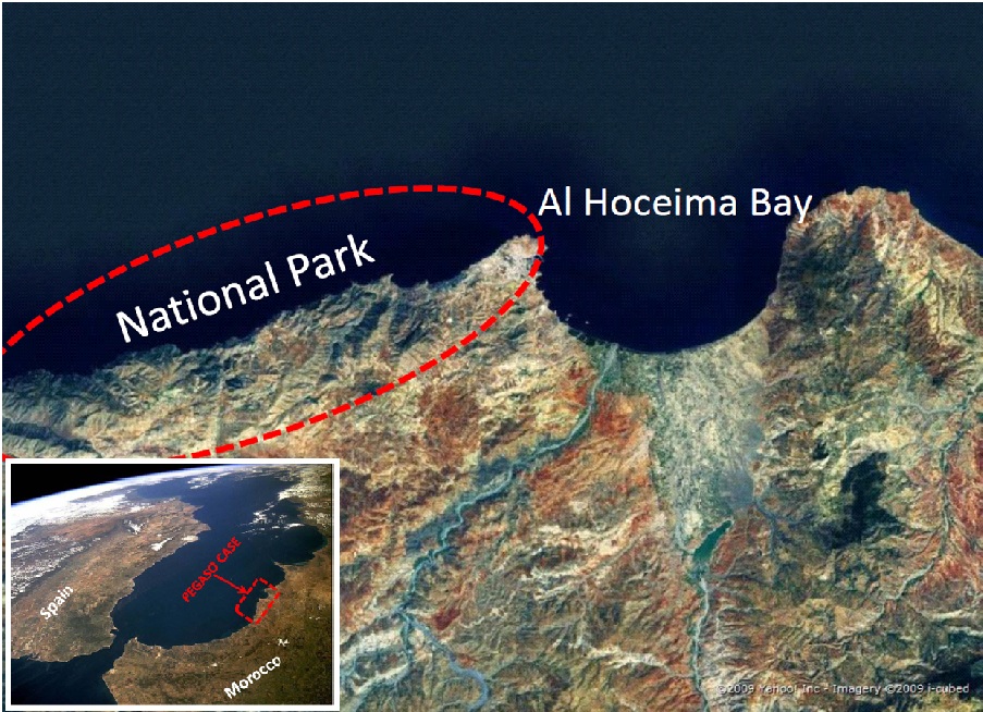
| 19:48, 29 June 2011 | Al Hoceima Coast map.jpg (file) |  |
267 KB | Heidid | 2 | |
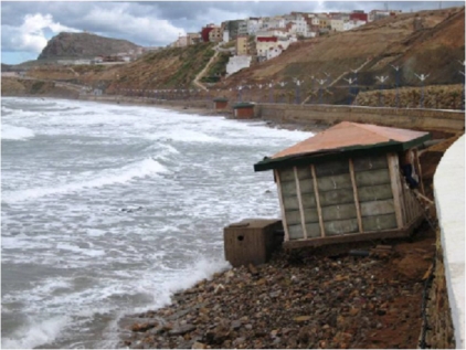
| 19:49, 29 June 2011 | Al Hoceima Coast1.jpg (file) |  |
107 KB | Heidid | Coastal erosion (Author: Mohamed El Andaloussi) | 1 |
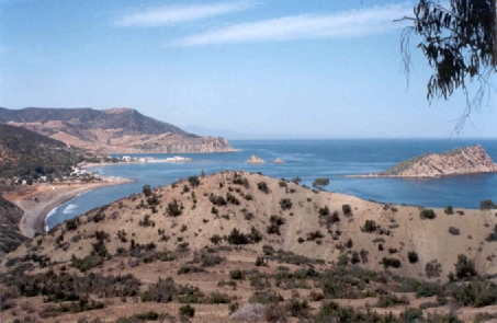
| 19:50, 29 June 2011 | Al Hoceima Coast2.jpg (file) |  |
107 KB | Heidid | Landscape values (Author: Hocein Bazaïri) | 1 |
| 20:10, 29 June 2011 | Dalyan-Köycegiz map.jpg (file) | Error creating thumbnail: File missing |
278 KB | Heidid | 2 | |
| 20:11, 29 June 2011 | Dalyan-Köycegiz1.jpg (file) | Error creating thumbnail: File missing |
112 KB | Heidid | Fishery gate in Daylan (Author: Erdal Ozhan) | 1 |
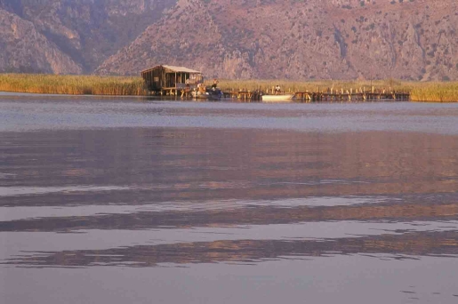
| 20:12, 29 June 2011 | Dalyan-Koycegiz1.jpg (file) |  |
112 KB | Heidid | Fishery gate in Daylan (Author: Erdal Ozhan) | 2 |
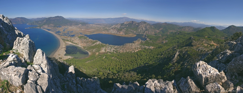
| 20:13, 29 June 2011 | Dalyan-Koycegiz2.jpg (file) |  |
282 KB | Heidid | Daylan Delta (Author: Igor Podymov) | 1 |
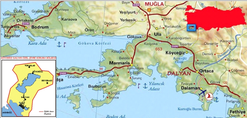
| 20:14, 29 June 2011 | Dalyan-Koycegiz map.jpg (file) |  |
278 KB | Heidid | 1 | |
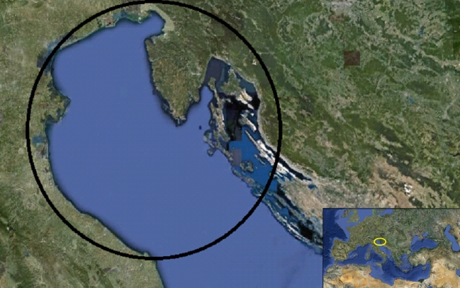
| 20:31, 29 June 2011 | North adriatic map.jpg (file) |  |
210 KB | Heidid | 1 | |
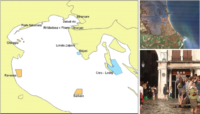
| 20:33, 29 June 2011 | North adriatic map2.jpg (file) |  |
147 KB | Heidid | Left: Marine Protected areas in the North Adriatic sea (Author: Francois Morisseau). <br> Right above: River Plume (Archivio Magistrato alle Acque di Venezia – Consorzio Venezia Nuova). <br> Right below: Venice flooded (Consorzio Venezia Nuova) | 2 |
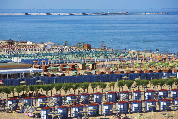
| 20:34, 29 June 2011 | North adriatic.jpg (file) |  |
317 KB | Heidid | Sottomarina beach (Author: archivio fotografico Regione Veneto) | 1 |
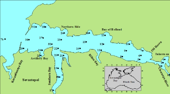
| 20:50, 29 June 2011 | Sevastopol bay map.jpg (file) |  |
76 KB | Heidid | 1 | |
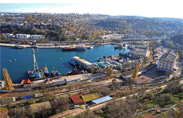
| 20:50, 29 June 2011 | Sevastopol bay 1.jpg (file) |  |
245 KB | Heidid | Maritime and municipal activities in the Sevastopol Bay | 1 |
| 20:51, 29 June 2011 | Sevastopol bay 2.jpg (file) |  |
107 KB | Heidid | Climate change impact for the Sevastopol Bay | 1 |
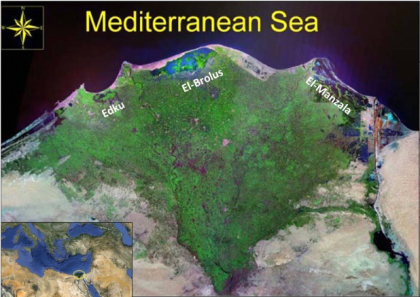
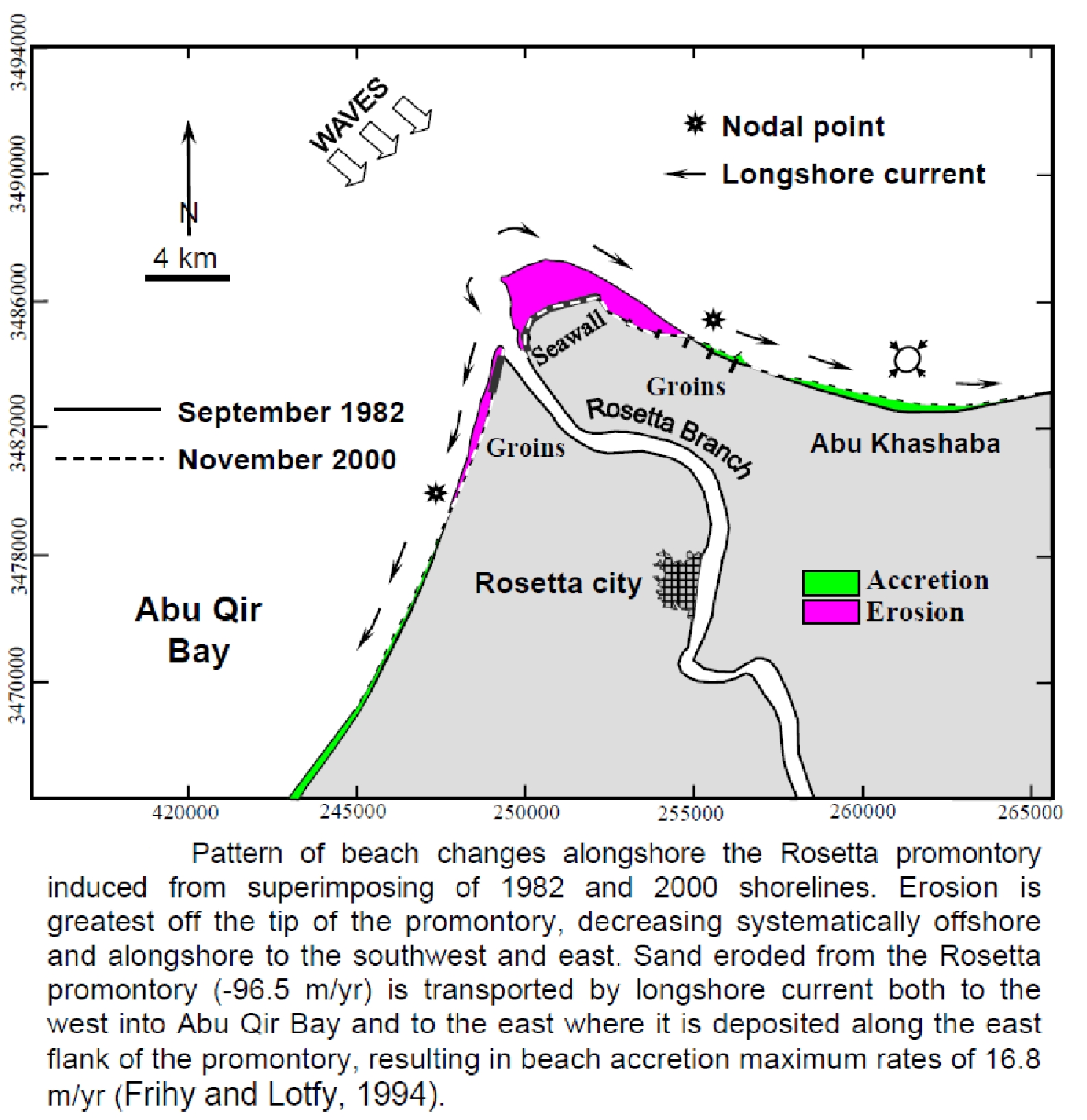
| 21:00, 29 June 2011 | Nile delta map.jpg (file) |  |
200 KB | Heidid | 1 | |
| 21:00, 29 June 2011 | Nile delta map 2.jpg (file) |  |
738 KB | Heidid | 1 | |
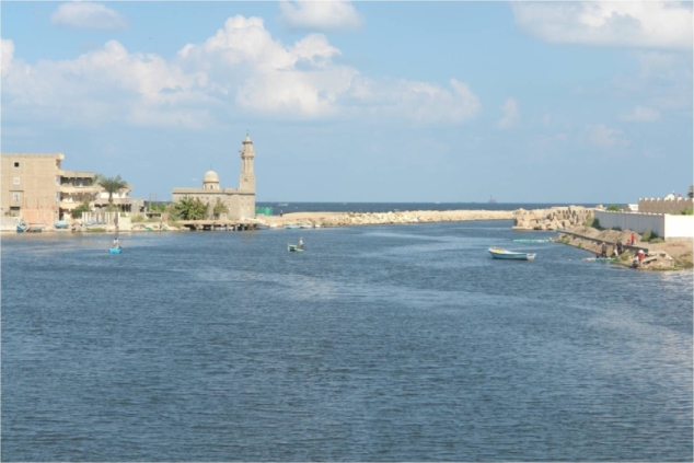
| 21:01, 29 June 2011 | Nile delta.jpg (file) |  |
158 KB | Heidid | Idku lake (Author: Suzan Kholeif) | 1 |
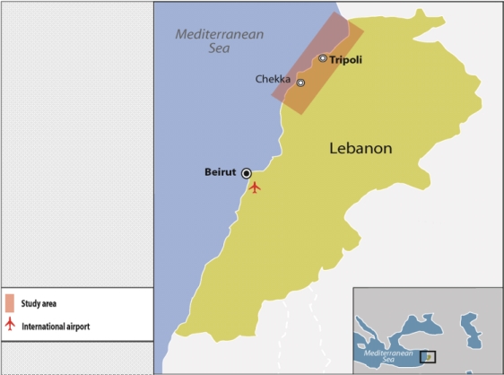
| 21:18, 29 June 2011 | North lebanon map.jpg (file) |  |
97 KB | Heidid | 1 | |
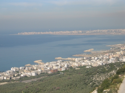
| 21:19, 29 June 2011 | North lebanon1.jpg (file) |  |
101 KB | Heidid | Marine Resources and Coastal Zone Management Program - Institute of the Environment - University of Balamand | 1 |
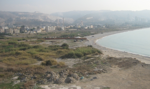
| 21:19, 29 June 2011 | North lebanon2.jpg (file) |  |
113 KB | Heidid | Marine Resources and Coastal Zone Management Program - Institute of the Environment - University of Balamand | 1 |
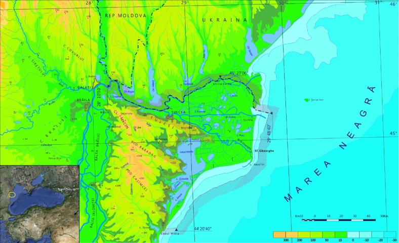
| 21:33, 29 June 2011 | Danube delta map.jpg (file) |  |
293 KB | Heidid | 1 | |
| 21:33, 29 June 2011 | Danube delta1.jpg (file) |  |
113 KB | Heidid | Sakhalin island (Author:Paul Goriup) | 1 |
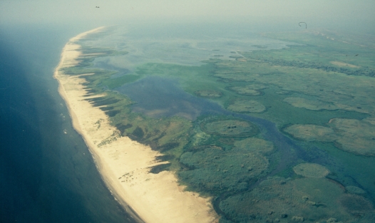
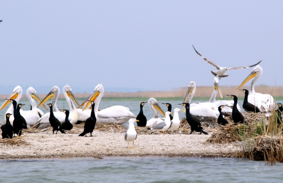
| 21:34, 29 June 2011 | Danube delta2.jpg (file) |  |
150 KB | Heidid | Pelicans in Razim Lake, Kiss Janos Botond | 1 |
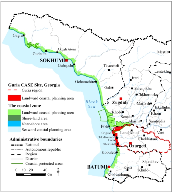
| 21:45, 29 June 2011 | Guria map.jpg (file) |  |
168 KB | Heidid | 1 | |
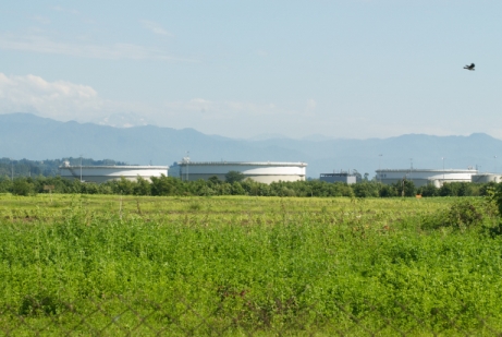
| 21:46, 29 June 2011 | Guria1.jpg (file) |  |
106 KB | Heidid | British Petroleum Terminal in the river Supsa area (Photo: Patrick Breslin) | 1 |
| 21:47, 29 June 2011 | Guria2.jpg (file) |  |
149 KB | Heidid | Coastal wetlands patches close to the proposed Supsa port development area (Photo: Patrick Breslin) | 1 |
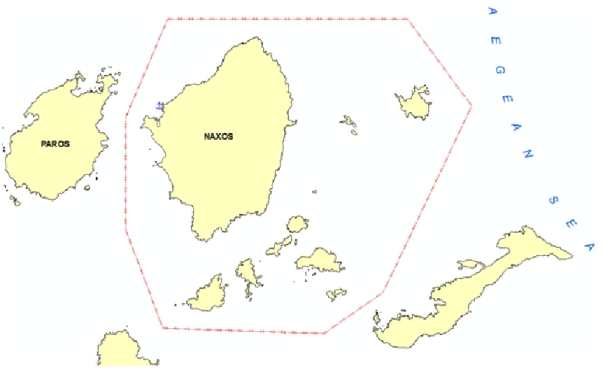
| 21:55, 29 June 2011 | Aegean islands map.jpg (file) |  |
60 KB | Heidid | 1 | |
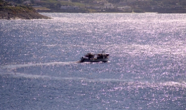
| 21:56, 29 June 2011 | Aegean islands1.jpg (file) |  |
76 KB | Heidid | Illegal fishing | 1 |
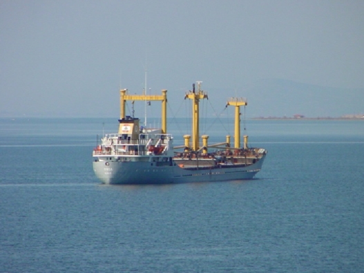
| 21:56, 29 June 2011 | Aegean islands2.jpg (file) |  |
119 KB | Heidid | Transportation | 1 |
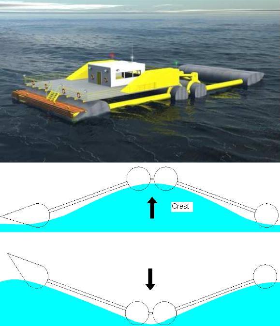
| 09:26, 8 July 2011 | DEXA concept.jpg (file) |  |
45 KB | MaartenDeRijcke | Artist's impression of the DEXA concept (above) and working principle (below) | 1 |
| 12:46, 8 July 2011 | OWCs examples.jpg (file) |  |
20 KB | MaartenDeRijcke | 2 | |
| 09:28, 12 July 2011 | OVTs examples.jpg (file) |  |
26 KB | MaartenDeRijcke | Different approaches to OVTs: Wave Dragon prototype (above) and an artists impression of breakwaters with SSGs. | 2 |
| 13:11, 12 July 2011 | Point absorbers and attenuators.jpg (file) |  |
22 KB | MaartenDeRijcke | 2 | |
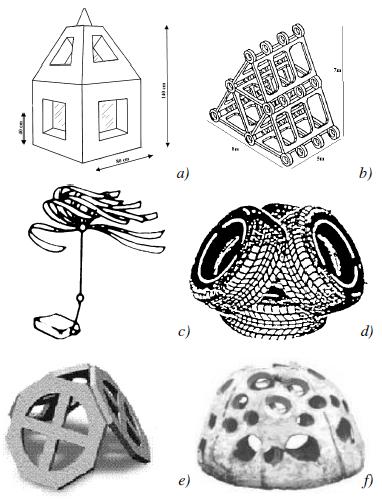
| 12:54, 14 July 2011 | ArtificialReefUnits.jpg (file) |  |
39 KB | MaartenDeRijcke | Different examples of artificial reef unit designs: a) Simple Hollow concrete module; b) Japanese reef module “JUMBO”; c) Plastic Kelp; d) American tyre reef modules; e) Tecnoreef module; f) Reef ball | 1 |
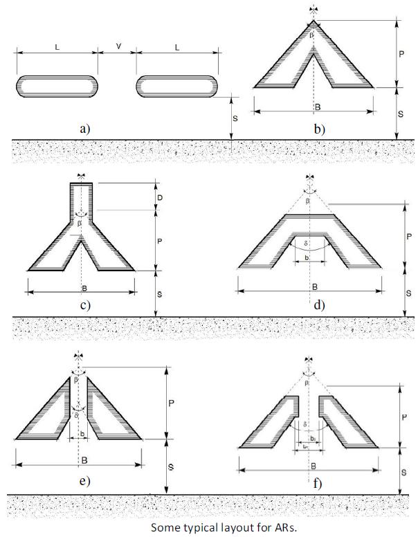
| 08:12, 15 July 2011 | ARLayout.jpg (file) |  |
61 KB | MaartenDeRijcke | Some examples of potential layouts for artificial reefs | 1 |
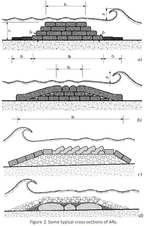
| 11:38, 15 July 2011 | ARCross.jpg (file) |  |
82 KB | MaartenDeRijcke | Some examples of typical artificial reef cross sections | 1 |
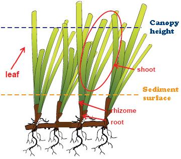
| 08:54, 19 July 2011 | SeagrassNom.jpg (file) |  |
25 KB | MaartenDeRijcke | Nomenclature commonly used to describe parts and attributes of seagrasses and the canopy they form (Koch et al., 2006) | 1 |
| 13:55, 25 July 2011 | ICZM phases.jpg (file) |  |
115 KB | Heidid | Phases of the ICZM Process | 1 |
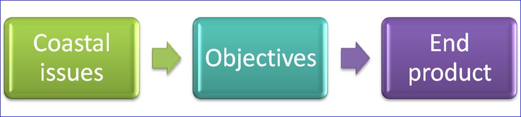
| 14:00, 25 July 2011 | Picture2.jpg (file) | 27 KB | Heidid | Relation between coastal issues, objectives and end products | 1 | |
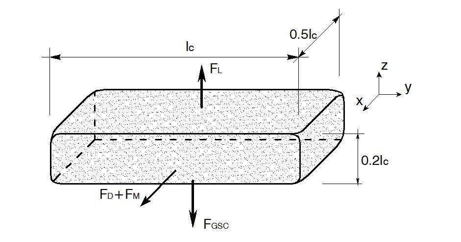
| 11:13, 26 July 2011 | GSC forces.jpg (file) |  |
67 KB | MaartenDeRijcke | Forces acting upon a geotextile sand container (artificial reef unit). | 1 |
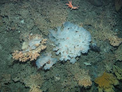
| 07:59, 27 July 2011 | Biogenic reef.jpg (file) |  |
36 KB | MaartenDeRijcke | 1 | |
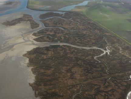
| 08:06, 27 July 2011 | Salt-marsh.jpg (file) |  |
19 KB | MaartenDeRijcke | Aerial view of a salt-marsh (picture by Prof. M. Stive). | 1 |
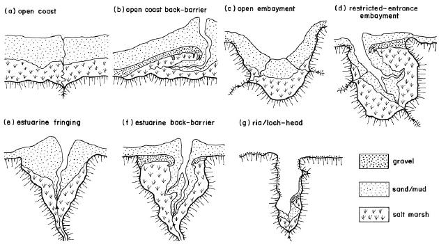
| 08:51, 27 July 2011 | Salt-marsh classification.jpg (file) |  |
52 KB | MaartenDeRijcke | A geomorphological classification of salt marshes (Allen; 2000, as adopted from Pye and French, 1993) | 1 |
| 13:26, 28 July 2011 | Theseus.jpg (file) |  |
178 KB | MaartenDeRijcke | Theseus project logo (www.theseusproject.eu) | 2 |
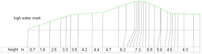
| 15:27, 28 July 2011 | DutchDike.jpg (file) | 15 KB | MaartenDeRijcke | Example of a cross section of a Dutch dike | 1 | |
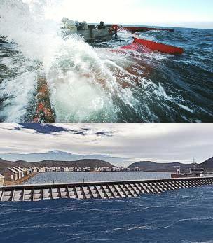
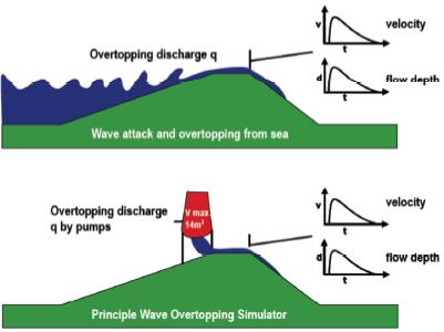
| 11:00, 29 July 2011 | Wave overtopping principle.jpg (file) |  |
16 KB | MaartenDeRijcke | Basic principle of Wave Overtopping Simulators | 1 |
| 13:15, 29 July 2011 | Overtopping volume.jpg (file) |  |
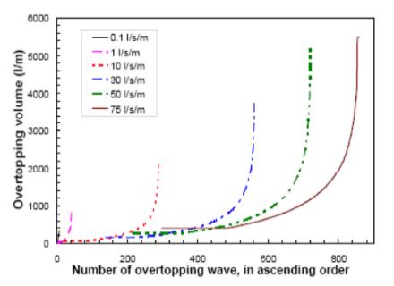
16 KB | MaartenDeRijcke | Distribution of overtopping volumes of waves for sea dikes and various mean overtopping discharges, as simulated by the Wave Overtopping Simulator, based on Hs = 2 m and wave steepness 0.04 (peak period). | 1 |
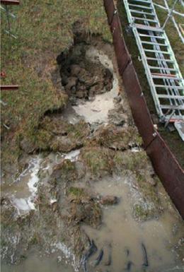
| 13:51, 29 July 2011 | Saint Philips.jpg (file) |  |
23 KB | MaartenDeRijcke | Example of damage caused by wave overtopping experiments at Saint Philips (Netherlands) | 1 |
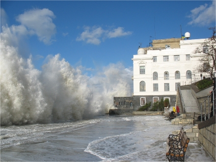
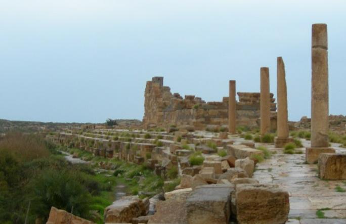
| 08:22, 2 August 2011 | Roman breakwater.jpeg (file) |  |
31 KB | MaartenDeRijcke | An ancient Roman Breakwater at the harbour of Leptis Magna (Photo taken by Simon White) | 1 |