Difference between revisions of "File:Temp germanbight.gif"
From Coastal Wiki
Goetzfloeser (talk | contribs) (The diagram shows the temperature at the North Sea measuring station "German Bight" during the year 2001, from close to the surface to 30 m water depth. During spring and summer, stratification occurs that breaks down in early autumn when the water become) |
(No difference)
|
Latest revision as of 10:23, 13 November 2007
The diagram shows the temperature at the North Sea measuring station "German Bight" during the year 2001, from close to the surface to 30 m water depth. During spring and summer, stratification occurs that breaks down in early autumn when the water becomes well mixed by storms.
File history
Click on a date/time to view the file as it appeared at that time.
| Date/Time | Thumbnail | Dimensions | User | Comment | |
|---|---|---|---|---|---|
| current | 10:23, 13 November 2007 | 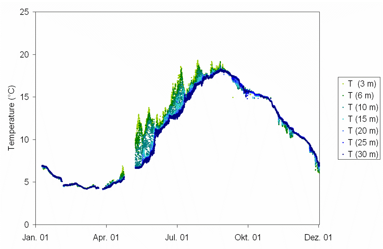 | 1,238 × 805 (83 KB) | Goetzfloeser (talk | contribs) | The diagram shows the temperature at the North Sea measuring station "German Bight" during the year 2001, from close to the surface to 30 m water depth. During spring and summer, stratification occurs that breaks down in early autumn when the water become |
- You cannot overwrite this file.
File usage
There are no pages that link to this file.
