Difference between revisions of "File:SeagrassWaddenSchleswig-Holstein.jpg"
From Coastal Wiki
Dronkers J (talk | contribs) (Areal size (ha) of seagrass beds (coverage >60% and coverage 20-60%) in the intertidal zone of the Northfrisian Wadden Sea (Schleswig-Holstein) as estimated from aerial surveys in August or September between 1994 and 2015. Source: Wadden Sea Quality St...) |
(No difference)
|
Latest revision as of 17:26, 20 November 2020
Summary
Areal size (ha) of seagrass beds (coverage >60% and coverage 20-60%) in the intertidal zone of the Northfrisian Wadden Sea (Schleswig-Holstein) as estimated from aerial surveys in August or September between 1994 and 2015. Source: Wadden Sea Quality Status Report 2017.
File history
Click on a date/time to view the file as it appeared at that time.
| Date/Time | Thumbnail | Dimensions | User | Comment | |
|---|---|---|---|---|---|
| current | 17:26, 20 November 2020 | 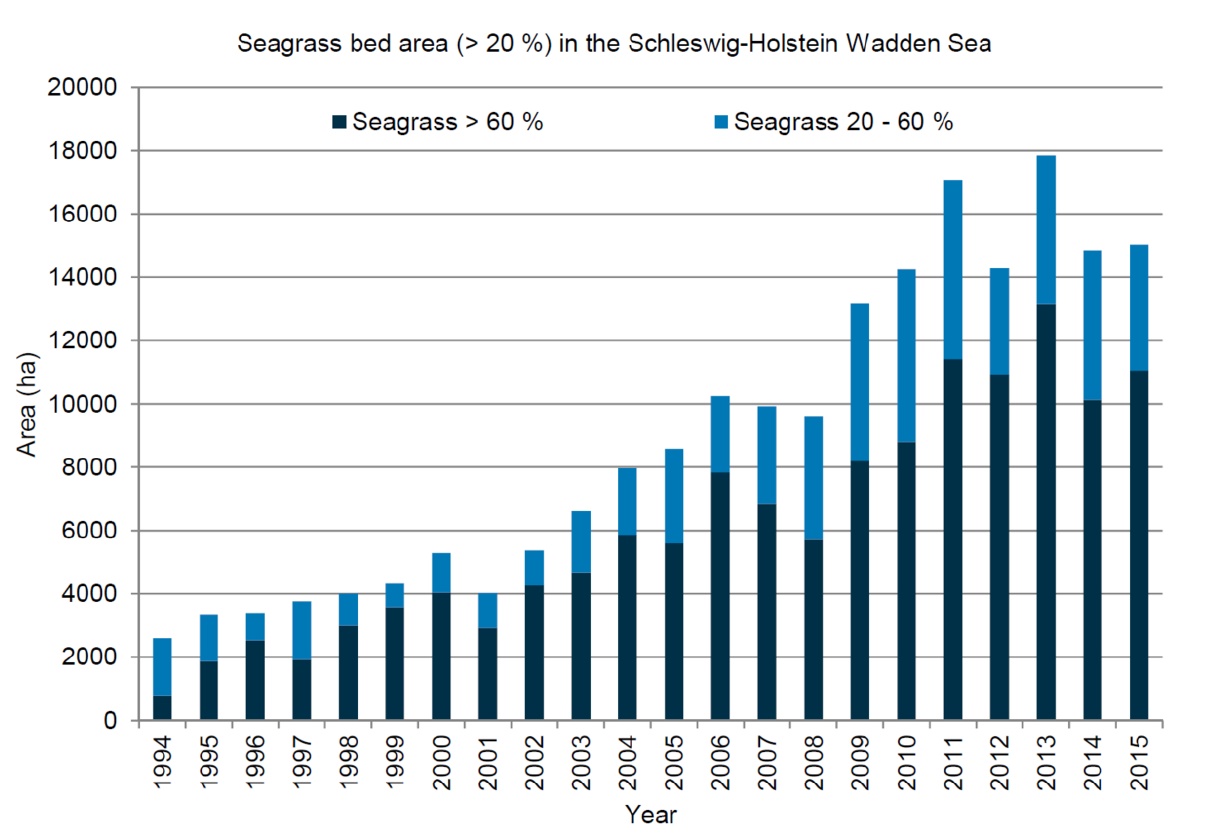 | 1,205 × 833 (178 KB) | Dronkers J (talk | contribs) | Areal size (ha) of seagrass beds (coverage >60% and coverage 20-60%) in the intertidal zone of the Northfrisian Wadden Sea (Schleswig-Holstein) as estimated from aerial surveys in August or September between 1994 and 2015. Source: Wadden Sea Quality St... |
- You cannot overwrite this file.
File usage
The following page links to this file:
