Difference between revisions of "Geographical Information System"
| Line 127: | Line 127: | ||
| − | ''8th January, Ulrik Lumborg | + | ''8th January, Ulrik Lumborg, DHI.'' |
Revision as of 11:19, 12 January 2007
Geographical Information System (GIS) is a tool for analysis and presentation of spatial data. It is a collection of computer hardware, software and geographic data for capturing, managing, analysing and displaying all forms of geographically referenced information.
Contents
What is GIS?
- Simple definition
- A Geographic Information System organizes large volumes of raw data into a map form for easy comprehension.
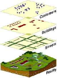
- GIS divides raw data into layers so it can give you a better understanding for the whole world.
A GIS is designed for the collection, storage, and analysis of objects and phenomena where geographic location is an important characteristic or critical to the analysis - this definition is broad and applies to a wide variety of methods for storing, accessing, and manipulating geographic information; it does not limit GIS to the computer environment[1] .
Why is GIS unique?
- GIS handles SPATIAL information
- Information referenced by its location in space
GIS Data
GIS stores geographic coordinate data (spatial data) and attribute data.
Spatial data:
- represent features having known locations on earth
- one of: points (0D), lines (1D) or areas (2D)
Attribute data:
- non-graphic information linked to the geographical features (spatial data) describing features eg type of road, name, history.
Data formats
Two basic formats for storing and processing coordinate data: Vector and Raster
Vector:
- uses point locations (X,Y coordinate)
- advantage: less storage space
- disadvantage: may be more difficult to perform certain overlay functions
Raster:
- data stored as a matrix of pixels, representing points.
- to analyse or overlay multiple data layers, the layers must share a common projection and coordinate system, and layers must have topology established
- Disadvantage: it is necessary to store the entire matrix
- Advantage: can perform neighbourhood analysis easily
Data types
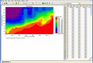
- DFS2 Data MIKE 21
- Dfs1 Data MIKE 21
- XYZ Data
- Wave time series & Rose
- Scanned Maps
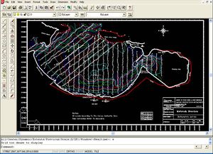
- CAD drawing
Additional Data
- Land use
- Sediment classification
- Satellite images
- Geographical maps
- Reports (design, licenses, Site investigation)
- ….etc.
Map data is separated and stored in layers usually based on common geographical themes or data type. And alternative is objected-oriented GIS, where geographical and all other information regarding a feature stored as an object.
GIS functions
- Data input
- Storage
- Management
- Analysis
- Output
Data input
- keyboard entry, digitize maps; digital scanning (like a photocopy)
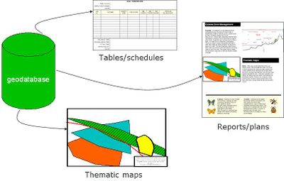
Storing data using Geodatabase
- Geodatabase is a container for spatial and non- spatial data that can be organized in a certain structure.
- Advantages:
- provide a single, consolidated data storage for field measurements and all types of data used.
- Controlling data entry by applying validation rule on the attributes.
Data management
- database management system controls the way data are stored and retrieved
- includes verifying geographic coordinates and examining for accuracy
GIS analysis
- create new data by manipulating existing data or analyzing relationships between sets of data
- basic operations: retriecal, map generalization, map abstractions, map sheet manipulation, map abstractions, map sheet manipulation, buffer generation, polgygon overlay and dissolve, measurements, digital terrain analysis and network analysis (Cox and wotshisface, 1997).
Output
- display of output through printers and computer screens
Benefits of GIS
- ability to integrate different databases into one environment
- ability to display and manage spatial data in a spatial contect
- rapid production of specialized map and graphic products
- performs complex spatial analysis
CZM and GIS
- GIS stores all data relevant for the CZM
- GIS handles data on all spatial scales (North Egypt coast vs. a single harbour)
- GIS is a powerful analysis tool.
- Comparison of measurements from different years
- Overlay analysis of measurements and modelling results
External links
GIS WWWW resource list of servers likely to be of interest to the GIS community
References
- ↑ Cox, A., Gifford, F. An overview to geographic information systems. The Journal of Academic Librarianship, Volume 23, Issue 6, November 1997, Pages 449-461
8th January, Ulrik Lumborg, DHI.
