File list
This special page shows all uploaded files.
| Date | Name | Thumbnail | Size | User | Description | Versions |
|---|---|---|---|---|---|---|
| 17:05, 30 March 2007 | Dimi biomarkers5.jpg (file) |  |
40 KB | Francoishissel | 1 | |
| 17:05, 30 March 2007 | Dimi biomarkers4.jpg (file) | 24 KB | Francoishissel | 1 | ||
| 17:05, 30 March 2007 | Dimi biomarkers3.jpg (file) |  |
15 KB | Francoishissel | 1 | |
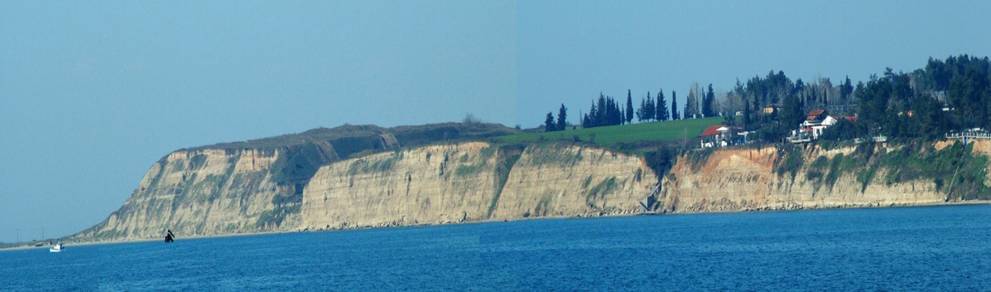
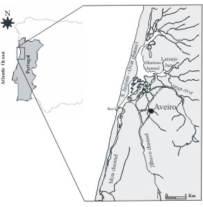
| 17:05, 30 March 2007 | Vouvalidispic3.jpg (file) |  |
397 KB | Kpavlop | Fig. 3: The coastal terraces formation due to the erosional action of waves on the eastern coast of the Thermaikos Gulf. | 1 |
| 17:05, 30 March 2007 | Dimi biomarkers2.jpg (file) |  |
31 KB | Francoishissel | 1 | |
| 17:04, 30 March 2007 | Dimi biomarkers1.jpg (file) |  |
22 KB | Francoishissel | 1 | |
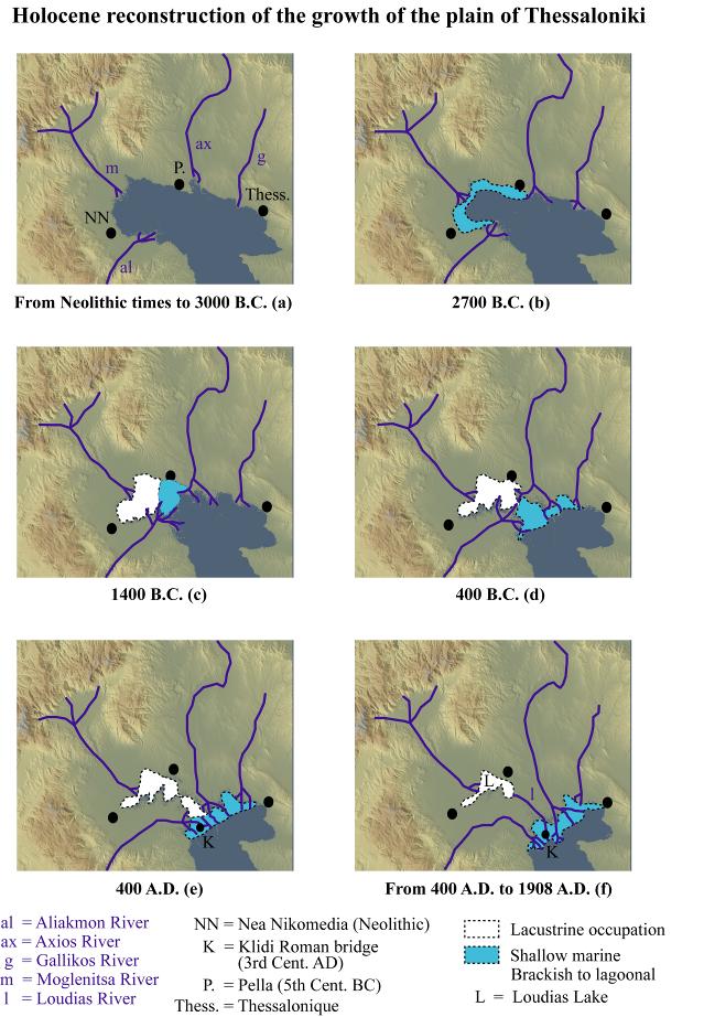
| 16:59, 30 March 2007 | Vouvalidispic2.jpg (file) |  |
98 KB | Kpavlop | Figure 2: Holocene reconstruction of the growth of the deltaic plain of Thessaloniki (Fouache et al., in press). | 1 |
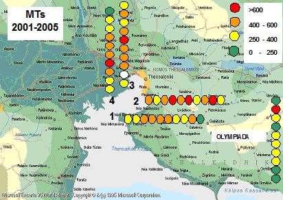
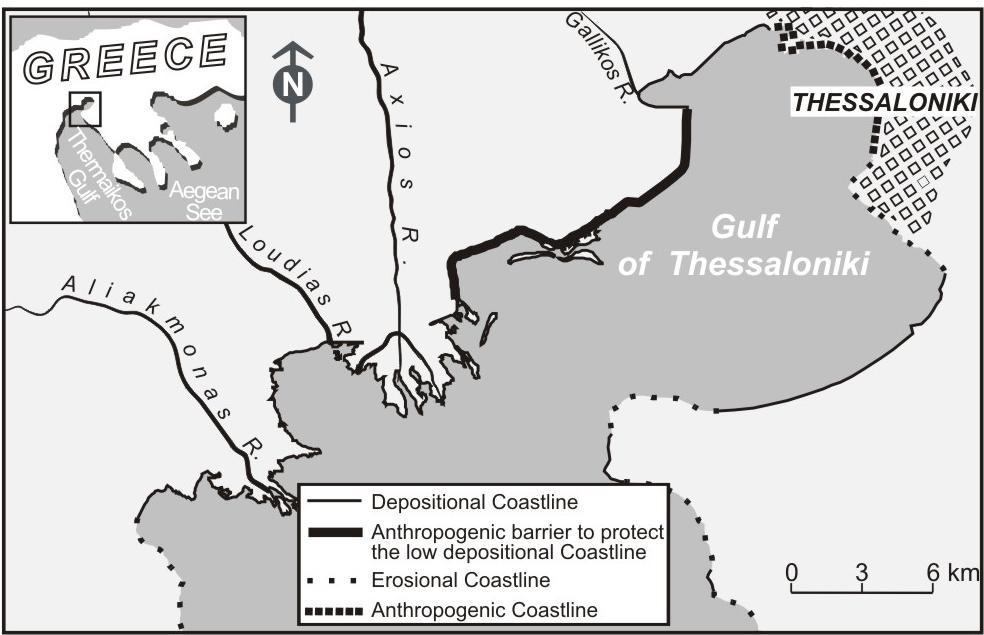
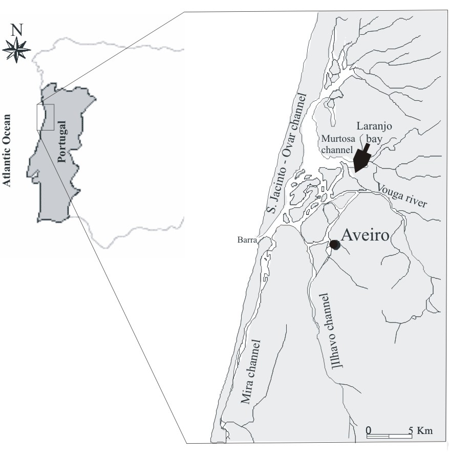
| 16:57, 30 March 2007 | Vouvalidispic1.jpg (file) |  |
80 KB | Kpavlop | Figure 1. Location of the study area together with the type of coasts found in the North Thermaikos Gulf and the Thessaloniki Bay. | 1 |
| 16:50, 30 March 2007 | Pavlopoulospic3.jpg (file) |  |
56 KB | Kpavlop | 1 | |
| 16:47, 30 March 2007 | Pavlopoulospic2.jpg (file) |  |
41 KB | Kpavlop | 1 | |
| 16:47, 30 March 2007 | Pavlopoulostable1.jpg (file) |  |
67 KB | Kpavlop | 1 | |
| 16:44, 30 March 2007 | Pavlopoulospic1.jpg (file) |  |
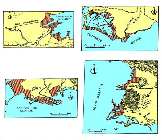
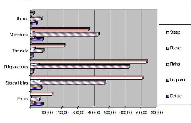
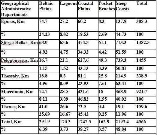
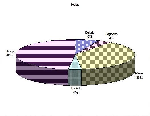
24 KB | Kpavlop | Fig 1. The distribution of the five coastal types by geographical department. Worthnoting is the great extent of low lying coasts (deltaic plains and lagoons) in Thrace (88 %). On the contrary, the steep coasts comprise about 2/3 of the coasts of Thess | 1 |
| 15:58, 29 March 2007 | Image010.JPG (file) |  |
35 KB | Jan van de Graaff | 1 | |
| 15:31, 29 March 2007 | Image009.JPG (file) |  |
15 KB | Jan van de Graaff | 1 | |
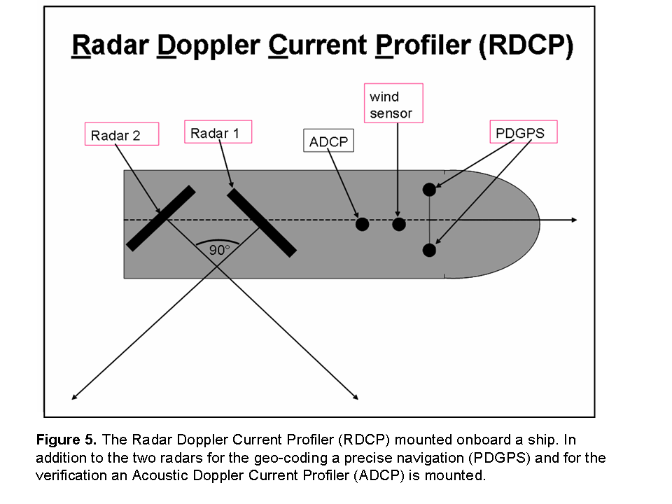
| 14:20, 29 March 2007 | RDCP Scheme.png (file) |  |
61 KB | Friedwartzeimer | 1 | |
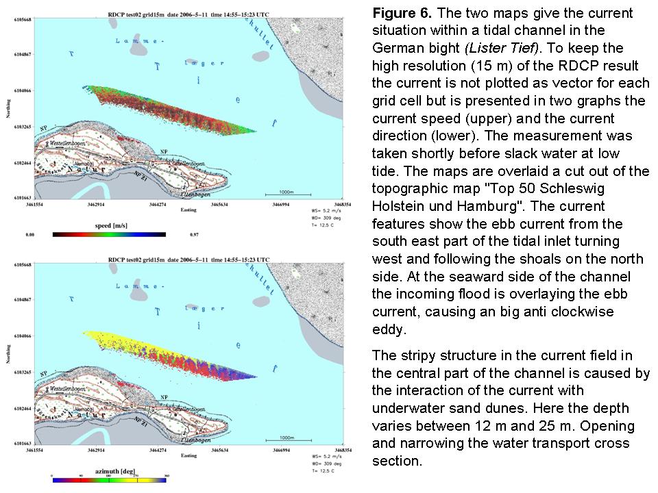
| 14:20, 29 March 2007 | Rdcp result new.jpg (file) |  |
150 KB | Friedwartzeimer | 1 | |
| 14:17, 29 March 2007 | RDCP result new.png (file) | Error creating thumbnail: File missing |
288 KB | Friedwartzeimer | 1 | |
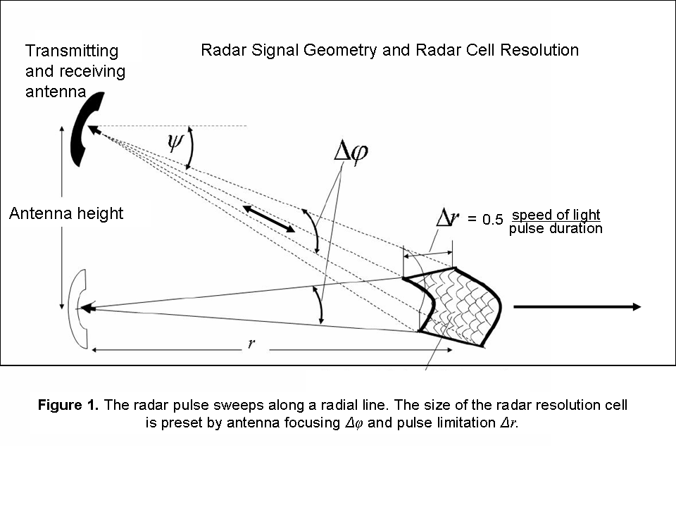
| 13:53, 29 March 2007 | Radargeometrie.png (file) |  |
84 KB | Friedwartzeimer | 4 | |
| 12:54, 29 March 2007 | Image006.JPG (file) |  |
43 KB | Jan van de Graaff | 1 | |
| 12:49, 29 March 2007 | Image005.JPG (file) | Error creating thumbnail: File missing |
43 KB | Jan van de Graaff | 3 | |
| 11:39, 29 March 2007 | Image007.JPG (file) |  |
29 KB | Jan van de Graaff | 2 | |
| 11:09, 29 March 2007 | Image003.JPG (file) |  |
69 KB | Jan van de Graaff | 1 | |
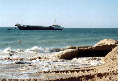
| 15:44, 28 March 2007 | Technical solution.jpg (file) |  |
106 KB | Lpneves | Dredging operations (source: [http://www.dragapor.com/ DRAGAPOR - Dragagens de Portugal, S.A.]). | 1 |
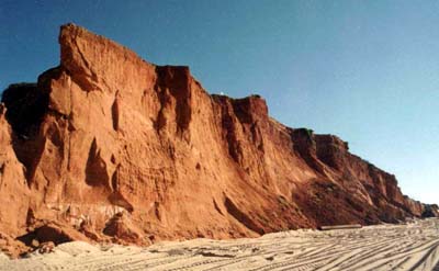
| 15:43, 28 March 2007 | Red cliffs.jpg (file) |  |
24 KB | Lpneves | Red sand cliffs (source: [http://www.dragapor.com/ DRAGAPOR - Dragagens de Portugal, S.A.]). | 1 |
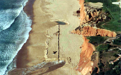
| 15:42, 28 March 2007 | Beach during.jpg (file) |  |
124 KB | Lpneves | Vale do Lobo beach during the artificial sand nourishment operation (source: [http://www.dragapor.com/ DRAGAPOR - Dragagens de Portugal, S.A.]). | 1 |
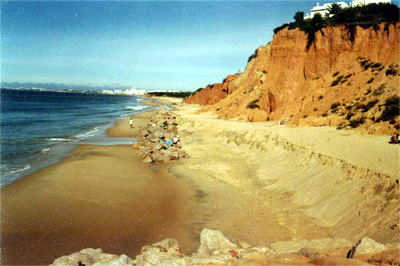
| 15:41, 28 March 2007 | Beach before.jpg (file) |  |
117 KB | Lpneves | Vale do Lobo beach before the artificial sand nourishment operation (source: DRAGAPOR - Dragagens de Portugal, S.A.). | 1 |
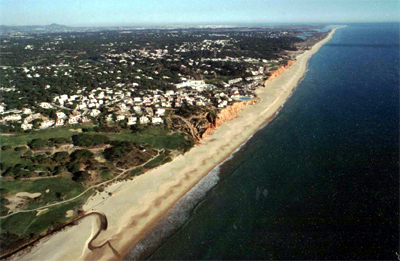
| 15:37, 28 March 2007 | Beach after.jpg (file) |  |
114 KB | Lpneves | Vale do Lobo beach after the artificial sand nourishment operation (source: DRAGAPOR - Dragagens de Portugal, S.A.). | 1 |
| 12:54, 28 March 2007 | Achtung-90.gif (file) |  |
3 KB | Thijs Damsma | source: http://commons.wikimedia.org/wiki/Image:Important.svg | 1 |
| 12:54, 28 March 2007 | Achtung-70.gif (file) |  |
3 KB | Thijs Damsma | source: http://commons.wikimedia.org/wiki/Image:Important.svg | 1 |
| 12:54, 28 March 2007 | Achtung-50.gif (file) |  |
2 KB | Thijs Damsma | source: http://commons.wikimedia.org/wiki/Image:Important.svg | 1 |
| 10:58, 28 March 2007 | CPimage001.JPG (file) |  |
110 KB | Jan van de Graaff | 1 | |
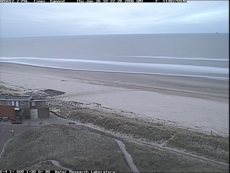
| 15:11, 27 March 2007 | 1138270948.Thu.Jan.26 10 22 28.GMT.2006.jvspeijk.c4.timex.jpg (file) |  |
54 KB | Cohen | argus picture | 1 |
| 13:22, 26 March 2007 | Broc mixing4.jpg (file) |  |
6 KB | Francoishissel | Illustration of the influence of macrovortices in the nearshore - transport of passive tracers. | 1 |
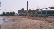
| 13:22, 26 March 2007 | Broc mixing3.jpg (file) |  |
4 KB | Francoishissel | Illustration of the influence of macrovortices in the nearshore - picture of the beach landscape. | 1 |
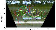
| 13:21, 26 March 2007 | Broc mixing2.jpg (file) |  |
7 KB | Francoishissel | Illustration of the influence of macrovortices in the nearshore - quantitative description of the macrovortices forcing the transport. | 1 |
| 13:20, 26 March 2007 | Broc mixing1.jpg (file) |  |
4 KB | Francoishissel | Illustration of the influence of macrovortices in the nearshore - modelled water surface elevation of the storm event | 1 |
| 17:05, 22 March 2007 | Fig 1.jpg (file) |  |
21 KB | Aduarte | 1 | |
| 17:00, 22 March 2007 | Fig1.jpg (file) |  |
92 KB | Aduarte | 1 | |
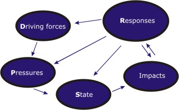
| 16:11, 22 March 2007 | DPSIR.jpg (file) |  |
18 KB | Aduarte | 5 | |
| 15:14, 22 March 2007 | Derous new concept.jpg (file) |  |
94 KB | Sederous | 1 | |
| 15:13, 22 March 2007 | Derous Figure1 new.jpg (file) |  |
94 KB | Sederous | 2 | |
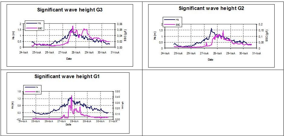
| 15:10, 22 March 2007 | Poulospic7.jpg (file) |  |
70 KB | Kpavlop | Figure 7. Graphs representing the significant wave height (Hs) and suspended sediment concentration (SSC) over the study period. | 1 |
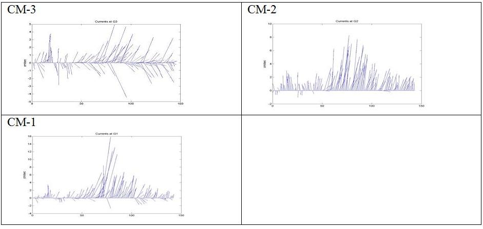
| 15:10, 22 March 2007 | Poulospic6.jpg (file) |  |
36 KB | Kpavlop | Figure 6. Current directions and speeds for each station G1 (inshore), G2, and G3 (offshore) during the study period. Values on the ‘x’ axis refer to time in hours from the starting time of 15:52 on the 24th July 2003 | 1 |
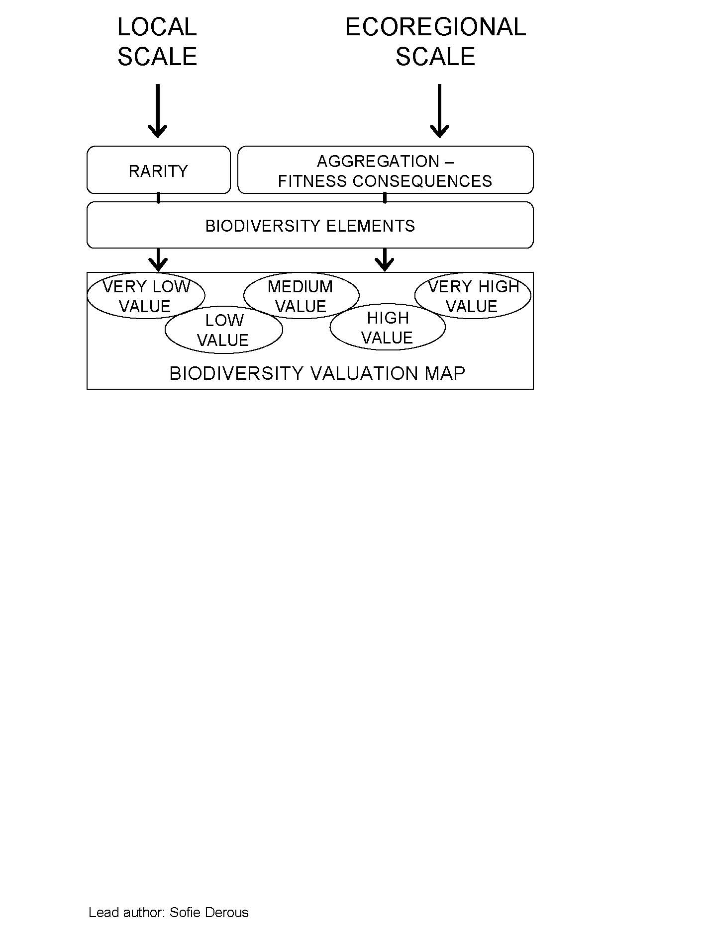
| 14:38, 22 March 2007 | Biodiversity elements.jpg (file) |  |
219 KB | Sederous | 1 | |
| 13:26, 22 March 2007 | Poulospic5.jpg (file) |  |
265 KB | Kpavlop | Figure 5. Geomorphological and sedimentological characteristics of the study area (Poulos et al, 1998). Sampling stations for the present study are indicated (G1, G2, G3). Note: (n=1,2,..), bathymetry in metres. | 1 |
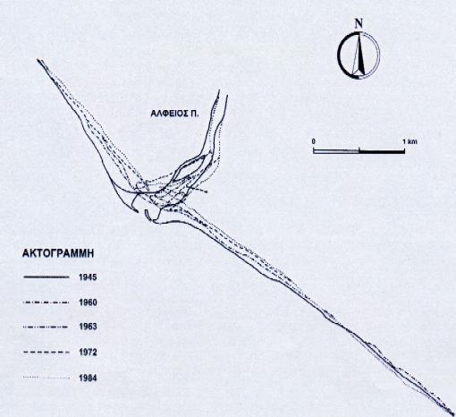
| 13:13, 22 March 2007 | Poulospic4.jpg (file) |  |
27 KB | Kpavlop | Figure 4. Shoreline retreat of the Mouth area of R. Alfios following the construction of dams (Ghionis et al., 2005) | 1 |
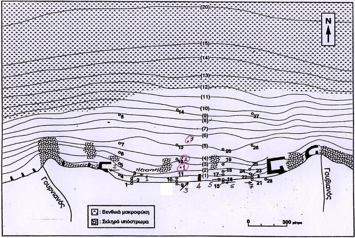
| 13:11, 22 March 2007 | Poulospic3.jpg (file) |  |
9 KB | Kpavlop | Figure 3. The mouth area of R. Alfios (NW Peloponnese, Ionian Sea) Topgraphic map published by the Hellenic Army Geographical Service, in 1972. | 1 |
| 13:03, 22 March 2007 | Poulospic2.jpg (file) |  |
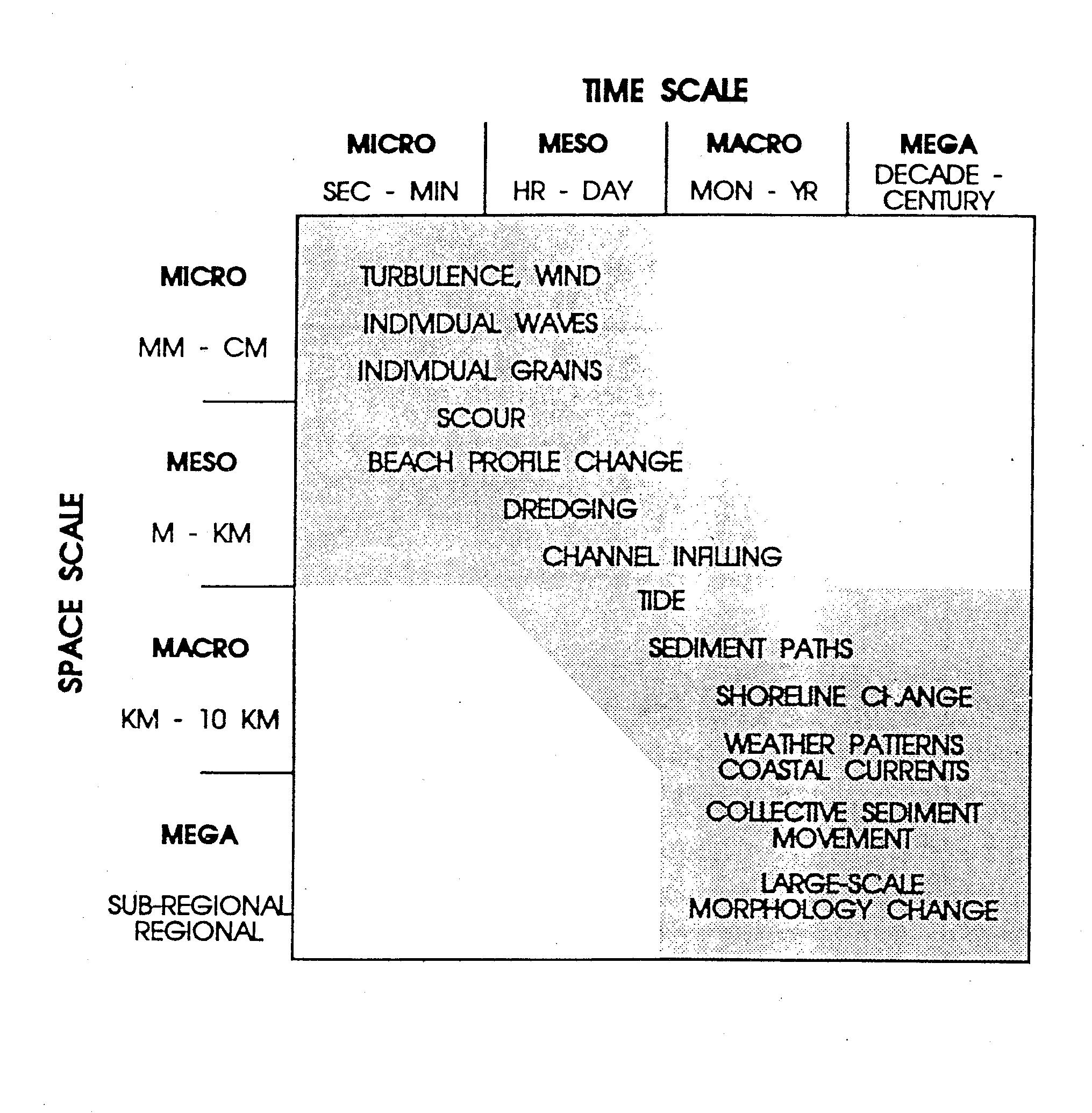
667 KB | Kpavlop | Figure 2. Morphological changes in relation to spatial and time scale (Kraus et al., 1991) | 1 |
| 12:49, 22 March 2007 | Poulospic1um8.jpg (file) |  |
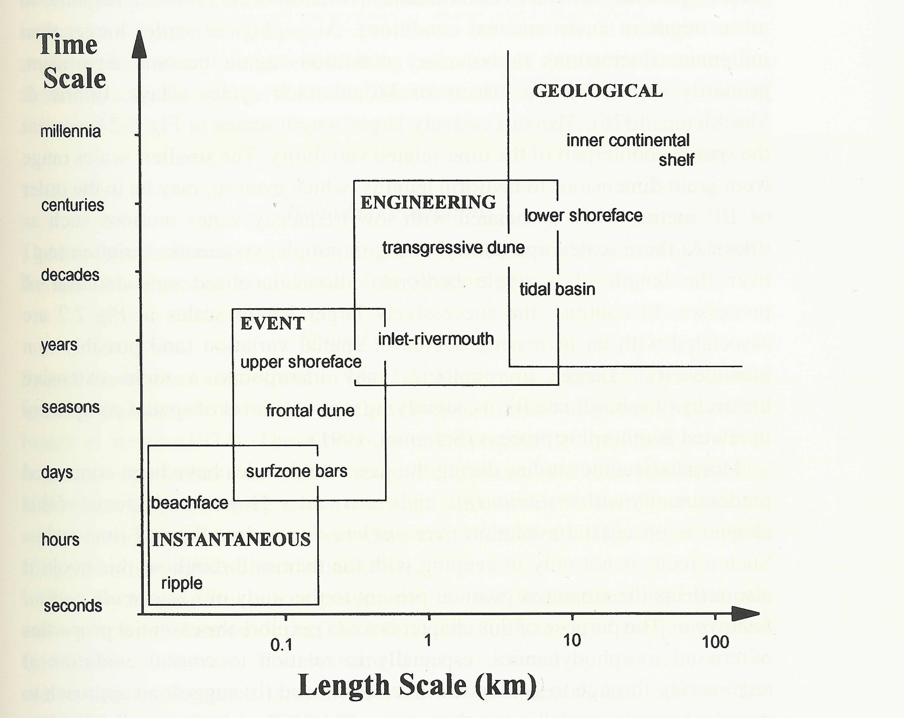
344 KB | Kpavlop | Figure 1. Spatial and temporal scales involved in coastal morphological changes (after Cowell and Thom, 1997) | 1 |
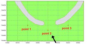
| 11:11, 22 March 2007 | 8b illustration morph evol front of harbour.jpg (file) |  |
10 KB | Caitlin | 2 |