File:GroyneFieldRip.jpg
From Coastal Wiki

Size of this preview: 800 × 524 pixels. Other resolutions: 320 × 210 pixels | 1,173 × 768 pixels.
Original file (1,173 × 768 pixels, file size: 79 KB, MIME type: image/jpeg)
Summary
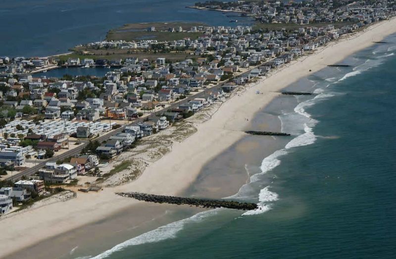
Groin field at Beach Haven, New Jersey (USA), showing boundary rips. From Hapke et al. (2010[1]).- ↑ Hapke, C.J., Himmelstoss, E.A., Kratzmann, M.G., List, J.H. and Thieler, E.R. 2010. National Assessment of Shoreline Change: Historical Shoreline Change along the New England and Mid-Atlantic Coasts Open-File Report 2010–1118 U.S. Geological Survey
File history
Click on a date/time to view the file as it appeared at that time.
| Date/Time | Thumbnail | Dimensions | User | Comment | |
|---|---|---|---|---|---|
| current | 22:38, 25 June 2026 | | 1,173 × 768 (79 KB) | Dronkers J (talk | contribs) | Groin field at Beach Haven, New Jersey (USA), showing boundary rips. From Hapke et al. (2010<ref name=H10>Hapke, C.J., Himmelstoss, E.A., Kratzmann, M.G., List, J.H. and Thieler, E.R. 2010. National Assessment of Shoreline Change: Historical Shoreline... |
- You cannot overwrite this file.
File usage
The following page links to this file:
