File:InnerClosureDepth.jpg
From Coastal Wiki
Size of this preview: 800 × 367 pixels. Other resolutions: 320 × 147 pixels | 884 × 405 pixels.
Original file (884 × 405 pixels, file size: 48 KB, MIME type: image/jpeg)
Summary
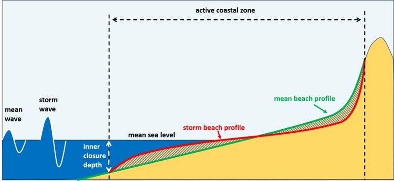
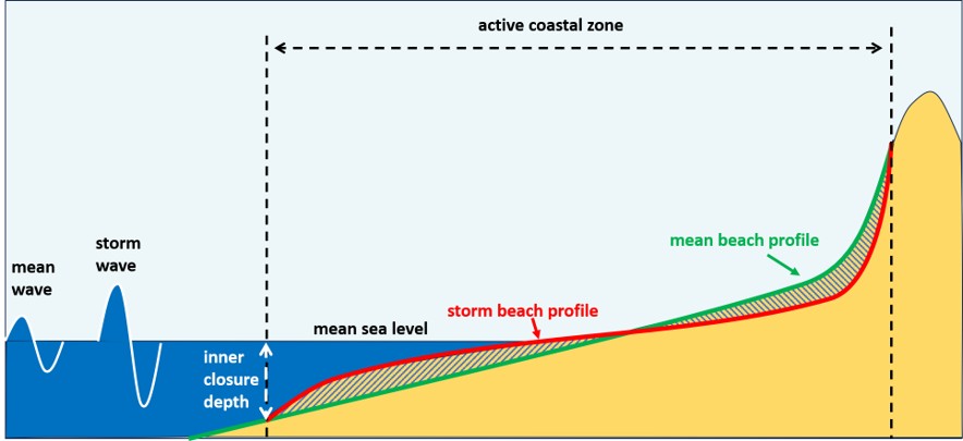
Schematic illustration of the closure-depth concepts of Hallermeier and Kraus et al. The active coastal zone is represented here by the upper shoreface, where cross-shore sediment exchange occurs frequently over timescales of years to decades. The inner closure depth is located where the mean beach profile converges with the storm profile associated with wave conditions exceeded for approximately 12 hours per year.
File history
Click on a date/time to view the file as it appeared at that time.
| Date/Time | Thumbnail | Dimensions | User | Comment | |
|---|---|---|---|---|---|
| current | 20:28, 6 August 2026 | | 884 × 405 (48 KB) | Dronkers J (talk | contribs) | Schematic illustration of the closure-depth concepts of Hallermeier and Kraus et al. The active coastal zone is represented here by the upper shoreface, where cross-shore sediment exchange occurs frequently over timescales of years to decades. The inne... |
- You cannot overwrite this file.
File usage
The following page links to this file: