Difference between revisions of "File:DuneBeltsGoeree2005.jpg"
From Coastal Wiki
Dronkers J (talk | contribs) (Following the construction of the Rhine discharge sluices ('Haringvliet sluices') in 1970, a strong progradation occurred at the adjacent coast of Goeree. The image from 2005 shows new dune ridges that formed on the accreted strand plain. Photo credit...) |
(No difference)
|
Latest revision as of 15:08, 30 August 2021
Summary
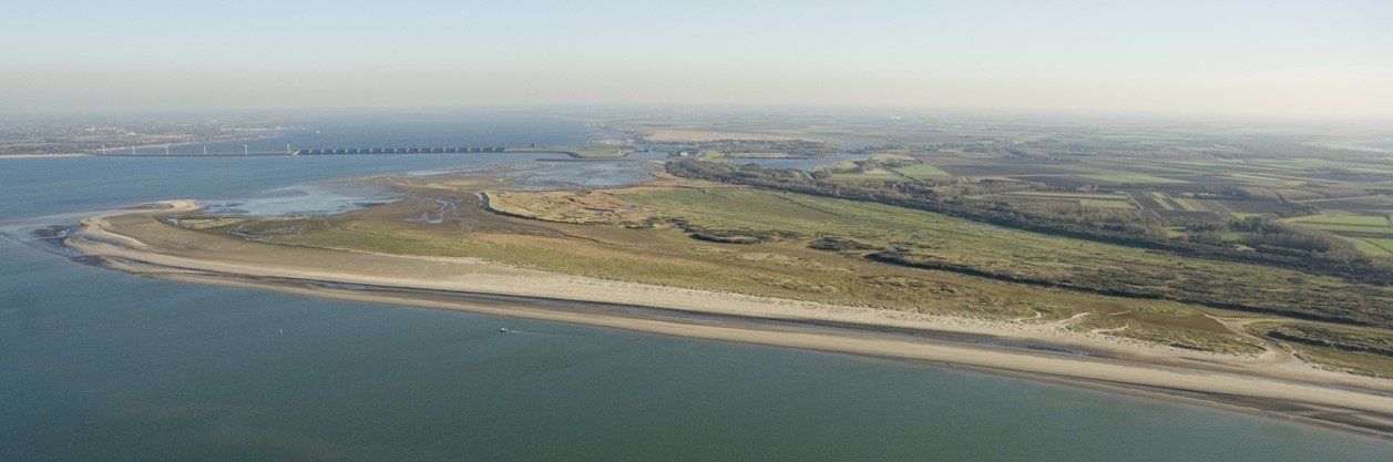
Following the construction of the Rhine discharge sluices ('Haringvliet sluices') in 1970, a strong progradation occurred at the adjacent coast of Goeree. The image from 2005 shows new dune ridges that formed on the accreted strand plain. Photo credit Rens Jacobs, Beeldbank Rijkswaterstaat.
File history
Click on a date/time to view the file as it appeared at that time.
| Date/Time | Thumbnail | Dimensions | User | Comment | |
|---|---|---|---|---|---|
| current | 15:08, 30 August 2021 | 1,257 × 417 (93 KB) | Dronkers J (talk | contribs) | Following the construction of the Rhine discharge sluices ('Haringvliet sluices') in 1970, a strong progradation occurred at the adjacent coast of Goeree. The image from 2005 shows new dune ridges that formed on the accreted strand plain. Photo credit... |
- You cannot overwrite this file.
File usage
The following 2 pages link to this file:
