File:Geodetic base for shoreline measurements.jpg
From Coastal Wiki
Revision as of 16:48, 8 April 2019 by Dronkers J (talk | contribs) (Geodetic base for shoreline measurements.)
No higher resolution available.
Geodetic_base_for_shoreline_measurements.jpg (606 × 469 pixels, file size: 35 KB, MIME type: image/jpeg)
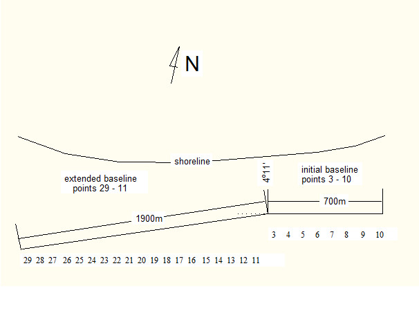
Geodetic base for shoreline measurements.
File history
Click on a date/time to view the file as it appeared at that time.
| Date/Time | Thumbnail | Dimensions | User | Comment | |
|---|---|---|---|---|---|
| current | 16:48, 8 April 2019 | | 606 × 469 (35 KB) | Dronkers J (talk | contribs) | Geodetic base for shoreline measurements. |
- You cannot overwrite this file.
File usage
The following page links to this file:
