Difference between revisions of "File:MumbaiFlood2005.jpg"
From Coastal Wiki
Dronkers J (talk | contribs) (Inundated areas during the 2005 flood in Mumbai correspond to the reclaimed low-lying zones in between the former islands. Red lines are district borders. Image from the Fact Finding Committee on Mumbai floods (MCGM 2006).) |
(No difference)
|
Latest revision as of 21:58, 9 September 2022
Summary
Inundated areas during the 2005 flood in Mumbai correspond to the reclaimed low-lying zones in between the former islands. Red lines are district borders. Image from the Fact Finding Committee on Mumbai floods (MCGM 2006).
File history
Click on a date/time to view the file as it appeared at that time.
| Date/Time | Thumbnail | Dimensions | User | Comment | |
|---|---|---|---|---|---|
| current | 21:58, 9 September 2022 | 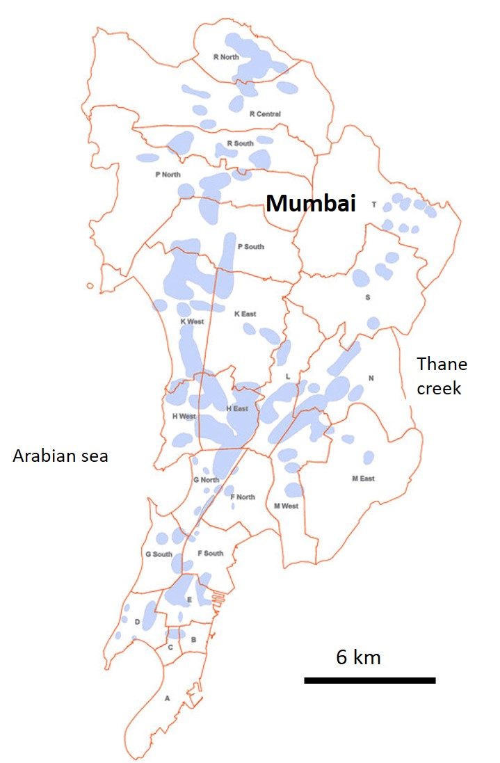 | 719 × 1,097 (98 KB) | Dronkers J (talk | contribs) | Inundated areas during the 2005 flood in Mumbai correspond to the reclaimed low-lying zones in between the former islands. Red lines are district borders. Image from the Fact Finding Committee on Mumbai floods (MCGM 2006). |
- You cannot overwrite this file.
File usage
The following page links to this file:
