FUTURECOAST project, UK
The UK FUTURECOAST PROJECT (2002)
This major project represents a significant step forward in conceptualising the factors affecting coastal change. It was commissioned by the UK government Department for the Environment Food and Rural Affairs (DEFRA) (https://www.channelcoast.org/ccoresources/futurecoast/) and carried out by a team lead by the Halcrow Group. This article presents an overview of the project, the methodogies developed and the results obtained.
Contents
Introduction
Analysis of coastal dynamics and evolution is difficult due to both the range of spatial and temporal scales over which coastal changes occur, and the complex interactions that result in shoreline responses of varying, non-linear and often unpredictable nature. There is also inter-dependence between different geomorphic features that make up the natural system, such that the evolution of one particular element of the coast is influenced by evolution in adjacent areas. Often these influences extend in a number of directions, thereby further complicating the task of assessing change.
Whilst a variety of modelling techniques exist to assist in predicting coastal behaviour, many of these focus on short-term, relatively local-scale analysis based upon contemporary hydrodynamic forcing, as opposed to considering larger-scale and longer-term evolutionary behaviour. Although such modelling provides vital information, it does not necessarily provide the complete picture of influence and change.
It is also important to understand how the coastal zone functions on a wider scale both in time and space. Within Coastal Engineering, there is a strong focus upon littoral processes and this approach is frequently used as a basis for analysing coastal change and assessing future policy options and impacts. Whilst the littoral cell concept is a valid approach, it is only one aspect of coastal system behaviour and other factors also need to be taken into account when assessing future shoreline evolution. Therefore, in terms of making large-scale or longer-term predictions of coastal evolution, the coastal cell concept can have a number of shortcomings.
The Behavioural Systems Approach
A ‘behavioural systems’ approach, such as was adopted by the FUTURECOAST project, involves the identification of the different elements that make up the coastal structure and developing an understanding of how these elements interact on a range of both temporal and spatial scales. In this exercise it is the interaction between the units that is central to determining the behaviour. Feedback invariably plays an important role and changes in energy/sediment inputs that affect one unit can in turn affect other units, which themselves give rise to a change in the level of energy/sediment input.
Whilst the starting point for a behavioural system is the energy and sediment pathways, it is important to identify the causative mechanism as a basis for building a robust means of predicting the response to change. This must take account of variations in sediment supply and forcing parameters, such as tide and wave energy. However, it is also important to look for situations where the system response is to switch to a different state, for example, the catastrophic failure of a spit, or the switching of channels as a consequence of episodic storm events.
Recognising shoreline types
Key influences upon plan-form shape, and evolution, are the underlying geology and coastal forcing, e.g. prevailing wave activity. Large-scale shoreline evolution may be broadly considered in terms of those areas that are unlikely to alter significantly, i.e. hard rock coasts, and those areas that are susceptible to change, i.e. soft coasts.
The evolution of hard rock coasts is almost exclusively a function of the resistant nature of the geology, with the influence of prevailing coastal forcing on the orientation of these shorelines only occurring over very long timescales (millennia). Differential erosion may occur along these coastlines to create indentations or narrow pockets where there is an area of softer geology, or faulting, which has been exploited by wave activity.
Soft Coasts
The evolution of softer shorelines is more strongly influenced by coastal forcing, although geology continues to play a significant role in both influencing this forcing (e.g. diffraction of waves around headlands) and dictating the rate at which change may occur. The plan-form of these shorelines will, over timescales of decades to centuries, tend towards a shape whose orientation is in balance with both the sediment supply and the capacity of the forcing parameters to transport available sediment. In general soft shorelines have already undergone considerable evolution. Some shoreline may have reached their equilibrium plan-form in response to prevailing conditions, whilst others have not and continue to change.
Reasons why such shorelines have not reached a dynamic equilibrium, and may still be adjusting in orientation, include constraints upon the rate of change (e.g. the level of resistance of the geology) and changes in conditions (e.g. sediment availability, emergence of new controls, breakdown of older features, changes in offshore topography). It should be recognised that we are presently at a point in time when most of England and Wales is in a generally transgressive phase (i.e. a period of rising relative sea levels) and shorelines are still adjusting to this. Under rising sea levels there are two main possible responses: (1) the feature adjusts to maintain its form and position relative to mean water level, i.e. moves inland, or (2) the feature becomes over-run and is either drowned or eroded and lost.
It is the softer shorelines that are most sensitive to changes in environmental conditions, such as climate change impacts, which may alter the coastal forcing. Such changes in conditions are not necessarily instantaneous, and can take many decades or centuries to occur. Therefore, some of the changes taking place at the shoreline over the next century may be a continuation of a response to events that occurred at some time in the past.
Swash aligned and drift aligned coastlines
The natural tendency for most shorelines is to become orientated to the predominant wave direction, although clearly there are many constraints and influences upon this. This concept applies equally to the shoreface, foreshore and backshore, although is perhaps best illustrated by beach behaviour; the shoreline adjusts in form because sediment is moved, giving rise to areas of erosion and deposition.
Swash-aligned, or swash-dominated, coasts build parallel to incoming wave crests, whereas Drift-aligned, or drift-dominated, coasts are built parallel to the line of maximum longshore sediment transport and are generated by obliquely-incident waves (but not necessarily uni-directional). In general, swash-dominated coasts are smoother in outline than those that are drift-dominated, which tend to exhibit intermittent spits and sediment accumulations, such as nesses. Due to variability in the wave climate, few beaches are entirely swash- or drift-aligned, but identification of the predominant characteristic can help in predicting likely future evolution.
Soft shoreline evolution
Where shorelines have become adjusted to the prevailing pattern of the waves, i.e. are in ‘dynamic equilibrium’, they reach a state of relative stability. Where changes are made to the shoreline controls, whether natural or anthropogenic, for example removal of defences, there may be tendency towards greater drift-alignment, with increased mobility of foreshore sediments and backshore erosion. Shorelines of any form have the potential to evolve in three ways: continuation of present form; breakdown of present form, or transition to a different form. These changes could occur for various reasons, including: • changes in the rate or volume of sediment input/output, e.g. due to construction or demolition of coastal defences or exhaustion of a relict sediment source; • changes in composition of sediment input, e.g. due to the loss of sand over time through winnowing; • changes in wave energy or approach, resulting in a change in the drift rate and/or direction; • changes in the balance between longshore and cross-shore sediment transfer.
Hard rock coasts
These are resilient to significant changes in orientation over decadal to century timescales and require little further discussion. In most cases embayments within this hard strata may have been formed by submergence (sea level rise) in combination with abrasive and marine erosive processes, although in some cases they may be formed by marine erosion alone. In the latter case, the geology can have a major influence upon the coastal processes and the resultant orientation of the shoreline, in particular the formation and evolution of deeper embayments, some of which are referred to as zeta bays. These form due to wave diffraction around at least one fixed point, although often between two fixed points, e.g. headlands; a soft coast between two resistant points will readjust its orientation to minimise the wave-generated longshore energy. Most bay forms that have reached an equilibrium state exhibit an almost circular section behind the updrift headlands, which reflects the wave crests diffracted around the fixed points.
Notwithstanding this, differential resistance of the backing geology will also influence the position of the shoreline, which in some cases may produce secondary embayments as new headlands emerge. A further influence is the response of the different geomorphological elements that comprise the backshore. This could, for example, create floodplains or inlets that alter the hydrodynamics operating within the bay and thus the alignment tendencies at the shoreline.
Tide Dominated Coasts
All coasts are affected by tides, but only a few types of coastal environments can be considered to be tide-dominated. Tide-dominated coasts generally occur in more sheltered areas where wave action is largely removed, e.g. due to shoaling or by direct shelter, such as by a spit at a river mouth, and are therefore they are most commonly associated with estuaries, although there are parts of the open coast around England and Wales where tidal influences are most dominant upon the shore plan-form. The landforms reflect the change in dominant influence from waves to tides and sediments tend to be characterised by silts and muds due to the lower energy levels. These shorelines are generally low-lying and the shoreline plan-form arises from the deposition of fine sediments, which creates large intertidal flats.
The future plan-form evolution of tide-dominated shoreline is perhaps the most difficult to predict accurately due to the complex interactions within these environments. One of the key influences on the evolution of tide-dominated coasts is the change in tidal currents. This may occur for a number of reasons, but one of the key causes is due to changing tidal prisms, i.e. the amount of water that enters and exits an estuary every ebb-flood tidal cycle. Another influence on evolution is the configuration of ebb and flood channels, which affects the pattern of erosion, transport and deposition both across the intertidal zone and at the shoreline. In many estuaries, changes in the position of these channels have had a significant impact upon the adjacent shorelines (e.g. Morecambe Bay). Where a major channel lies close to the shoreline it allows larger, higher energy waves to attack the marsh cliff, whereas where there are sandbanks adjacent to the marsh wave energy is attenuated. It is often not clear what causes a channel to meander because there are a number of interacting factors involved.
Influences upon coastal behaviour
To understand the morphological evolution of the shoreline will, in many instances, require the identification of key controls and influences on large-scale shoreline behaviour, and the interactions taking place within coastal systems. Many changes tend to occur at scales that relate to long-term responses to past conditions. Often the underlying pressures for shoreline change are related to large-scale reorientation of the coast, which may include the emergence of new features and/or the deterioration of existing features. Some examples include: • changes in geological controls (e.g. emergence of headlands in eroding cliffs, changes in backshore geology); • alteration to hydrodynamic forcing (e.g. increased or decreased wave diffraction processes around headlands or over offshore banks); • changes in hydrodynamic influences (e.g. interruption of drift by newly created tidal inlets, development of tidal deltas); • changes in sediment budget (e.g. exhaustion of relict sediment sources, shorelines switching from drift- to swash-alignment); and • human intervention (e.g. cessation of sediment supply due to cliff protection).
Appreciation of these factors enables the long-term and large-scale evolutionary tendencies to be broadly established and in particular identify where a change from past evolution may be expected. To understand the impacts of these factors on behaviour of the local-scale geomorphology, requires the following points to be considered: • changes in foreshore response to wider-scale and local factors; • assessment of the implications of foreshore response on backshore features; • wider-scale geomorphological assessment of this coastal response (e.g. feedback interactions); and • identification of any potential changes in geomorphological form (e.g. breakdown of gravel barriers).
Assessing shoreline evolution
In assessing coastal and shoreline behaviour a complex number of factors need to be considered. To ensure that all relevant factors are addressed it is useful to have a framework of generic questions, which have been developed and are outlined below. These questions detail the main issues that need to be addressed when assessing future geomorphological behaviour and coastal evolution. To answer these questions requires an input of both data and understanding of processes and geomorphology.
Past evolution
Knowing how a feature or geomorphological system formed can assist in assessing how it will respond to future changes in the forcing parameters. This assessment may also provide information regarding sources or sinks of sediment. Key questions to be addressed therefore are: • How and why has the feature formed, and over what timescales? Have some features disappeared and what are the possible reasons for this? • What has been the historic behaviour of the feature at millennial, centennial and decadal timescales, e.g. has the volume held within a dune system changed, or has there been a change in position? • Are the processes that caused the features to form still occurring today, or can the features be considered relict? • How does the evolution of a certain feature, or geomorphological element, fit into a larger-scale pattern of change? Is the contemporary landscape a product of a previous different landscape form?
Controls and influences
Key to understanding larger scale behaviour is the understanding of the main controls on the system. • What are the key geological controls, e.g. are there predominant headlands, and are these composed of hard or soft geology? How is the geology changing over time, i.e. what is the resistance to erosion and what is the main failure mechanism? • Are there any offshore or nearshore controls e.g. banks or islands? Are these changing and/or is there potential for them to change in the future? What control do they have on the shoreline, e.g. are they providing shelter or causing wave focussing? • What estuarine or inlet controls are present? Is there a delta that is an influence on the shoreline, e.g. by providing protection? Are there spits, and how are these behaving?
Forcing
Coastal morphology changes due to the processes that act upon it. Although much of our knowledge regarding processes is contemporary, by understanding the coastal response to current conditions, it is possible to estimate future response. • What tidal processes operate? Are coastal processes effectively tidal-driven? Is the shoreline subject to storm surges? What has been the past response to such events? • What wave processes operate? Are coastal processes effectively wave-driven? What are the predominant directions of wave approach? Are there differences in wave energy along the shoreline, e.g. due to wave diffraction?
Linkages
The formation and maintenance/growth of geomorphological features is dependent upon a supply of sediment of an appropriate size-grade. This therefore depends upon a suitable source and a transport pathway. • What are the key sources of sediment within the system? What sizes of sediments are released? How does this compare with the composition of the depositional features, e.g. dunes or beach ridges, present? • Have previous sources of sediment now been exhausted or removed from the system, e.g. due to rising sea levels? • Are there key sinks of sediment? Can these be considered permanent or temporary stores? If temporary, are these volumes likely to be released in the future and under what processes, e.g. cannibalisation of a barrier as it migrates landwards? • What are the key mechanisms of sediment transport, e.g. suspended or bedload, onshore or longshore? • What are the interactions between features? Over what temporal and spatial scales are linkages evident? What is the relative strength/importance of these linkages?
Morphology
At the local-scale, response of the geomorphological elements is key to the predictions of future coastal evolution. Understanding why the feature is where it is and its particular morphology is essential to the understanding of future behaviour. • What are the key internal physical controls on the behaviour of the feature, e.g. geology/composition, resistance to erosion, height, width, position etc.? • What are the key external physical controls on the behaviour of the feature, e.g. is it a wind-created feature, wave-dominated feature etc.? • Does it depend on a sediment supply and if so what are the key sources? Is the source of sediment contemporary or relict? • What are its links with neighbouring geomorphic units, e.g. does is depend upon another feature for its sediment supply, or is it a source for other features? • Does its evolution fit into a larger-scale pattern of change?
FUTURECOAST OUTPUT
The results of the FUTURECOAST project, which addresses these generic questions for the coastline of England and Wales, are available on CD, from DEFRA, and have been widely distributed in the UK. The CD's comprise:
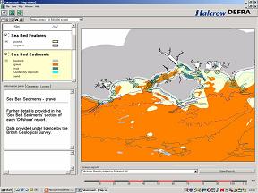
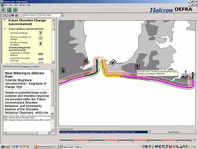
A single interactive CD-ROM containing the entire Futurecoast analysis for 6000km of shoreline, containing approximately 3000 pages of reported analysis and over 70,000 mapped features. This includes a variety of framework reports, data, thematic reports, and interpretative reports, plus mapping of a variety of features and mapping of predictions.
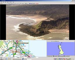
Two further CD-ROMs containing complete aerial oblique-imagery coverage for the entire English shoreline.
Acknowledgements
This article is based on material supplied by Kevin Burgess of the Halcrow Group, which was published in a similar form in Reeve, Chadwick and Fleming (2004). It is reproduced here with the permission of E & FN Spon
References
Reeve, D., Chadwick, A. J., Fleming, C. (2004). Coastal Engineering: Processes, Theory and Design Practice E & FN Spon.
DEFRA 2002. The Futurecoast Project. Project code FD2002
Please note that others may also have edited the contents of this article.
|


